Arnsbarrow Tarn

Lake, Pool, Pond, Freshwater Marsh in Lancashire South Lakeland

England

Arnsbarrow Tarn

Coniston Water from the A5084 At last a view of the lake - the A593 does not run alongside and it is not until you head south of Torver on the A5084 that the lake comes into view.
Coniston Water from the A5084 Credit: Eirian Evans

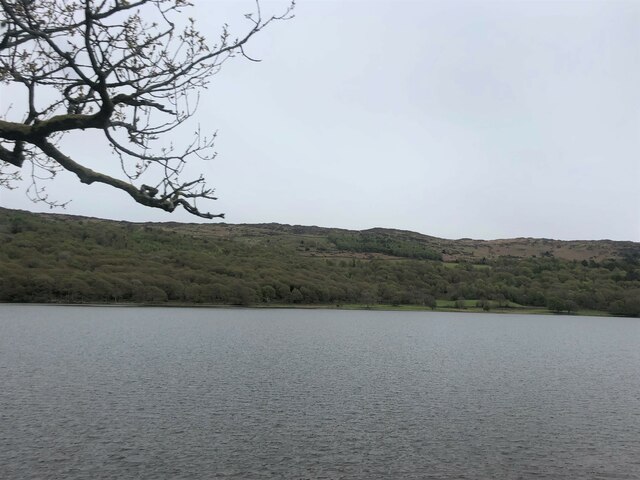
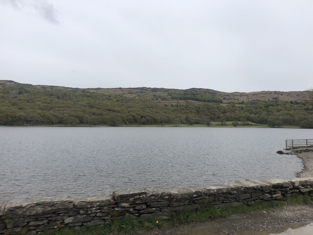
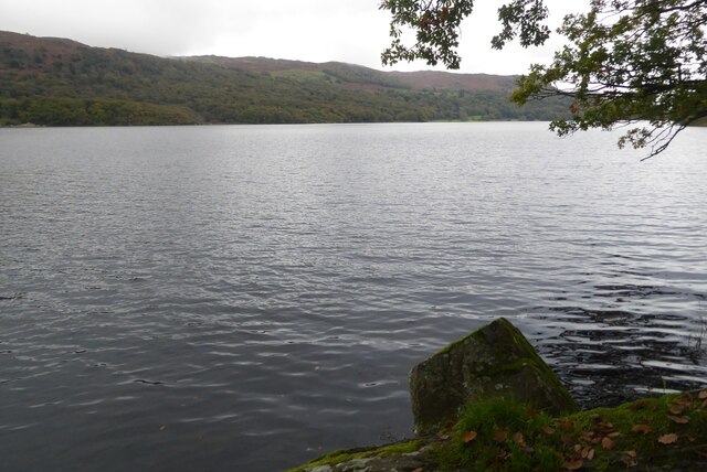
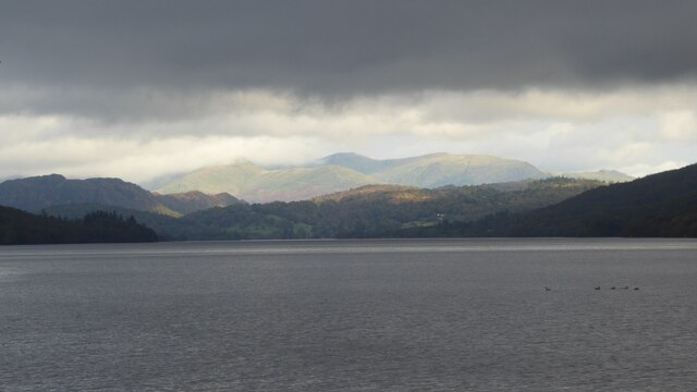
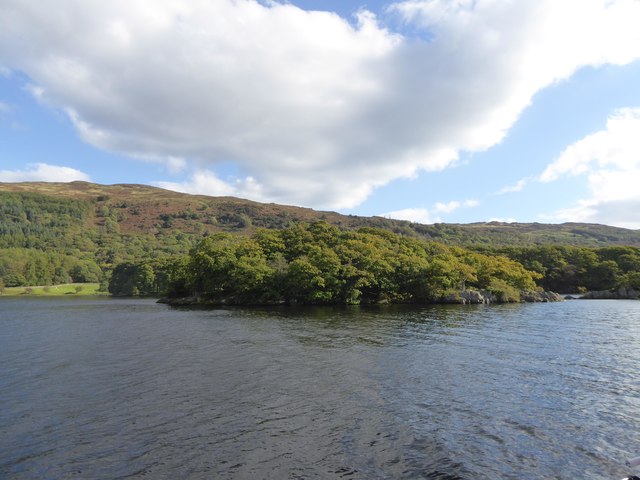
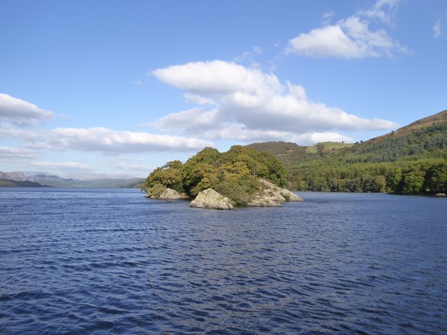
Arnsbarrow Tarn is a picturesque freshwater body located in Lancashire, England. Nestled in the heart of the Arnside and Silverdale Area of Outstanding Natural Beauty, this tarn is a serene and tranquil escape from the bustling nearby towns.

Covering an area of approximately 2.5 acres, Arnsbarrow Tarn is a small but enchanting body of water. It is characterized by its clear, still waters, surrounded by lush vegetation and rolling hills. The tarn is fed by natural springs and rainfall, ensuring a constant flow of fresh water.

Its shoreline is adorned with a diverse range of flora, including reeds, rushes, and water lilies, creating a vibrant and ecologically rich habitat. This attracts a variety of wildlife, such as waterfowl, dragonflies, and frogs. The tarn is also home to several species of fish, providing ample opportunities for fishing enthusiasts.

Arnsbarrow Tarn is a popular spot for outdoor enthusiasts and nature lovers alike. It offers a serene atmosphere for picnics, leisurely walks, and birdwatching. Additionally, the tarn is surrounded by well-maintained footpaths, allowing visitors to explore the surrounding countryside and enjoy panoramic views of the area.

The tarn is easily accessible, with a car park located nearby, and is open to the public year-round. It is a designated Site of Special Scientific Interest, highlighting its importance for conservation and biodiversity. Whether seeking a peaceful retreat or a chance to immerse oneself in nature, Arnsbarrow Tarn is a hidden gem that promises a truly enchanting experience.

If you have any feedback on the listing, please let us know in the comments section below.

Arnsbarrow Tarn Images

Images are sourced within 2km of 54.316397/-3.0617282 or Grid Reference SD3191. Thanks to Geograph Open Source API. All images are credited.

Coniston Water from the A5084 At last a view of the lake - the A593 does not run alongside and it is not until you head south of Torver on the A5084 that the lake comes into view.
Coniston Water from the A5084
At last a view of the lake - the A593 does not run alongside and it is not until you head south of Torver on the A5084 that the lake comes into view.
Coniston Water Coniston Water is the fifth largest of the lakes, at five miles long, and with a maximum depth of 184 feet. It provided an important fish source for the monks of Furness Abbey who owned the lake and much of the surrounding land in the 13th and 14th Centuries.
Coniston Water
Coniston Water is the fifth largest of the lakes, at five miles long, and with a maximum depth of 184 feet. It provided an important fish source for the monks of Furness Abbey who owned the lake and much of the surrounding land in the 13th and 14th Centuries.
View to Peel Island on Coniston Water
At Low Peel Near, Coniston Water
At Low Peel Near looking up Coniston Water
Coniston Water at Low Peel Near Looking to The Old Man of Coniston
Coniston Water at Low Peel Near
Looking to The Old Man of Coniston
Coniston Water shoreline
Coniston Water Oxen House Bay on Coniston Water.
Coniston Water
Oxen House Bay on Coniston Water.
Coniston Water
Coniston Water
Mountains of  the Fairfield Round Mountains of  the Fairfield Round above Ambleside viewed from Coniston Water.
Mountains of the Fairfield Round
Mountains of the Fairfield Round above Ambleside viewed from Coniston Water.
Coniston Water
Coniston Water
Canoes on Coniston Water
Jetty on Coniston Water
Peel Island, Coniston Water Better known as Wild Cat Island to readers of Arthur Ransome
Peel Island, Coniston Water
Better known as Wild Cat Island to readers of Arthur Ransome
South-western end of Peel Island, Coniston Water Wild Cat Island in Arthur Ransome's books
South-western end of Peel Island, Coniston Water
Wild Cat Island in Arthur Ransome's books
The rocks at the secret harbour of Wild Cat Island, Peel Island
Open grassland north of Peel Near Wood Looking up Selside
Open grassland north of Peel Near Wood
Looking up Selside
Show me another place!

Arnsbarrow Tarn is located at Grid Ref: SD3191 (Lat: 54.316397, Lng: -3.0617282)

Administrative County: Cumbria

District: South Lakeland

Police Authority: Cumbria

What 3 Words

///divides.compliant.branded. Near Windermere, Cumbria

Related Wikis

Top o'Selside

Top o'Selside is a hill in the Lake District in Cumbria, England. At 335 metres (1,099 ft), it is the highest point of the group of hills situated between...

Peel Island, Cumbria

Peel Island (formerly known as Montague Island or the Gridiron) is one of the three islands of Coniston Water in the English Lake District, Cumbria. The...

Nibthwaite

Nibthwaite is a village in the South Lakeland District in the county of Cumbria in the northwest of England. It is in the civil parish of Colton, and on...

Kelly Hall Tarn

Kelly Hall Tarn is a pool in Cumbria, England, to the west of Coniston Water. It is located about one km south-south-east of the village of Torver, on...

Nearby Amenities

Located within 500m of 54.316397,-3.0617282
Top o' Selside (Wainwright)
Ele: 335
Natural: peak
Wikidata: Q8525223
Wikipedia: en:Top o'Selside
Lat/Long: 54.317645/-3.0652172
Heel Toe Hill
Ele: 319
Natural: peak
Source: OS OpenData StreetView
Lat/Long: 54.3181058/-3.0570852
Man Made: cairn
Lat/Long: 54.3176277/-3.0652207
Great Hill
Ele: 325
Natural: peak
Lat/Long: 54.31802/-3.0676024
Neile Stove Crag
Place: locality
Lat/Long: 54.3153984/-3.0592294
Ford: yes
Lat/Long: 54.3137853/-3.064004
Ford: yes
Lat/Long: 54.3160963/-3.0619748
Top o' Selside
Ele: 335
Natural: peak
Lat/Long: 54.3180168/-3.0641619
The data included in this document is from www.openstreetmap.org. The data is made available under ODbL.

Have you been to Arnsbarrow Tarn?

Leave your review of Arnsbarrow Tarn below (or comments, questions and feedback).