Costa Hill

Hill, Mountain in Orkney

Scotland

Costa Hill

Inyamehellya (Inyama Hellier on OS map) A large geo near Costa Head with a rock stack called Standard
Inyamehellya (Inyama Hellier on OS map) Credit: John Comloquoy

Costa Hill is a prominent geographical feature located in the Orkney Islands, an archipelago situated off the northeastern coast of mainland Scotland. Rising to an elevation of approximately 208 meters (682 feet), it is classified as a hill rather than a mountain.

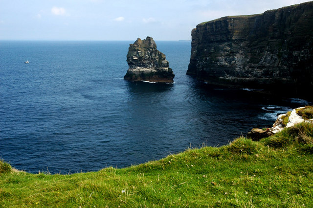
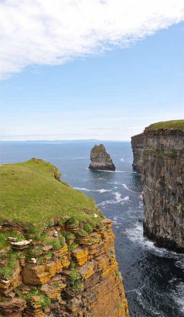
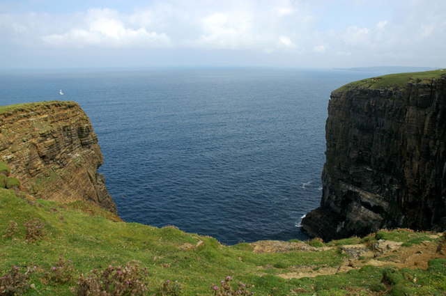
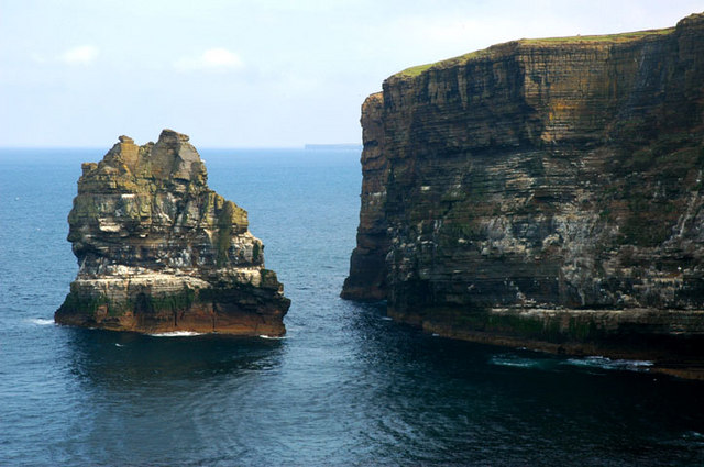
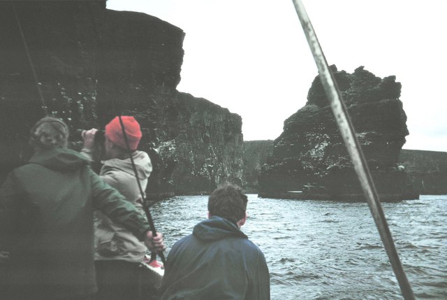
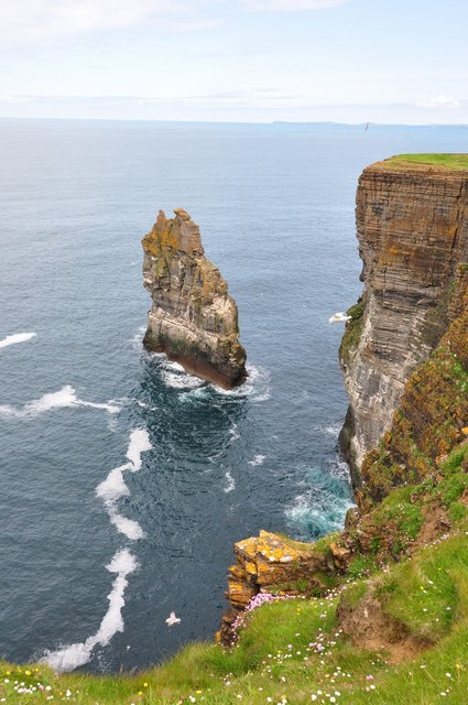
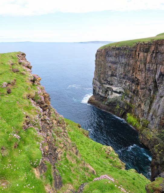
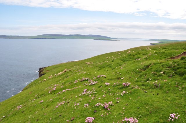
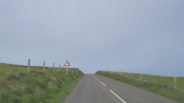
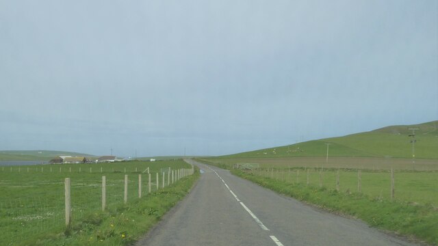
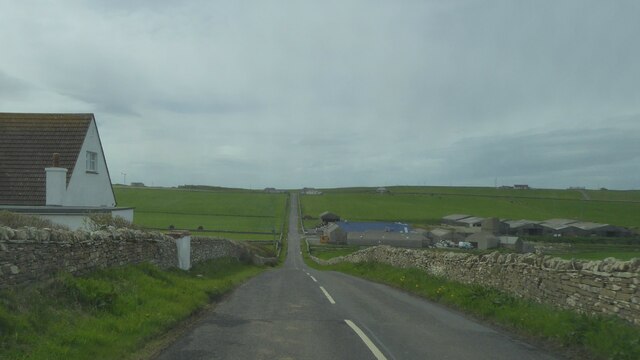
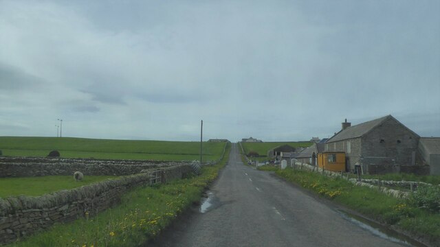
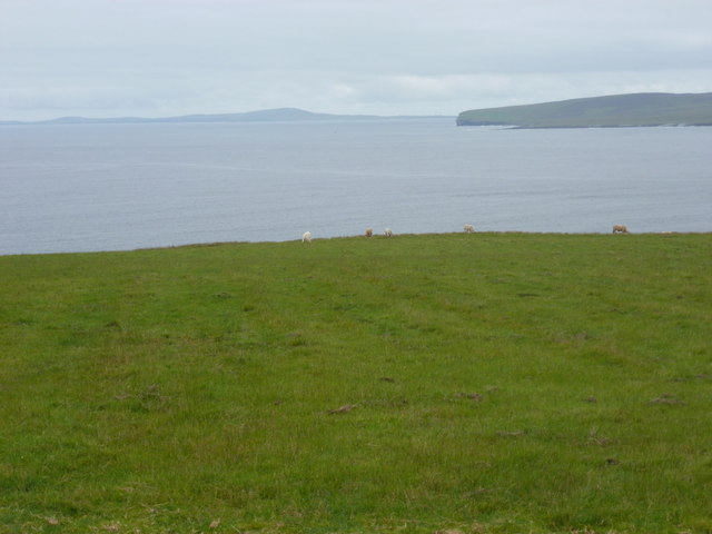
Situated on the island of Mainland, Costa Hill offers breathtaking panoramic views of the surrounding landscape, including the rugged coastline, rolling green hills, and the serene waters of the North Sea. Its strategic location on the eastern side of the island makes it easily accessible and a popular destination for hikers, nature enthusiasts, and tourists alike.

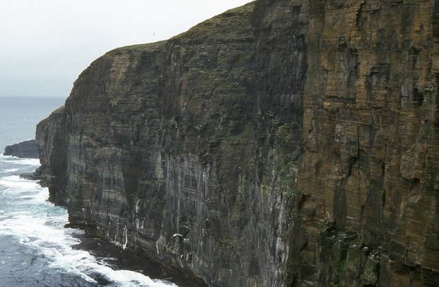
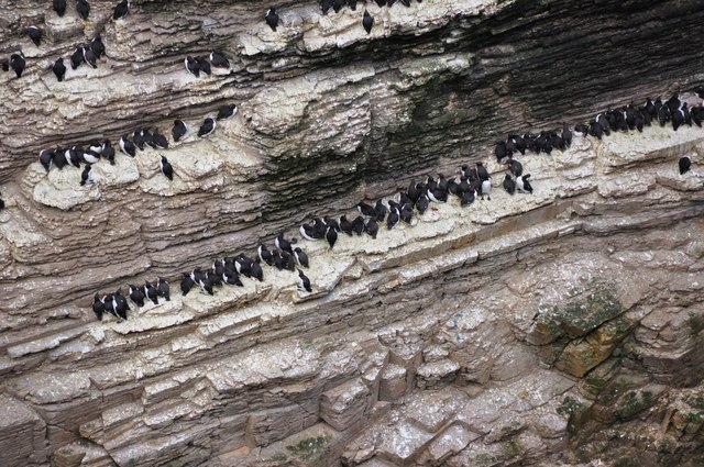
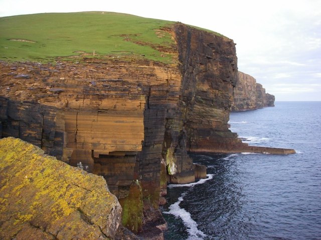
The hill is predominantly composed of rugged, rocky terrain, interspersed with patches of lush vegetation. Its slopes are covered with heather, grasses, and wildflowers, providing a haven for various species of birds and small mammals. The path to the summit is well-defined, making it relatively easy for visitors to navigate.

Once atop Costa Hill, visitors are rewarded with commanding views of neighboring islands, such as Hoy and South Ronaldsay, as well as the iconic Churchill Barriers, a series of causeways constructed during World War II. On clear days, it is even possible to catch a glimpse of the Scottish mainland in the distance.

Overall, Costa Hill is a picturesque and accessible natural landmark, offering visitors the opportunity to immerse themselves in the breathtaking beauty of the Orkney Islands and appreciate the rich diversity of its landscapes.

If you have any feedback on the listing, please let us know in the comments section below.
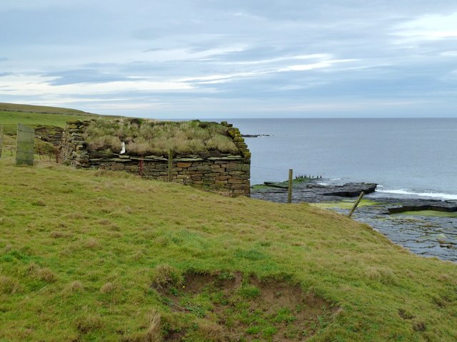
Costa Hill Images

Images are sourced within 2km of 59.148481/-3.2058993 or Grid Reference HY3129. Thanks to Geograph Open Source API. All images are credited.

Inyamehellya (Inyama Hellier on OS map) A large geo near Costa Head with a rock stack called Standard
Inyamehellya (Inyama Hellier on OS map)
A large geo near Costa Head with a rock stack called Standard
Clifftop View Dramatic clifftop view of the geo of Inyama Hellia, sea stack of Standard and far away Westray, with Fulmars and Thrift in the foreground.
Clifftop View
Dramatic clifftop view of the geo of Inyama Hellia, sea stack of Standard and far away Westray, with Fulmars and Thrift in the foreground.
Ramna Geo, below Costa Hill Looking northeast to north isles
Ramna Geo, below Costa Hill
Looking northeast to north isles
Standard A large outlying sea stack at Inyamehellya
Standard
A large outlying sea stack at Inyamehellya
The Standard The Standard photographed from the Shapinsay fishing boat 'Flourish'.
The Standard
The Standard photographed from the Shapinsay fishing boat 'Flourish'.
Costa Head, Orkney Sea cliffs, here 100 m high.
Costa Head, Orkney
Sea cliffs, here 100 m high.
The Standard is High But not as high as me! - Curiously un-orcadian sounding sea stack called Standard which is about 170ft tall - my vantage point is over 300ft.
The Standard is High
But not as high as me! - Curiously un-orcadian sounding sea stack called Standard which is about 170ft tall - my vantage point is over 300ft.
Ramna Geo Looking down into the depths of Ramna Geo from the cliff edge - in the distance is Rousay and Westray.
Ramna Geo
Looking down into the depths of Ramna Geo from the cliff edge - in the distance is Rousay and Westray.
Costa Head Thrift Just east of Costa Head a lovely carpet of thrift amongst the luss grass that the sheep were enjoying. Rousay in the distance.
Costa Head Thrift
Just east of Costa Head a lovely carpet of thrift amongst the luss grass that the sheep were enjoying. Rousay in the distance.
All Lined Up Guillemots on one of the many ledges of the sea stack called Standard.
All Lined Up
Guillemots on one of the many ledges of the sea stack called Standard.
Cliffs at Costa Head Impressive cliffs of Old Red Sandstone drop precipitously into the sea at the northernmost point of Mainland.
Cliffs at Costa Head
Impressive cliffs of Old Red Sandstone drop precipitously into the sea at the northernmost point of Mainland.
A966 near Upper Midhouse, Orkney
A966 near Crismo, Orkney
A966 near Swannay Farm, Orkney
Costa: grazing cattle and Westray view Looking out across the northwestern end of Eynhallow Sound towards the western tip of the isle of Rousay. In the distance, the outline of Westray can be discerned.
Costa: grazing cattle and Westray view
Looking out across the northwestern end of Eynhallow Sound towards the western tip of the isle of Rousay. In the distance, the outline of Westray can be discerned.
Little Hut This hut, containing fishing gear, is not marked on the map and is only just inside the Grid Square.
This square is one of the three or four very last Orkney Mainland squares to be Geographed
Little Hut
This hut, containing fishing gear, is not marked on the map and is only just inside the Grid Square. This square is one of the three or four very last Orkney Mainland squares to be Geographed
Little Hut Inside the <a href="https://www.geograph.org.uk/photo/2698399">HY3229 : Little Hut</a>.
It is very cosy with even a small hearth. But it is perilously close to the eroding cliff edge.
Little Hut
Inside the HY3229 : Little Hut. It is very cosy with even a small hearth. But it is perilously close to the eroding cliff edge.
Show me another place!

Costa Hill is located at Grid Ref: HY3129 (Lat: 59.148481, Lng: -3.2058993)

Unitary Authority: Orkney Islands

Police Authority: Highlands and Islands

What 3 Words

///anchovies.fence.news. Near Birsay, Orkney Islands

Related Wikis

Costa Head

Costa Head is a prominent headland on Eynhallow Sound on the northwestern coast of the Orkney Mainland, Scotland. The tidal indraught of Eynhallow Sound...

Loch of Swannay

The Loch of Swannay is the most northerly loch on the mainland of Orkney and lies within the parish of Birsay in the north west of the island. It is an...

Abune-the-hill

Abune-the-Hill is a place on in the North of the Orkney Mainland (59.13° N 03.25° W HY2828) and just to the west of the Loch of Swannay.Abune-the-Hill...

Loch of Hundland

The Loch of Hundland is a shallow freshwater loch in the parish of Birsay in the north west of the mainland of Orkney, Scotland. The loch lies between...

Eynhallow Church

Eynhallow Church is a ruined medieval church located on the uninhabited island of Eynhallow in Orkney, Scotland. The church dates back to the 12th-century...

Eynhallow

Eynhallow (Scots: Eynhallow; Old Norse: Eyinhelga; Norn: Øjinhellig) is a small, presently uninhabited island, part of Orkney, off the north coast of mainland...

Evie, Orkney

Evie (pronounced ) is a parish and village on Mainland, Orkney, Scotland. The parish is located in the north-west of the Mainland, between Birsay and Rendall...

Birsay

Birsay () (Old Norse: Birgisherað) is a parish in the north west corner of The Mainland of Orkney, Scotland. Almost all the land in the parish is devoted...

Nearby Amenities

Located within 500m of 59.148481,-3.2058993
Costa Hill
Corbett: no
Ele: 151
Graham: no
Marilyn: no
Munro: no
Natural: peak
Lat/Long: 59.148746/-3.206561
Power: pole
Lat/Long: 59.1470205/-3.2132332
Power: pole
Lat/Long: 59.1466772/-3.2123275
Power: pole
Lat/Long: 59.1461628/-3.210822
Power: pole
Lat/Long: 59.145791/-3.2097565
Power: pole
Lat/Long: 59.14526/-3.2082741
Power: pole
Lat/Long: 59.1448371/-3.2070743
Power: pole
Lat/Long: 59.1443762/-3.2057494
Costa - site of 1st turbine to be connected to the national grid
Historic: archaeological_site
Lat/Long: 59.1486246/-3.2058564
The data included in this document is from www.openstreetmap.org. The data is made available under ODbL.

Have you been to Costa Hill?

Leave your review of Costa Hill below (or comments, questions and feedback).