Vane Hill

Hill, Mountain in Kinross-shire

Scotland

Vane Hill

Barley Field near the Loch Leven Path Field of barley on the eastern side of Loch Leven next to the Heritage Trail.
Barley Field near the Loch Leven Path Credit: Scott Cormie

Vane Hill is a prominent hill located in the county of Kinross-shire, Scotland. Situated near the town of Kinross, it forms part of the Ochil Hills range, which stretches across the central-southern regions of Scotland. Vane Hill stands at an elevation of approximately 276 meters (905 feet) above sea level, making it a notable landmark in the area.

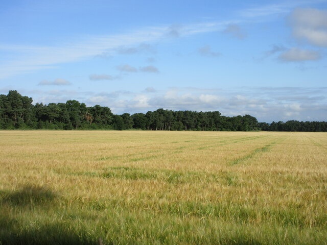
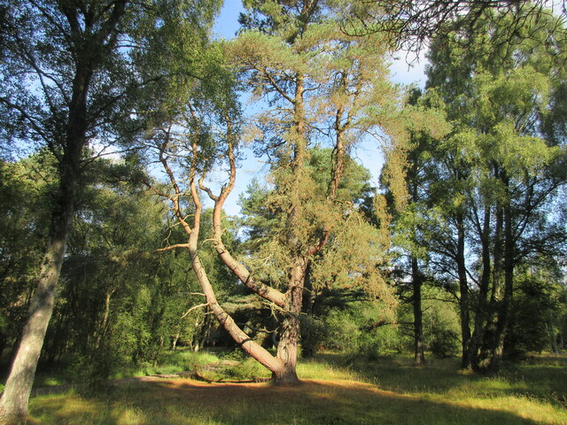
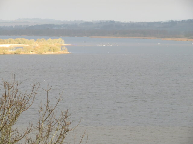
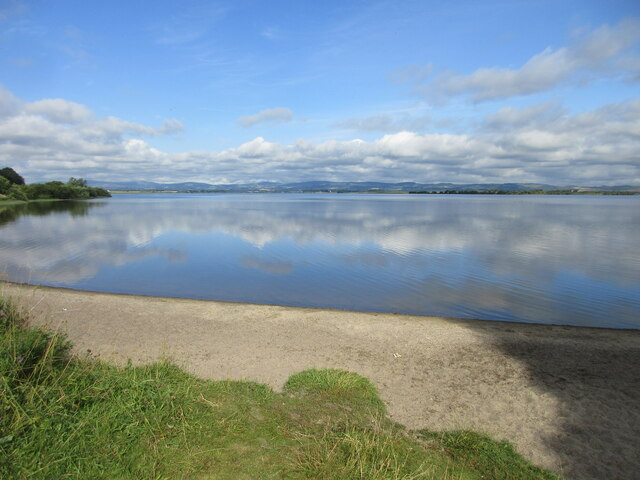
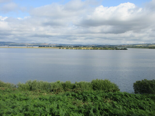
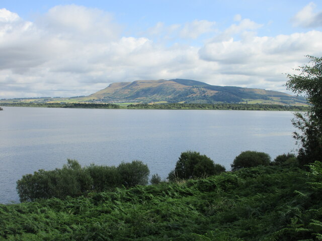
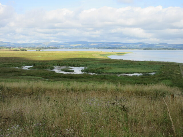
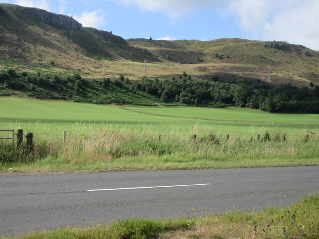
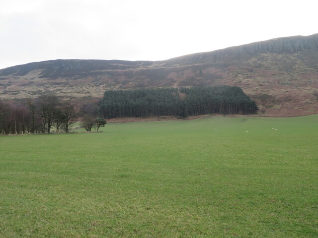
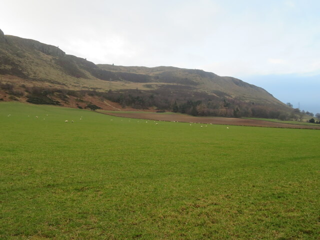
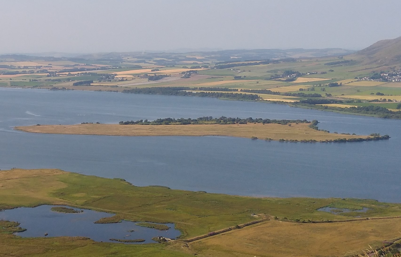
The hill is characterized by its gently sloping sides and is primarily covered in grass and heather, creating a picturesque landscape. From the summit of Vane Hill, visitors are rewarded with panoramic views of the surrounding countryside, including Loch Leven, the town of Kinross, and the nearby Ochil Hills.

Vane Hill is a popular destination for outdoor enthusiasts, offering various recreational activities such as hillwalking, hiking, and birdwatching. The hill provides a relatively moderate climb, making it accessible to individuals of various fitness levels. It is also a renowned spot for nature lovers, as the area is home to a diverse range of flora and fauna, including several species of birds and butterflies.

In addition to its natural beauty, Vane Hill holds historical significance. The hill is believed to have been a site of human activity dating back to prehistoric times, with ancient artifacts and remains discovered in the surrounding area. Its strategic location also made it an important vantage point during various conflicts throughout history.

Overall, Vane Hill in Kinross-shire offers visitors a chance to immerse themselves in Scotland's stunning natural landscapes, while also providing insights into the region's rich history and cultural heritage.

If you have any feedback on the listing, please let us know in the comments section below.
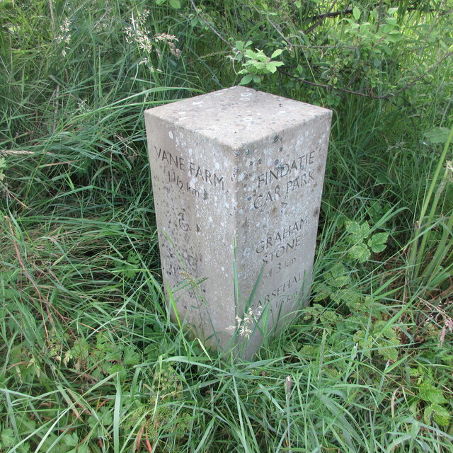
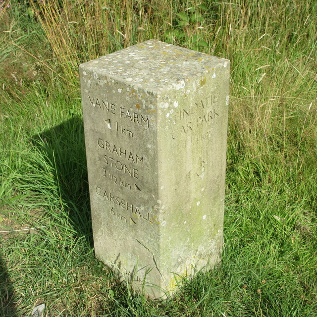
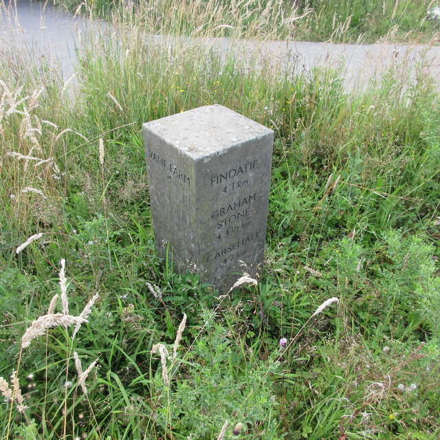
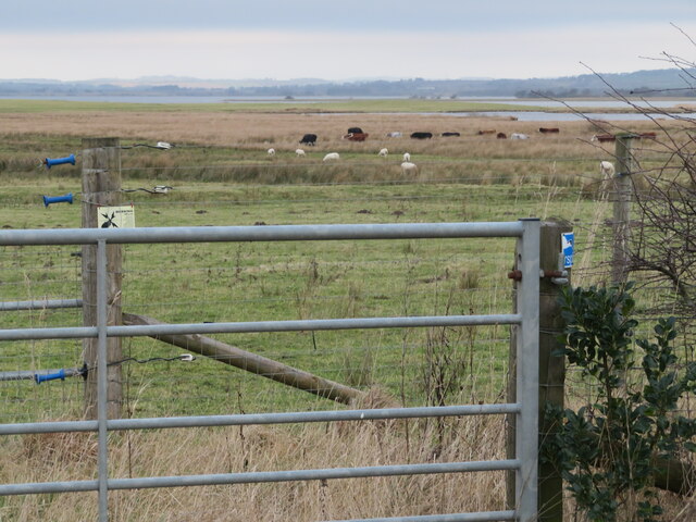
Vane Hill Images

Images are sourced within 2km of 56.175211/-3.3474835 or Grid Reference NT1698. Thanks to Geograph Open Source API. All images are credited.

Barley Field near the Loch Leven Path Field of barley on the eastern side of Loch Leven next to the Heritage Trail.
Barley Field near the Loch Leven Path
Field of barley on the eastern side of Loch Leven next to the Heritage Trail.
Pine in the Levenmouth Plantation Twisted pine tree in the Levenmouth Plantation close to the Heritage Trail.
Pine in the Levenmouth Plantation
Twisted pine tree in the Levenmouth Plantation close to the Heritage Trail.
Loch Leven Heritage Trail Milestone (Levenmouth Wood) Milestone (in km), on the Loch Leven Trail on the eastern side of the loch in Levenmouth Wood.
Loch Leven Heritage Trail Milestone (Levenmouth Wood)
Milestone (in km), on the Loch Leven Trail on the eastern side of the loch in Levenmouth Wood.
Loch Leven & St Serf's Island The eastern end of the island catching the sun, with a group of unidentified swans.
Loch Leven & St Serf's Island
The eastern end of the island catching the sun, with a group of unidentified swans.
Bridge over the River Leven Footbridge over the River Leven near Findatie, with a Loch Leven Heritage Trail milestone in the foreground.
Bridge over the River Leven
Footbridge over the River Leven near Findatie, with a Loch Leven Heritage Trail milestone in the foreground.
Southern shore of Loch Leven The southern shore of Loch Leven just west of the Sluice House.
Southern shore of Loch Leven
The southern shore of Loch Leven just west of the Sluice House.
Loch Leven from the south Looking north over Loch Leven towards St Serf's Island.
Loch Leven from the south
Looking north over Loch Leven towards St Serf's Island.
Looking north-east over Loch Leven Looking north-east over Loch Leven from above the southern shore, with Bishop Hill in the distance.
Looking north-east over Loch Leven
Looking north-east over Loch Leven from above the southern shore, with Bishop Hill in the distance.
Wetland at Loch Leven National Nature Reserve Looking north-west over wetlands on the southern side of Loch Leven.
Wetland at Loch Leven National Nature Reserve
Looking north-west over wetlands on the southern side of Loch Leven.
Woodland on the northern slopes of Benarty Hill Looking over the B9097 from the Loch Leven Trail, to woodland under the northern escarpment of Benarty Hill.
Woodland on the northern slopes of Benarty Hill
Looking over the B9097 from the Loch Leven Trail, to woodland under the northern escarpment of Benarty Hill.
Loch Leven Heritage Trail Milestone (Levenmouth) Milestone (in km), on the Loch Leven Trail near the wildlife hide at Levenmouth towards the south-eastern corner of the loch.
Loch Leven Heritage Trail Milestone (Levenmouth)
Milestone (in km), on the Loch Leven Trail near the wildlife hide at Levenmouth towards the south-eastern corner of the loch.
Loch Leven Heritage Trail Milestone (River Leven) Milestone (in km), on the Loch Leven Trail at the bridge over the River Leven on the south-east corner of the loch.
Loch Leven Heritage Trail Milestone (River Leven)
Milestone (in km), on the Loch Leven Trail at the bridge over the River Leven on the south-east corner of the loch.
Loch Leven Heritage Trail Milestone (Findatie C.P.) Milestone (in km), on the Loch Leven Trail near the car park at Findatie at the south-east corner of the loch.
Loch Leven Heritage Trail Milestone (Findatie C.P.)
Milestone (in km), on the Loch Leven Trail near the car park at Findatie at the south-east corner of the loch.
Loch Leven Heritage Trail Milestone (Findatie) Milestone (in km), on the Loch Leven Trail west of Findatie towards the south-eastern corner of the loch.
Loch Leven Heritage Trail Milestone (Findatie)
Milestone (in km), on the Loch Leven Trail west of Findatie towards the south-eastern corner of the loch.
Loch Leven Heritage Trail Milestone (Vane Farm) Milestone (in km), on the Loch Leven Trail near Vane Farm on the south side of the loch.
Loch Leven Heritage Trail Milestone (Vane Farm)
Milestone (in km), on the Loch Leven Trail near Vane Farm on the south side of the loch.
Conservation grazing at Vane Farm Between Loch Leven and Benarty Hill, part of the RSPB Vane Farm Nature Reserve.
Conservation grazing at Vane Farm
Between Loch Leven and Benarty Hill, part of the RSPB Vane Farm Nature Reserve.
Plantations on Benarty Hill At the boundary between hill and farmland.
Plantations on Benarty Hill
At the boundary between hill and farmland.
Sheep pasture at East Brackley And the lower slopes of Benarty Hill.
Sheep pasture at East Brackley
And the lower slopes of Benarty Hill.
Show me another place!

Vane Hill is located at Grid Ref: NT1698 (Lat: 56.175211, Lng: -3.3474835)

Unitary Authority: Perth and Kinross

Police Authority: Tayside

What 3 Words

///aliens.pulsing.hungry. Near Ballingry, Fife

Nearby Locations

Egg Plantation Vane Hill

Related Wikis

St Serf's Inch Priory

The St Serf's Inch Priory (or Portmoak Priory) was a community of Augustinian canons based, initially at least, on St Serf's Inch in Loch Leven, Perth...

Benarty Hill

Benarty Hill, locally simply Benarty, rises above and to the west of Ballingry, in the west of Fife, Scotland. The summit ridge forms the boundary with...

St Serf's Inch

St Serf's Inch or St Serf's Island is an island in Loch Leven, in south-eastern Perth and Kinross, Scotland. It was the home of a Culdee and then an Augustinian...

Benarty

Benarty is the name informally used to refer to the ex-mining towns of Ballingry and Lochore and the villages of Crosshill, Lochcraig and Glencraig. The...

Related Videos

A Campervan Adventure & Hiking with a Puppy

After a trip to Silver Sands at Aberdour for a walk on the beach with Brora we headed to Lochore Meadows Country Park where ...

Fife Walking Trail - Loch Ore Meadows

This walking trail starts at the free car park to the west end of Loch Ore Meadows Country Park in Fife. Along the route we will ...

Nearby Amenities

Located within 500m of 56.175211,-3.3474835
Cafe
RSPB Loch Leven
Addr Postcode: KY13 9LX
Note: http://www.rspb.org.uk/reserves/guide/v/vanefarm/index.asp
Old Name: RSPB Vane Farm
Lat/Long: 56.1766018/-3.3550397
Power: tower
Lat/Long: 56.1730278/-3.3470595
Power: tower
Lat/Long: 56.1731528/-3.3421044
Power: tower
Lat/Long: 56.1719126/-3.3513986
Vane Hill
Ele: 253
Natural: peak
Lat/Long: 56.1750253/-3.3491277
Bench
Lat/Long: 56.1721642/-3.3521215
Bench
Lat/Long: 56.1721496/-3.352168
Board Type: nature
Information: board
Operator: RSPB
Tourism: information
Lat/Long: 56.171954/-3.3482921
Leisure: picnic_table
Lat/Long: 56.1767148/-3.3546537
Bench
Lat/Long: 56.1769697/-3.3542488
Leisure: picnic_table
Lat/Long: 56.176715/-3.3547846
Bicycle Parking
Lat/Long: 56.1767476/-3.3546506
Bench
Source: survey
Tourism: viewpoint
Lat/Long: 56.1786991/-3.3504612
Source: survey
Tourism: viewpoint
Lat/Long: 56.1756925/-3.3486434
Bench
Source: survey
Tourism: viewpoint
Lat/Long: 56.1760232/-3.350983
Bench
Source: survey
Lat/Long: 56.1756757/-3.3486515
Bench
Source: survey
Lat/Long: 56.1757007/-3.3486233
Man Made: cairn
Source: survey
Lat/Long: 56.1757261/-3.3486649
Power: pole
Lat/Long: 56.1743094/-3.3542519
Power: pole
Lat/Long: 56.1736673/-3.3547305
Bench
Lat/Long: 56.1721797/-3.3520613
Bench
Lat/Long: 56.1721908/-3.3520213
Power: pole
Lat/Long: 56.1748336/-3.3538494
Power: pole
Lat/Long: 56.1754463/-3.3534087
Power: pole
Lat/Long: 56.1762284/-3.353215
Power: pole
Lat/Long: 56.1765443/-3.3531404
Power: pole
Lat/Long: 56.1769418/-3.3530276
Power: pole
Lat/Long: 56.1773577/-3.3523208
Power: pole
Lat/Long: 56.1779028/-3.3514501
Power: pole
Lat/Long: 56.1781587/-3.3505368
Power: pole
Lat/Long: 56.1783839/-3.3497151
Power: pole
Lat/Long: 56.1784953/-3.3482504
Power: pole
Lat/Long: 56.1783945/-3.3471541
Power: pole
Lat/Long: 56.1782778/-3.3460452
Power: pole
Lat/Long: 56.1781675/-3.344754
Power: pole
Lat/Long: 56.1780627/-3.3437685
Power: pole
Lat/Long: 56.1779157/-3.3425874
Power: pole
Lat/Long: 56.1780396/-3.341526
Leisure: picnic_table
Lat/Long: 56.1769584/-3.3544998
Leisure: picnic_table
Lat/Long: 56.1768677/-3.3544304
Entrance: yes
Lat/Long: 56.1766518/-3.3548663
Door: yes
Entrance: yes
Wheelchair: yes
Lat/Long: 56.176593/-3.3549102
Entrance: yes
Lat/Long: 56.1766757/-3.3549538
Toilets
Access: yes
Fee: no
Wheelchair: yes
Lat/Long: 56.1765863/-3.354768
Power: pole
Lat/Long: 56.176383/-3.3542278
Generator Method: wind_turbine
Generator Source: wind
Power: generator
Lat/Long: 56.1756209/-3.3553812
Defibrillator
Emergency: defibrillator
Indoor: yes
Lat/Long: 56.1765692/-3.3547767
Door: yes
Entrance: yes
Wheelchair: yes
Lat/Long: 56.17658/-3.3548164
Power: pole
Lat/Long: 56.1757098/-3.3533434
Power: pole
Lat/Long: 56.1750902/-3.3536648
The data included in this document is from www.openstreetmap.org. The data is made available under ODbL.

Have you been to Vane Hill?

Leave your review of Vane Hill below (or comments, questions and feedback).