Craig Balnafuaran

Hill, Mountain in Banffshire

Scotland

Craig Balnafuaran

Gate, Shenval Wood A landrover track to moorland leaves the wood here.
Gate, Shenval Wood Credit: Dorothy Carse

Craig Balnafuaran is a prominent hill located in Banffshire, Scotland. It stands at an impressive height of 1,093 feet (333 meters) above sea level and is situated in the eastern part of the county. The hill is a part of the Grampian Mountains, which are known for their rugged beauty and breathtaking landscapes.

Craig Balnafuaran offers stunning panoramic views of the surrounding countryside, including the picturesque River Deveron that flows through Banffshire. The hill is covered in heather and grass, giving it a vibrant and colorful appearance, especially during the summer months. Its slopes are moderately steep, making it a popular destination for hikers and outdoor enthusiasts.

The summit of Craig Balnafuaran provides a fantastic vantage point to observe the surrounding scenery, including other nearby mountains such as Ben Rinnes and Knock Hill. On clear days, it is even possible to catch a glimpse of the North Sea shimmering in the distance.

The hill is easily accessible via well-marked trails and footpaths, which make it an ideal location for both experienced hikers and beginners. Visitors can enjoy a peaceful and tranquil ambiance while exploring the hill's diverse flora and fauna.

Overall, Craig Balnafuaran is a captivating hill that offers a memorable outdoor experience for nature lovers. With its breathtaking views and accessibility, it is undoubtedly a must-visit destination for those exploring the beauty of Banffshire.

If you have any feedback on the listing, please let us know in the comments section below.

Craig Balnafuaran Images

Images are sourced within 2km of 57.37568/-3.3912664 or Grid Reference NJ1632. Thanks to Geograph Open Source API. All images are credited.

Gate, Shenval Wood A landrover track to moorland leaves the wood here.
Gate, Shenval Wood
A landrover track to moorland leaves the wood here.
View over Shenval Wood towards Glenlivet Steam from The Glenlivet Distillery can be seen at top right.
View over Shenval Wood towards Glenlivet
Steam from The Glenlivet Distillery can be seen at top right.
Hill track near Chapelton Going up from Shenval Wood to grouse moors east of Creag an Tarmachain.  Glenlivet in the distance.
Hill track near Chapelton
Going up from Shenval Wood to grouse moors east of Creag an Tarmachain. Glenlivet in the distance.
End of hill track near Chapelton Argo tracks carry on up the hill from here.  Looking down towards Glenlivet.
End of hill track near Chapelton
Argo tracks carry on up the hill from here. Looking down towards Glenlivet.
Grouse butt east of Creag an Tarmachain A line of old broken butts goes up the eastern slopes of the hill.  They are not marked on the map.  Argo tracks go up the hill alongside the butts.
Grouse butt east of Creag an Tarmachain
A line of old broken butts goes up the eastern slopes of the hill. They are not marked on the map. Argo tracks go up the hill alongside the butts.
Cairn, Creag an Tarmachain On the Cromdale Hills.
Cairn, Creag an Tarmachain
On the Cromdale Hills.
Grouse butt on Creag an Tarmachain The last one at the top of a line on the east side of the hill.  They are all old and broken and are not marked on the map.
Grouse butt on Creag an Tarmachain
The last one at the top of a line on the east side of the hill. They are all old and broken and are not marked on the map.
A small cairn on Creag an Tarmachain Near of the top of the NE ridge.
A small cairn on Creag an Tarmachain
Near of the top of the NE ridge.
Eastern slopes of Creag an Tarmachain Heather covered slopes.
Eastern slopes of Creag an Tarmachain
Heather covered slopes.
Western edge of Shenval Wood A plantation of young fir trees.
Western edge of Shenval Wood
A plantation of young fir trees.
Tom a' Chait Road to the mast at the northern end of the Cromdale Hills.
Tom a' Chait
Road to the mast at the northern end of the Cromdale Hills.
The Other Side of Strath Avon The farm at the apex of the fields is Tomnabrilach, and to its right and above the trees is the gully of the Burn of Scoupeck. The summit is Creag an Tarmachain, 'Crag of the Ptarmigan'. Seen from Hill of Deskie on the Tomintoul Spur of the Speyside Way <span class="nowrap"><a title="http://speysideway.co.uk/" rel="nofollow ugc noopener" href="http://speysideway.co.uk/">Link</a><img style="margin-left:2px;" alt="External link" title="External link - shift click to open in new window" src="https://s1.geograph.org.uk/img/external.png" width="10" height="10"/></span> .
The Other Side of Strath Avon
The farm at the apex of the fields is Tomnabrilach, and to its right and above the trees is the gully of the Burn of Scoupeck. The summit is Creag an Tarmachain, 'Crag of the Ptarmigan'. Seen from Hill of Deskie on the Tomintoul Spur of the Speyside Way LinkExternal link .
Minor road at Kilnmaichlie Looking northward.
Minor road at Kilnmaichlie
Looking northward.
Minor road near to Kilnmaichlie Looking southward.
Minor road near to Kilnmaichlie
Looking southward.
Minor road at Black Knowe Looking south-eastward.
Minor road at Black Knowe
Looking south-eastward.
Kilnmaichlie House This is the front of the house, which faces east across the River Avon. It shows the T-plan of the original house, which is thought to date from the early 17th century. <a href="https://www.geograph.org.uk/photo/6990">NJ1832 : Kilmaichlie House</a> shows the house from the other side. <span class="nowrap"><a title="http://www.rcahms.gov.uk/pls/portal/canmore.newcandig_details_gis?inumlink=16031" rel="nofollow ugc noopener" href="http://www.rcahms.gov.uk/pls/portal/canmore.newcandig_details_gis?inumlink=16031">Link</a><img style="margin-left:2px;" alt="External link" title="External link - shift click to open in new window" src="https://s1.geograph.org.uk/img/external.png" width="10" height="10"/></span> for fuller details.
Kilnmaichlie House
This is the front of the house, which faces east across the River Avon. It shows the T-plan of the original house, which is thought to date from the early 17th century. NJ1832 : Kilmaichlie House shows the house from the other side. LinkExternal link for fuller details.
Kilnmaichlie This small outbuilding stands at right angles to the main house at Kilmaichlie (there are two alternative spellings of the name). It looks much more recent than the house.
Kilnmaichlie
This small outbuilding stands at right angles to the main house at Kilmaichlie (there are two alternative spellings of the name). It looks much more recent than the house.
Kilmaichlie House Gateway The house is glimpsed between the stone pillars which guard its entrance.
Kilmaichlie House Gateway
The house is glimpsed between the stone pillars which guard its entrance.
Show me another place!

Craig Balnafuaran is located at Grid Ref: NJ1632 (Lat: 57.37568, Lng: -3.3912664)

Unitary Authority: Moray

Police Authority: North East

What 3 Words

///rave.landings.crouch. Near Grantown-on-Spey, Highland

Nearby Locations

Craig Balnafuaran

Related Wikis

Tormore distillery

Tormore distillery is a Speyside single malt Scotch whisky distillery located approximately 1 km south of the River Spey. Its water source is the Allt...

Drumin Castle

Drumin Castle is a ruined tower house near Glenlivet, Moray, Scotland. The castle is situated on a ridge above the junction of the Livet and Avon Rivers...
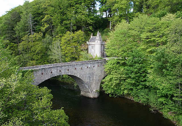
Bridge of Avon

The Bridge of Avon is a bridge over the River Avon at Ballindalloch in Moray, Scotland, built between 1800 and 1801 by George Burn. The bridge is mainly...

Cragganmore distillery

Cragganmore distillery is a Scotch whisky distillery situated in the village of Ballindalloch in Banffshire, Scotland. == History == The distillery was...

Ballindalloch railway station

Ballindalloch railway station served the village of Ballindalloch, Banffshire, Scotland from 1863 to 1965 on the Strathspey Railway. == History == The...

Deskie Castle

Deskie Castle was a medieval tower house that is thought to have been near Bridgend of Livet, Moray, Scotland. == History == Little is known of the castle...

Advie railway station

Advie railway station served the village of Advie, Morayshire, in Scotland. == History == Opened by the Strathspey Railway (GNoSR), it was absorbed by...

Ballindalloch Railway Bridge

The Ballindalloch Railway Bridge is a former railway bridge on the crossing the River Spey at Ballindalloch in Moray, Scotland. Built in 1863 as a part...

Have you been to Craig Balnafuaran?

Leave your review of Craig Balnafuaran below (or comments, questions and feedback).