Egg Plantation

Wood, Forest in Fife

Scotland

Egg Plantation

Back Road to Ballingry This track leads to the site of the demolished Lochore House and on to Ballingry.
Back Road to Ballingry Credit: Robert Struthers

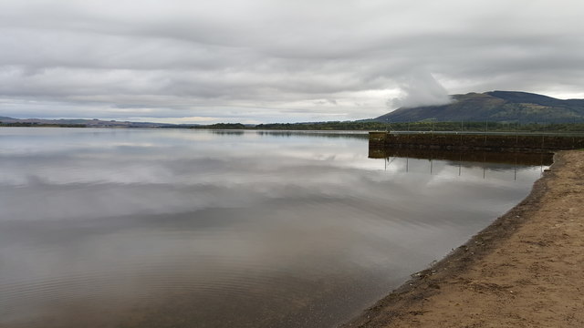
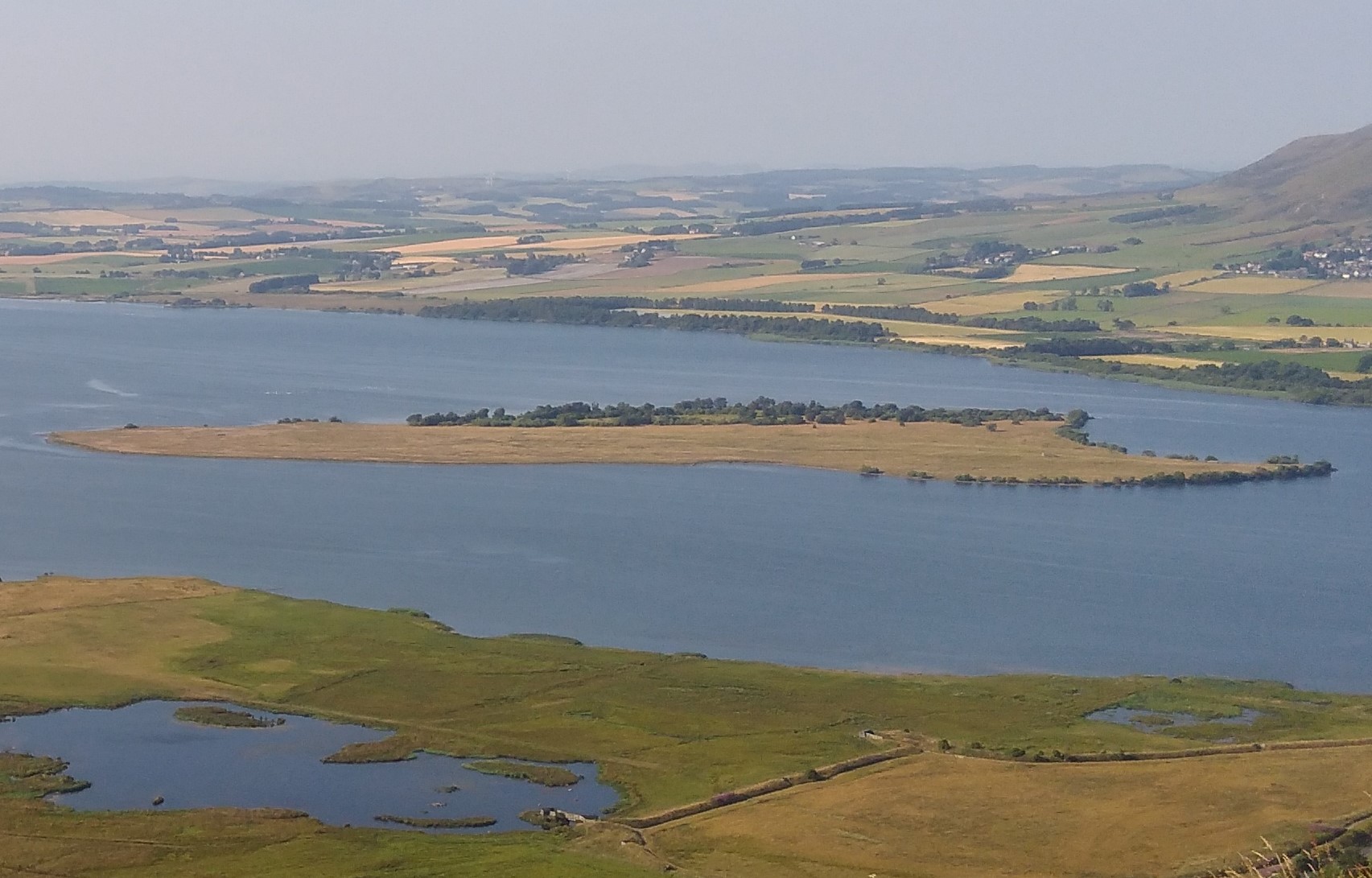
Egg Plantation, located in Fife (Wood, Forest), is a popular and picturesque destination that attracts visitors from all over. Nestled amidst the lush greenery of the forest, this enchanting plantation offers a serene and tranquil environment for nature enthusiasts and those seeking a peaceful retreat.

Egg Plantation spans over a vast area of woodland, featuring a diverse range of trees and vegetation that create a stunning landscape. The forest is home to a variety of flora and fauna, making it a haven for wildlife lovers. Visitors can spot indigenous species such as deer, squirrels, and a wide array of bird species while exploring the plantation.

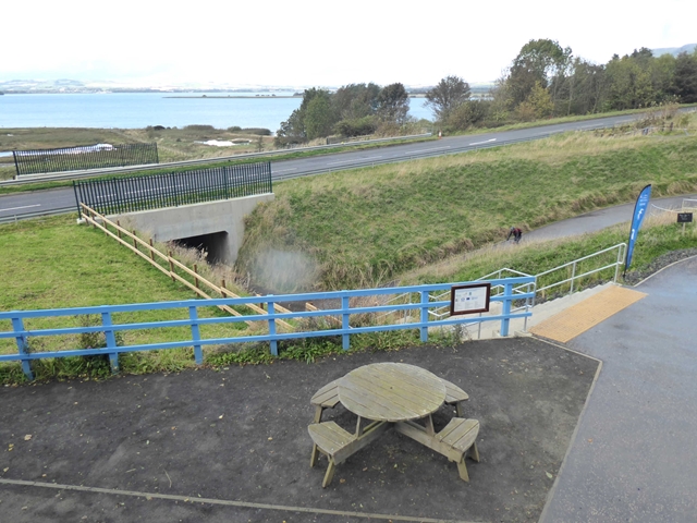
The plantation offers numerous walking trails and hiking paths, allowing visitors to immerse themselves in the beauty of nature and admire the stunning views. These trails vary in difficulty, catering to both experienced hikers and casual walkers. Along the way, visitors can enjoy the sights and sounds of the forest, including babbling brooks and gentle streams.

In addition to its natural beauty, Egg Plantation also features several amenities for visitors. There are picnic areas where visitors can relax and enjoy a meal amidst the tranquility of the forest. The plantation also offers camping facilities, allowing visitors to extend their stay and truly immerse themselves in the natural surroundings.

Overall, Egg Plantation in Fife (Wood, Forest) provides a breathtaking experience for nature lovers, offering a perfect blend of natural beauty, wildlife, and recreational activities. Whether one seeks a peaceful stroll through the woods or an adventurous hike, this plantation is a must-visit destination for anyone looking to reconnect with nature.

If you have any feedback on the listing, please let us know in the comments section below.

Egg Plantation Images

Images are sourced within 2km of 56.167952/-3.3424299 or Grid Reference NT1698. Thanks to Geograph Open Source API. All images are credited.

Back Road to Ballingry This track leads to the site of the demolished Lochore House and on to Ballingry.
Back Road to Ballingry
This track leads to the site of the demolished Lochore House and on to Ballingry.
Steps to Benarty The initial ascent of Benarty is via a series of steps.
Steps to Benarty
The initial ascent of Benarty is via a series of steps.
Benarty Trig Point Looking south to the Firth of Forth
Benarty Trig Point
Looking south to the Firth of Forth
Benarty Hill (trig point) The trig point on the summit of Benarty Hill.
Benarty Hill (trig point)
The trig point on the summit of Benarty Hill.
Subway beneath B9097 The subway connects the RSPB reserve at Vane Farm with the reserve's hides on the north side of the road.
Subway beneath B9097
The subway connects the RSPB reserve at Vane Farm with the reserve's hides on the north side of the road.
Steps and path descending to Vane Farm visitor centre The RSPB nature reserve at Vane Farm is on the south side of Loch Leven. The steps and path connect the visitor centre with the woodland part of the reserve.
Steps and path descending to Vane Farm visitor centre
The RSPB nature reserve at Vane Farm is on the south side of Loch Leven. The steps and path connect the visitor centre with the woodland part of the reserve.
Loch Leven with the walls that channel the water to the Sluice House
Rain sweeping in Making the Loch Leven wetlands even wetter.
Rain sweeping in
Making the Loch Leven wetlands even wetter.
Loch Leven Lodges, Coffee Shop and reception Car park with easy access to the path around Loch Leven.  The holiday hut complex is growing.
Loch Leven Lodges, Coffee Shop and reception
Car park with easy access to the path around Loch Leven. The holiday hut complex is growing.
Loch Leven Lodges Coffee Shop The coffee shop and reception at Loch Leven Lodges, viewed from the car park.
Loch Leven Lodges Coffee Shop
The coffee shop and reception at Loch Leven Lodges, viewed from the car park.
Construction site at Loch Leven Construction (purpose unknown) under way immediately west of the RSPB Visitor Centre on Loch Leven. The cliffs of Benarty on the skyline.
Construction site at Loch Leven
Construction (purpose unknown) under way immediately west of the RSPB Visitor Centre on Loch Leven. The cliffs of Benarty on the skyline.
New underpass under construction Work under way to install a new underpass under the busy B9097. The underpass will link the RSPB Visitor Centre with the wetlands on the southern shore of Loch Leven and will be accessed by a gently inclined ramp. It will replace the old rather inadequate underpass to the east which could only be accessed by steps (see <a href="https://www.geograph.org.uk/photo/5363544">NT1699 : Subway beneath B9097</a>).
New underpass under construction
Work under way to install a new underpass under the busy B9097. The underpass will link the RSPB Visitor Centre with the wetlands on the southern shore of Loch Leven and will be accessed by a gently inclined ramp. It will replace the old rather inadequate underpass to the east which could only be accessed by steps (see NT1699 : Subway beneath B9097).
Squirrel carving at RSPB Loch Leven Hopefully a red not a grey!
Squirrel carving at RSPB Loch Leven
Hopefully a red not a grey!
The courtyard at Vane Farm RSPB Visitor Centre on the southern shores of Loch Leven.
The courtyard at Vane Farm
RSPB Visitor Centre on the southern shores of Loch Leven.
The Sluice House, Loch Leven These sluices control water flowing out of Loch Leven;  and thus is born the River Leven.
The Sluice House, Loch Leven
These sluices control water flowing out of Loch Leven; and thus is born the River Leven.
Winter shore on Loch Leven
New underpass in operation Seen from a different viewpoint, the new underpass <a href="https://www.geograph.org.uk/photo/5891920">NT1699 : New underpass under construction</a> under the busy B9097 is now complete. The ramped access allows cyclists to access the cycleways on the north side of the road.
New underpass in operation
Seen from a different viewpoint, the new underpass NT1699 : New underpass under construction under the busy B9097 is now complete. The ramped access allows cyclists to access the cycleways on the north side of the road.
Loch Leven Lodges Holiday accommodation.
Loch Leven Lodges
Holiday accommodation.
Show me another place!

Egg Plantation is located at Grid Ref: NT1698 (Lat: 56.167952, Lng: -3.3424299)

Unitary Authority: Fife

Police Authority: Fife

What 3 Words

///screening.river.saints. Near Ballingry, Fife

Nearby Locations

Egg Plantation Vane Hill

Related Wikis

Benarty Hill

Benarty Hill, locally simply Benarty, rises above and to the west of Ballingry, in the west of Fife, Scotland. The summit ridge forms the boundary with...

Benarty

Benarty is the name informally used to refer to the ex-mining towns of Ballingry and Lochore and the villages of Crosshill, Lochcraig and Glencraig. The...

Lochore

Lochore is a former mining village in Fife, Scotland. It takes its name from the nearby Loch Ore. It is largely joined to the adjacent villages of Ballingry...

Ballingry

Ballingry ( or locally or (older) ); Scots: Ballingry, Bingry, Scottish Gaelic: Baile Iongrach) is a small town in Fife, Scotland. It is near the boundary...

Crosshill, Fife

Crosshill is a village in Fife, Scotland, located just to the south of the village of Lochore, and to the east of Loch Ore. == History == Crosshill was...

St Serf's Inch Priory

The St Serf's Inch Priory (or Portmoak Priory) was a community of Augustinian canons based, initially at least, on St Serf's Inch in Loch Leven, Perth...

Fife power station

Fife power station was a 120 megawatt gas-fired combined cycle gas turbine generating station at Cardenden in Fife, Scotland. It was a 1+1 configuration...

St Serf's Inch

St Serf's Inch or St Serf's Island is an island in Loch Leven, in south-eastern Perth and Kinross, Scotland. It was the home of a Culdee and then an Augustinian...

Nearby Amenities

Located within 500m of 56.167952,-3.3424299
The data included in this document is from www.openstreetmap.org. The data is made available under ODbL.

Have you been to Egg Plantation?

Leave your review of Egg Plantation below (or comments, questions and feedback).