Kelton Fell

Hill, Mountain in Cumberland Copeland

England

Kelton Fell

Fields near Smaithwaite Farm
Fields near Smaithwaite Farm Credit: David Medcalf

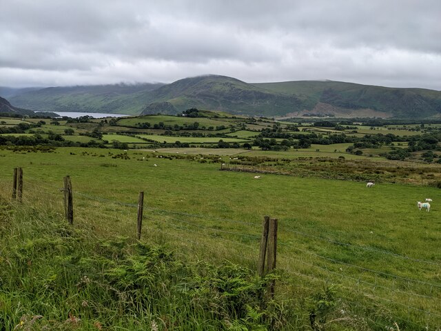
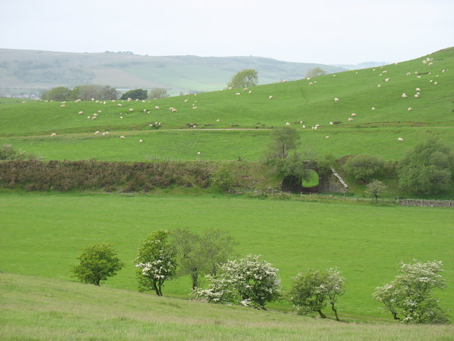
Kelton Fell is a prominent hill located in the county of Cumberland in Northwest England. It is part of the larger Lake District National Park and stands at an elevation of approximately 508 meters (1666 feet) above sea level. Positioned to the northeast of the market town of Wigton, Kelton Fell offers breathtaking views of the surrounding countryside, making it a popular destination for outdoor enthusiasts and nature lovers.

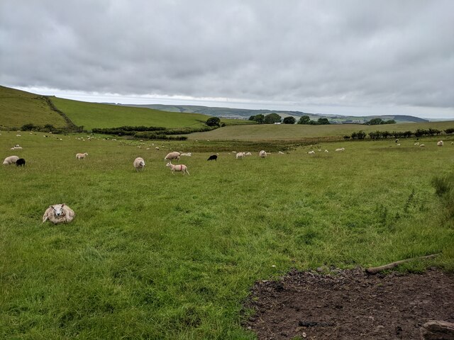
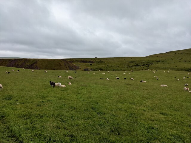
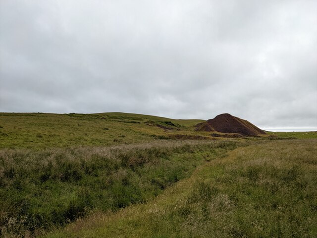
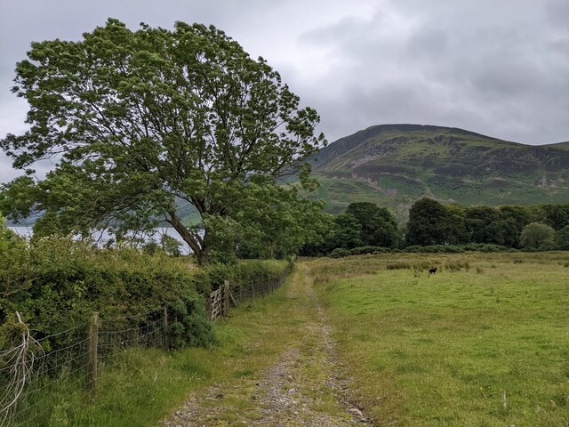
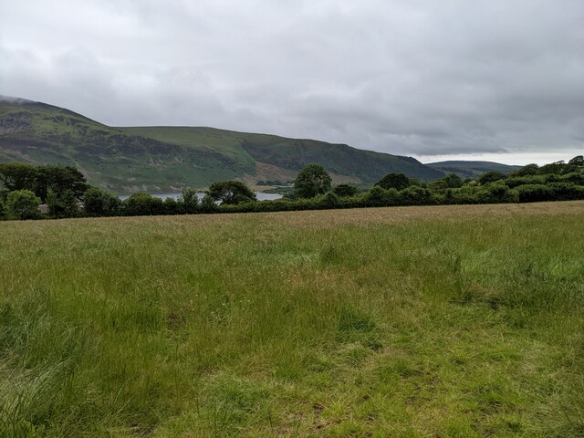
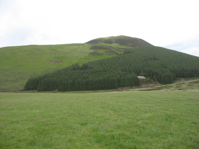
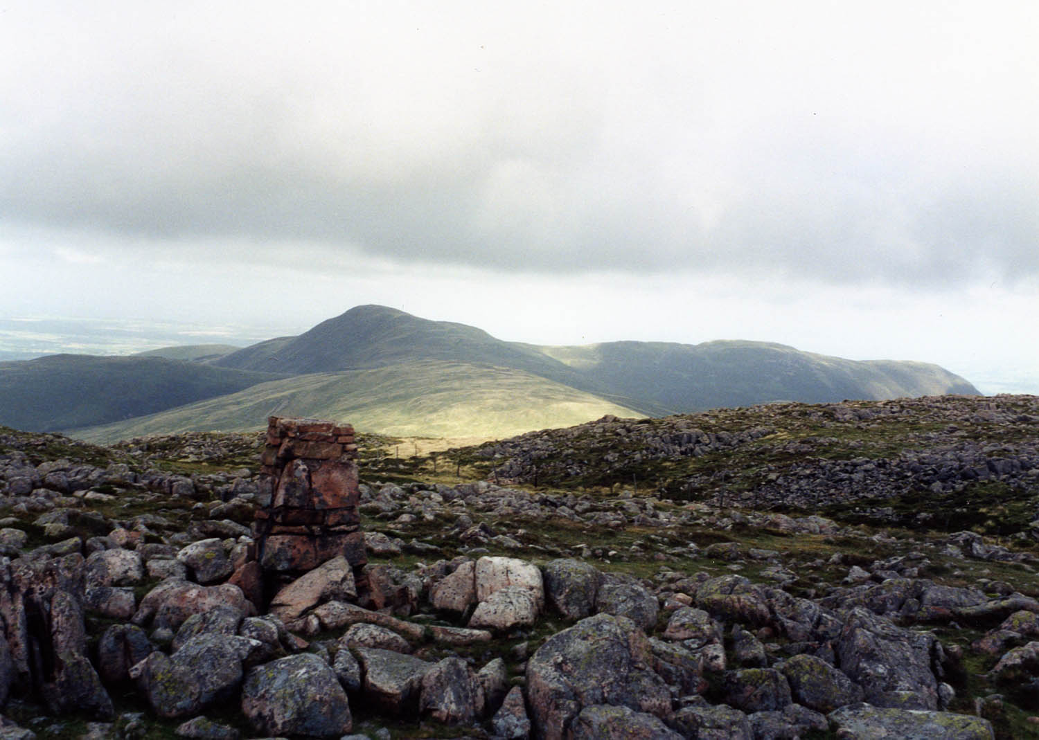
The fell is characterized by its rolling grassy slopes and rocky outcrops, which provide a diverse habitat for a variety of flora and fauna. The lower slopes are covered in heather, gorse, and bracken, while the higher areas are more rugged and rocky. The summit of Kelton Fell offers panoramic vistas of the Solway Firth, the Scottish coastline, and the nearby fells of the Lake District.

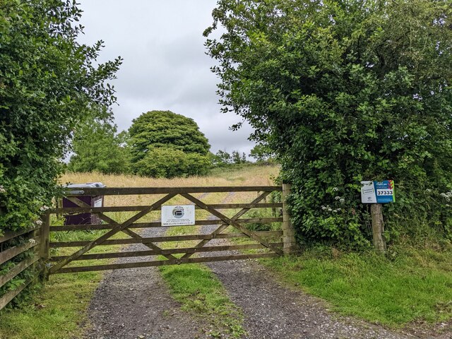
The hill is easily accessible, with several footpaths and trails leading to its summit. Hikers and walkers can enjoy the challenge of ascending the steep slopes, rewarded with stunning views at the top. The area is also a favorite spot for birdwatching, with sightings of buzzards, kestrels, and peregrine falcons being common.

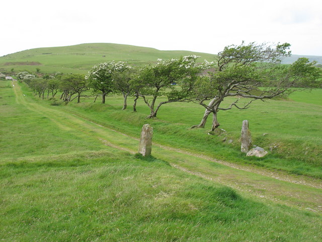
Kelton Fell is steeped in history, with evidence of prehistoric settlements and ancient burial mounds found in the vicinity. The hill has also played a role in the region's mining history, with traces of lead and copper mining activities dating back to the 17th century.

Overall, Kelton Fell offers a fantastic opportunity to explore the natural beauty and rich history of Cumberland's landscape. Whether for hiking, birdwatching, or simply enjoying the scenic views, it is a must-visit destination for outdoor enthusiasts and those seeking a connection with nature.

If you have any feedback on the listing, please let us know in the comments section below.
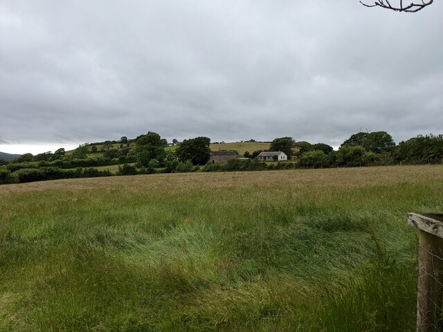
Kelton Fell Images

Images are sourced within 2km of 54.550293/-3.4010721 or Grid Reference NY0918. Thanks to Geograph Open Source API. All images are credited.

Fields near Smaithwaite Farm
Fields by Smaithwaite Beck Looking towards the old mine tips.
Fields by Smaithwaite Beck
Looking towards the old mine tips.
The gate to Felldyke Bunkhouse
The junction with the bridleway from How Hall Farm
The bridleway to How Hall Farm
Mine tips near Smaithwaite Beck
A rough track off Cauda Brow Not seeming to lead anywhere, it is probably related to the old mines in the area.
A rough track off Cauda Brow
Not seeming to lead anywhere, it is probably related to the old mines in the area.
Looking towards How Hall Farm
Rough ground below Cauda Brow
A first glimpse of Ennerdale Water From Cauda Brow.
A first glimpse of Ennerdale Water
From Cauda Brow.
A colourful addition to the lane above Croasdale A new electricity cable is being laid.
A colourful addition to the lane above Croasdale
A new electricity cable is being laid.
A bridleway leading to Ennerdale Water
Buildings in Croasdale
Looking towards Croftfoot
A field near Ennerdale Water
Murton Fell from Kelton Fell
The track to Kelton Fell Looking back to the T-junction and the road to Kirkland. The direction of the prevailing wind is clear!
The track to Kelton Fell
Looking back to the T-junction and the road to Kirkland. The direction of the prevailing wind is clear!
Disused railway A bridge on the former railway serving the mine on Murton Fell.
Disused railway
A bridge on the former railway serving the mine on Murton Fell.
Show me another place!

Kelton Fell is located at Grid Ref: NY0918 (Lat: 54.550293, Lng: -3.4010721)

Administrative County: Cumbria

District: Copeland

Police Authority: Cumbria

What 3 Words

///annoys.arch.aimlessly. Near Frizington, Cumbria

Related Wikis

Knock Murton

Knock Murton or Murton Fell is a hill of 464.4 metres (1,524 ft) in the north west of the Lake District, England. It lies in the Borough of Copeland in...

Cogra Moss

Cogra Moss is a shallow reservoir to the east of the village of Lamplugh on the western edge of the English Lake District. It was created by the damming...

Blake Fell

Blake Fell is a hill in the Western part of the English Lake District. It is the highest point of the Loweswater Fells, an area of low grassy hills with...

Gavel Fell

Gavel Fell is a hill in the English Lake District. Centremost of the five Loweswater Fells in the western part of the District, it stands between Hen Comb...

Nearby Amenities

Located within 500m of 54.550293,-3.4010721
Croasdale Iron Mine
Abandoned: yes
Historic: mine
Man Made: mine
Mineral: iron
Lat/Long: 54.5487613/-3.3961314
Kelton Fell
Ele: 311
Natural: peak
Lat/Long: 54.5502553/-3.4010668
Abandoned: yes
Historic: mine_shaft
Man Made: mineshaft
Lat/Long: 54.5468457/-3.4045914
Abandoned: yes
Historic: adit
Man Made: adit
Lat/Long: 54.5474061/-3.402783
Abandoned: yes
Historic: mine_shaft
Man Made: mineshaft
Lat/Long: 54.5477086/-3.4029797
Abandoned: yes
Historic: mine_shaft
Man Made: mineshaft
Lat/Long: 54.5485486/-3.4001331
Abandoned: yes
Direction: 310
Historic: adit
Man Made: adit
Lat/Long: 54.5485479/-3.3982211
Abandoned: yes
Historic: mine_shaft
Man Made: mineshaft
Lat/Long: 54.5496862/-3.3973978
Abandoned: yes
Historic: mine_shaft
Man Made: mineshaft
Lat/Long: 54.5503017/-3.3980126
Abandoned: yes
Historic: mine_shaft
Man Made: mineshaft
Mineral: iron_ore
Lat/Long: 54.551109/-3.4012074
Abandoned: yes
Historic: mine_shaft
Man Made: mineshaft
Lat/Long: 54.549345/-3.408589
Abandoned: yes
Historic: mine_shaft
Man Made: mineshaft
Mineral: iron_ore
Lat/Long: 54.554349/-3.3985091
Abandoned: yes
Historic: mine_shaft
Man Made: mineshaft
Mineral: iron_ore
Lat/Long: 54.5543048/-3.4009884
Abandoned: yes
Historic: mine_shaft
Man Made: mineshaft
Lat/Long: 54.5498269/-3.4045593
Abandoned: yes
Historic: mine_shaft
Man Made: mineshaft
Lat/Long: 54.5521382/-3.4062722
Abandoned: yes
Historic: mine_shaft
Man Made: mineshaft
Lat/Long: 54.547744/-3.3984307
Abandoned: yes
Historic: mine_shaft
Man Made: mineshaft
Mineral: iron_ore
Lat/Long: 54.5540515/-3.401334
Abandoned: yes
Historic: mine_shaft
Man Made: mineshaft
Mineral: iron_ore
Lat/Long: 54.5546647/-3.3997117
Abandoned: yes
Historic: mine_shaft
Man Made: mineshaft
Lat/Long: 54.5477705/-3.4031944
Abandoned: yes
Historic: mine_shaft
Man Made: mineshaft
Lat/Long: 54.5470109/-3.4023543
Hole Gill
Place: locality
Lat/Long: 54.5499288/-3.3976739
Man Made: cairn
Lat/Long: 54.548426/-3.3980826
Leisure: picnic_table
Lat/Long: 54.5484976/-3.3980501
Barrier: stile
Lat/Long: 54.5476914/-3.3997062
Generator Method: wind_turbine
Generator Source: wind
Power: generator
Lat/Long: 54.5467905/-3.4025874
Abandoned: yes
Historic: mine_shaft
Man Made: mineshaft
Mineral: iron_ore
Lat/Long: 54.5547148/-3.402438
The data included in this document is from www.openstreetmap.org. The data is made available under ODbL.

Have you been to Kelton Fell?

Leave your review of Kelton Fell below (or comments, questions and feedback).