Honey Hill

Settlement in Kent Canterbury

England

Honey Hill

Denstroude Farm In the part of Kent known as The Blean; an area of pasture and woodland between Canterbury and the north coast.
Denstroude Farm Credit: Jonathan Billinger

Honey Hill is a charming village located in the county of Kent, England. Situated in the southeastern part of the country, it is nestled amidst the picturesque countryside that characterizes the region. With a population of around 500 residents, Honey Hill exudes a peaceful and tranquil atmosphere, making it a desirable destination for those seeking a break from the hustle and bustle of city life.

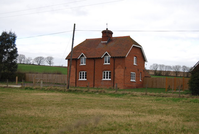
The village is known for its quaint and well-preserved architecture, with many traditional cottages and buildings lining its narrow streets. The historic St. Mary's Church, a prominent landmark in Honey Hill, dates back to the 12th century and showcases stunning medieval architecture.

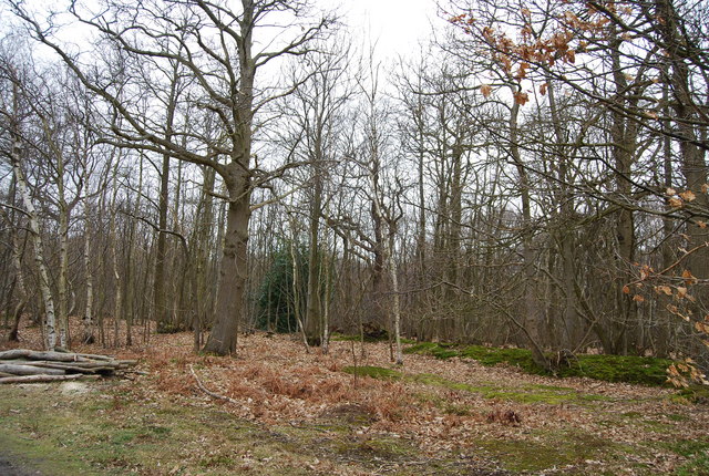
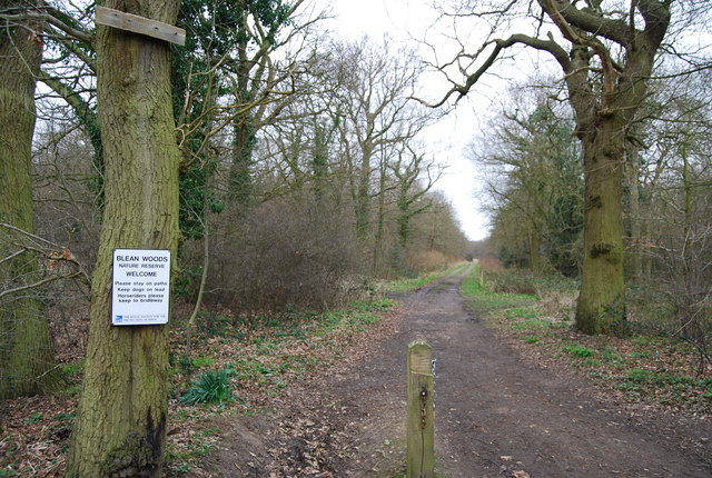
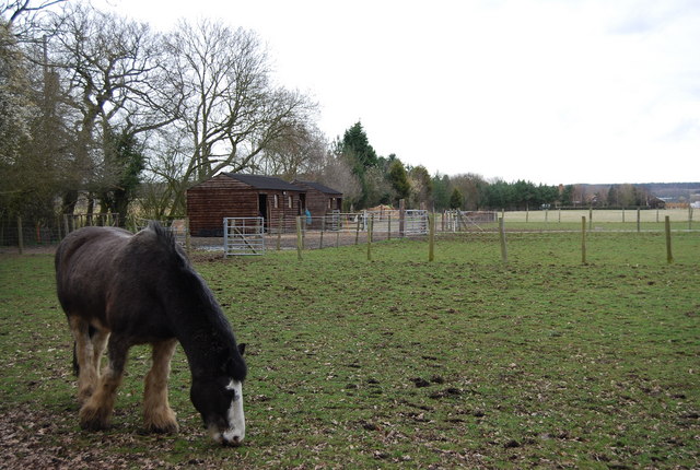
Surrounded by lush green fields and rolling hills, Honey Hill offers ample opportunities for outdoor activities and exploration. The village is blessed with an abundance of natural beauty, with scenic walking trails and countryside views that attract both locals and visitors alike. Nature enthusiasts can enjoy birdwatching, cycling, or simply taking a leisurely stroll in the countryside.

In terms of amenities, Honey Hill boasts a range of local businesses, including a village shop, a cozy pub, and a few small cafes. While it may not have extensive commercial facilities, the village's close proximity to nearby towns and cities ensures that residents have easy access to a wider range of services.

Overall, Honey Hill is a delightful village that offers a peaceful retreat and a glimpse into the rich history and natural beauty of Kent. Its idyllic setting and friendly community make it a truly charming place to visit or call home.

If you have any feedback on the listing, please let us know in the comments section below.
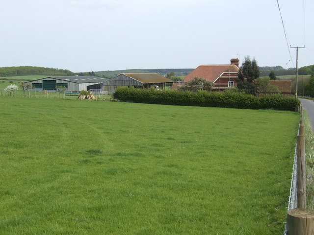
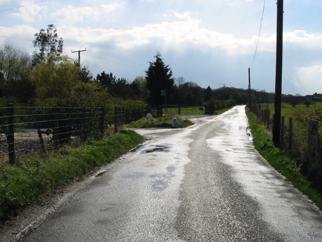
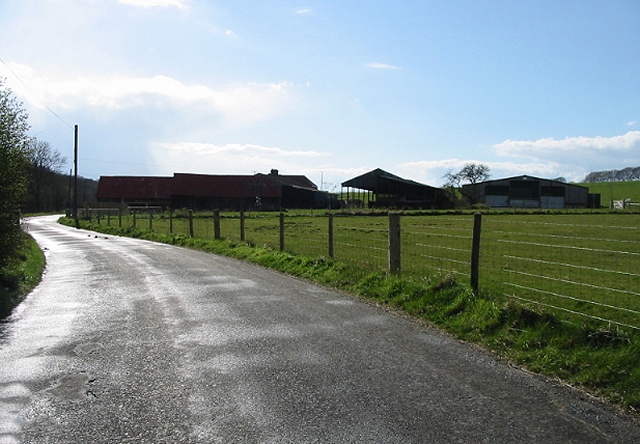
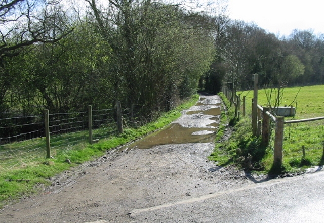
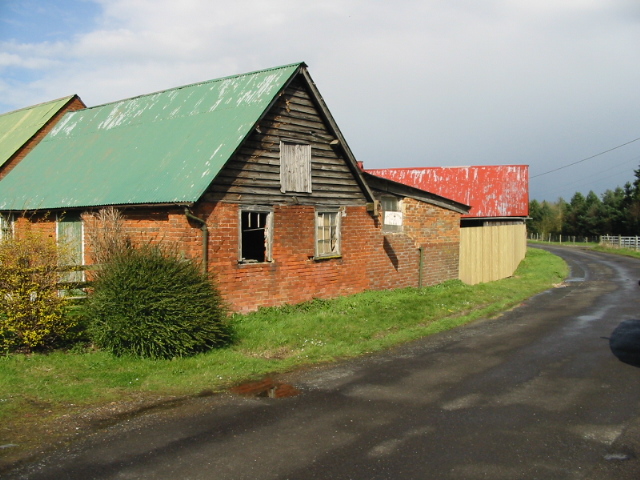
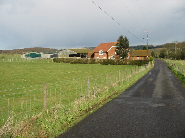
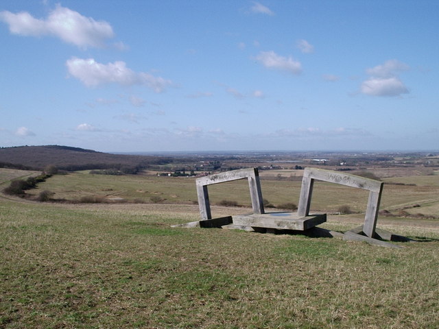
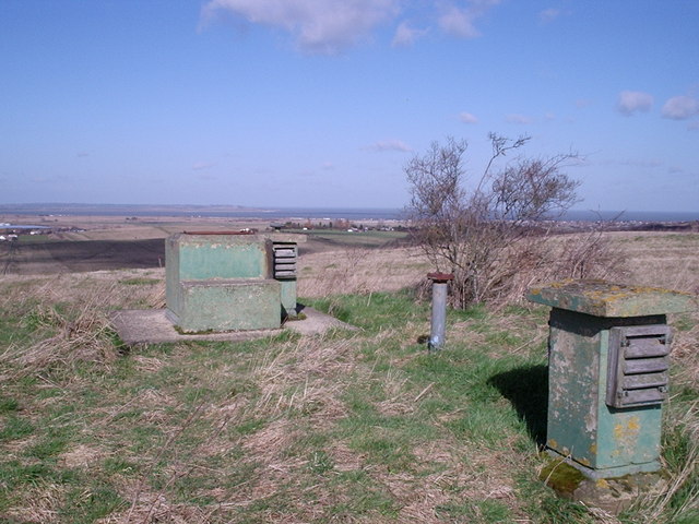
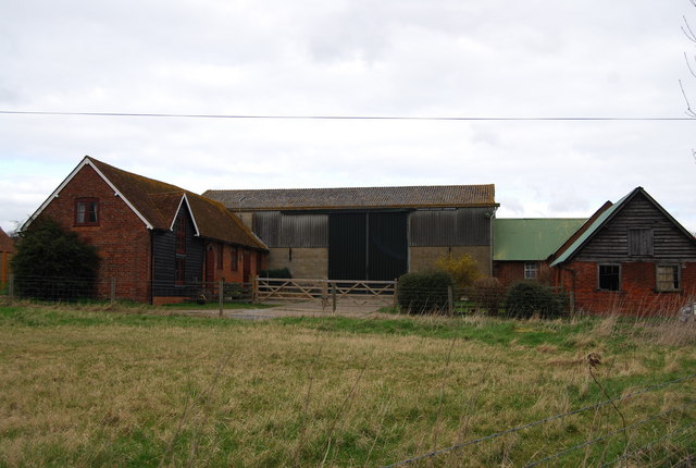
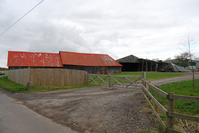
Honey Hill Images

Images are sourced within 2km of 51.313228/1.033483 or Grid Reference TR1161. Thanks to Geograph Open Source API. All images are credited.

Denstroude Farm In the part of Kent known as The Blean; an area of pasture and woodland between Canterbury and the north coast.
Denstroude Farm
In the part of Kent known as The Blean; an area of pasture and woodland between Canterbury and the north coast.
View along Denstroude Lane to junction with road to Parsonage farm
Meeting of the ways! Denstroude Lane, footpath and road to Parsonage Farm
Meeting of the ways!
Denstroude Lane, footpath and road to Parsonage Farm
Road to Brook Farm from Denstroude Lane
Footpaths and road to Parsonage Farm off Denstroude Lane
Looking NE along Denstroude Lane
Denstroude Farm on Denstroude Lane
Footpath to North Bishopden Wood North Bishopden Wood is part of the much larger Blean Woods National Nature Reserve.
Footpath to North Bishopden Wood
North Bishopden Wood is part of the much larger Blean Woods National Nature Reserve.
Farm buildings on Denstroude Farm
Denstroude Farm on Denstroude Lane
The Link Sculpture, Victory Wood The Victory Wood project (<span class="nowrap"><a title="http://www.wt-woods.org.uk/victorywood/description.asp)" rel="nofollow ugc noopener" href="http://www.wt-woods.org.uk/victorywood/description.asp)">Link</a><img style="margin-left:2px;" alt="External link" title="External link - shift click to open in new window" src="https://s1.geograph.org.uk/img/external.png" width="10" height="10"/></span> will see the establishment of a new area of woodland connecting Blean Wood (to the west) and Ellenden Wood (to the east).  This sculpture symbolizes the future link between the existing woods.
The Link Sculpture, Victory Wood
The Victory Wood project (LinkExternal link will see the establishment of a new area of woodland connecting Blean Wood (to the west) and Ellenden Wood (to the east). This sculpture symbolizes the future link between the existing woods.
Disused ROC monitoring post This underground Royal Observer Corps nuclear monitoring post is situated in the area which will become Victory Wood. <span class="nowrap"><a title="http://www.wt-woods.org.uk/VictoryWood" rel="nofollow ugc noopener" href="http://www.wt-woods.org.uk/VictoryWood">Link</a><img style="margin-left:2px;" alt="External link" title="External link - shift click to open in new window" src="https://s1.geograph.org.uk/img/external.png" width="10" height="10"/></span>
Disused ROC monitoring post
This underground Royal Observer Corps nuclear monitoring post is situated in the area which will become Victory Wood. LinkExternal link
Earthbank, Blean Wood The earthbank is a boundary between 2 districts or parishes, probably dating back many hundreds of years.
Earthbank, Blean Wood
The earthbank is a boundary between 2 districts or parishes, probably dating back many hundreds of years.
Track into Blean Wood Nature Reserve West Blean (including Thornden Wood) is a SSSI and forms an important part of a wider conservation jigsaw, linking the Blean Woods National Nature Reserve in the west with East Blean Wood in the east, and thereby establishing a continuous nature conservation complex, owned and managed by a partnership of local and national bodies. (KWT)
40% of the reserve is densely planted conifer plantation and 40% is sweet chestnut coppice plantation. The remaining 20% is mixed native deciduous woodland.
Part of the woods is the Blean Wood National Nature Reserve. <span class="nowrap"><a title="http://www.theblean.co.uk/" rel="nofollow ugc noopener" href="http://www.theblean.co.uk/">Link</a><img style="margin-left:2px;" alt="External link" title="External link - shift click to open in new window" src="https://s1.geograph.org.uk/img/external.png" width="10" height="10"/></span>  
Natural England: <span class="nowrap"><a title="http://www.naturalengland.org.uk/ourwork/conservation/designatedareas/nnr/1006017.aspx" rel="nofollow ugc noopener" href="http://www.naturalengland.org.uk/ourwork/conservation/designatedareas/nnr/1006017.aspx">Link</a><img style="margin-left:2px;" alt="External link" title="External link - shift click to open in new window" src="https://s1.geograph.org.uk/img/external.png" width="10" height="10"/></span>
Track into Blean Wood Nature Reserve
West Blean (including Thornden Wood) is a SSSI and forms an important part of a wider conservation jigsaw, linking the Blean Woods National Nature Reserve in the west with East Blean Wood in the east, and thereby establishing a continuous nature conservation complex, owned and managed by a partnership of local and national bodies. (KWT) 40% of the reserve is densely planted conifer plantation and 40% is sweet chestnut coppice plantation. The remaining 20% is mixed native deciduous woodland. Part of the woods is the Blean Wood National Nature Reserve. LinkExternal link Natural England: LinkExternal link
Horse in a paddock, Denstroude Lane
Cottage, Denstroude Farm, Denstroude Lane
Denstroude Farm, Denstroude Lane
Denstroude Farm, Denstroude Lane (2)
Show me another place!

Honey Hill is located at Grid Ref: TR1161 (Lat: 51.313228, Lng: 1.033483)

Administrative County: Kent

District: Canterbury

Police Authority: Kent

What 3 Words

///scariest.jets.fails. Near Blean, Kent

Related Wikis

Honey Hill, Kent

Honey Hill is a hamlet on the A290 road, near the village of Blean, in the Canterbury district, in the English county of Kent.

Blean

Blean is a village and civil parish in the Canterbury district of Kent, England. The civil parish is large and is mostly woodland, much of which is ancient...

Denstroude

Denstroude is a dispersed hamlet located to the west of the A290 road north of Canterbury in Kent, England. It is a collection of houses and farms, one...

Blean and Tyler Hill Halt railway station

Blean and Tyler Hill Halt was a minor station on the Canterbury and Whitstable Railway at Tyler Hill, Kent. It opened in 1908 and closed in 1931. ��2...

Ellenden Wood

Ellenden Wood is a 90.6-hectare (224-acre) biological Site of Special Scientific Interest south of Whitstable in Kent. It is a Nature Conservation Review...

Canterbury (UK Parliament constituency)

Canterbury is a constituency in Kent represented in the House of Commons of the UK Parliament since 2017 by Rosie Duffield of the Labour Party.The seat...

Church Woods, Blean

Church Woods, Blean is a 526.7-hectare (1,302-acre) biological Site of Special Scientific Interest north-west of Canterbury in Kent. It is a Nature Conservation...

Duncan Down

Duncan Down is an open, public, area to the south west of Whitstable and is the largest village green in the United Kingdom. It is a 21 hectare (52 acre...

Nearby Amenities

Located within 500m of 51.313228,1.033483
Bus Stop
The Royal Oak
Bench: no
Bin: no
Flag: yes
Lit: no
Naptan AtcoCode: 2400A048330A
Naptan Bearing: SE
Naptan CommonName: The Royal Oak
Naptan Indicator: adj
Naptan Landmark: The Royal Oak
Naptan NaptanCode: kntgagma
Naptan Street: Blean Common
Naptan Verified: yes
Public Transport: platform
Ref: kntgagma
Shelter: no
Source: naptan_import
Source Date: 2018-08-20T14:17:00
Tactile Paving: no
Lat/Long: 51.3114474/1.0368654
Post Box
Collection Plate: CP5D
Collection Times: Mo-Fr 09:00, Sa 07:00
Location: In the wall.of the "The Royal Oak" pub.
Old Ref: CT2 70
Operator: Royal Mail
Operator Wikidata: Q638098
Post Box Type: wall
Postal Code: CT2
Ref: CT2 70D
Royal Cypher: VR
Source: survey
Survey Date: 2023-07-03
Lat/Long: 51.3113244/1.0370521
Bus Stop
The Royal Oak
Bench: yes
Bin: yes
Lit: yes
Naptan AtcoCode: 2400A048320A
Naptan Bearing: NW
Naptan CommonName: The Royal Oak
Naptan Indicator: opp
Naptan Landmark: The Royal Oak
Naptan NaptanCode: kntgagjw
Naptan Street: Blean Common
Naptan Verified: yes
Public Transport: platform
Ref: kntgagjw
Shelter: yes
Source: naptan_import
Source Date: 2018-08-20T14:19:00
Tactile Paving: no
Lat/Long: 51.3110083/1.037391
Bus Stop
Druidstone
Bench: no
Bin: no
Naptan AtcoCode: 2400A048340A
Naptan Bearing: N
Naptan CommonName: Druidstone
Naptan Indicator: opp
Naptan Landmark: Druidstone Wildlife Park
Naptan NaptanCode: kntgagmd
Naptan Street: Honey Hill
Naptan Verified: no
Public Transport: platform
Ref: kntgagmd
Shelter: no
Source: naptan_import
Source Date: 2018-08-20T14:20:00
Tactile Paving: no
Lat/Long: 51.3139421/1.0346621
Bus Stop
Druidstone
Bench: no
Bin: no
Flag: yes
Naptan AtcoCode: 2400A048350A
Naptan Bearing: S
Naptan CommonName: Druidstone
Naptan Indicator: adj
Naptan Landmark: Druidstone Wildlife Park
Naptan NaptanCode: kntgagmg
Naptan Street: Honey Hill
Naptan Verified: no
Public Transport: platform
Ref: kntgagmg
Shelter: no
Source: naptan_import
Source Date: 2018-08-20T14:22:00
Lat/Long: 51.3139639/1.0348645
Power: pole
Lat/Long: 51.314306/1.0358838
Power: pole
Lat/Long: 51.3152963/1.0385219
Power: pole
Lat/Long: 51.3141473/1.030045
Power: pole
Lat/Long: 51.3142066/1.0332377
Power: pole
Lat/Long: 51.3142625/1.0348414
Power: pole
Lat/Long: 51.3140894/1.0271293
Power: pole
Lat/Long: 51.3141736/1.0313981
Power: pole
Lat/Long: 51.3148463/1.0373329
Power: pole
Lat/Long: 51.314209/1.0341188
Power: pole
Lat/Long: 51.3141058/1.0286918
Barrier: stile
Foot: yes
Material: wood
Source: survey
Stile: stepover
Lat/Long: 51.3125705/1.0396931
Grit Bin
Colour: yellow
Lat/Long: 51.3137338/1.0348799
Entrance: exit
Lat/Long: 51.3171114/1.0343653
Entrance: main
Lat/Long: 51.317157/1.0343369
Cafe
Lat/Long: 51.316987/1.0351074
Generator Method: photovoltaic
Generator Output Electricity: yes
Generator Source: solar
Generator Type: solar_photovoltaic_panel
Location: roof
Power: generator
Lat/Long: 51.3104552/1.0373135
The data included in this document is from www.openstreetmap.org. The data is made available under ODbL.

Have you been to Honey Hill?

Leave your review of Honey Hill below (or comments, questions and feedback).