Honey Tye

Settlement in Suffolk Babergh

England

Honey Tye

A134 Nayland Road & Leavenheath Village sign <span class="nowrap"><a title="https://en.wikipedia.org/wiki/Leavenheath" rel="nofollow ugc noopener" href="https://en.wikipedia.org/wiki/Leavenheath">Link</a><img style="margin-left:2px;" alt="External link" title="External link - shift click to open in new window" src="https://s1.geograph.org.uk/img/external.png" width="10" height="10"/></span>
A134 Nayland Road & Leavenheath Village sign Credit: Geographer

Honey Tye is a small village located in the county of Suffolk, England. Situated approximately 5 miles east of the town of Colchester, Honey Tye is nestled in a picturesque rural setting, surrounded by stunning countryside and farmland.

The village itself is characterized by its charming and quaint atmosphere, with a handful of traditional cottages and buildings constructed from local materials, giving it a distinct and timeless character. The population of Honey Tye is relatively small, with around 200 residents, contributing to its tight-knit community feel.

Despite its small size, Honey Tye benefits from being in close proximity to several amenities and services. The nearby town of Colchester offers a range of shops, supermarkets, restaurants, and recreational facilities, ensuring residents have easy access to all their daily needs.

The surrounding natural beauty of Honey Tye provides ample opportunities for outdoor activities and exploration. The village is situated near Dedham Vale, an Area of Outstanding Natural Beauty, renowned for its stunning landscapes, rolling hills, and tranquil riverside walks. This makes Honey Tye an ideal location for nature enthusiasts, hikers, and those seeking a peaceful retreat away from the hustle and bustle of city life.

Overall, Honey Tye offers a peaceful and idyllic lifestyle, with its rural charm, close-knit community, and access to beautiful natural surroundings. It is a place where residents can enjoy the best of both worlds – the tranquility of the countryside and the convenience of nearby amenities.

If you have any feedback on the listing, please let us know in the comments section below.

Honey Tye Images

Images are sourced within 2km of 51.985015/0.846221 or Grid Reference TL9535. Thanks to Geograph Open Source API. All images are credited.

A134 Nayland Road & Leavenheath Village sign <span class="nowrap"><a title="https://en.wikipedia.org/wiki/Leavenheath" rel="nofollow ugc noopener" href="https://en.wikipedia.org/wiki/Leavenheath">Link</a><img style="margin-left:2px;" alt="External link" title="External link - shift click to open in new window" src="https://s1.geograph.org.uk/img/external.png" width="10" height="10"/></span>
A134 Nayland Road & Leavenheath Village sign
Leavenheath Village sign On the A134 Nayland Road
Leavenheath Village sign
On the A134 Nayland Road
Leavenheath Village sign On the A134 Nayland Road
Leavenheath Village sign
On the A134 Nayland Road
A134 Nayland Road, Leavenheath At the entrance of Leaven Hall
A134 Nayland Road, Leavenheath
At the entrance of Leaven Hall
Leavenheath Village sign On the A134 Nayland Road
Leavenheath Village sign
On the A134 Nayland Road
St. Matthew's Church Notice Board At the entrance of St. Matthew's Church off the A134 Nayland Road
<span class="nowrap"><a title="http://www.suffolkchurches.co.uk/leavenheath.htm" rel="nofollow ugc noopener" href="http://www.suffolkchurches.co.uk/leavenheath.htm">Link</a><img style="margin-left:2px;" alt="External link" title="External link - shift click to open in new window" src="https://s1.geograph.org.uk/img/external.png" width="10" height="10"/></span>
St. Matthew's Church Notice Board
At the entrance of St. Matthew's Church off the A134 Nayland Road LinkExternal link
Entrance of St. Matthew's Church At the junction with the A134 Nayland Road
<span class="nowrap"><a title="http://www.suffolkchurches.co.uk/leavenheath.htm" rel="nofollow ugc noopener" href="http://www.suffolkchurches.co.uk/leavenheath.htm">Link</a><img style="margin-left:2px;" alt="External link" title="External link - shift click to open in new window" src="https://s1.geograph.org.uk/img/external.png" width="10" height="10"/></span>
Entrance of St. Matthew's Church
At the junction with the A134 Nayland Road LinkExternal link
A134 Nayland Road, Leavenheath At the entrance of St. Matthew's Church
A134 Nayland Road, Leavenheath
At the entrance of St. Matthew's Church
St. Matthew's Church, Leavenheath Off the A134 Nayland Road
<span class="nowrap"><a title="http://www.suffolkchurches.co.uk/leavenheath.htm" rel="nofollow ugc noopener" href="http://www.suffolkchurches.co.uk/leavenheath.htm">Link</a><img style="margin-left:2px;" alt="External link" title="External link - shift click to open in new window" src="https://s1.geograph.org.uk/img/external.png" width="10" height="10"/></span>
St. Matthew's Church, Leavenheath
Off the A134 Nayland Road LinkExternal link
High Road, Leavenheath At the junction with the A134 Honey Tye
Road No.U8611
High Road, Leavenheath
At the junction with the A134 Honey Tye Road No.U8611
High Road sign On High Road at the junction with the A134 Honey Tye
Road No.U8611
High Road sign
On High Road at the junction with the A134 Honey Tye Road No.U8611
Signpost on  the A134 Honey Tye At the junction with High Road
Signpost on the A134 Honey Tye
At the junction with High Road
A134 Honey Tye, Leavenheath At the junction with High Road
A134 Honey Tye, Leavenheath
At the junction with High Road
A134 Honey Tye, Leavenheath At the junction with High Road
A134 Honey Tye, Leavenheath
At the junction with High Road
High Road, Leavenheath At the junction with Wrights Way
Road No.U8611
High Road, Leavenheath
At the junction with Wrights Way Road No.U8611
High Road sign On High Road at the junction with the A134 Honey Tye
Road No.U8611
High Road sign
On High Road at the junction with the A134 Honey Tye Road No.U8611
High Road & Kingland Lane Postbox At the junction with Kingsland Lane
Postbox No.CO6 351
Road No.U8611
High Road & Kingland Lane Postbox
At the junction with Kingsland Lane Postbox No.CO6 351 Road No.U8611
Kingland Lane Postbox On High Road at the junction with Kingsland Lane
Postbox No.CO6 351
Kingland Lane Postbox
On High Road at the junction with Kingsland Lane Postbox No.CO6 351
Show me another place!

Honey Tye is located at Grid Ref: TL9535 (Lat: 51.985015, Lng: 0.846221)

Administrative County: Suffolk

District: Babergh

Police Authority: Suffolk

What 3 Words

///trooper.scavenger.fountain. Near Bures St Mary, Suffolk

Nearby Locations

Honey Tye

Related Wikis

Leavenheath

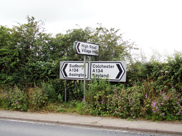
Leavenheath is a village and civil parish in Suffolk, England, close to the Essex border. Located on the A134 between Sudbury and Colchester, it is part...

Nayland-with-Wissington

Nayland-with-Wissington is a civil parish which comprises the larger village of Nayland and the adjoining rural village of Wissington (these days usually...
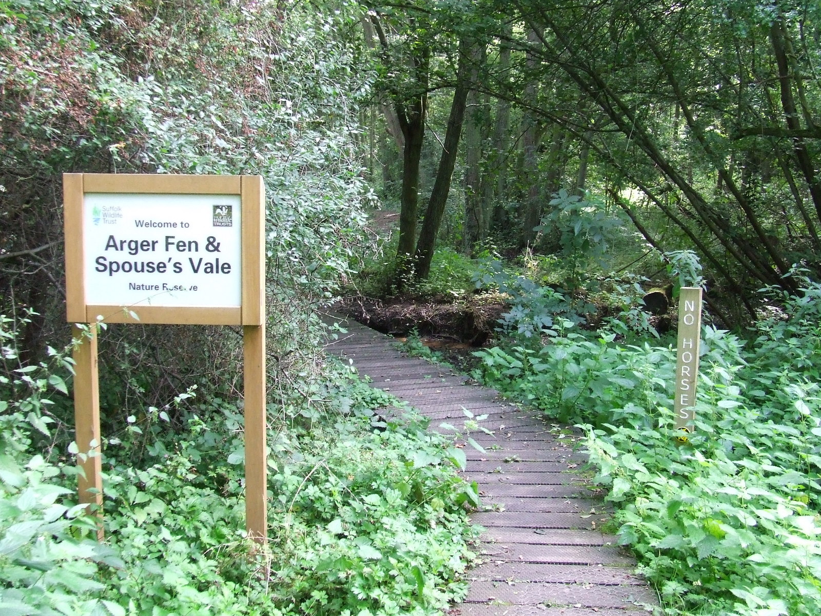
Arger Fen

Arger Fen is a 49.7-hectare (123-acre) biological Site of Special Scientific Interest (SSSI) south-east of Sudbury in Suffolk, England. The site occupies...

Wissington, Suffolk

Wissington or Wiston is a small village and former civil parish, now in the parish of Nayland-with-Wissington, in the Babergh district, in south Suffolk...

Nearby Amenities

Located within 500m of 51.985015,0.846221
Red Lion
Naptan AtcoCode: 390010102
Naptan Bearing: NW
Naptan BusStopType: CUS
Naptan CommonName: Red Lion
Naptan Indicator: opp
Naptan Landmark: Red Lion
Naptan NaptanCode: sufadjam
Naptan Street: A134
Naptan Verified: no
Public Transport: platform
Source: naptan_import
Lat/Long: 51.9849966/0.846306
Red Lion
Naptan AtcoCode: 390010103
Naptan Bearing: S
Naptan BusStopType: CUS
Naptan CommonName: Red Lion
Naptan Indicator: o/s
Naptan Landmark: Red Lion
Naptan NaptanCode: sufadjap
Naptan Street: A134
Naptan Verified: no
Public Transport: platform
Source: naptan_import
Lat/Long: 51.9856103/0.8461459
Honey Tye
Place: hamlet
Wikidata: Q3981049
Lat/Long: 51.9852039/0.846076
Bus Stop
High Road
Naptan AtcoCode: 390019667
Naptan BusStopType: CUS
Naptan NaptanCode: sufmgwmp
Naptan Verified: no
Public Transport: platform
Source: naptan
Lat/Long: 51.9891704/0.844779
The data included in this document is from www.openstreetmap.org. The data is made available under ODbL.

Have you been to Honey Tye?

Leave your review of Honey Tye below (or comments, questions and feedback).