Butler's Court Wood

Wood, Forest in Kent Canterbury

England

Butler's Court Wood

Meeting of the ways! Denstroude Lane, footpath and road to Parsonage Farm
Meeting of the ways! Credit: Nick Smith

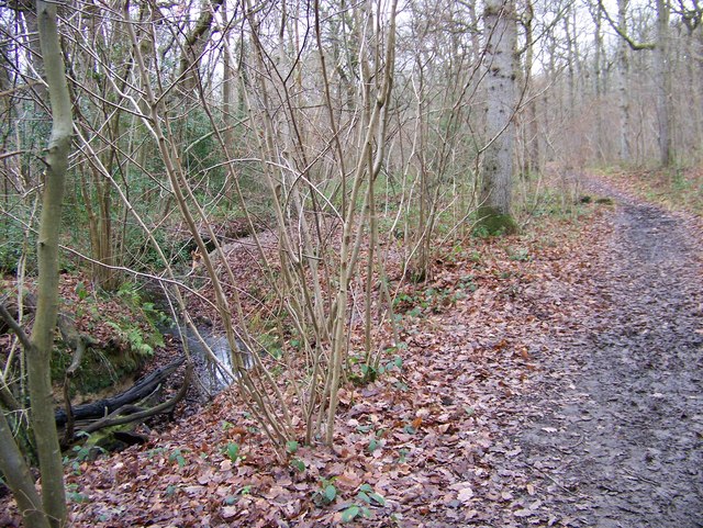
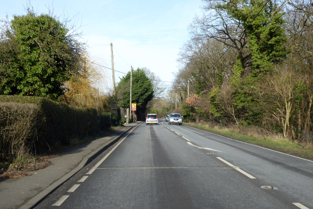
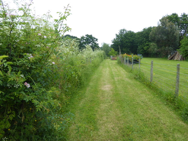
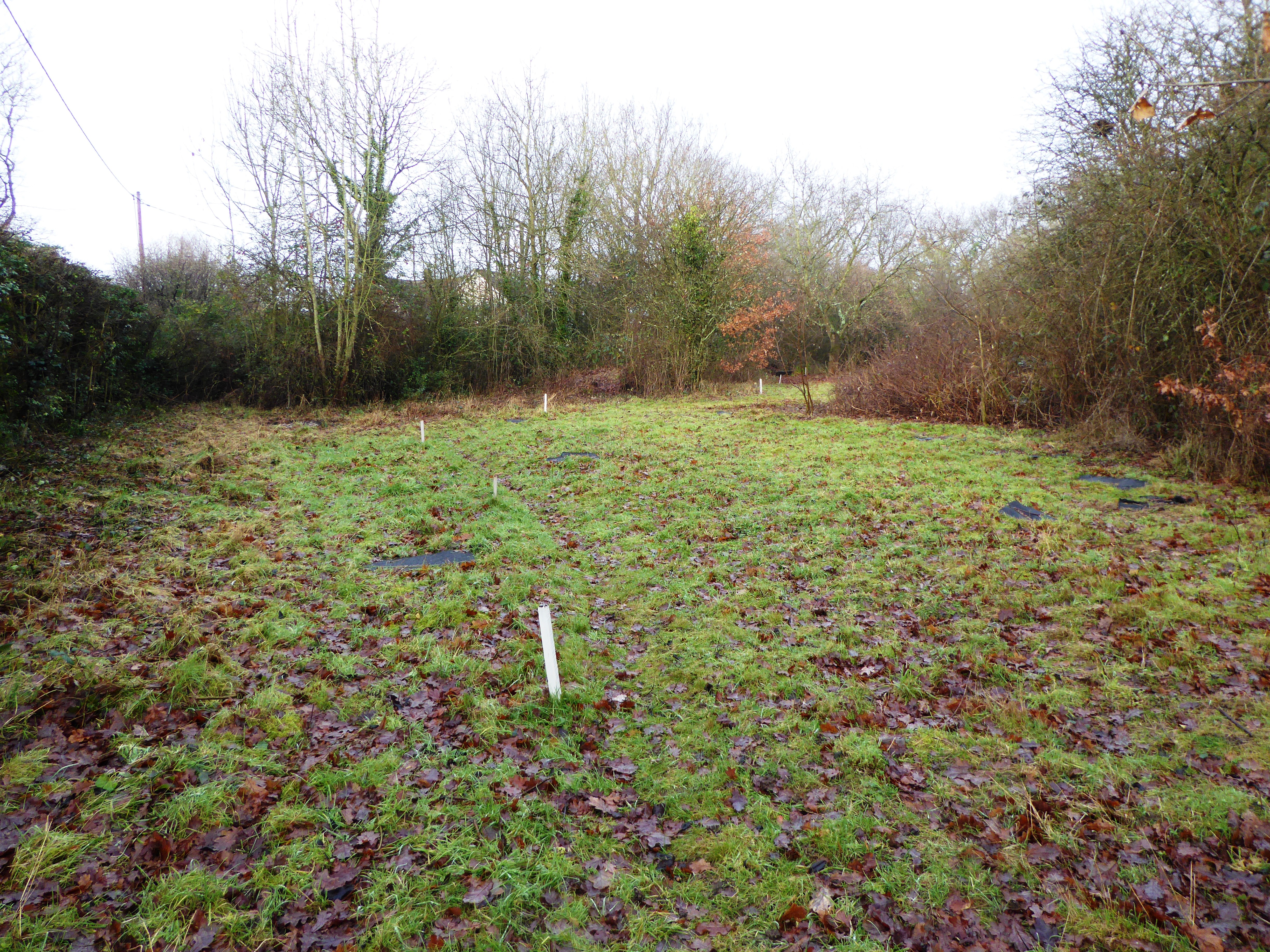
Butler's Court Wood, located in Kent, England, is a picturesque woodland area that spans over a vast expanse of approximately 100 acres. This stunning forest, also known as Butler's Court, is a designated Site of Special Scientific Interest (SSSI) due to its rich biodiversity and natural beauty.

The wood is composed of a mixture of deciduous and coniferous trees, creating a diverse and vibrant landscape throughout the year. Ancient oaks, beech, and birch trees dominate the wood, providing a habitat for a wide range of plant and animal species. The forest floor is adorned with a carpet of bluebells in spring, creating a breathtaking sight for visitors.

The woodland is home to numerous bird species, including nuthatches, woodpeckers, and tawny owls. It is also a haven for small mammals such as foxes, badgers, and various species of bats. Nature enthusiasts can often spot these animals while exploring the many walking trails that crisscross the wood.

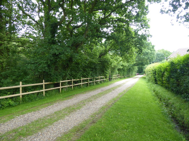
Butler's Court Wood provides a peaceful escape from the hustle and bustle of urban life, attracting locals and visitors alike. The wood is managed by the Forestry Commission, ensuring its preservation and protection for future generations to enjoy. It offers a range of recreational activities, including walking, birdwatching, and photography.

With its serene atmosphere, diverse flora and fauna, and its designation as an SSSI, Butler's Court Wood is a true gem of the Kent countryside. Whether you are seeking solace in nature or simply want to immerse yourself in its beauty, this woodland is a must-visit destination for nature lovers.

If you have any feedback on the listing, please let us know in the comments section below.

Butler's Court Wood Images

Images are sourced within 2km of 51.31602/1.0383875 or Grid Reference TR1161. Thanks to Geograph Open Source API. All images are credited.

Meeting of the ways! Denstroude Lane, footpath and road to Parsonage Farm
Meeting of the ways!
Denstroude Lane, footpath and road to Parsonage Farm
Road to Brook Farm from Denstroude Lane
Footpaths and road to Parsonage Farm off Denstroude Lane
Looking NE along Denstroude Lane
Entrance to Brook Farm, Denstroude Lane
Footpath leading off Denstroude Lane
Wooden Barn off Denstroude Lane
Footpath sign on Denstroude Lane A path (No.CB3A) leads past Parsonage Farm towards Brook Lodge then onto Denstroude Lane, near Honey Hill. Another path (No.ZR674) leads to Grimshill Wood and Church Wood.
Footpath sign on Denstroude Lane
A path (No.CB3A) leads past Parsonage Farm towards Brook Lodge then onto Denstroude Lane, near Honey Hill. Another path (No.ZR674) leads to Grimshill Wood and Church Wood.
Ellenden Wood  near Dargate Footpath leading along the northern edge of the wood.
Ellenden Wood near Dargate
Footpath leading along the northern edge of the wood.
Footpath in Blean Woods
A290 past the Blean Tavern Heading towards Whitstable.
A290 past the Blean Tavern
Heading towards Whitstable.
A290 past Meadow Grange Nursery Heading towards Whitstable.
A290 past Meadow Grange Nursery
Heading towards Whitstable.
A290 towards Whitstable
A290 Pean Hill Heading towards Whitstable.
A290 Pean Hill
Heading towards Whitstable.
Route of the former Canterbury & Whitstable Railway The Canterbury & Whitstable Railway is often said to have been the first passenger railway in the world.  Construction of the 6 mile line took several years and work excavating the 828 yard Tyler Hill Tunnel proved difficult and lengthy. There were great celebrations for the opening on 3rd May 1830. In Canterbury, the cathedral bells were rung and guns were fired in salute.  

Sections of the line were so steeply graded that stationary engines were required to haul trains by cable up the steep ascents.  After the First World War, bus competition began to cause problems and the line to Whitstable finally closed to passengers on 1st January 1931. Goods traffic continued for a number of years but final closure came on 1st December 1952 after which time the track was removed.  A path now follows part of the old route and is known as the Crab & Winkle Way. Here though it is a private driveway to a house known appropriately as 'The Halt'. The Halt is now a private residence converted from an engineer's cottage.

This section of the old trackbed is particularly interesting as Blean & Tyler Hill Halt was located ahead between here and Tyler Hill Road. It was opened in 1908 and closed a mere 22 years later with the last passenger train. See <a title="https://www.geograph.org.uk/photo/1832585" href="https://www.geograph.org.uk/photo/1832585">Link</a>

See <span class="nowrap"><a title="http://www.bbc.co.uk/kent/content/articles/2008/05/27/history_lost_railway_feature.shtml" rel="nofollow ugc noopener" href="http://www.bbc.co.uk/kent/content/articles/2008/05/27/history_lost_railway_feature.shtml">Link</a><img style="margin-left:2px;" alt="External link" title="External link - shift click to open in new window" src="https://s1.geograph.org.uk/img/external.png" width="10" height="10"/></span>  and <span class="nowrap"><a title="https://en.wikipedia.org/wiki/Canterbury_and_Whitstable_Railway" rel="nofollow ugc noopener" href="https://en.wikipedia.org/wiki/Canterbury_and_Whitstable_Railway">Link</a><img style="margin-left:2px;" alt="External link" title="External link - shift click to open in new window" src="https://s1.geograph.org.uk/img/external.png" width="10" height="10"/></span>   and <span class="nowrap"><a title="http://crabandwinkle.org/?page_id=19" rel="nofollow ugc noopener" href="http://crabandwinkle.org/?page_id=19">Link</a><img style="margin-left:2px;" alt="External link" title="External link - shift click to open in new window" src="https://s1.geograph.org.uk/img/external.png" width="10" height="10"/></span>
Route of the former Canterbury & Whitstable Railway
The Canterbury & Whitstable Railway is often said to have been the first passenger railway in the world. Construction of the 6 mile line took several years and work excavating the 828 yard Tyler Hill Tunnel proved difficult and lengthy. There were great celebrations for the opening on 3rd May 1830. In Canterbury, the cathedral bells were rung and guns were fired in salute. Sections of the line were so steeply graded that stationary engines were required to haul trains by cable up the steep ascents. After the First World War, bus competition began to cause problems and the line to Whitstable finally closed to passengers on 1st January 1931. Goods traffic continued for a number of years but final closure came on 1st December 1952 after which time the track was removed. A path now follows part of the old route and is known as the Crab & Winkle Way. Here though it is a private driveway to a house known appropriately as 'The Halt'. The Halt is now a private residence converted from an engineer's cottage. This section of the old trackbed is particularly interesting as Blean & Tyler Hill Halt was located ahead between here and Tyler Hill Road. It was opened in 1908 and closed a mere 22 years later with the last passenger train. See Link See LinkExternal link and LinkExternal link and LinkExternal link
Old sign for the Canterbury & Whitstable Railway The Canterbury & Whitstable Railway is often said to have been the first passenger railway in the world.  Construction of the 6 mile line took several years and work excavating the 828 yard Tyler Hill Tunnel proved difficult and lengthy. There were great celebrations for the opening on 3rd May 1830. In Canterbury, the cathedral bells were rung and guns were fired in salute.  

Sections of the line were so steeply graded that stationary engines were required to haul trains by cable up the steep ascents.  After the First World War, bus competition began to cause problems and the line to Whitstable finally closed to passengers on 1st January 1931. Goods traffic continued for a number of years but final closure came on 1st December 1952 after which time the track was removed.  A path now follows part of the old route and is known as the Crab & Winkle Way. Here though it is alongside a private driveway to a house known appropriately as 'The Halt'. The old sign has survived - see <a title="https://www.geograph.org.uk/photo/5809263" href="https://www.geograph.org.uk/photo/5809263">Link</a>  for a close up. The Halt is now a private residence converted from an engineer's cottage. This section of the old trackbed is particularly interesting as Blean & Tyler Hill Halt was located between here and Tyler Hill Road just behind where I am standing. It was opened in 1908 and closed a mere 22 years later with the last passenger train. See <a title="https://www.geograph.org.uk/photo/1832585" href="https://www.geograph.org.uk/photo/1832585">Link</a>


See <span class="nowrap"><a title="http://www.bbc.co.uk/kent/content/articles/2008/05/27/history_lost_railway_feature.shtml" rel="nofollow ugc noopener" href="http://www.bbc.co.uk/kent/content/articles/2008/05/27/history_lost_railway_feature.shtml">Link</a><img style="margin-left:2px;" alt="External link" title="External link - shift click to open in new window" src="https://s1.geograph.org.uk/img/external.png" width="10" height="10"/></span>  and <span class="nowrap"><a title="https://en.wikipedia.org/wiki/Canterbury_and_Whitstable_Railway" rel="nofollow ugc noopener" href="https://en.wikipedia.org/wiki/Canterbury_and_Whitstable_Railway">Link</a><img style="margin-left:2px;" alt="External link" title="External link - shift click to open in new window" src="https://s1.geograph.org.uk/img/external.png" width="10" height="10"/></span>   and <span class="nowrap"><a title="http://crabandwinkle.org/?page_id=19" rel="nofollow ugc noopener" href="http://crabandwinkle.org/?page_id=19">Link</a><img style="margin-left:2px;" alt="External link" title="External link - shift click to open in new window" src="https://s1.geograph.org.uk/img/external.png" width="10" height="10"/></span>
Old sign for the Canterbury & Whitstable Railway
The Canterbury & Whitstable Railway is often said to have been the first passenger railway in the world. Construction of the 6 mile line took several years and work excavating the 828 yard Tyler Hill Tunnel proved difficult and lengthy. There were great celebrations for the opening on 3rd May 1830. In Canterbury, the cathedral bells were rung and guns were fired in salute. Sections of the line were so steeply graded that stationary engines were required to haul trains by cable up the steep ascents. After the First World War, bus competition began to cause problems and the line to Whitstable finally closed to passengers on 1st January 1931. Goods traffic continued for a number of years but final closure came on 1st December 1952 after which time the track was removed. A path now follows part of the old route and is known as the Crab & Winkle Way. Here though it is alongside a private driveway to a house known appropriately as 'The Halt'. The old sign has survived - see Link for a close up. The Halt is now a private residence converted from an engineer's cottage. This section of the old trackbed is particularly interesting as Blean & Tyler Hill Halt was located between here and Tyler Hill Road just behind where I am standing. It was opened in 1908 and closed a mere 22 years later with the last passenger train. See Link See LinkExternal link and LinkExternal link and LinkExternal link
Old railway sign The Canterbury & Whitstable Railway is often said to have been the first passenger railway in the world.  Construction of the 6 mile line took several years and work excavating the 828 yard Tyler Hill Tunnel proved difficult and lengthy. There were great celebrations for the opening on 3rd May 1830. In Canterbury, the cathedral bells were rung and guns were fired in salute.  

Sections of the line were so steeply graded that stationary engines were required to haul trains by cable up the steep ascents.  After the First World War, bus competition began to cause problems and the line to Whitstable finally closed to passengers on 1st January 1931. Goods traffic continued for a number of years but final closure came on 1st December 1952 after which time the track was removed.  

A path now follows part of the old route and is known as the Crab & Winkle Way. Here though it a private driveway to a house known appropriately as 'The Halt'. The Halt is now a private residence converted from an engineer's cottage. This section of the old trackbed is particularly interesting as Blean & Tyler Hill Halt was located between here and Tyler Hill Road just behind where I am standing. It was opened in 1908 and closed a mere 22 years later with the last passenger train. See <a title="https://www.geograph.org.uk/photo/1832585" href="https://www.geograph.org.uk/photo/1832585">Link</a>  The other reminder that this was once a railway is this old sign - see <a title="https://www.geograph.org.uk/photo/5809261" href="https://www.geograph.org.uk/photo/5809261">Link</a>  for its location.

See <span class="nowrap"><a title="http://www.bbc.co.uk/kent/content/articles/2008/05/27/history_lost_railway_feature.shtml" rel="nofollow ugc noopener" href="http://www.bbc.co.uk/kent/content/articles/2008/05/27/history_lost_railway_feature.shtml">Link</a><img style="margin-left:2px;" alt="External link" title="External link - shift click to open in new window" src="https://s1.geograph.org.uk/img/external.png" width="10" height="10"/></span>  and <span class="nowrap"><a title="https://en.wikipedia.org/wiki/Canterbury_and_Whitstable_Railway" rel="nofollow ugc noopener" href="https://en.wikipedia.org/wiki/Canterbury_and_Whitstable_Railway">Link</a><img style="margin-left:2px;" alt="External link" title="External link - shift click to open in new window" src="https://s1.geograph.org.uk/img/external.png" width="10" height="10"/></span>   and <span class="nowrap"><a title="http://crabandwinkle.org/?page_id=19" rel="nofollow ugc noopener" href="http://crabandwinkle.org/?page_id=19">Link</a><img style="margin-left:2px;" alt="External link" title="External link - shift click to open in new window" src="https://s1.geograph.org.uk/img/external.png" width="10" height="10"/></span>
Old railway sign
The Canterbury & Whitstable Railway is often said to have been the first passenger railway in the world. Construction of the 6 mile line took several years and work excavating the 828 yard Tyler Hill Tunnel proved difficult and lengthy. There were great celebrations for the opening on 3rd May 1830. In Canterbury, the cathedral bells were rung and guns were fired in salute. Sections of the line were so steeply graded that stationary engines were required to haul trains by cable up the steep ascents. After the First World War, bus competition began to cause problems and the line to Whitstable finally closed to passengers on 1st January 1931. Goods traffic continued for a number of years but final closure came on 1st December 1952 after which time the track was removed. A path now follows part of the old route and is known as the Crab & Winkle Way. Here though it a private driveway to a house known appropriately as 'The Halt'. The Halt is now a private residence converted from an engineer's cottage. This section of the old trackbed is particularly interesting as Blean & Tyler Hill Halt was located between here and Tyler Hill Road just behind where I am standing. It was opened in 1908 and closed a mere 22 years later with the last passenger train. See Link The other reminder that this was once a railway is this old sign - see Link for its location. See LinkExternal link and LinkExternal link and LinkExternal link
Footpath from Tyler Hill Road This footpath crosses the old route of the Canterbury & Whitstable Railway just ahead - see <a title="https://www.geograph.org.uk/photo/5809261" href="https://www.geograph.org.uk/photo/5809261">Link</a>  Beyond that it meets Fleets Lane.
Footpath from Tyler Hill Road
This footpath crosses the old route of the Canterbury & Whitstable Railway just ahead - see Link Beyond that it meets Fleets Lane.
Show me another place!

Butler's Court Wood is located at Grid Ref: TR1161 (Lat: 51.31602, Lng: 1.0383875)

Administrative County: Kent

District: Canterbury

Police Authority: Kent

What 3 Words

///speeds.increment.spit. Near Blean, Kent

Related Wikis

Honey Hill, Kent

Honey Hill is a hamlet on the A290 road, near the village of Blean, in the Canterbury district, in the English county of Kent.

Blean

Blean is a village and civil parish in the Canterbury district of Kent, England. The civil parish is large and is mostly woodland, much of which is ancient...

Blean and Tyler Hill Halt railway station

Blean and Tyler Hill Halt was a minor station on the Canterbury and Whitstable Railway at Tyler Hill, Kent. It opened in 1908 and closed in 1931. ��2...

Denstroude

Denstroude is a dispersed hamlet located to the west of the A290 road north of Canterbury in Kent, England. It is a collection of houses and farms, one...

Ellenden Wood

Ellenden Wood is a 90.6-hectare (224-acre) biological Site of Special Scientific Interest south of Whitstable in Kent. It is a Nature Conservation Review...

Canterbury (UK Parliament constituency)

Canterbury is a constituency in Kent represented in the House of Commons of the UK Parliament since 2017 by Rosie Duffield of the Labour Party.The seat...

Tyler Hill Meadow

Tyler Hill Meadow is a 0.8-hectare (2.0-acre) Local Nature Reserve in Hackington, north of Canterbury in Kent. It is owned by Hackington Parish Council...

Duncan Down

Duncan Down is an open, public, area to the south west of Whitstable and is the largest village green in the United Kingdom. It is a 21 hectare (52 acre...

Nearby Amenities

Located within 500m of 51.31602,1.0383875
Bus Stop
Druidstone
Bench: no
Bin: no
Naptan AtcoCode: 2400A048340A
Naptan Bearing: N
Naptan CommonName: Druidstone
Naptan Indicator: opp
Naptan Landmark: Druidstone Wildlife Park
Naptan NaptanCode: kntgagmd
Naptan Street: Honey Hill
Naptan Verified: no
Public Transport: platform
Ref: kntgagmd
Shelter: no
Source: naptan_import
Source Date: 2018-08-20T14:20:00
Tactile Paving: no
Lat/Long: 51.3139421/1.0346621
Bus Stop
Druidstone
Bench: no
Bin: no
Flag: yes
Naptan AtcoCode: 2400A048350A
Naptan Bearing: S
Naptan CommonName: Druidstone
Naptan Indicator: adj
Naptan Landmark: Druidstone Wildlife Park
Naptan NaptanCode: kntgagmg
Naptan Street: Honey Hill
Naptan Verified: no
Public Transport: platform
Ref: kntgagmg
Shelter: no
Source: naptan_import
Source Date: 2018-08-20T14:22:00
Lat/Long: 51.3139639/1.0348645
Bus Stop
Red Lion House
Bench: no
Bin: no
Naptan AtcoCode: 2400A048360A
Naptan Bearing: N
Naptan CommonName: Red Lion House
Naptan Indicator: opp
Naptan Landmark: Meadow Grange Nursery
Naptan NaptanCode: kntgagmj
Naptan Street: Honey Hill
Naptan Verified: no
Shelter: no
Source: naptan_import
Tactile Paving: no
Lat/Long: 51.3183446/1.032649
Bus Stop
Red Lion House
Naptan AtcoCode: 2400A048370A
Naptan Bearing: S
Naptan CommonName: Red Lion House
Naptan Indicator: o/s
Naptan Landmark: Meadow Grange Nursery
Naptan NaptanCode: kntgagmp
Naptan Street: Honey Hill
Naptan Verified: no
Source: naptan_import
Lat/Long: 51.3187464/1.0327617
Power: pole
Lat/Long: 51.314306/1.0358838
Power: pole
Lat/Long: 51.3152963/1.0385219
Power: pole
Lat/Long: 51.3170312/1.0450943
Power: pole
Lat/Long: 51.3164434/1.0454858
Power: pole
Lat/Long: 51.315772/1.0414115
Power: pole
Lat/Long: 51.3142066/1.0332377
Power: pole
Lat/Long: 51.3142625/1.0348414
Power: pole
Lat/Long: 51.31778/1.0446101
Power: pole
Lat/Long: 51.3160004/1.0427643
Power: pole
Lat/Long: 51.3155045/1.0397806
Power: pole
Lat/Long: 51.3148463/1.0373329
Power: pole
Lat/Long: 51.3162102/1.0440743
Power: pole
Lat/Long: 51.314209/1.0341188
Power: pole
Lat/Long: 51.3185187/1.0440986
Barrier: stile
Foot: yes
Material: wood
Source: survey
Stile: stepover
Lat/Long: 51.312765/1.0418791
Barrier: stile
Foot: yes
Material: wood
Source: survey
Stile: stepover
Lat/Long: 51.3127381/1.0417772
Barrier: stile
Foot: yes
Material: wood
Source: survey
Stile: stepover
Lat/Long: 51.3126811/1.0413051
Barrier: stile
Foot: yes
Material: wood
Source: survey
Stile: stepover
Lat/Long: 51.3126476/1.0412016
Barrier: stile
Foot: yes
Material: wood
Source: survey
Stile: stepover
Lat/Long: 51.3125705/1.0396931
Grit Bin
Colour: yellow
Lat/Long: 51.3137338/1.0348799
Entrance: exit
Lat/Long: 51.3171114/1.0343653
Entrance: main
Lat/Long: 51.317157/1.0343369
Cafe
Lat/Long: 51.316987/1.0351074
Generator Method: photovoltaic
Generator Source: solar
Generator Type: solar_photovoltaic_panel
Location: roof
Power: generator
Lat/Long: 51.3184923/1.0324064
The data included in this document is from www.openstreetmap.org. The data is made available under ODbL.

Have you been to Butler's Court Wood?

Leave your review of Butler's Court Wood below (or comments, questions and feedback).