Croft Hill

Hill, Mountain in Kirkcudbrightshire

Scotland

Croft Hill

Road junction near Shankfoot Bridge
Road junction near Shankfoot Bridge Credit: Leslie Barrie

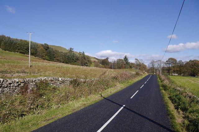
Croft Hill, located in Kirkcudbrightshire, is a prominent hill in the southern region of Scotland. With an elevation of approximately 144 meters (472 feet), it stands as a significant landmark in the area. Its location, situated just outside the town of Kirkcudbright, offers picturesque views of the surrounding countryside, making it a popular destination for locals and tourists alike.

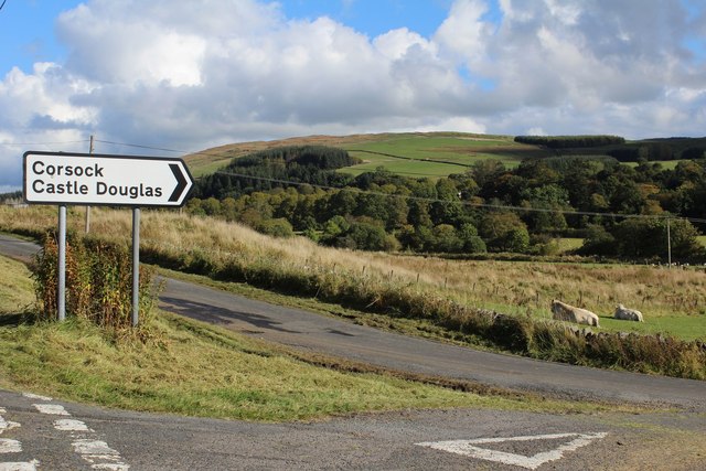
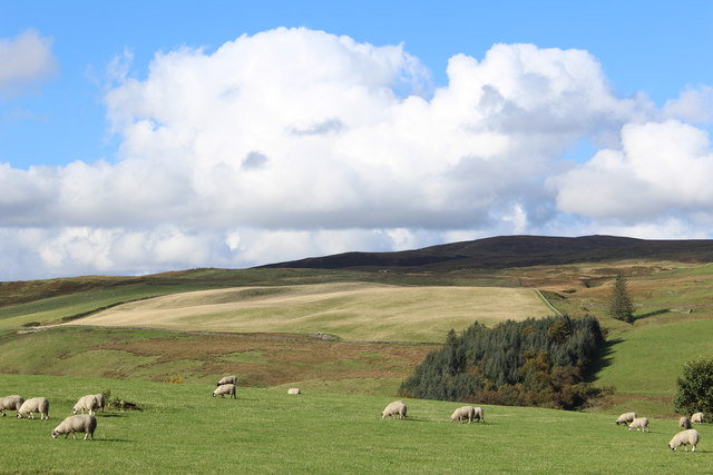
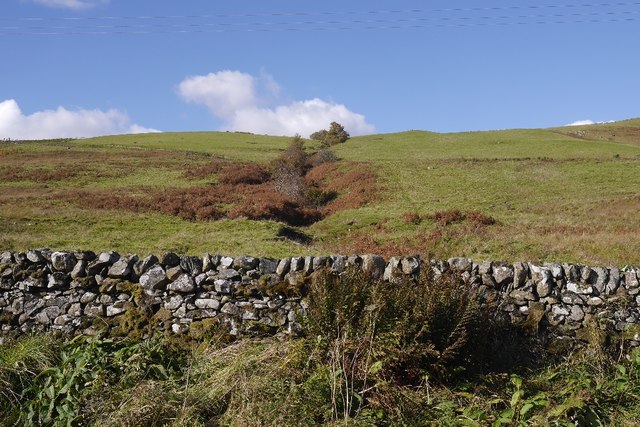
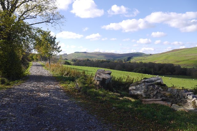
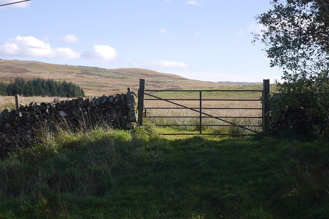
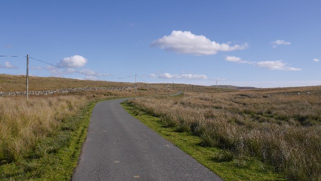
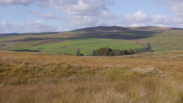
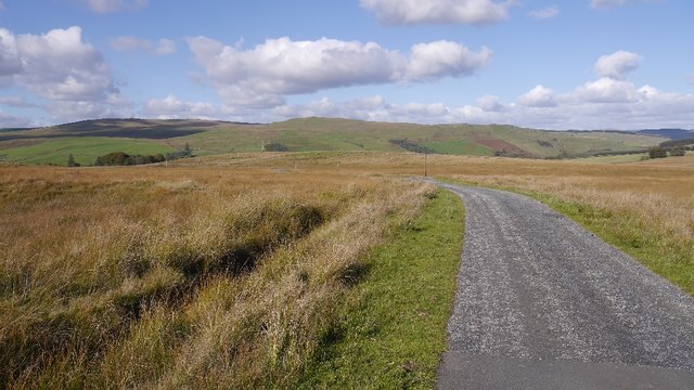
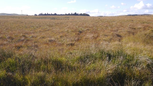
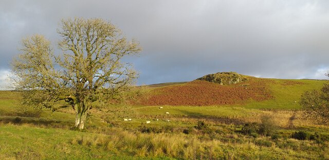
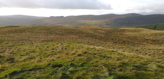
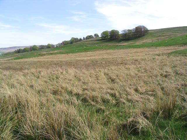
The hill is characterized by its gently sloping sides, covered in vibrant green grass and scattered with low-lying shrubs and trees. Its summit provides a panoramic view of the surrounding landscape, including the nearby hills, farmland, and the Solway Firth.

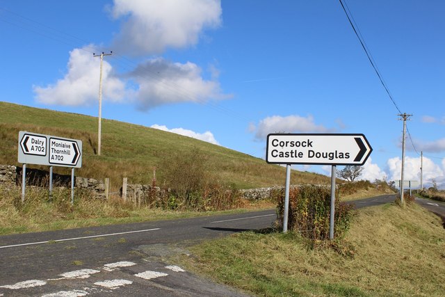
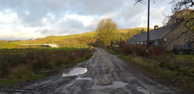
Croft Hill is accessible via several hiking trails, allowing visitors to explore and appreciate its natural beauty. The trails are well-maintained and suitable for all levels of hikers, making it an ideal spot for outdoor enthusiasts.

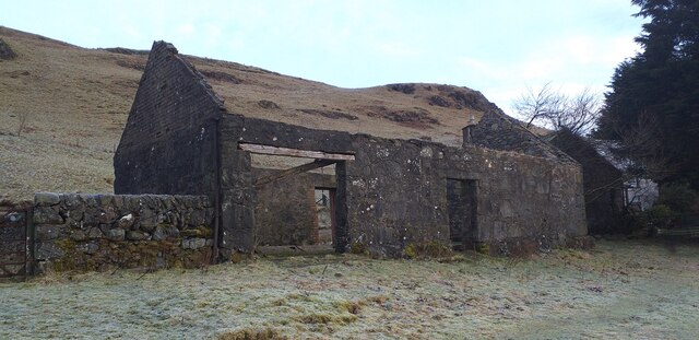
Additionally, the hill holds historical importance as it is believed to have been an ancient fortification site during the Iron Age. Archaeological evidence suggests that Croft Hill was once occupied and used as a defensive position.

Due to its accessibility and scenic beauty, Croft Hill is a popular spot for outdoor activities such as walking, picnicking, and photography. Visitors can also enjoy birdwatching, as the hill is home to a variety of bird species.

Overall, Croft Hill in Kirkcudbrightshire offers a blend of natural beauty, historical significance, and recreational opportunities, making it an attractive destination for those seeking a peaceful escape in the Scottish countryside.

If you have any feedback on the listing, please let us know in the comments section below.

Croft Hill Images

Images are sourced within 2km of 55.15845/-3.9859338 or Grid Reference NX7386. Thanks to Geograph Open Source API. All images are credited.

Road junction near Shankfoot Bridge
View towards Glencrosh Hill
Opposite Auchencheyne A hillside above the A702. A burn runs down off Brown Hill and the steep sides shelter some trees from the nibblers.
Opposite Auchencheyne
A hillside above the A702. A burn runs down off Brown Hill and the steep sides shelter some trees from the nibblers.
A702 An A road, but very quiet.
A702
An A road, but very quiet.
Road to Craigmuie Newly surfaced with coarse stone. A beech tree has been felled/fallen over recently.
Road to Craigmuie
Newly surfaced with coarse stone. A beech tree has been felled/fallen over recently.
Through the gate Rough grazing and moorland, typical of the area.
Through the gate
Rough grazing and moorland, typical of the area.
Road to Loch Urr A moorland road between the Castlefairn glen and Corsock.
Road to Loch Urr
A moorland road between the Castlefairn glen and Corsock.
Craigmuie Moor View across the glen carrying the Castlefairn Water to Big Morton Hill.
Craigmuie Moor
View across the glen carrying the Castlefairn Water to Big Morton Hill.
Road over Craigmuie Moor A gentle descent over the moors to the Castlefairn Water.
Road over Craigmuie Moor
A gentle descent over the moors to the Castlefairn Water.
Peneilly Wood A small wood in the middle of Craigmuie Moor.
Peneilly Wood
A small wood in the middle of Craigmuie Moor.
Rough grazing on the Minnygryle Burn Rough grazing on the Minnygryle Burn near Moniaive.
Rough grazing on the Minnygryle Burn
Rough grazing on the Minnygryle Burn near Moniaive.
Summit area of Glencrosh Hill Summit area of Glencrosh Hill.
Summit area of Glencrosh Hill
Summit area of Glencrosh Hill.
Start of the road to Minnygryle Start of the road to Minnygryle.
Start of the road to Minnygryle
Start of the road to Minnygryle.
Which way now? Road junction on the A702 Dalry to Thornhill road.
Which way now?
Road junction on the A702 Dalry to Thornhill road.
Physic Well Wood Physic Well Wood, an area of native woodland.
Physic Well Wood
Physic Well Wood, an area of native woodland.
Lochrennie An old derelict outbuilding at Lochrennie.
Lochrennie
An old derelict outbuilding at Lochrennie.
Rough grazing Near Craigmuie Bridge with Crow Wood in the background centre right.
Rough grazing
Near Craigmuie Bridge with Crow Wood in the background centre right.
Show me another place!

Croft Hill is located at Grid Ref: NX7386 (Lat: 55.15845, Lng: -3.9859338)

Unitary Authority: Dumfries and Galloway

Police Authority: Dumfries and Galloway

What 3 Words

///silks.contracting.oaks. Near Thornhill, Dumfries & Galloway
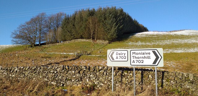
Related Wikis

Loch Skae

Loch Skae is a small, upland freshwater loch to the north of Blackcraig Hill, approximately 18 miles (29 km) west of Dumfries, Scotland, 0.5 mi (0.80 km...

Craigdarroch

"Craigdarroch, An Accessory to Murder" is an expansion set for the board game Kill Doctor Lucky Craigdarroch is a house near Moniaive, Dumfries and Galloway...

Loch Howie

Loch Howie is a small, narrow, upland freshwater loch on the north side of Blackcraig Hill, approximately 18 miles (29 km) west of Dumfries, Scotland....

Craigenputtock

Craigenputtock (usually spelled by the Carlyles as Craigenputtoch) is an estate in Scotland where Thomas Carlyle lived from 1828 to 1834. He wrote several...

Moniaive railway station

Moniaive railway station is the closed station terminus of the Cairn Valley Light Railway (CVR) branch, from Dumfries. It served the rural area of Moniaive...

Moniaive

Moniaive ( 'monny-IVE'; Scottish Gaelic: Am Moine Naomh, "The Holy Moor") is a village in the Parish of Glencairn, in Dumfries and Galloway, southwest...

Carsphairn and Scaur Hills

The Carsphairn and Scaur Hills are the western and eastern hills respectively of a hill range in the Southern Uplands of Scotland. Ordnance Survey maps...

Crawfordton House

Crawfordton House is a category B listed 19th-century country house, situated close to Moniaive in Dumfriesshire, Scotland. It was operated as Crawfordton...

Nearby Amenities

Located within 500m of 55.15845,-3.9859338
Fixme: continue
Lat/Long: 55.1573824/-3.9862795
Fixme: continue
Lat/Long: 55.1559091/-3.9844423
Power: pole
Lat/Long: 55.1610762/-3.9801724
Power: pole
Lat/Long: 55.1609174/-3.981144
Power: pole
Lat/Long: 55.1607162/-3.9822387
Power: pole
Lat/Long: 55.1605288/-3.9833016
Power: pole
Lat/Long: 55.1602945/-3.9846296
Power: pole
Lat/Long: 55.1600145/-3.9861697
Power: pole
Lat/Long: 55.1597952/-3.9874256
Power: pole
Lat/Long: 55.1597249/-3.9881999
Power: pole
Lat/Long: 55.1595782/-3.9897931
Power: pole
Lat/Long: 55.1594801/-3.9907987
Power: pole
Lat/Long: 55.1593625/-3.9920376
Power: pole
Lat/Long: 55.159234/-3.9934696
Power: pole
Lat/Long: 55.1598594/-3.9838361
Power: pole
Lat/Long: 55.1592183/-3.9843241
Power: pole
Lat/Long: 55.1587189/-3.9847335
Power: pole
Lat/Long: 55.1578342/-3.9854442
Power: pole
Lat/Long: 55.1599867/-3.9918764
Power: pole
Lat/Long: 55.1604508/-3.9929096
Power: pole
Lat/Long: 55.1607611/-3.9924747
Power: pole
Lat/Long: 55.1607659/-3.9914288
Power: pole
Lat/Long: 55.1607938/-3.9904678
Power: pole
Lat/Long: 55.1610168/-3.986087
Power: pole
Lat/Long: 55.160612/-3.9852511
Ford: yes
Lat/Long: 55.1572068/-3.993163
The data included in this document is from www.openstreetmap.org. The data is made available under ODbL.

Have you been to Croft Hill?

Leave your review of Croft Hill below (or comments, questions and feedback).