Bombie Hill

Hill, Mountain in Kirkcudbrightshire

Scotland

Bombie Hill

Galtway Churchyard, nr Kirkcudbright Galtway Church dated from the 12th century, and was very small at about 30ft x 15ft. Very little remains of the church, but the churchyard is still in occasional use, with one gravestone recording a death in 2012. In the foreground of this photo is the tomb of the Lidderdale family, including John Lidderdale, died 1777. The church is also known as St Michael's Church. A quarter of a mile to the ENE of the graveyard was located Galtway Village. Known to have been inhabited in 1641, hardly anything remains of the settlement.
Galtway Churchyard, nr Kirkcudbright Credit: Forrest and Jen

Bombie Hill is a prominent hill located in the county of Kirkcudbrightshire, Scotland. Situated approximately 2 miles southeast of the town of Gatehouse of Fleet, it forms part of the Galloway Hills range. Standing at an elevation of 423 meters (1,388 feet), Bombie Hill offers breathtaking views of the surrounding countryside, making it a popular destination among hikers and nature enthusiasts.

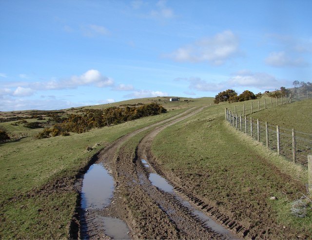
The hill is characterized by its gently sloping terrain, which gradually becomes steeper towards the summit. It is predominantly composed of granite and is covered in lush grasses and heather, lending it a picturesque appearance. The summit of Bombie Hill provides panoramic vistas of the rolling hills, dense forests, and nearby lochs, such as Loch Whinyeon and Loch Fleet.

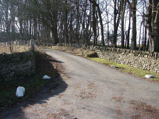
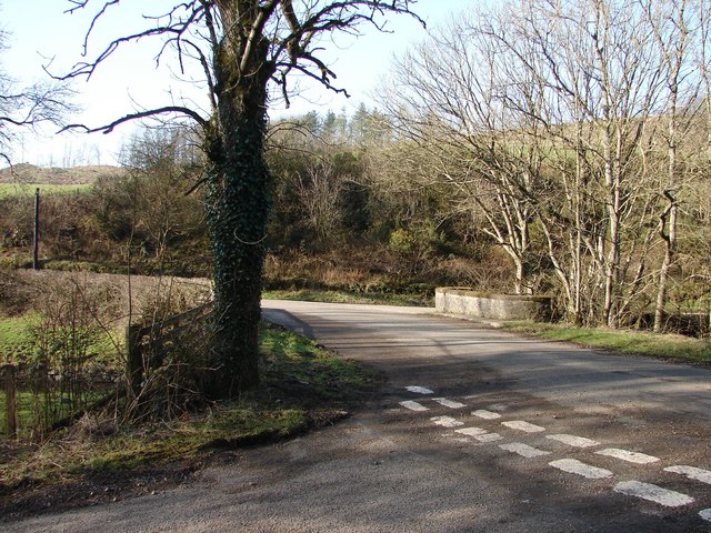
Access to Bombie Hill is relatively straightforward, with several well-marked trails leading to the summit. The most common starting point is from the village of Gatehouse of Fleet, where hikers can follow a well-maintained path that gradually ascends the hill. The route is suitable for walkers of all abilities, although caution should be exercised during inclement weather conditions.

Wildlife enthusiasts visiting Bombie Hill may have the opportunity to spot various bird species, including red grouse, golden eagles, and buzzards. The surrounding area is also home to a diverse range of flora and fauna, such as wildflowers, deer, and the elusive red squirrels.

Overall, Bombie Hill offers a rewarding hiking experience with its stunning natural beauty and panoramic views, making it a must-visit destination for outdoor adventurers in Kirkcudbrightshire.

If you have any feedback on the listing, please let us know in the comments section below.
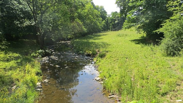
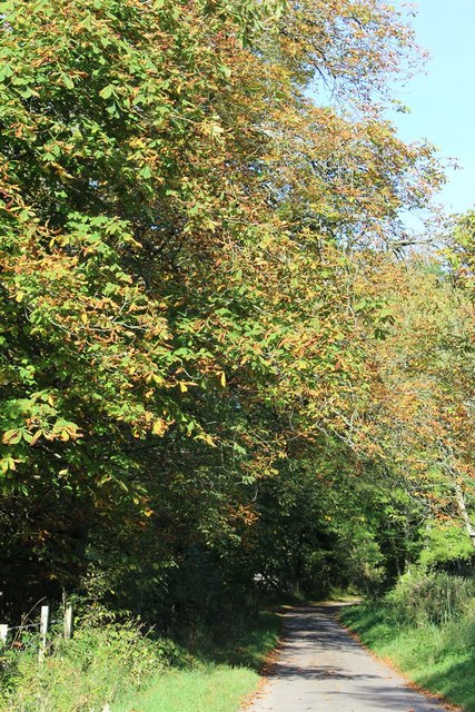
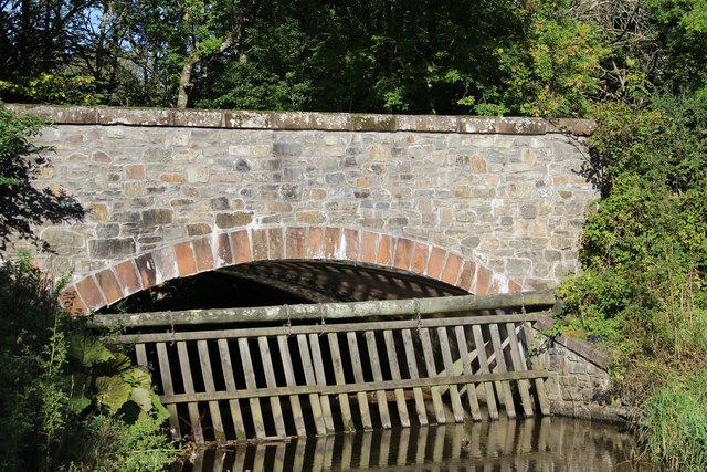
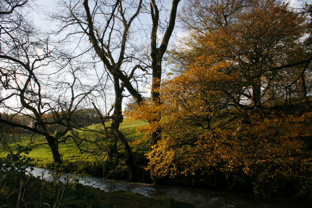
Bombie Hill Images

Images are sourced within 2km of 54.823282/-3.9950059 or Grid Reference NX7149. Thanks to Geograph Open Source API. All images are credited.

Galtway Churchyard, nr Kirkcudbright Galtway Church dated from the 12th century, and was very small at about 30ft x 15ft. Very little remains of the church, but the churchyard is still in occasional use, with one gravestone recording a death in 2012. In the foreground of this photo is the tomb of the Lidderdale family, including John Lidderdale, died 1777. The church is also known as St Michael's Church. A quarter of a mile to the ENE of the graveyard was located Galtway Village. Known to have been inhabited in 1641, hardly anything remains of the settlement.
Galtway Churchyard, nr Kirkcudbright
Galtway Church dated from the 12th century, and was very small at about 30ft x 15ft. Very little remains of the church, but the churchyard is still in occasional use, with one gravestone recording a death in 2012. In the foreground of this photo is the tomb of the Lidderdale family, including John Lidderdale, died 1777. The church is also known as St Michael's Church. A quarter of a mile to the ENE of the graveyard was located Galtway Village. Known to have been inhabited in 1641, hardly anything remains of the settlement.
High Banks Steading, nr Kirkcudbright Now in ruins, High Banks Steading dates back to before 1850. The wooden stables in the foreground were built about 2018. To the NW is High Banks House.
High Banks Steading, nr Kirkcudbright
Now in ruins, High Banks Steading dates back to before 1850. The wooden stables in the foreground were built about 2018. To the NW is High Banks House.
A711 at Galtway The house on the right faces across the road towards the military training area.
A711 at Galtway
The house on the right faces across the road towards the military training area.
Wetland beneath Newlaw Hill Rough farmland looking a bit like the Dundrennan ranges.
Wetland beneath Newlaw Hill
Rough farmland looking a bit like the Dundrennan ranges.
Farm track, Bombie Galloway, dry at last. The armco suggests that cattle are loaded here.
Farm track, Bombie
Galloway, dry at last. The armco suggests that cattle are loaded here.
Road, Bombie A minor road between Dundrennan and Kirkcudbright. A near miss: Bombie Hill only overlooks the military lands - it would have been priceless if the name applied to one of the range hills instead.
Road, Bombie
A minor road between Dundrennan and Kirkcudbright. A near miss: Bombie Hill only overlooks the military lands - it would have been priceless if the name applied to one of the range hills instead.
Fields, Bombie Hill A previous view: <a href="https://www.geograph.org.uk/photo/736083">NX7149 : Bombie Hill</a>
Fields, Bombie Hill
A previous view: NX7149 : Bombie Hill
Road and fields, Bombie Grassland, somewhat parched at the end of a long dry spell.
Road and fields, Bombie
Grassland, somewhat parched at the end of a long dry spell.
Buckland Burn Downstream from Buckland Bridge.
Buckland Burn
Downstream from Buckland Bridge.
Minor Road SW of Buckland Bridge
Buckland Bridge
Buckland Bridge
Sign for the delightfully named tongue of Bombie
The Buckland Burn The burn about 150 yards from the bridge, on the road to Corbie Nest.
The Buckland Burn
The burn about 150 yards from the bridge, on the road to Corbie Nest.
Auchengool New plantation on the Auchengool estate. Auchengool House lies to the upper left of the picture, the farm and cottages to the right.
Auchengool
New plantation on the Auchengool estate. Auchengool House lies to the upper left of the picture, the farm and cottages to the right.
Castle Creavie Copse View from Castle Creavie entrance, the Drumboy-Buckland lane continues westward past the copse.
Castle Creavie Copse
View from Castle Creavie entrance, the Drumboy-Buckland lane continues westward past the copse.
Castle Creavie Entrance Entrance to Castle Creavie farm and holiday workshops.
Castle Creavie Entrance
Entrance to Castle Creavie farm and holiday workshops.
Buckland Bridge Buckland Bridge crosses the Buckland Burn at the lower end of Bombie Glen. It is also a junction of 4 lanes to/from Dundrennan, Kirkcudbright, Mutehill and Whinnieliggate.
Buckland Bridge
Buckland Bridge crosses the Buckland Burn at the lower end of Bombie Glen. It is also a junction of 4 lanes to/from Dundrennan, Kirkcudbright, Mutehill and Whinnieliggate.
Track to Newlaw Hill View from Bar Hill towards Newlaw Hill on which are archaeological sites of a Cup & Ring mark and a hut circle.
Track to Newlaw Hill
View from Bar Hill towards Newlaw Hill on which are archaeological sites of a Cup & Ring mark and a hut circle.
Show me another place!

Bombie Hill is located at Grid Ref: NX7149 (Lat: 54.823282, Lng: -3.9950059)

Unitary Authority: Dumfries and Galloway

Police Authority: Dumfries and Galloway

What 3 Words

///steam.regard.until. Near Kirkcudbright, Dumfries & Galloway

Nearby Locations

Bombie Hill Birch Wood

Related Wikis

High Banks cup and ring markings

The High Banks cup and ring markings are a series of Neolithic or Bronze Age carvings on an outcrop of rock near High Banks farm, 3 km SE of Kirkcudbright...

Dundrennan Range

Dundrennan Range is a weapons testing range on the Solway Firth, near Kirkcudbright in Dumfries and Galloway, in south west Scotland, it is part of the...

Dundrennan

Dundrennan (Gaelic: Dun Droighnein) is a village Dumfries and Galloway, Scotland, about 5 miles (8 km) east of Kirkcudbright. Its population is around...

Kirkcudbright

Kirkcudbright ( kur-KOO-bree; Scots: Kirkcoubrie; Scottish Gaelic: Cille Chùithbeirt) is a town, parish and a Royal Burgh from 1455 in Kirkcudbrightshire...

Dundrennan Abbey

Dundrennan Abbey, in Dundrennan, Scotland, near to Kirkcudbright, was a Cistercian monastery in the Romanesque architectural style, established in 1142...

Kirkcudbright Hospital

Kirkcudbright Hospital is a health facility in Barrhill Road, Kirkcudbright, Dumfries and Galloway, Scotland. It is managed by NHS Dumfries and Galloway...

Kirkcudbright railway station

Kirkcudbright railway station served the town of Kirkcudbright, Dumfries and Galloway, Scotland from 1864 to 1965 on the Kirkcudbright Railway. == History... ==

Kirkcudbright Railway

The Kirkcudbright Railway was a railway branch line linking Kirkcudbright to the Castle Douglas and Dumfries Railway at Castle Douglas. It opened in 1864...

Nearby Amenities

Located within 500m of 54.823282,-3.9950059
Castlecreavie Fort/Settlement
Archaeological Site: fortification
Fortification Type: hill_fort
Historic: archaeological_site
Source: Popular Edition (Scotland)
Lat/Long: 54.8220333/-3.9880606
Bombie Hill
Natural: peak
Source: Popular Edition (Scotland)
Lat/Long: 54.823671/-3.9964323
The data included in this document is from www.openstreetmap.org. The data is made available under ODbL.

Have you been to Bombie Hill?

Leave your review of Bombie Hill below (or comments, questions and feedback).