Meall na Mòine

Hill, Mountain in Perthshire

Scotland

Meall na Mòine

Moorland, Meall na Mòine
Moorland, Meall na Mòine Credit: Richard Webb

Meall na Mòine is a prominent hill located in Perthshire, Scotland. It stands at an elevation of 679 meters (2,228 feet) and is part of the Grampian Mountains range. The hill is situated about 18 kilometers (11 miles) northwest of the town of Pitlochry.

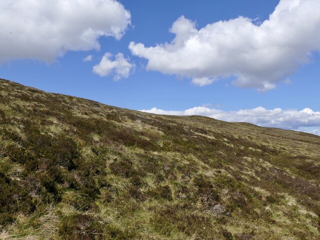
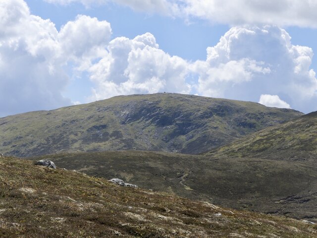
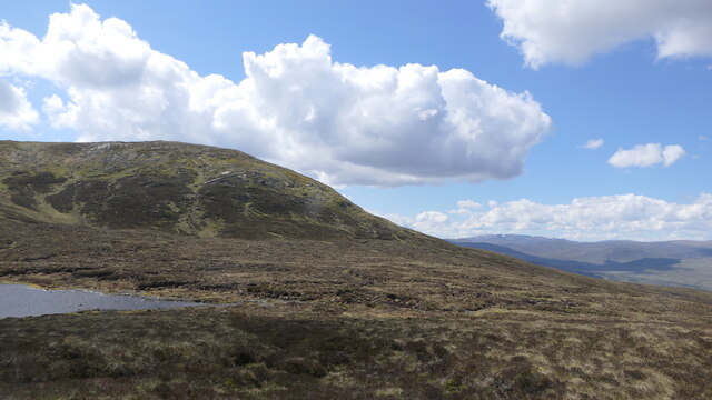
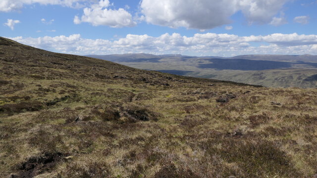
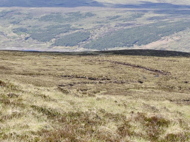
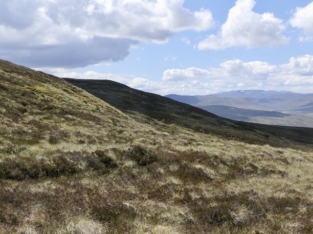
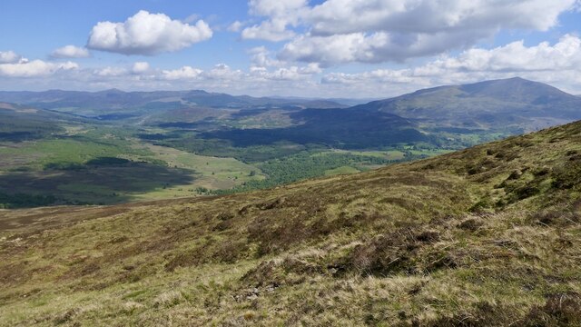
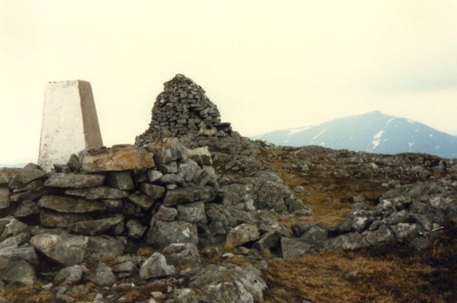
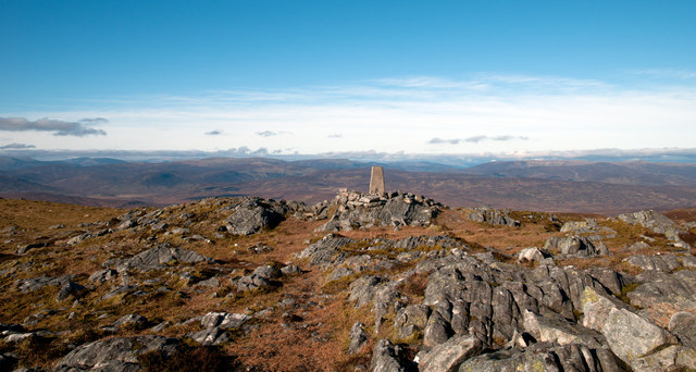
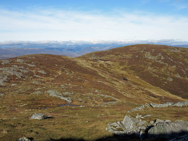
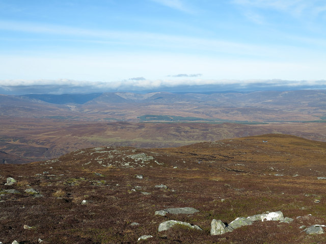
Meall na Mòine is characterized by its distinctive cone-shaped peak, which offers breathtaking panoramic views of the surrounding countryside. The hill is covered in heather and grass, providing a picturesque landscape that changes with the seasons. It is a popular destination for hikers, walkers, and mountaineers who are looking to explore the natural beauty of the area.

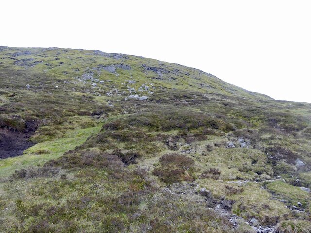
The ascent of Meall na Mòine can be achieved from various starting points, with several well-marked trails leading to the summit. The most common route begins at the Pass of Killiecrankie, where walkers can follow a path that gradually gains elevation, passing through moorland and rocky terrain. The climb is considered moderate in difficulty and can be completed in around 3-4 hours, depending on fitness levels and weather conditions.

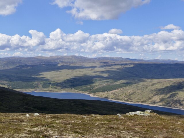
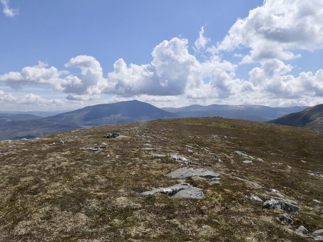
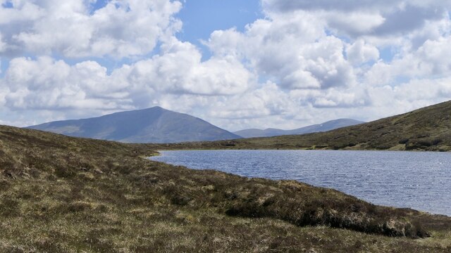
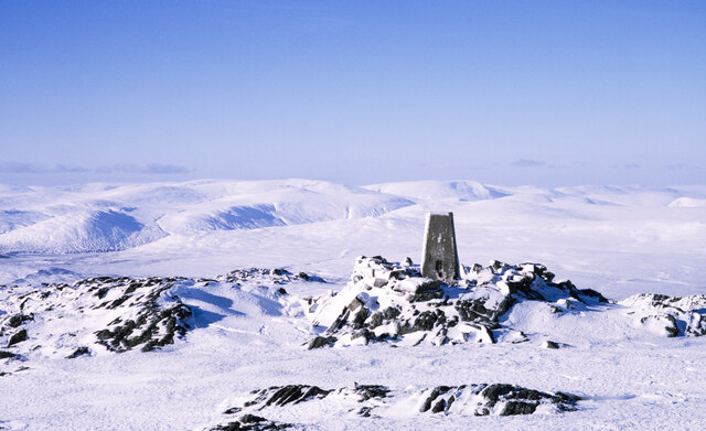
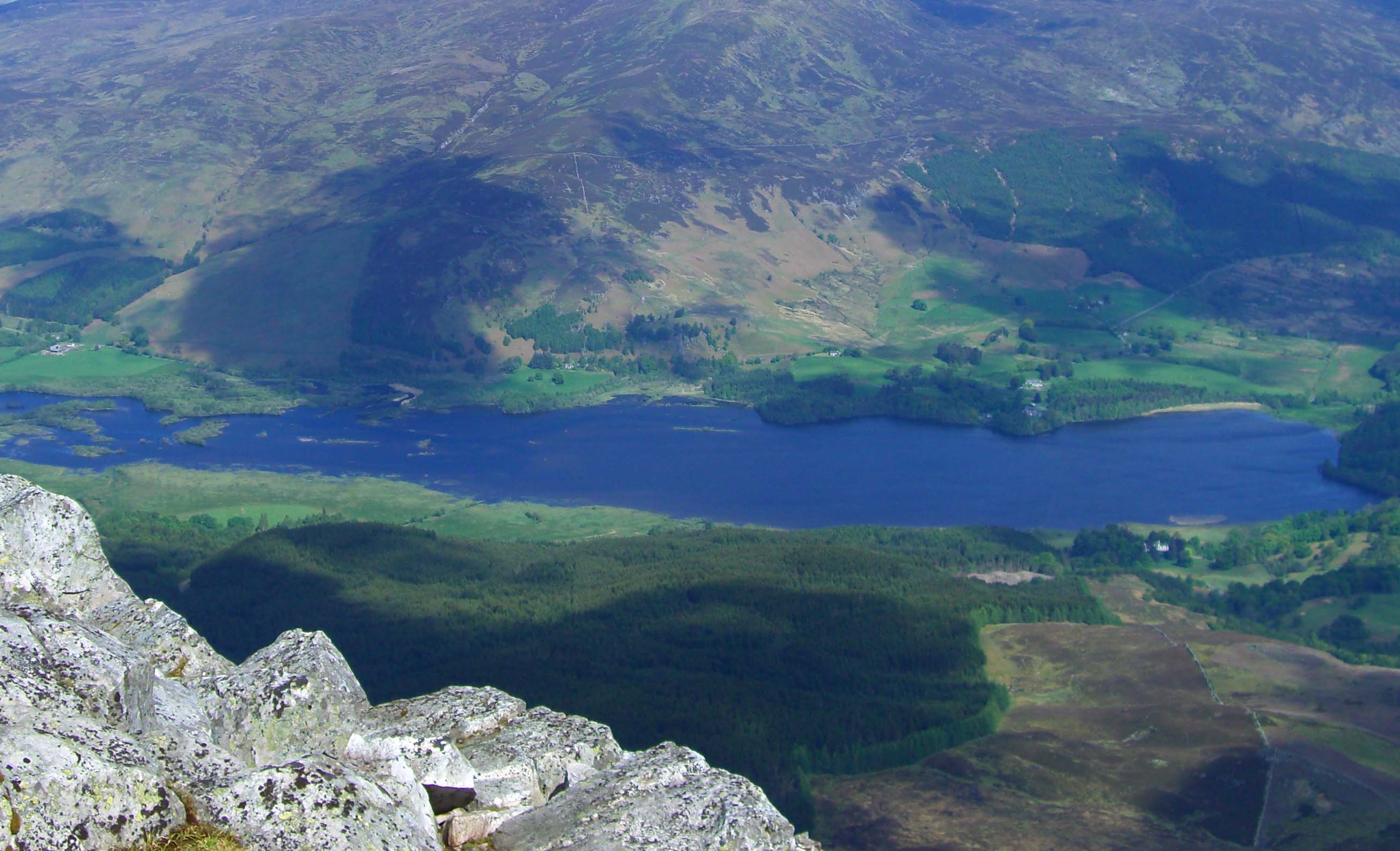
At the top of Meall na Mòine, visitors are rewarded with stunning vistas of the surrounding Perthshire countryside, including views of nearby mountains such as Ben Vrackie and Schiehallion. On clear days, it is possible to see as far as the Cairngorms National Park and even the peaks of Ben Nevis, the highest mountain in the British Isles.

Overall, Meall na Mòine offers outdoor enthusiasts and nature lovers a chance to immerse themselves in the rugged beauty of the Scottish Highlands, making it a must-visit destination in Perthshire.

If you have any feedback on the listing, please let us know in the comments section below.

Meall na Mòine Images

Images are sourced within 2km of 56.740023/-4.1326975 or Grid Reference NN6962. Thanks to Geograph Open Source API. All images are credited.

Moorland, Meall na Mòine
View over Loch Errochty Looking towards Druim Uachdair from the slopes of Beinn a' Chuallaich.
View over Loch Errochty
Looking towards Druim Uachdair from the slopes of Beinn a' Chuallaich.
Beinn a' Chuallaich View from around 700m on the northeast ridge.
Beinn a' Chuallaich
View from around 700m on the northeast ridge.
743m top above Loch na Caillich View towards Schiehallion from one of Beinn a' Chuallaich's lower tops.
743m top above Loch na Caillich
View towards Schiehallion from one of Beinn a' Chuallaich's lower tops.
Outflow, Loch na Caillich Lochan on Beinn a' Chuallaich.
Outflow, Loch na Caillich
Lochan on Beinn a' Chuallaich.
Loch na Caillich and Schiehallion
Bog on Beinn a' Chuallaich Below Meall nan Eun, deep dissected peat deposits.
Bog on Beinn a' Chuallaich
Below Meall nan Eun, deep dissected peat deposits.
Meall nan Eun Steep slopes above bogs on Beinn a' Chuallaich.
Meall nan Eun
Steep slopes above bogs on Beinn a' Chuallaich.
Bog on Beinn a' Chuallaich Northern slopes above Loch Errochty.
Bog on Beinn a' Chuallaich
Northern slopes above Loch Errochty.
North side of Beinn a' Chuallaich Under the steep slopes of Meall nan Eun.
North side of Beinn a' Chuallaich
Under the steep slopes of Meall nan Eun.
Eastern slopes of Beinn a' Chuallaich A view down Strath Tummel from below a 743m top.
Eastern slopes of Beinn a' Chuallaich
A view down Strath Tummel from below a 743m top.
Trig point on Beinn a' Chuallaich The mountain's trig point seen from the actual summit which is at a cairn a short distance away.
The distant, rounded mountains are those around the Pass of Drumochter.
Trig point on Beinn a' Chuallaich
The mountain's trig point seen from the actual summit which is at a cairn a short distance away. The distant, rounded mountains are those around the Pass of Drumochter.
Trig point and summit cairn on Beinn a' Chuallaich The triangulation pillar has an Ordnance Survey flush bracket serial number S9358. More information at <span class="nowrap"><a title="http://www.trigpointinguk.com/trigs/trig-details.php?t=1143" rel="nofollow ugc noopener" href="http://www.trigpointinguk.com/trigs/trig-details.php?t=1143">Link</a><img style="margin-left:2px;" alt="External link" title="External link - shift click to open in new window" src="https://s1.geograph.org.uk/img/external.png" width="10" height="10"/></span>
Trig point and summit cairn on Beinn a' Chuallaich
The triangulation pillar has an Ordnance Survey flush bracket serial number S9358. More information at LinkExternal link
Approaching the summit of Beinn a' Chuallaich Footprints lead to the trig point and cairn
Approaching the summit of Beinn a' Chuallaich
Footprints lead to the trig point and cairn
Rocks at summit area of Beinn a' Chuallaich The summit of Beinn a' Chuallaich is marked by a large cairn from which this image was recorded; it shows the area to the north with extensive rocky outcrops and an OS trig point.
Rocks at summit area of Beinn a' Chuallaich
The summit of Beinn a' Chuallaich is marked by a large cairn from which this image was recorded; it shows the area to the north with extensive rocky outcrops and an OS trig point.
Meall nan Eun The two rises of Meall nan Eun as seen from north of the summit of the parent mountain, Beinn a' Chuallaich.
Meall nan Eun
The two rises of Meall nan Eun as seen from north of the summit of the parent mountain, Beinn a' Chuallaich.
Northern slopes of Meall nan Eun Heather moorland on the north side of Meall nan Eun descending towards Loch Errochty.
Northern slopes of Meall nan Eun
Heather moorland on the north side of Meall nan Eun descending towards Loch Errochty.
North ridge of Meall na Mòine Meall na Mòine is the name given by some hill-goers to the subsidiary top north-east of Beinn a' Chuallaich, at 743m, though that name appears on OS maps seemingly referring to quite a different feature. The ridge descends towards Loch Errochty.
North ridge of Meall na Mòine
Meall na Mòine is the name given by some hill-goers to the subsidiary top north-east of Beinn a' Chuallaich, at 743m, though that name appears on OS maps seemingly referring to quite a different feature. The ridge descends towards Loch Errochty.
Show me another place!

Meall na Mòine is located at Grid Ref: NN6962 (Lat: 56.740023, Lng: -4.1326975)

Unitary Authority: Perth and Kinross

Police Authority: Tayside

What 3 Words

///speeded.wordplay.ourselves. Near Blair Atholl, Perth & Kinross

Related Wikis

Beinn a' Chuallaich

Beinn a' Chuallaich is a Scottish hill, four kilometres northeast of the village of Kinloch Rannoch in the Perth and Kinross council area. It is part of...

Loch Errochty

Loch Errochty is a man made freshwater loch situated within the Perth and Kinross council area at the edge of the Scottish Highlands near the Highland...

Trinafour

Trinafour (; Scottish Gaelic: Trian a' Phùir) is a village in Perth and Kinross, Scotland, approximately 17 miles (27 km) north-west of Pitlochry, its...

Dunalastair

Dunalastair (Scottish Gaelic: Dùn Alastair, meaning "fort of Alexander") is an estate in the southern part of the Highlands, in Perthshire, Scotland....

Dunalastair Water

Dunalastair Water (Scottish Gaelic: "Loch Dhùn Alastair") is an entirely man made reservoir in Scotland which lies between Loch Rannoch and Loch Tummel...

Bohespic

Bohespic (Gaelic: Both Easbaig 'bishop's house') is a place near Blair Atholl in the Perth and Kinross area of Scotland. The name also appears in older...

Loch Con

Loch Con is a small, remote, shallow, irregular shaped freshwater loch that is located in Glen Errochty in the Perth and Kinross council area, at the...

Kinloch Rannoch

Kinloch Rannoch (; Gaelic: Ceann Loch Raineach) is a village in Perth and Kinross, Scotland, at the eastern end of Loch Rannoch, 18 miles (29 km) west...

Nearby Amenities

Located within 500m of 56.740023,-4.1326975
Ele: 742
Natural: peak
Lat/Long: 56.7399436/-4.1339738
The data included in this document is from www.openstreetmap.org. The data is made available under ODbL.

Have you been to Meall na Mòine?

Leave your review of Meall na Mòine below (or comments, questions and feedback).