Wether Hill

Hill, Mountain in Dumfriesshire

Scotland

Wether Hill

Pond, Glen Cairn Clear felled Berry Craig in the background.
Pond, Glen Cairn Credit: Richard Webb

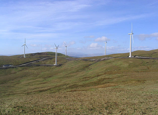
Wether Hill is a prominent hill located in Dumfriesshire, Scotland. Situated in the southern part of the country, it is part of the Lowther Hills range. With an elevation of 707 meters (2,320 feet), Wether Hill is a notable landmark in the region.

The hill offers stunning panoramic views of the surrounding countryside, including the picturesque valleys and rolling hills that characterize Dumfriesshire. On a clear day, visitors can even catch a glimpse of the Solway Firth and the Lake District in England.

Wether Hill is a popular destination for outdoor enthusiasts, particularly hikers and mountaineers. There are several walking routes that lead to the summit, allowing visitors to explore the natural beauty of the area. The ascent can be challenging at times, but the reward is well worth the effort.

The hill is also known for its rich wildlife. Red deer, mountain hares, and various bird species can often be spotted during a hike. The surrounding moorland and heather-covered slopes provide a habitat for a diverse range of flora and fauna.

Adjacent to Wether Hill is the village of Wanlockhead, which is renowned for being the highest village in Scotland. This historic village offers a glimpse into the area's mining heritage, with the Leadhills and Wanlockhead Railway providing a unique way to explore the local history.

Overall, Wether Hill is a captivating natural landmark in Dumfriesshire, offering breathtaking views, challenging hikes, and a chance to immerse oneself in the beauty of the Scottish countryside.

If you have any feedback on the listing, please let us know in the comments section below.

Wether Hill Images

Images are sourced within 2km of 55.224901/-4.0508494 or Grid Reference NX6994. Thanks to Geograph Open Source API. All images are credited.

Pond, Glen Cairn Clear felled Berry Craig in the background.
Pond, Glen Cairn
Clear felled Berry Craig in the background.
Stand of trees below Bail Hill A small enclosure with trees by the road through the Dalwhat valley.
Stand of trees below Bail Hill
A small enclosure with trees by the road through the Dalwhat valley.
Small hillside plantation near Auchenstroan
Forest Ride near Martour Hill in Cairnhead Forest
Lower and Upper Glenjaan In the valley of the Dalwhat Water, with the Wether Hill Wind Farm <a href="https://www.geograph.org.uk/photo/3545467">NX6993 : Wether Hill Wind Farm</a> on the hill behind.
Lower and Upper Glenjaan
In the valley of the Dalwhat Water, with the Wether Hill Wind Farm NX6993 : Wether Hill Wind Farm on the hill behind.
Desecration of a Hillside The summit area of Wether Hill (Point 535) is changing radically. Vast new forestry tracks are being constructed complete with their own little quarries to provide surface chippings.
Desecration of a Hillside
The summit area of Wether Hill (Point 535) is changing radically. Vast new forestry tracks are being constructed complete with their own little quarries to provide surface chippings.
Glenjaan Craig Cairns Not quite Andy Goldsworthy but these cairn builders have put in a good effort.
Glenjaan Craig Cairns
Not quite Andy Goldsworthy but these cairn builders have put in a good effort.
Wether Hill wind farm Part of a new 14 turbine wind farm on Wether Hill operated by Scottish Power that will produce 1.3MW of power with 18.2MW capacity. (Source: British Wind Energy Association)
Wether Hill wind farm
Part of a new 14 turbine wind farm on Wether Hill operated by Scottish Power that will produce 1.3MW of power with 18.2MW capacity. (Source: British Wind Energy Association)
Mid Hill Rough grazing on Mid Hill with forestry plantations beyond.
Mid Hill
Rough grazing on Mid Hill with forestry plantations beyond.
Rough grazing Between Mid Hill and Cornharrow Hill looking down to the building at Cornharrow.
Rough grazing
Between Mid Hill and Cornharrow Hill looking down to the building at Cornharrow.
Wind Farm Some of the Wether Hill wind farm turbines near Cornharrow Hill.
Wind Farm
Some of the Wether Hill wind farm turbines near Cornharrow Hill.
Craiglour Hawse
Craiglour Hawse
Outcrop at Craiglirian Craig
Firebreak A firebreak and dyke at a forestry area west of Greengair viewed from the edge of the square.
Firebreak
A firebreak and dyke at a forestry area west of Greengair viewed from the edge of the square.
Craiglirian Craig Looking down from Craiglirian Craig to the new access road to the wind farm on Wether Hill.
Craiglirian Craig
Looking down from Craiglirian Craig to the new access road to the wind farm on Wether Hill.
Turbo Wind Generators on Greengair Hill Fourteen turbines in total owned by Scottish Power.
Turbo Wind Generators on Greengair Hill
Fourteen turbines in total owned by Scottish Power.
Upper Glenjaan Hill Looking up the eastern end of Wether Hill
Upper Glenjaan Hill
Looking up the eastern end of Wether Hill
Upland grazing Looking towards Greengair with some of the Wether Hill wind farm turbines on the right.
Upland grazing
Looking towards Greengair with some of the Wether Hill wind farm turbines on the right.
Show me another place!

Wether Hill is located at Grid Ref: NX6994 (Lat: 55.224901, Lng: -4.0508494)

Unitary Authority: Dumfries and Galloway

Police Authority: Dumfries and Galloway

What 3 Words

///bags.estuaries.ranch. Near Sanquhar, Dumfries & Galloway

Related Wikis

Carsphairn and Scaur Hills

The Carsphairn and Scaur Hills are the western and eastern hills respectively of a hill range in the Southern Uplands of Scotland. Ordnance Survey maps...

Craigdarroch

"Craigdarroch, An Accessory to Murder" is an expansion set for the board game Kill Doctor Lucky Craigdarroch is a house near Moniaive, Dumfries and Galloway...

Moniaive

Moniaive ( 'monny-IVE'; Scottish Gaelic: Am Moine Naomh, "The Holy Moor") is a village in the Parish of Glencairn, in Dumfries and Galloway, southwest...

Moniaive railway station

Moniaive railway station is the closed station terminus of the Cairn Valley Light Railway (CVR) branch, from Dumfries. It served the rural area of Moniaive...

Nearby Amenities

Located within 500m of 55.224901,-4.0508494
Generator Method: wind_turbine
Generator Output Electricity: yes
Generator Source: wind
Generator Type: horizontal_axis
Power: generator
Lat/Long: 55.224469/-4.0580155
Generator Method: wind_turbine
Generator Output Electricity: yes
Generator Source: wind
Generator Type: horizontal_axis
Power: generator
Lat/Long: 55.2255854/-4.0537503
Generator Method: wind_turbine
Generator Output Electricity: yes
Generator Source: wind
Generator Type: horizontal_axis
Power: generator
Lat/Long: 55.2241566/-4.0446203
Generator Method: wind_turbine
Generator Output Electricity: yes
Generator Source: wind
Generator Type: horizontal_axis
Power: generator
Lat/Long: 55.2232222/-4.0492987
Generator Method: wind_turbine
Generator Output Electricity: yes
Generator Source: wind
Generator Type: horizontal_axis
Power: generator
Lat/Long: 55.2254294/-4.0502905
Generator Method: wind_turbine
Generator Output Electricity: yes
Generator Source: wind
Generator Type: horizontal_axis
Power: generator
Lat/Long: 55.2236823/-4.0533694
The data included in this document is from www.openstreetmap.org. The data is made available under ODbL.

Have you been to Wether Hill?

Leave your review of Wether Hill below (or comments, questions and feedback).