Hocombe

Settlement in Hampshire Winchester

England

Hocombe

Beechwood Crescent, looking west Do high hedges make good neighbours, as fences are supposed to?
Beechwood Crescent, looking west Credit: Christine Johnstone

Hocombe is a small village located in the county of Hampshire, in the southern region of England. Situated approximately 5 miles northwest of the city of Southampton, Hocombe is nestled amidst picturesque countryside and surrounded by rolling hills. The village is characterized by its rural charm and tranquil atmosphere, making it an ideal destination for those seeking a peaceful retreat.

Hocombe is known for its rich history, dating back to medieval times. The village features several historical landmarks, including the Grade II listed Hocombe House, a stunning Georgian mansion that once served as a country residence. The house is set within beautiful grounds and offers a glimpse into the area's past.

The village is also home to a close-knit community, with a population of around 500 residents. Hocombe boasts a primary school, providing education for local children, and a small church, St. Peter's, which serves as a focal point for religious activities and community events.

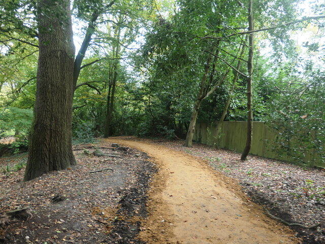
Nature enthusiasts will appreciate the surrounding countryside, with ample opportunities for walking, cycling, and exploring the nearby woodlands. Hocombe is also conveniently located near the South Downs National Park, offering breathtaking views and a wealth of outdoor pursuits.

Although Hocombe is a predominantly residential area, the nearby city of Southampton provides residents with access to a wide range of amenities, including shopping centers, restaurants, and cultural attractions. The village is well-connected by road, with easy access to major highways, making it a convenient base for those wishing to explore the surrounding areas.

In summary, Hocombe is a charming and historic village in Hampshire, offering a peaceful and idyllic setting amidst stunning countryside. With its rich history, close-knit community, and proximity to Southampton and the South Downs National Park, Hocombe is a hidden gem that appeals to both residents and visitors alike.

If you have any feedback on the listing, please let us know in the comments section below.

Hocombe Images

Images are sourced within 2km of 51.000586/-1.3680024 or Grid Reference SU4422. Thanks to Geograph Open Source API. All images are credited.
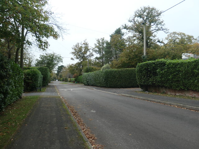
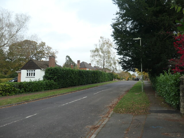
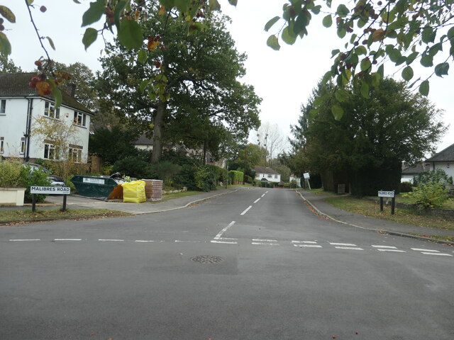
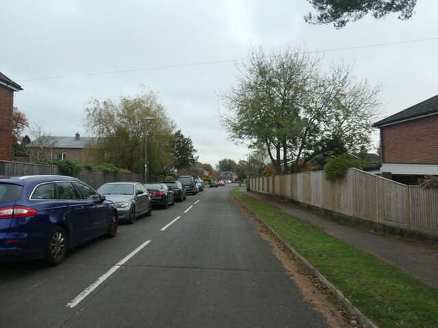
Beechwood Crescent, looking west Do high hedges make good neighbours, as fences are supposed to?
Beechwood Crescent, looking west
Do high hedges make good neighbours, as fences are supposed to?
Waymarked footbridge, Hocombe Upper Plantation On the public footpath to Hursley Road.
Waymarked footbridge, Hocombe Upper Plantation
On the public footpath to Hursley Road.
Polite request at the entrance to Hocombe Upper Plantation On the public footpath heading north-west from Hursley Road.
Polite request at the entrance to Hocombe Upper Plantation
On the public footpath heading north-west from Hursley Road.
Residential road parallel to a through route The houses on the west side of Hursley Road [the B3043] are separated from that road by a strip of woodland. The houses on the east side are not.
Residential road parallel to a through route
The houses on the west side of Hursley Road [the B3043] are separated from that road by a strip of woodland. The houses on the east side are not.
East end of Heatherdene Road, Hiltingbury Beautified by a large deciduous tree.
East end of Heatherdene Road, Hiltingbury
Beautified by a large deciduous tree.
West end of Grosvenor Road, Hiltingbury Planned and mapped in the 1930s, but no houses were built until after 1945. Near the junction with Thorold Road.
West end of Grosvenor Road, Hiltingbury
Planned and mapped in the 1930s, but no houses were built until after 1945. Near the junction with Thorold Road.
East end of Grosvenor Road, Hiltingbury Planned and mapped in the 1930s, but no houses were built until after 1945. Looking towards the junction with Kingsway.
East end of Grosvenor Road, Hiltingbury
Planned and mapped in the 1930s, but no houses were built until after 1945. Looking towards the junction with Kingsway.
Junction of Kingsway and Grosvenor Road, Hiltingbury There is a 56 metre spot height at the manhole cover.
Junction of Kingsway and Grosvenor Road, Hiltingbury
There is a 56 metre spot height at the manhole cover.
Thornbury Wood, no through road The spine road of a small housing estate on the east side of Kingsway, Hiltingbury.
Thornbury Wood, no through road
The spine road of a small housing estate on the east side of Kingsway, Hiltingbury.
Malibres Road, Hiltingbury Planned and mapped in the 1930s, but no houses were built until after 1945. Named after Malibres Copse, which it was built on.
Malibres Road, Hiltingbury
Planned and mapped in the 1930s, but no houses were built until after 1945. Named after Malibres Copse, which it was built on.
Entrance to Freshwater Court, Hiltingbury And also the access to a house behind the flats.
Entrance to Freshwater Court, Hiltingbury
And also the access to a house behind the flats.
The Old Post Office, Hiltingbury Road Mapped as a post office in the 1930s, but not even built in 1910.
The Old Post Office, Hiltingbury Road
Mapped as a post office in the 1930s, but not even built in 1910.
Sold house, Kingsway, Hiltingbury On a street where high hedges are popular.
Sold house, Kingsway, Hiltingbury
On a street where high hedges are popular.
Parked cars, Kingsway Gardens, Hiltingbury On the east side of Kingsway and built much later.
Parked cars, Kingsway Gardens, Hiltingbury
On the east side of Kingsway and built much later.
Mistletoe in a Hiltingbury front garden Mistletoe is quite common in this area, which was the heavily-wooded Hiltingbury Common until about 100 years ago.
Mistletoe in a Hiltingbury front garden
Mistletoe is quite common in this area, which was the heavily-wooded Hiltingbury Common until about 100 years ago.
Hiltingbury Lake, from the dam The lake is shown on the large-scale OS map surveyed in 1895, but not on the one surveyed in 1867. It is now a fishing lake, surrounded by pleasant woodland paths.
Hiltingbury Lake, from the dam
The lake is shown on the large-scale OS map surveyed in 1895, but not on the one surveyed in 1867. It is now a fishing lake, surrounded by pleasant woodland paths.
Perimeter path, Hiltingbury Lake A pleasant wooded walk in the northern suburbs of Chandler's Ford.
Perimeter path, Hiltingbury Lake
A pleasant wooded walk in the northern suburbs of Chandler's Ford.
Resurfacing work, at Hiltingbury Lakes Eastleigh Borough Council have contracted B & M McHugh Ltd to do this work.
Resurfacing work, at Hiltingbury Lakes
Eastleigh Borough Council have contracted B & M McHugh Ltd to do this work.
Show me another place!

Hocombe is located at Grid Ref: SU4422 (Lat: 51.000586, Lng: -1.3680024)

Administrative County: Hampshire

District: Winchester

Police Authority: Hampshire

What 3 Words

///scan.calm.clubs. Near Compton, Hampshire

Related Wikis

Thornden School

Thornden School is a secondary school with academy status in Chandler's Ford, Hampshire. It is an 11-16 (no sixth form), mixed specialist Arts College...

Cranbury Park

Cranbury Park is a stately home and country estate situated in the parish of Hursley, Winchester, England. It was formerly the home to Sir Isaac Newton...

Lakeside School, Chandler's Ford

Lakeside School is an 11–16 boys special school with specialist SEN status located in Chandler's Ford, Hampshire, England. The head teacher is Mr Gareth...

Hiltingbury

Hiltingbury is an area within the Borough of Eastleigh in Hampshire, England. There are two electoral wards representing Hiltingbury, returning a total...

Hocombe Mead

Hocombe Mead is a 8.3-hectare (21-acre) Local Nature Reserve in Eastleigh in Hampshire. It is owned by Eastleigh Borough Council and managed by Eastleigh...

Otterbourne

Otterbourne is a village in Hampshire, England. It is located approximately four miles (6.4 km) south of Winchester and eight miles (13 km) north of Southampton...

Chandler's Ford

Chandler's Ford (originally The Ford and historically Chandlersford) is a largely residential area and civil parish in the Borough of Eastleigh in Hampshire...

Chandler's Ford shooting

The Chandler's Ford shooting (codenamed Operation Hurlock by the police) was the shooting of armed robbers in the town of Chandler's Ford, Hampshire, in...

Nearby Amenities

Located within 500m of 51.000586,-1.3680024
Turning Circle
Lat/Long: 50.9982638/-1.3621988
Turning Circle
Lat/Long: 50.9962446/-1.369328
Post Box
Collection Plate: CP7D
Collection Times: Mo-Fr 09:00; Sa 07:00
Operator: Royal Mail
Post Box Type: lamp
Ref: SO53 489D
Royal Cypher: EIIR
Royal Cypher Wikidata: Q33102113
Lat/Long: 51.0002252/-1.3686281
Board Type: history
Description: folly ruins & tower built from stones of ruined Netley Castle 1770
Information: board
Tourism: information
Lat/Long: 51.002416/-1.3636457
The data included in this document is from www.openstreetmap.org. The data is made available under ODbL.

Have you been to Hocombe?

Leave your review of Hocombe below (or comments, questions and feedback).