Hoddesdon

Settlement in Hertfordshire Broxbourne

England

Hoddesdon

The A10, Broxbourne
The A10, Broxbourne Credit: David Howard

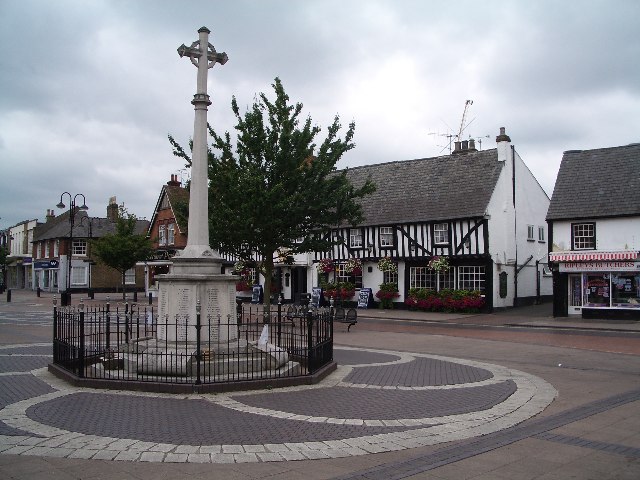
Hoddesdon is a town located in the county of Hertfordshire, England. Situated in the Lea Valley, it lies about 20 miles north of London and has a population of approximately 20,000 residents. The town has a rich history that dates back to the Domesday Book, where it is mentioned as a small settlement.

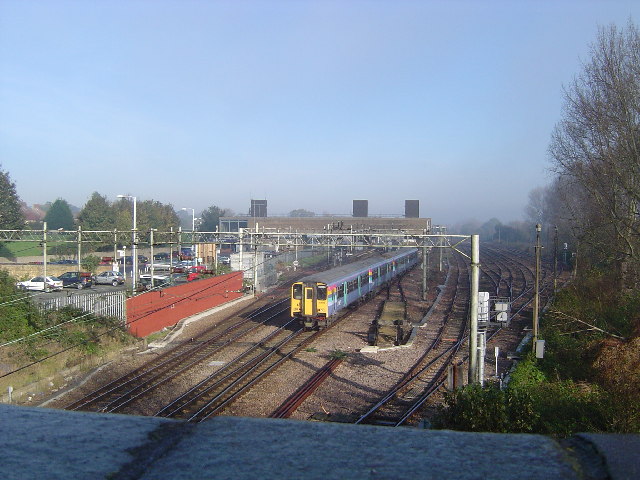
Hoddesdon is well-connected to the surrounding areas, with good transport links. The A10 road runs through the town, providing easy access to London and other major cities. The town also has a railway station, offering regular services to London Liverpool Street and Cambridge.

In terms of amenities, Hoddesdon offers a range of shops, restaurants, and leisure facilities. The town center is home to a mix of independent stores and well-known retail chains, providing a variety of shopping options. There are also several supermarkets, making it convenient for residents to access everyday essentials.

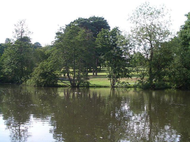
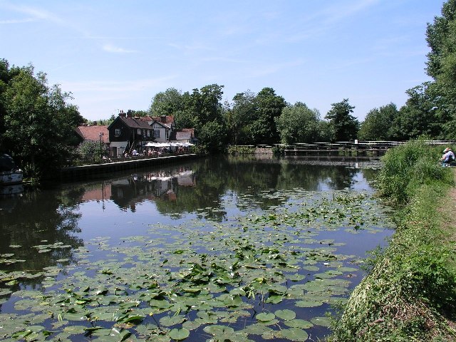
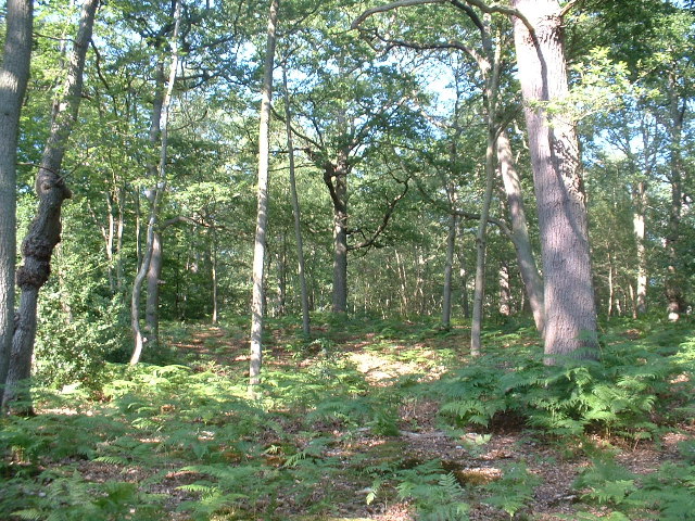
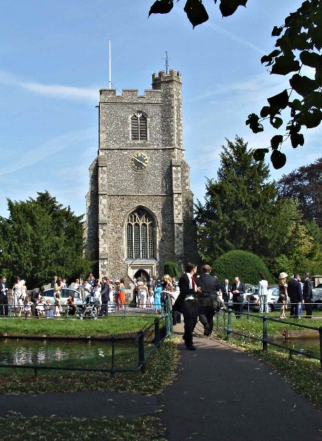
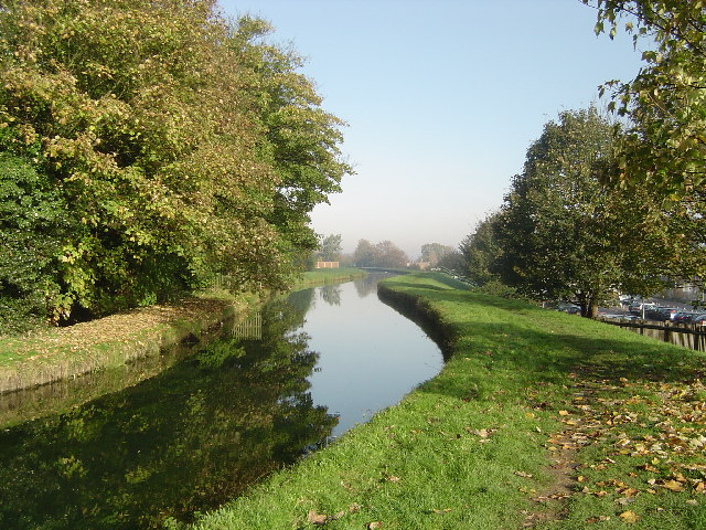
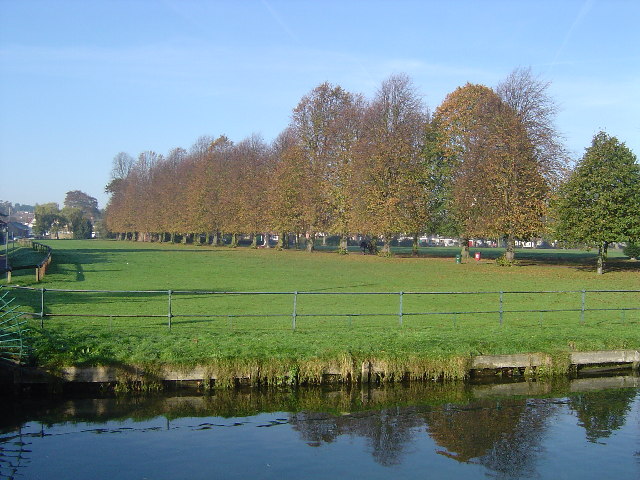
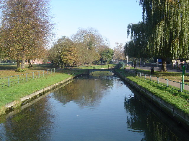
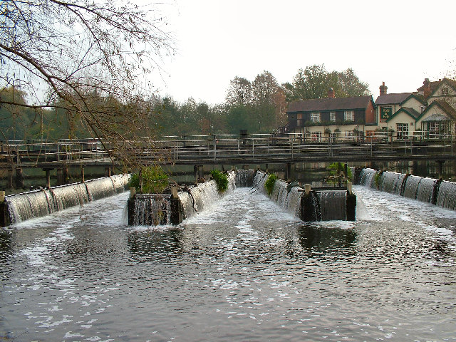
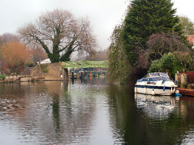
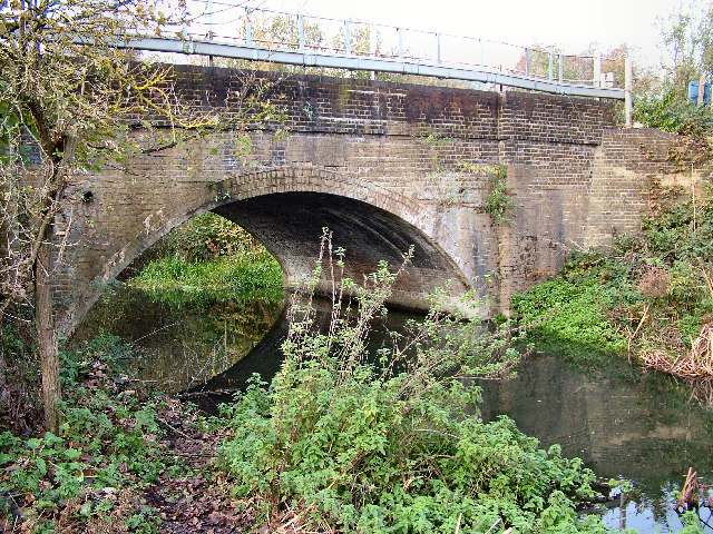
For recreation, Hoddesdon offers several parks and green spaces, including the popular Lowewood Museum Gardens. The town is situated on the River Lea, providing opportunities for walking, boating, and fishing. Nearby, the Lee Valley Regional Park offers additional outdoor activities, such as cycling and horse riding.

Education in Hoddesdon is well-served, with a range of primary and secondary schools available. The town also has a further education college, which provides a variety of courses for students of all ages.

Overall, Hoddesdon is a bustling town with a rich history, good transport links, and a range of amenities, making it an attractive place to live and visit.

If you have any feedback on the listing, please let us know in the comments section below.
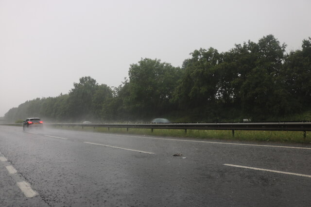
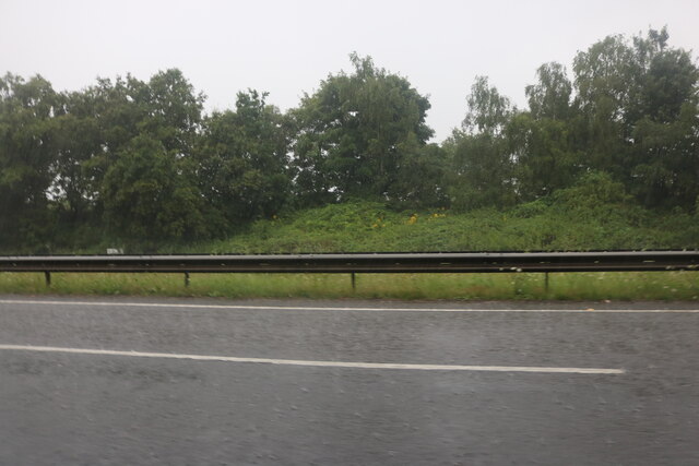
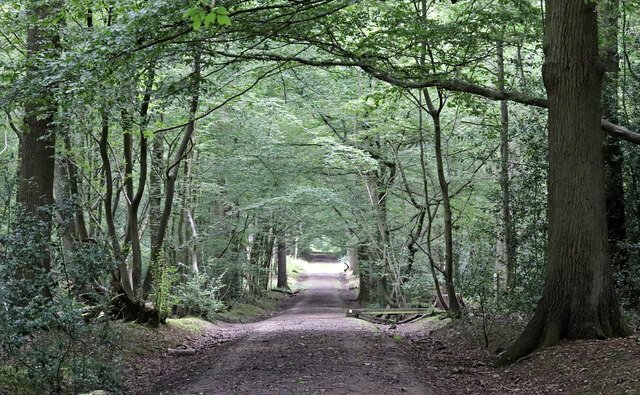
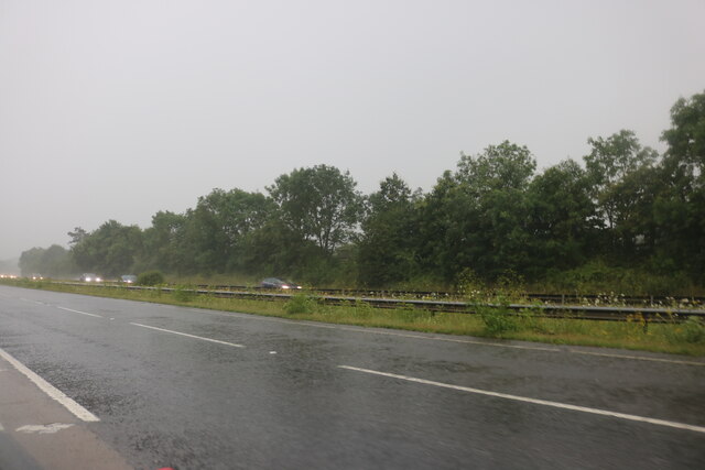
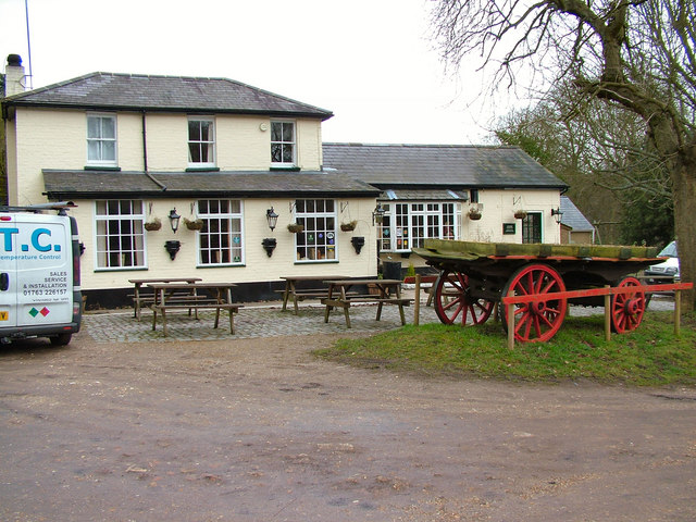
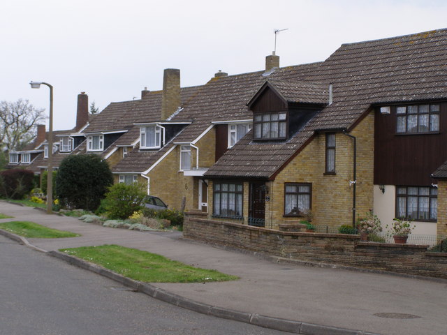
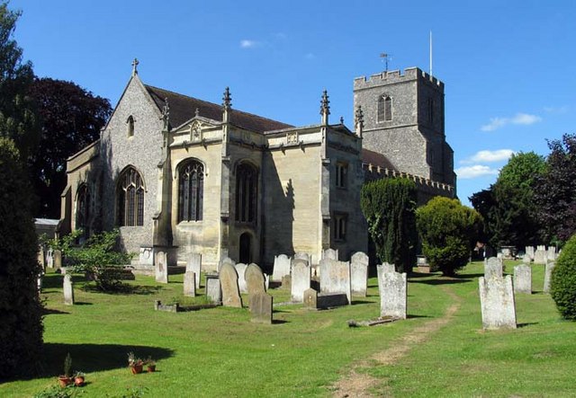
Hoddesdon Images

Images are sourced within 2km of 51.757089/-0.019351 or Grid Reference TL3608. Thanks to Geograph Open Source API. All images are credited.

The A10, Broxbourne
The A10, Broxbourne
The A10, Broxbourne
The A10, Broxbourne
Footpath in Hoddesdon Park Wood Hoddesdon Park Wood is managed by the Woodland Trust <span class="nowrap"><a title="https://www.woodlandtrust.org.uk/visiting-woods/woods/hoddesdon-park-wood/" rel="nofollow ugc noopener" href="https://www.woodlandtrust.org.uk/visiting-woods/woods/hoddesdon-park-wood/">Link</a><img style="margin-left:2px;" alt="External link" title="External link - shift click to open in new window" src="https://s1.geograph.org.uk/img/external.png" width="10" height="10"/></span>

Part of Broxbourne Woods National Nature Reserve <span class="nowrap"><a title="https://www.gov.uk/government/publications/hertfordshires-national-nature-reserve" rel="nofollow ugc noopener" href="https://www.gov.uk/government/publications/hertfordshires-national-nature-reserve">Link</a><img style="margin-left:2px;" alt="External link" title="External link - shift click to open in new window" src="https://s1.geograph.org.uk/img/external.png" width="10" height="10"/></span>

This is the Hertfordshire Way Long Distance Footpath <span class="nowrap"><a title="https://ldwa.org.uk/ldp/members/show_path.php?path_name=Hertfordshire+Way" rel="nofollow ugc noopener" href="https://ldwa.org.uk/ldp/members/show_path.php?path_name=Hertfordshire+Way">Link</a><img style="margin-left:2px;" alt="External link" title="External link - shift click to open in new window" src="https://s1.geograph.org.uk/img/external.png" width="10" height="10"/></span>
Footpath in Hoddesdon Park Wood
Hoddesdon Park Wood is managed by the Woodland Trust LinkExternal link Part of Broxbourne Woods National Nature Reserve LinkExternal link This is the Hertfordshire Way Long Distance Footpath LinkExternal link
The A10, Woollensbrook On the edge of Hoddesdon
The A10, Woollensbrook
On the edge of Hoddesdon
Hoddesdon Town Hoddesdon Town Centre showing War Memorial and White Swan Public House
Hoddesdon Town
Hoddesdon Town Centre showing War Memorial and White Swan Public House
Barclay Park The photograph faces north across the Lake in Barclay Park. The park was given to the town of Hoddesdon in 1935 as a recreational area
Barclay Park
The photograph faces north across the Lake in Barclay Park. The park was given to the town of Hoddesdon in 1935 as a recreational area
Dobb's Weir, Nazeing. Fish & Eels pub by the canal at Dobb's Weir, Lea Valley, Nazeing & Hoddesdon area
Dobb's Weir, Nazeing.
Fish & Eels pub by the canal at Dobb's Weir, Lea Valley, Nazeing & Hoddesdon area
Hoddesdon Wood Nature reserve Hoddesdon Wood is a nature reserve cared for by the Woodland trust
Hoddesdon Wood Nature reserve
Hoddesdon Wood is a nature reserve cared for by the Woodland trust
St Augustine's Church, Church Fields, Broxbourne St Augustine's is the Church of England Parish Church at Broxbourne, and is situated at Church Fields, Broxbourne.  This image was taken at wedding of Andrew Church and Sorrel Wallis on 24 July 2004.

<span class="nowrap"><a title="http://www.acny.org.uk/venue.php?V=7853" rel="nofollow ugc noopener" href="http://www.acny.org.uk/venue.php?V=7853">Link</a><img style="margin-left:2px;" alt="External link" title="External link - shift click to open in new window" src="https://s1.geograph.org.uk/img/external.png" width="10" height="10"/></span>
St Augustine's Church, Church Fields, Broxbourne
St Augustine's is the Church of England Parish Church at Broxbourne, and is situated at Church Fields, Broxbourne. This image was taken at wedding of Andrew Church and Sorrel Wallis on 24 July 2004. LinkExternal link
The New River, Broxbourne The New River is something of a misnomer since it is neither a river nor new. It is an aqueduct built under the direction of Sir Hugh Myddleton between 1607 and 1612 to bring fresh drinking water from Chadwell and Amwell Springs near Ware about 40 miles down the Lee Valley to London. <span class="nowrap"><a title="http://www.engineering-timelines.com/scripts/engineeringItem.asp?id=438" rel="nofollow ugc noopener" href="http://www.engineering-timelines.com/scripts/engineeringItem.asp?id=438">Link</a><img style="margin-left:2px;" alt="External link" title="External link - shift click to open in new window" src="https://s1.geograph.org.uk/img/external.png" width="10" height="10"/></span> for further information.
The New River, Broxbourne
The New River is something of a misnomer since it is neither a river nor new. It is an aqueduct built under the direction of Sir Hugh Myddleton between 1607 and 1612 to bring fresh drinking water from Chadwell and Amwell Springs near Ware about 40 miles down the Lee Valley to London. LinkExternal link for further information.
Broxbourne: Recreation Ground Viewed looking westwards from The New River
Broxbourne: Recreation Ground
Viewed looking westwards from The New River
Broxbourne railway station Viewed looking northwards from the Station Road bridge, Broxbourne station was moved from its old location by the bridge and rebuilt on its present site in 1960. The station is on the Liverpool Street to Cambridge and Stansted Airport and Hertford East lines. A southbound train for Liverpool Street is just leaving the station.
Broxbourne railway station
Viewed looking northwards from the Station Road bridge, Broxbourne station was moved from its old location by the bridge and rebuilt on its present site in 1960. The station is on the Liverpool Street to Cambridge and Stansted Airport and Hertford East lines. A southbound train for Liverpool Street is just leaving the station.
The New River, Broxbourne The New River is something of a misnomer since it is neither a river nor new. It is an aqueduct built under the direction of Sir Hugh Myddleton between 1607 and 1612 to bring fresh drinking water from Chadwell and Amwell Springs near Ware about 40 miles down the Lee Valley to London. <span class="nowrap"><a title="http://www.engineering-timelines.com/scripts/engineeringItem.asp?id=438" rel="nofollow ugc noopener" href="http://www.engineering-timelines.com/scripts/engineeringItem.asp?id=438">Link</a><img style="margin-left:2px;" alt="External link" title="External link - shift click to open in new window" src="https://s1.geograph.org.uk/img/external.png" width="10" height="10"/></span> for further information.
The New River, Broxbourne
The New River is something of a misnomer since it is neither a river nor new. It is an aqueduct built under the direction of Sir Hugh Myddleton between 1607 and 1612 to bring fresh drinking water from Chadwell and Amwell Springs near Ware about 40 miles down the Lee Valley to London. LinkExternal link for further information.
The Fish & Eels P.H. at Dobbs Weir
Bridge over The River Lea at Nazeing
Railway Bridge at Old Mill Broxbourne
The Huntsman, Goose Green The pub was known as the Green Man years ago.
The Huntsman, Goose Green
The pub was known as the Green Man years ago.
Suburban Housing Broxbourne Herts One of many relatively new housing estates that have been built in Broxbourne to help cater for the ever growing demand for housing in the South East.
Suburban Housing Broxbourne Herts
One of many relatively new housing estates that have been built in Broxbourne to help cater for the ever growing demand for housing in the South East.
Show me another place!

Hoddesdon is located at Grid Ref: TL3608 (Lat: 51.757089, Lng: -0.019351)

Administrative County: Hertfordshire

District: Broxbourne

Police Authority: Hertfordshire

What 3 Words

///winner.filed.intervals. Near Hoddesdon, Hertfordshire

Nearby Locations

High Leigh Hoddesdon

Related Wikis

Hoddesdon Town F.C.

Hoddesdon Town Football Club is a football club based in Hoddesdon, Hertfordshire, England. They are currently members of the Eastern Counties League Division...

Robert Barclay Academy

Robert Barclay Academy (formerly Sheredes School) is a co-educational secondary school and sixth form located in Hoddesdon in the English county of Hertfordshire...

Barclay Park

Barclay Park is a park in Hoddesdon, Hertfordshire, England. == History == In 1403 there was a house on the land called High Wyches which by 1677 had been...

Hoddesdon

Hoddesdon () is a town in the Borough of Broxbourne, Hertfordshire, lying entirely within the London Metropolitan Area and Greater London Urban Area....

Rawdon House

Rawdon House is a former residence in the High Street of Hoddesdon, Hertfordshire, England. It was built as a house in 1622 by Marmaduke Rawdon, and extended...

Hoddesdon Town Hall

Hoddesdon Town Hall, also known as Hoddesdon Clock House, was a municipal building in the High Street in Hoddesdon, Hertfordshire, England. Except for...

Broxbourne

Broxbourne is a town in the Borough of Broxbourne district, in Hertfordshire, England, with a population of 15,303 at the 2011 Census. It is located to...

Spital Brook

Spital Brook is a minor tributary of the River Lea which rises in Hoddesdonpark Wood in the county of Hertfordshire, England. Spital Brook flows eastwards...

Nearby Amenities

Located within 500m of 51.757089,-0.019351
Mini Roundabout
Direction: clockwise
Lat/Long: 51.759581/-0.0142835
Crossing
Crossing: traffic_signals
Lat/Long: 51.755772/-0.0130822
Mini Roundabout
Lat/Long: 51.7541299/-0.0247248
Bus Stop
Lowewood Museum
Bench: yes
Bus: yes
Local Ref: NR
Naptan AtcoCode: 210021701420
Naptan Bearing: N
Naptan CommonName: Broxbourne Civic Hall
Naptan Crossing: Police Station
Naptan Indicator: nr
Naptan Landmark: Police Station
Naptan NaptanCode: hrtamdtj
Naptan PlusbusZoneRef: BROXBRN
Naptan ShortCommonName: NA
Naptan Street: High Street
Naptan Verified: no
Public Transport: platform
Shelter: yes
Source: naptan_import
Tactile Paving: yes
Lat/Long: 51.7550734/-0.0134868
Bus Stop
Priory Close
Bench: yes
Bin: yes
Bus: yes
Local Ref: NR
Naptan AtcoCode: 210021702520
Naptan Bearing: S
Naptan CommonName: Priory Close
Naptan Crossing: Rawdon House
Naptan Indicator: nr
Naptan Landmark: Rawdon House
Naptan NaptanCode: hrtamajw
Naptan PlusbusZoneRef: BROXBRN
Naptan ShortCommonName: NA
Naptan Street: High Street
Naptan Verified: yes
Public Transport: platform
Shelter: yes
Source: naptan_import
Lat/Long: 51.7576995/-0.012526
Bus Stop
Lowewood Museum
Bench: no
Bus: yes
Naptan AtcoCode: 210021702540
Naptan Bearing: S
Naptan CommonName: Broxbourne Civic Hall
Naptan Crossing: opp Police Station
Naptan Indicator: opp
Naptan Landmark: opp Police Station
Naptan NaptanCode: hrtamama
Naptan PlusbusZoneRef: BROXBRN
Naptan ShortCommonName: NA
Naptan Street: High Street
Naptan Verified: yes
Public Transport: platform
Shelter: no
Source: naptan_import
Tactile Paving: no
Lat/Long: 51.7551884/-0.0131879
Post Box
Collection Times: Mo-Fr 09:00; Sa 07:00
Ref: EN11 108
Royal Cypher: EIIR
Lat/Long: 51.7610049/-0.0166529
Parking
Lat/Long: 51.7566711/-0.0177946
Post Box
Collection Times: Mo-Fr 16:45, Sa 11:00
Post Box Design: penfold
Post Box Type: pillar
Ref: EN11 109
Royal Cypher: VR
Royal Cypher Wikidata: Q33102356
Lat/Long: 51.7552177/-0.0134168
Give Way
Direction: backward
Lat/Long: 51.7559449/-0.0129596
Traffic Calming: hump
Lat/Long: 51.7568625/-0.0139915
Entrance: yes
Lat/Long: 51.7560601/-0.0148421
Entrance: yes
Lat/Long: 51.7556423/-0.0147883
Entrance: yes
Lat/Long: 51.7555831/-0.0147934
Barrier: lift_gate
Lat/Long: 51.7557567/-0.0148259
Barrier: kissing_gate
Lat/Long: 51.7580025/-0.0203224
Barrier: kissing_gate
Lat/Long: 51.7567653/-0.0175598
Bench
Backrest: yes
Material: wood
Seats: 3
Lat/Long: 51.757783/-0.0194236
Barrier: kissing_gate
Lat/Long: 51.758741/-0.0220261
Waste Basket
Check Date: 2023-06-18
Waste: dog
Lat/Long: 51.758723/-0.0220307
Barrier: stile
Lat/Long: 51.7542306/-0.0246207
Barrier: stile
Lat/Long: 51.754337/-0.0239482
Barrier: stile
Lat/Long: 51.7567643/-0.0251849
Bench
Backrest: yes
Lat/Long: 51.7600565/-0.0203865
Waste Basket
Lat/Long: 51.7587317/-0.0200458
Bench
Backrest: yes
Lat/Long: 51.7600549/-0.020129
Barrier: kissing_gate
Lat/Long: 51.7601039/-0.0200117
Waste Basket
Waste: dog
Lat/Long: 51.7585117/-0.0176909
Bench
Lat/Long: 51.7591094/-0.0185706
Bench
Backrest: yes
Material: metal
Seats: 3
Lat/Long: 51.7609472/-0.0228756
Waste Basket
Waste: dog
Lat/Long: 51.7600997/-0.0222372
Leisure: picnic_table
Lat/Long: 51.7587052/-0.0194906
Bench
Lat/Long: 51.7590114/-0.0201705
Bench
Lat/Long: 51.7588205/-0.0203221
Waste Basket
Lat/Long: 51.7586296/-0.0195094
Bench
Backrest: yes
Lat/Long: 51.7597511/-0.022087
Leisure: picnic_table
Lat/Long: 51.7586421/-0.0194115
Bench
Backrest: yes
Lat/Long: 51.7601088/-0.0215331
Leisure: picnic_table
Lat/Long: 51.758657/-0.0195604
Waste Basket
Lat/Long: 51.7583499/-0.0178893
Bench
Lat/Long: 51.7583665/-0.0180489
Bench
Lat/Long: 51.7583017/-0.0179859
Bench
Lat/Long: 51.758442/-0.0184861
Bench
Lat/Long: 51.758833/-0.0187409
Waste Basket
Lat/Long: 51.7587383/-0.0188724
Bench
Lat/Long: 51.7592331/-0.0191097
Bench
Backrest: yes
Material: wood
Lat/Long: 51.7600217/-0.0222265
Bench
Backrest: yes
Lat/Long: 51.7598914/-0.0221634
Bench
Lat/Long: 51.7590264/-0.0192063
Waste Basket
Lat/Long: 51.7599121/-0.0221728
Bench
Backrest: yes
Lat/Long: 51.7594066/-0.0210704
Crossing
Crossing: traffic_signals
Crossing Island: no
Tactile Paving: yes
Lat/Long: 51.7562515/-0.0174124
Bench
Lat/Long: 51.7576569/-0.0174698
Bench
Lat/Long: 51.7583952/-0.017799
Waste Basket
Lat/Long: 51.7582189/-0.0196665
Bench
Lat/Long: 51.7582371/-0.0197108
Bench
Lat/Long: 51.7583226/-0.0177481
070920132293.jpg
Cmt: 2013:09:07 18:46:24
Ele: 86.5
Link: D:\Tracks\img_0907\070920132293.jpg
Lat/Long: 51.7582072/-0.0195825
Bench
Lat/Long: 51.7581474/-0.017262
Waste Basket
Lat/Long: 51.7581367/-0.0188082
Recycling
Lat/Long: 51.7558562/-0.0143025
Parking Space: disabled
Lat/Long: 51.7559623/-0.0145619
Parking Space: disabled
Lat/Long: 51.7559995/-0.0145548
Parking Space: disabled
Lat/Long: 51.7558924/-0.0145751
Parking
Parking Space: disabled
Lat/Long: 51.7557045/-0.0147924
Parking
Parking Space: disabled
Lat/Long: 51.7556738/-0.0147951
Parking Space: disabled
Lat/Long: 51.7559281/-0.0145683
Entrance: yes
Lat/Long: 51.7556023/-0.0147917
Entrance: yes
Lat/Long: 51.7556258/-0.0147897
Barrier: stile
Lat/Long: 51.7561112/-0.0219119
Crossing
Crossing: unmarked
Crossing Island: no
Kerb: lowered
Tactile Paving: no
Lat/Long: 51.7546539/-0.0216982
Waste Basket
Source: gps+mapnoter
Lat/Long: 51.7578878/-0.0162059
Bench
Source: gps+mapnoter
Lat/Long: 51.7571706/-0.0163454
Bench
Source: gps+mapnoter
Lat/Long: 51.7574993/-0.0161737
Bench
Source: gps+mapnoter
Lat/Long: 51.7573598/-0.0162354
Bench
Source: gps+mapnoter
Lat/Long: 51.7572419/-0.0162998
Bench
Source: gps+mapnoter
Lat/Long: 51.7576138/-0.0161389
Bench
Source: gps+mapnoter
Lat/Long: 51.7578387/-0.0162479
Waste Basket
Source: gps+mapnoter
Lat/Long: 51.7588358/-0.0194085
Bench
Source: gps+mapnoter
Lat/Long: 51.7584573/-0.0175041
Barrier: entrance
Foot: yes
Lat/Long: 51.7588092/-0.0160168
Crossing
Crossing: unmarked
Crossing Island: yes
Tactile Paving: no
Lat/Long: 51.7609226/-0.0159905
Crossing
Crossing: marked
Crossing Island: no
Tactile Paving: yes
Traffic Calming: table
Lat/Long: 51.7600579/-0.0142227
Barrier: swing_gate
Lat/Long: 51.7558748/-0.0141322
Barrier: swing_gate
Lat/Long: 51.7562552/-0.0140392
Traffic Calming: hump
Lat/Long: 51.7566693/-0.014107
Give Way
Direction: backward
Lat/Long: 51.7574212/-0.0143399
Give Way
Direction: backward
Lat/Long: 51.757364/-0.0145406
Give Way
Direction: forward
Lat/Long: 51.7565007/-0.0139252
Give Way
Direction: backward
Lat/Long: 51.7543986/-0.0136823
The data included in this document is from www.openstreetmap.org. The data is made available under ODbL.

Have you been to Hoddesdon?

Leave your review of Hoddesdon below (or comments, questions and feedback).