Court Hill
Hill, Mountain in Renfrewshire
Scotland
Court Hill

Court Hill is a prominent hill located in Renfrewshire, Scotland. Rising to an elevation of around 200 meters (656 feet), it offers stunning panoramic views of the surrounding countryside and nearby towns. Situated in the southwestern part of Renfrewshire, Court Hill is a popular destination for locals and tourists alike.
The hill is covered in lush greenery, with a mix of grassy slopes and woodland areas. Its diverse flora and fauna make it an ideal spot for nature enthusiasts, hikers, and birdwatchers. The hill is home to various species of birds, including buzzards, kestrels, and owls, which can often be spotted soaring through the skies.
Court Hill also boasts a rich historical significance. It is said to have been used as a vantage point during battles fought in the area centuries ago. Additionally, remnants of a hillfort from the Iron Age can be found on its slopes, adding to its archaeological importance.
Access to Court Hill is relatively easy, with a network of footpaths and trails leading to its summit. The hill is often frequented by walkers and runners, who can enjoy the fresh air and picturesque scenery. It is also a popular spot for dog walkers, providing them with ample space for their pets to roam and explore.
Overall, Court Hill in Renfrewshire is a captivating natural landmark that combines breathtaking views, ecological diversity, and historical significance, making it a must-visit for anyone seeking an outdoor adventure or a peaceful retreat in this picturesque part of Scotland.
If you have any feedback on the listing, please let us know in the comments section below.
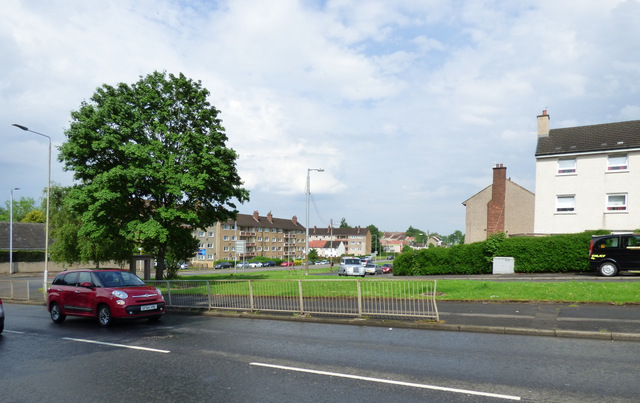
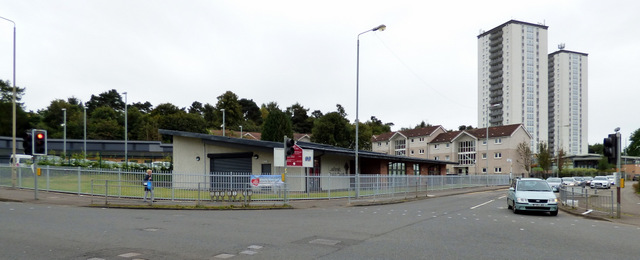
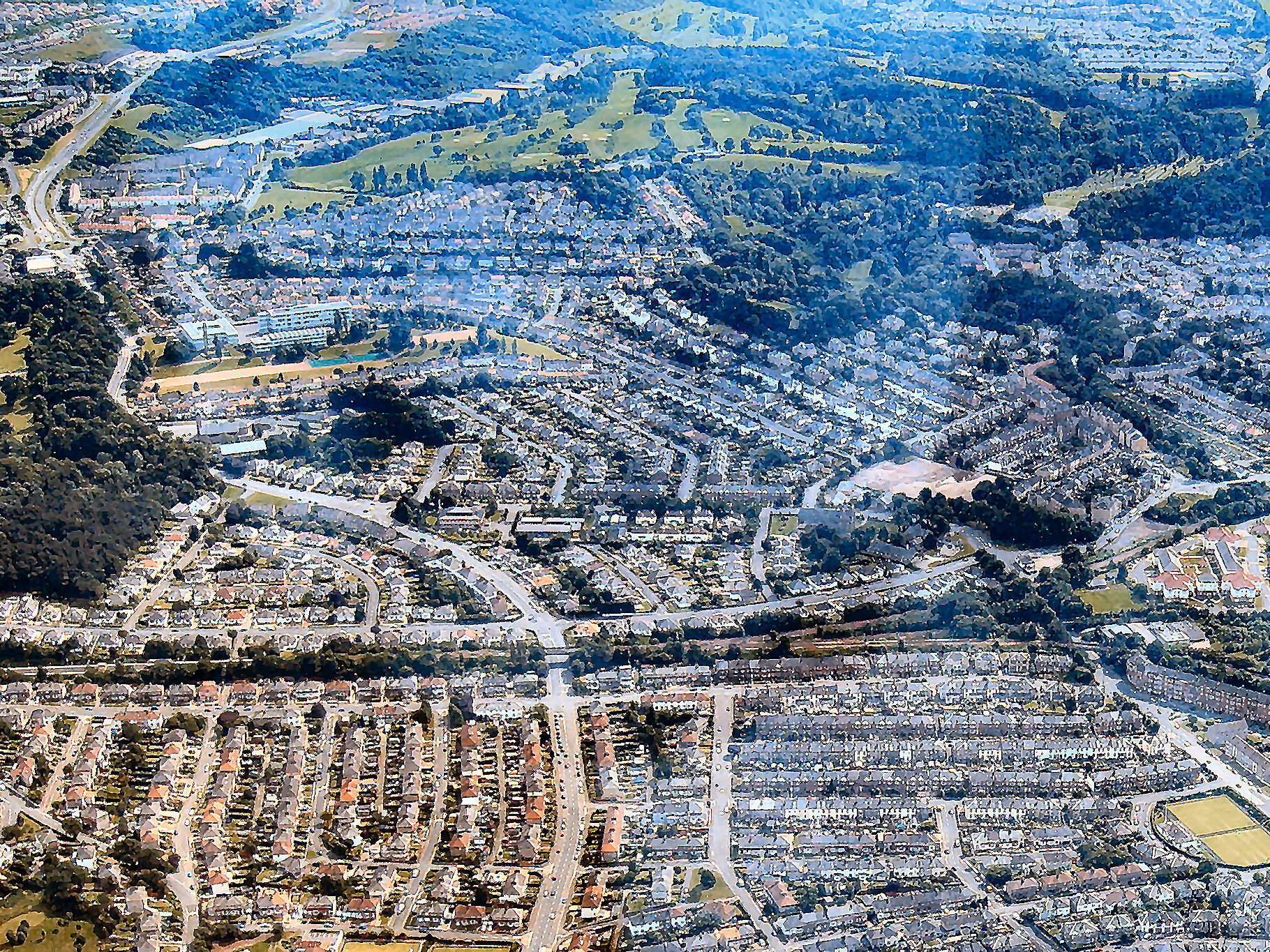
Court Hill Images
Images are sourced within 2km of 55.812833/-4.2540947 or Grid Reference NS5860. Thanks to Geograph Open Source API. All images are credited.


Court Hill is located at Grid Ref: NS5860 (Lat: 55.812833, Lng: -4.2540947)
Unitary Authority: City of Glasgow
Police Authority: Greater Glasgow
What 3 Words
///assume.cheek.studio. Near Netherlee, East Renfrewshire
Nearby Locations
Related Wikis
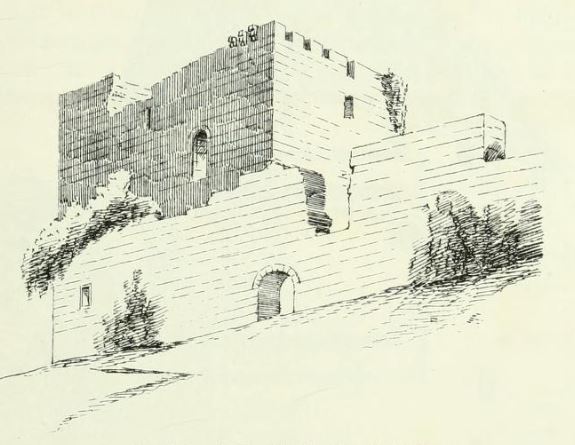
Cathcart Castle
Cathcart Castle was a 15th-century castle, located in what is now Linn Park in the Cathcart area of southern Glasgow, Scotland. The castle was abandoned...
Simshill
Simshill is an area of Glasgow, Scotland. It is on the South Side of the city, approximately 3.7 miles (6.0 km) south of the city centre. Adjacent areas...

King's Park Secondary School
King's Park Secondary School, on Fetlar Drive, in the King's Park area (or specifically in the Simshill area) of south Glasgow, is a Scottish non-denominational...
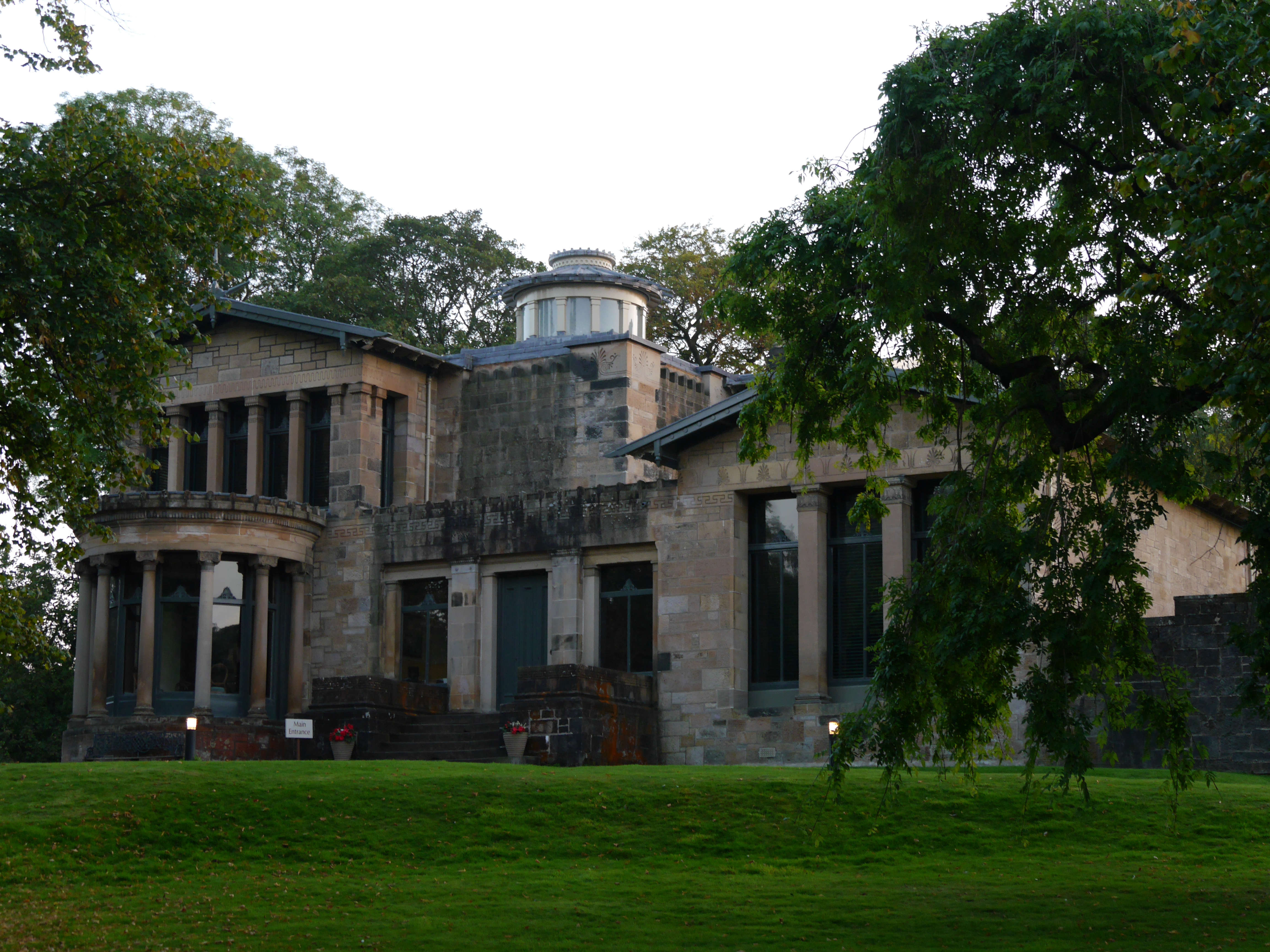
Holmwood House
Holmwood House is the finest and most elaborate residential villa designed by the Scottish architect Alexander "Greek" Thomson. It is also rare in retaining...

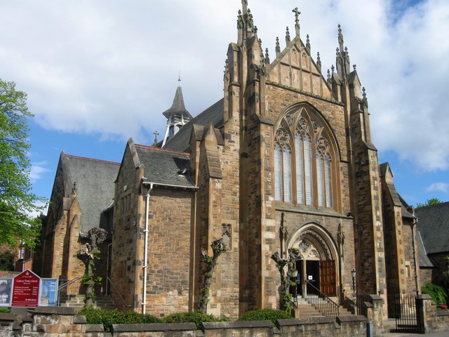
Cathcart Old Church
Cathcart Old Church is a Parish church of the Church of Scotland, located between the Cathcart and King's Park areas of Glasgow. == Previous Churches... ==
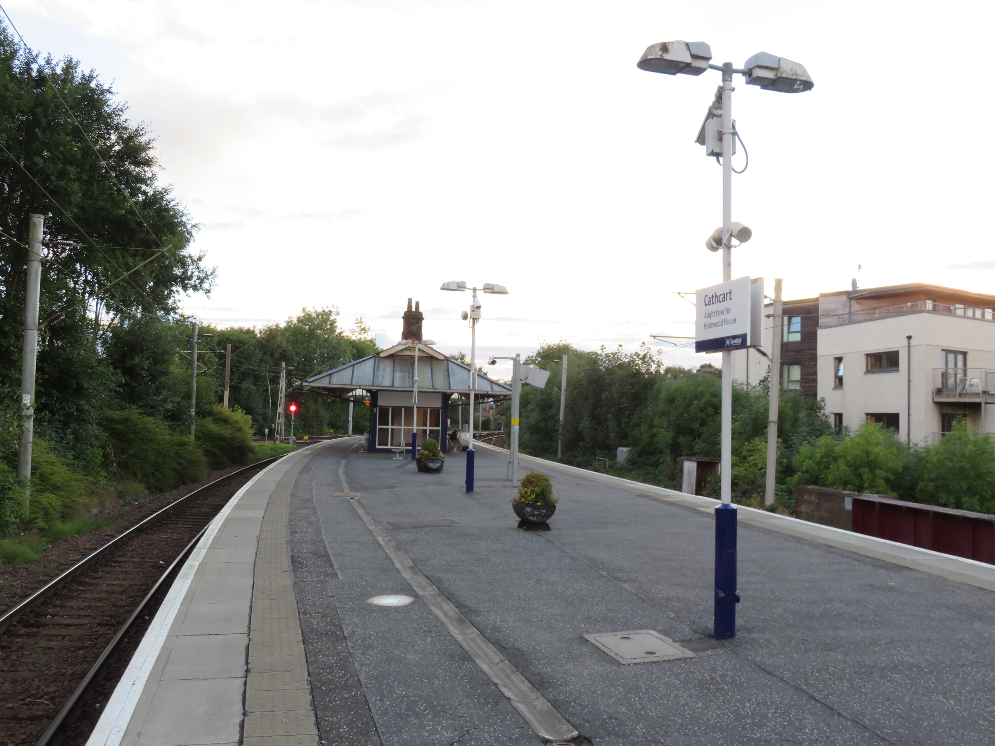
Cathcart railway station
Cathcart railway station is a railway station serving the Cathcart area of Glasgow, Scotland. It is located on the Cathcart Circle Line, 3.7 miles (6 km...
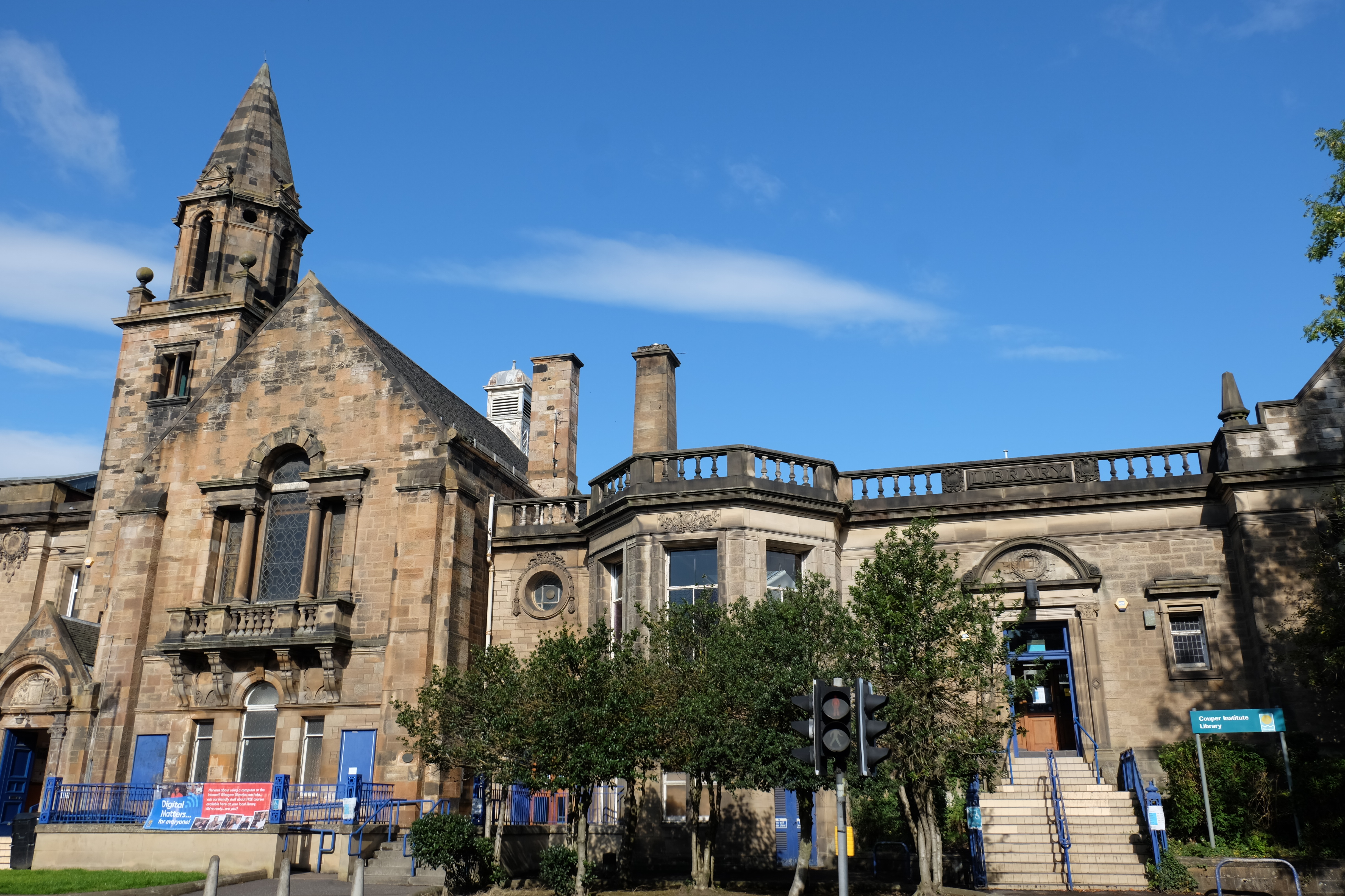
Couper Institute Library
The Couper Institute Library is a public library situated in Cathcart, Glasgow, Scotland. The Couper Institute was originally built by architects Campbell...
Cathcart Trinity Church
Cathcart Trinity Church is one of two Church of Scotland parish churches in the Cathcart area of Glasgow. == History of the building == The church was...
Nearby Amenities
Located within 500m of 55.812833,-4.2540947Have you been to Court Hill?
Leave your review of Court Hill below (or comments, questions and feedback).