Holmlea Park

Downs, Moorland in Renfrewshire

Scotland

Holmlea Park

Approaching Clarkston Road on Muirend Road
Approaching Clarkston Road on Muirend Road Credit: Elliott Simpson

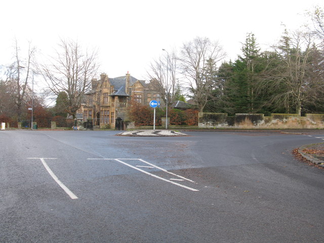
Holmlea Park is nestled in the picturesque region of Renfrewshire, Scotland, offering a tranquil and scenic retreat for visitors. The park is situated in the area known as Downs, which is characterized by its stunning moorland landscape.

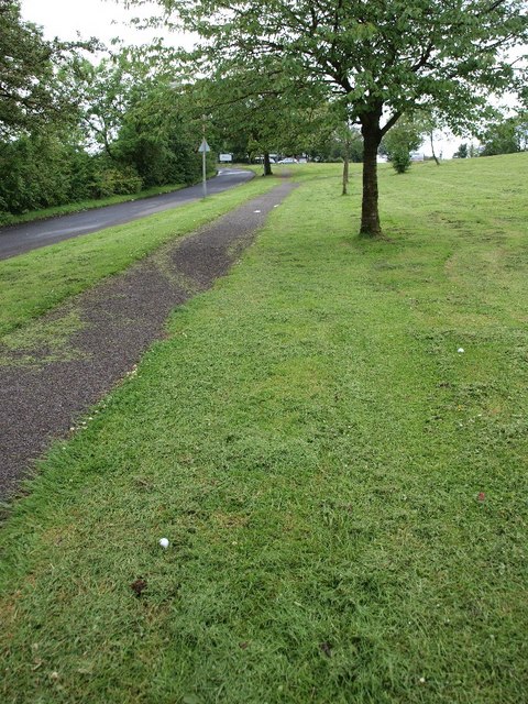
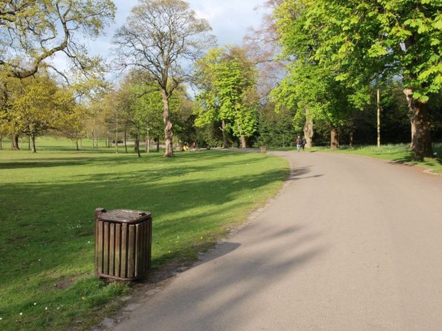
Spanning across a sprawling area, Holmlea Park boasts a diverse array of natural features and recreational amenities. The park is renowned for its expansive moorland, which provides a unique habitat for various plant and animal species. Visitors can enjoy leisurely walks or hikes through the moorland, immersing themselves in the natural beauty and serenity of the surroundings.

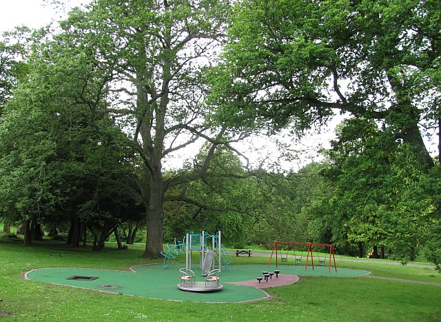
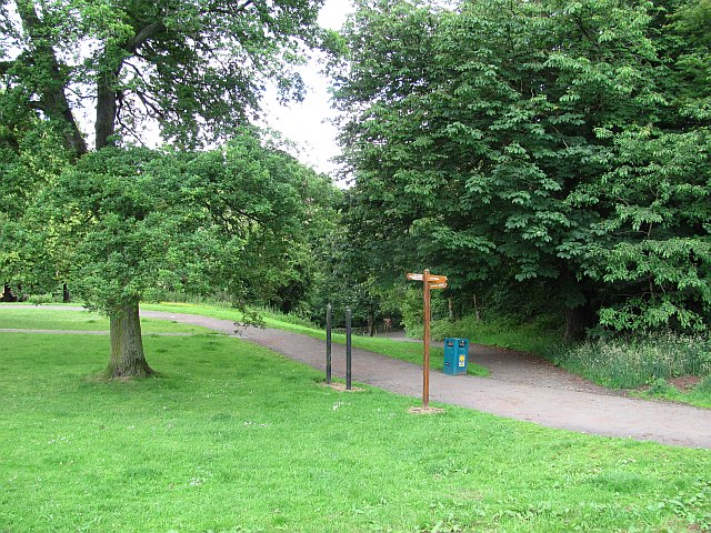
The park is well-maintained and offers a range of facilities to cater to visitors of all ages. It features well-marked trails and paths, ensuring easy navigation and accessibility. The park also provides picnic areas, where families and friends can gather to enjoy a delightful outdoor meal amidst the idyllic surroundings.

Furthermore, Holmlea Park offers ample opportunities for wildlife observation and bird watching, making it a favorite destination for nature enthusiasts. The moorland provides a habitat for various bird species, including skylarks and curlews, offering a delightful experience for birdwatchers.

Overall, Holmlea Park in Renfrewshire is a hidden gem, offering a peaceful and scenic retreat for visitors seeking to escape the hustle and bustle of daily life. With its beautiful moorland landscape and a range of recreational amenities, the park provides a welcome respite and an opportunity to reconnect with nature.

If you have any feedback on the listing, please let us know in the comments section below.
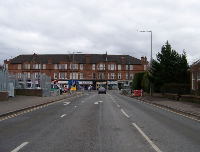
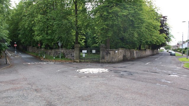
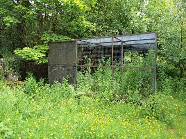
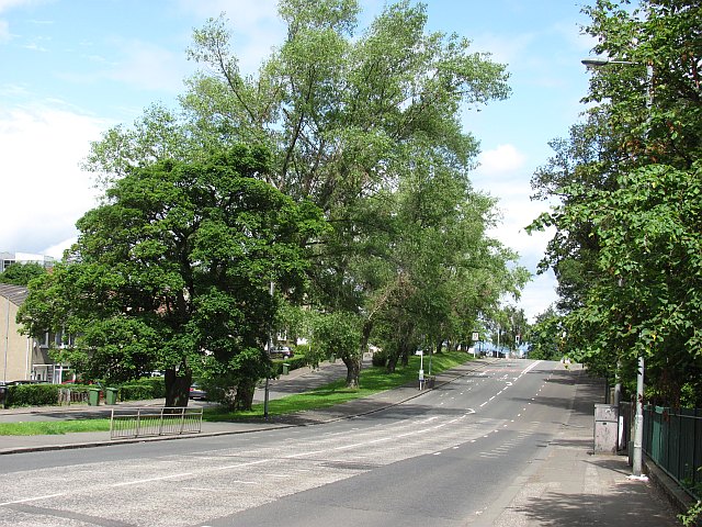
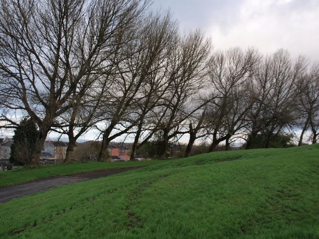
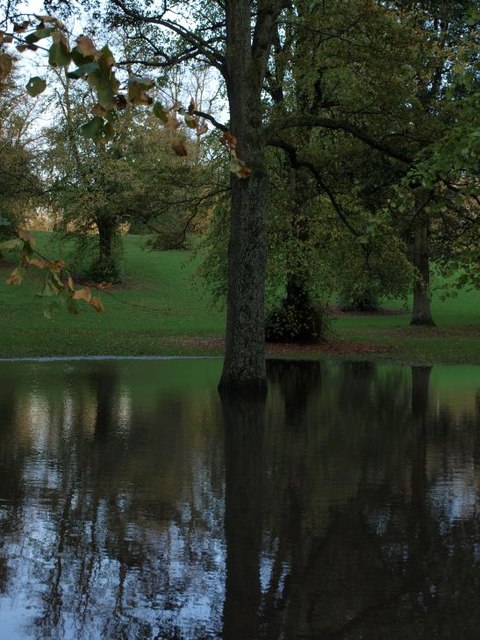
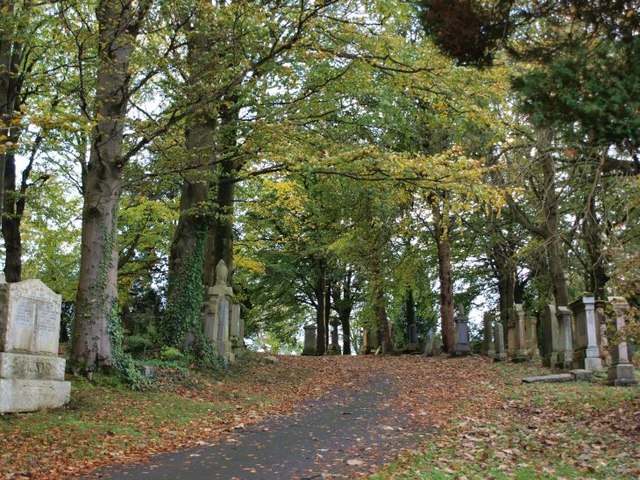
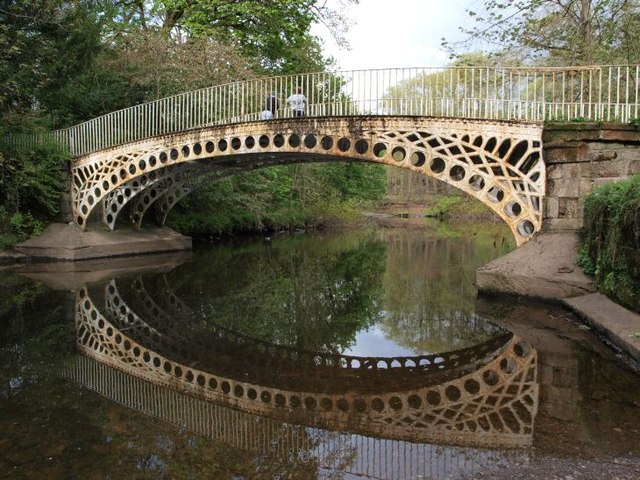
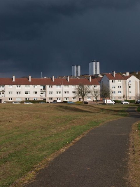
Holmlea Park Images

Images are sourced within 2km of 55.821086/-4.261788 or Grid Reference NS5860. Thanks to Geograph Open Source API. All images are credited.

Approaching Clarkston Road on Muirend Road
Mini-roundabout on Netherlee Road Netherlee Road meets Brenfield Road at this mini-roundabout. Netherlee Road splits Cathcart Cemetery in two and a gate into the northern section lies behind.
Mini-roundabout on Netherlee Road
Netherlee Road meets Brenfield Road at this mini-roundabout. Netherlee Road splits Cathcart Cemetery in two and a gate into the northern section lies behind.
Disused aviary in Linn Park I guess it was an aviary; possibly a reptile enclosure? Anyway it's not been used for some time.
Disused aviary in Linn Park
I guess it was an aviary; possibly a reptile enclosure? Anyway it's not been used for some time.
Simshill Road approaching Linn Park Golf Club Simshill Road climbs uphill to the entrance to Linn Park at the golf club. The actual course is on the behind the hedge on the left-hand side of the picture but a couple of presumably stray golf balls in the grass hint at its presence. Simshill road is traffic calmed at this point and there is a good path for pedestrians.
Simshill Road approaching Linn Park Golf Club
Simshill Road climbs uphill to the entrance to Linn Park at the golf club. The actual course is on the behind the hedge on the left-hand side of the picture but a couple of presumably stray golf balls in the grass hint at its presence. Simshill road is traffic calmed at this point and there is a good path for pedestrians.
Netherlee Road Netherlee Road used to provide a short-cut from Clarkston Road for some traffic heading north into the city. For many years it has been impossible to turn into it from Clarkston road (<a href="https://www.geograph.org.uk/photo/1342614">NS5759 : Traffic Island on Clarkston Road</a>). As shown here, it is also closed to south-heading traffic where it meets Brenfield Road.
Netherlee Road
Netherlee Road used to provide a short-cut from Clarkston Road for some traffic heading north into the city. For many years it has been impossible to turn into it from Clarkston road (NS5759 : Traffic Island on Clarkston Road). As shown here, it is also closed to south-heading traffic where it meets Brenfield Road.
Toddler tunnel This bit of pipe makes an adventurous tunnel for small children in this wee playpark in Linn Park.
Toddler tunnel
This bit of pipe makes an adventurous tunnel for small children in this wee playpark in Linn Park.
Thornicroft Drive, Croftfoot Residential street in the south of Glasgow.
Thornicroft Drive, Croftfoot
Residential street in the south of Glasgow.
Carmunnock Road A speed camera on Carmunnock Road, a busy route into/out of Glasgow.
Carmunnock Road
A speed camera on Carmunnock Road, a busy route into/out of Glasgow.
Carmunnock Road Carmunnock Road passing King's Park.
Carmunnock Road
Carmunnock Road passing King's Park.
Play apparatus, Linn Park Linn Park (73Ha) is the second largest park in Glasgow, according to the Council. (There may be other bigger ones looked after by the other local authorities). It is well wooded.
Play apparatus, Linn Park
Linn Park (73Ha) is the second largest park in Glasgow, according to the Council. (There may be other bigger ones looked after by the other local authorities). It is well wooded.
Linn Park Paths in the second largest park in Glasgow City Council's area (according to their website).
Linn Park
Paths in the second largest park in Glasgow City Council's area (according to their website).
Trees in Cathcart Cemetery On the lee of the hill the trees show the influence of the prevailing westerly winds.
Trees in Cathcart Cemetery
On the lee of the hill the trees show the influence of the prevailing westerly winds.
Tree in flood This slight hollow stands at the bottom of a slope in Linn Park popular for sledging in winter and egg-rolling on Easter Sunday. After the last few days' heavy rain quite a lot of water has collected there - not a particularly unusual sight in the winter.
Tree in flood
This slight hollow stands at the bottom of a slope in Linn Park popular for sledging in winter and egg-rolling on Easter Sunday. After the last few days' heavy rain quite a lot of water has collected there - not a particularly unusual sight in the winter.
Scene in Cathcart Cemetery
Bridge over the White Cart The bridge is viewed here from a little beach just to its south, on the other side from the view shown in <a href="https://www.geograph.org.uk/photo/1604980">NS5859 : Bridge over White Cart Water</a>. Since it is just upstream from the waterfall (<a href="https://www.geograph.org.uk/photo/984561">NS5859 : Waterfall in Linn Park</a>) and not far from the Clarkston Road entrance (<a href="https://www.geograph.org.uk/photo/1604974">NS5759 : Western entrance to Linn Park</a>) it sees lots of traffic from the Park's visitors. The river is not usually quite as tranquil as it was this afternoon.
Bridge over the White Cart
The bridge is viewed here from a little beach just to its south, on the other side from the view shown in NS5859 : Bridge over White Cart Water. Since it is just upstream from the waterfall (NS5859 : Waterfall in Linn Park) and not far from the Clarkston Road entrance (NS5759 : Western entrance to Linn Park) it sees lots of traffic from the Park's visitors. The river is not usually quite as tranquil as it was this afternoon.
Drakemire Drive with threatening sky The path in the foreground runs across the grassy area between Simshill Road (behind the photographer) and Drakemire Drive. The scary looking sky eventually fulfilled its promise, delivering a hail shower a couple of hours later.
Drakemire Drive with threatening sky
The path in the foreground runs across the grassy area between Simshill Road (behind the photographer) and Drakemire Drive. The scary looking sky eventually fulfilled its promise, delivering a hail shower a couple of hours later.
Scene in King's Park When I first came to Glasgow I was told that it has the most green space per head of population of all UK cities. I don't know if that's true but there are 90+ parks and gardens. King's Park is one of them, offering a pleasant space for the surrounding residential areas of Simshill, Castlemilk, Croftfoot and indeed King's Park.
Scene in King's Park
When I first came to Glasgow I was told that it has the most green space per head of population of all UK cities. I don't know if that's true but there are 90+ parks and gardens. King's Park is one of them, offering a pleasant space for the surrounding residential areas of Simshill, Castlemilk, Croftfoot and indeed King's Park.
Roundabout in Muirend At the junction of Langside Drive and Muirend Road.
Roundabout in Muirend
At the junction of Langside Drive and Muirend Road.
Show me another place!

Holmlea Park is located at Grid Ref: NS5860 (Lat: 55.821086, Lng: -4.261788)

Unitary Authority: City of Glasgow

Police Authority: Greater Glasgow

What 3 Words

///walks.thigh.neon. Near Netherlee, East Renfrewshire

Related Wikis

Nearby Amenities

Located within 500m of 55.821086,-4.261788
Traffic Signals
Lat/Long: 55.8183082/-4.2615003
Crossing
Crossing: unmarked
Kerb: lowered
Tactile Paving: no
Lat/Long: 55.8174517/-4.2590516
Railway: switch
Lat/Long: 55.8172114/-4.2620702
Cathcart
Naptan AtcoCode: 9100CCRT
Network: National Rail
Network Website: https://www.nationalrail.co.uk/stations/cct/
Network Wikidata: Q26334
Operator: ScotRail
Operator Website: https://www.scotrail.co.uk/plan-your-journey/stations-and-facilities/cct
Operator Wikidata: Q18356161
Public Transport: station
Railway: station
Ref Crs: CCT
Train: yes
Wheelchair: no
Wikidata: Q2209530
Wikipedia: en:Cathcart railway station
Lat/Long: 55.8177954/-4.2603903
Railway: switch
Lat/Long: 55.821009/-4.2586239
Mini Roundabout
Direction: clockwise
Lat/Long: 55.8186032/-4.2566591
Traffic Signals
Traffic Signals: signal
Lat/Long: 55.8207716/-4.2558406
Barrier: fence
Bicycle: yes
Foot: yes
Lat/Long: 55.8177796/-4.2564032
Railway: switch
Lat/Long: 55.8171104/-4.26256
Source: www.npemap.org.uk
Uk Postcode Centroid: G44
Lat/Long: 55.819321/-4.256769
Pub
Beechings
Lat/Long: 55.8168492/-4.2627255
Pub
The Clockwork Bar
Microbrewery: yes
Lat/Long: 55.8232021/-4.2589209
Cathcart
Is In: Glasgow
Place: suburb
Wikidata: Q5052163
Wikipedia: en:Cathcart
Lat/Long: 55.8169882/-4.2624244
Cathcart Old Parish Church Tower
Historic: ruins
Religion: christian
Lat/Long: 55.8180487/-4.2560854
Railway: railway_crossing
Lat/Long: 55.8173785/-4.2611491
Post Box
Collection Times: Mo-Fr 09:00, Sa 07:00
Post Box Type: pillar
Postal Code: G43
Ref: G43 485
Royal Cypher: EVIIR
Royal Cypher Wikidata: Q33102324
Lat/Long: 55.8181923/-4.267511
Bicycle Parking
Bicycle Parking: stands
Capacity: 4
Covered: no
Lat/Long: 55.8178605/-4.2620713
Telephone
Booth: KX100
Covered: booth
Operator: BT
Phone: +44 141 6371203
Lat/Long: 55.8182291/-4.267511
Bus Stop
Newlands Road / Earlspark Avenue
Bus: yes
Naptan AtcoCode: 60902594
Naptan Bearing: E
Naptan CommonName: Earls Park Avenue
Naptan Indicator: before
Naptan Landmark: Earls Park Avenue
Naptan NaptanCode: 45234263
Naptan Street: Newlands Road
Public Transport: platform
Ref: 60902594
Shelter: no
Lat/Long: 55.8181566/-4.2678411
Telephone
Booth: KX100
Covered: booth
Operator: BT
Phone: +44 141 637 0117
Lat/Long: 55.8172839/-4.2625032
Post Office
Barry's
Ref Pol Id: 3885
Source: OS OpenData StreetView
Lat/Long: 55.8174371/-4.2623121
Fast Food
Best Chippy
Cuisine: fish_and_chips
Lat/Long: 55.8245862/-4.2567795
Fast Food
Greggs
Addr Housenumber: 1158
Addr Postcode: G42 9EG
Addr Street: Cathcart Road
Brand: Greggs
Brand Wikidata: Q3403981
Brand Wikipedia: en:Greggs
Contact Website: https://www.greggs.co.uk/shop-finder?shop-code=2057
Cuisine: sandwich;bakery
Fhrs Id: 315967
Source Addr: FHRS Open Data
Takeaway: yes
Lat/Long: 55.8248/-4.2577795
Tesco Express
Addr Housenumber: 1160
Addr Postcode: G42 9EG
Addr Street: Cathcart Road
Brand: Tesco Express
Brand Wikidata: Q98456772
Brand Wikipedia: en:Tesco
Check Date Opening Hours: 2023-06-05
Contact Website: https://www.tesco.com/store-locator/glasgow/cathcart-rd
Fhrs Id: 466596
Opening Hours: Mo-Su 07:00-23:00
Payment Cash: yes
Shop: convenience
Source Addr: FHRS Open Data
Lat/Long: 55.8247158/-4.2578591
Bicycle Parking
Bicycle Parking: stands
Capacity: 4
Covered: no
Lat/Long: 55.8244948/-4.2568506
Post Box
Collection Times: Mo-Fr 16:30; Sa 13:00
Operator: Royal Mail
Operator Wikidata: Q638098
Ref: G44 806
Royal Cypher: GR
Lat/Long: 55.8244937/-4.2568269
Railway: railway_crossing
Lat/Long: 55.8169767/-4.2631776
Fast Food
Marini's
Cuisine: italian
Lat/Long: 55.8248597/-4.257746
Bus Stop
Battlefield Road / Cathcart Road
Bus: yes
Naptan AtcoCode: 60902562
Naptan Bearing: SE
Naptan CommonName: Cathcart Road
Naptan Indicator: before
Naptan Landmark: Cathcart Road
Naptan NaptanCode: 45234653
Naptan Street: Battlefield Road
Public Transport: platform
Ref: 60902562
Lat/Long: 55.82437/-4.25929
Bus Stop
Battlefield Road / No 320
Bus: yes
Naptan AtcoCode: 60903983
Naptan Bearing: NW
Naptan CommonName: Cathcart Road
Naptan Indicator: after
Naptan Landmark: No 320
Naptan NaptanCode: 45293274
Naptan Street: Battlefield Road
Public Transport: platform
Ref: 60903983
Lat/Long: 55.82438/-4.25975
Bus Stop
Carmunnock Road / Ballogie Road
Bus: yes
Naptan AtcoCode: 60902477
Naptan Bearing: S
Naptan CommonName: Ballogie Road
Naptan Indicator: opp
Naptan Landmark: Ballogie Road
Naptan NaptanCode: 45232638
Naptan Street: Carmunnock Road
Public Transport: platform
Ref: 60902477
Lat/Long: 55.82213/-4.25619
Bus Stop
Carmunnock Road / Ballogie Road
Bus: yes
Naptan AtcoCode: 60902478
Naptan Bearing: N
Naptan CommonName: Ballogie Road
Naptan Indicator: after
Naptan Landmark: Ballogie Road
Naptan NaptanCode: 45238535
Naptan Street: Carmunnock Road
Public Transport: platform
Ref: 60902478
Lat/Long: 55.82292/-4.25667
Bus Stop
Carmunnock Road / Kings Park Road
Bench: yes
Bin: yes
Bus: yes
Naptan AtcoCode: 60902474
Naptan Bearing: N
Naptan CommonName: Bowling Green
Naptan Indicator: At
Naptan Landmark: Kings Park Road
Naptan NaptanCode: 45234569
Naptan Street: Carmunnock Road
Public Transport: platform
Ref: 60902474
Shelter: yes
Tactile Paving: no
Lat/Long: 55.81955/-4.2558
Bus Stop
Carmunnock Road / Menock Road
Bus: yes
Naptan AtcoCode: 60902475
Naptan Bearing: S
Naptan CommonName: Bowling Green
Naptan Indicator: Opp
Naptan Landmark: Menock Road
Naptan NaptanCode: 45236524
Naptan Street: Carmunnock Road
Public Transport: platform
Ref: 60902475
Lat/Long: 55.81983/-4.25563
Bus Stop
Carmunnock Road / Second Avenue
Bus: yes
Naptan AtcoCode: 60902476
Naptan Bearing: N
Naptan CommonName: Second Avenue
Naptan Indicator: Opp
Naptan Landmark: Second Avenue
Naptan NaptanCode: 45242785
Naptan Street: Carmunnock Road
Public Transport: platform
Ref: 60902476
Lat/Long: 55.82143/-4.25623
Bus Stop
Cathcart Road / Letherby Drive
Bench: yes
Bin: no
Bus: yes
Lit: yes
Naptan AtcoCode: 60903583
Naptan Bearing: NE
Naptan CommonName: Cathkinview Road
Naptan Indicator: before
Naptan Landmark: Letherby Drive
Naptan NaptanCode: 45239353
Naptan Street: Cathcart Road
Public Transport: platform
Ref: 60903583
Shelter: yes
Tactile Paving: no
Lat/Long: 55.82443/-4.25795
Bus Stop
Cathcart Road / Mount Florida Primary School
Bus: yes
Naptan AtcoCode: 60902489
Naptan Bearing: NW
Naptan CommonName: Mount Florida Primary School
Naptan Indicator: At
Naptan Landmark: Mount Florida Primary School
Naptan NaptanCode: 45236532
Naptan Street: Cathcart Road
Public Transport: platform
Ref: 60902489
Lat/Long: 55.82452/-4.25726
Bus Stop
Cathcart Road / Mount Florida Primary School
Bus: yes
Naptan AtcoCode: 60902488
Naptan Bearing: E
Naptan CommonName: Mount Florida Primary School
Naptan Indicator: Opp
Naptan Landmark: Mount Florida Primary School
Naptan NaptanCode: 45243535
Naptan Street: Cathcart Road
Public Transport: platform
Ref: 60902488
Lat/Long: 55.82479/-4.25724
Bus Stop
Kings Park Road / Carmunnock Road
Bench: yes
Bin: no
Bus: yes
Lit: no
Naptan AtcoCode: 60902483
Naptan Bearing: NW
Naptan CommonName: Carmunnock Road
Naptan Indicator: after
Naptan Landmark: Carmunnock Road
Naptan NaptanCode: 45237587
Naptan Street: Kings Park Road
Public Transport: platform
Ref: 60902483
Shelter: yes
Tactile Paving: no
Lat/Long: 55.8211/-4.25658
Bus Stop
Kings Park Road / Carmunnock Road
Bench: no
Bin: no
Bus: yes
Lit: no
Naptan AtcoCode: 60902484
Naptan Bearing: SE
Naptan CommonName: Carmunnock Road
Naptan Indicator: before
Naptan Landmark: Carmunnock Road
Naptan NaptanCode: 45242936
Naptan Street: Kings Park Road
Public Transport: platform
Ref: 60902484
Shelter: no
Tactile Paving: no
Lat/Long: 55.82121/-4.25642
Bus Stop
King's Park Road / Cordiner Street
Bench: yes
Bin: yes
Bus: yes
Lit: no
Naptan AtcoCode: 60902485
Naptan Bearing: N
Naptan CommonName: Cordiner Street
Naptan Indicator: opp & before
Naptan Landmark: Cordiner Street
Naptan NaptanCode: 45243586
Naptan Street: Kings Park Road
Public Transport: platform
Ref: 60902485
Shelter: yes
Tactile Paving: no
Lat/Long: 55.82282/-4.25827
Bus Stop
Battlefield Road / Lochleven Road
Bus: yes
Naptan AtcoCode: 60902559
Naptan Bearing: NW
Naptan CommonName: Langside College
Naptan Indicator: opp
Naptan Landmark: Lochleven Road
Naptan NaptanCode: 45232357
Naptan Street: Battlefield Road
Public Transport: platform
Ref: 60902559
Lat/Long: 55.82524/-4.26311
Bus Stop
Cartside Quadrant / Cartvale Road
Bench: no
Bin: no
Bus: yes
Lit: yes
Naptan AtcoCode: 60902602
Naptan Bearing: NE
Naptan CommonName: Cartvale Road
Naptan Indicator: before
Naptan Landmark: Cartvale Road
Naptan NaptanCode: 45238489
Naptan Street: Cartside Quadrant
Public Transport: platform
Ref: 60902602
Shelter: no
Tactile Paving: no
Lat/Long: 55.82327/-4.26547
Bus Stop
Cartside Street / Lochleven Road
Bench: no
Bin: yes
Bus: yes
Lit: yes
Naptan AtcoCode: 60902603
Naptan Bearing: NW
Naptan CommonName: Lochleven Road
Naptan Indicator: Opp
Naptan Landmark: Lochleven Road
Naptan NaptanCode: 45237564
Naptan Street: Cartside Street
Public Transport: platform
Ref: 60902603
Shelter: no
Tactile Paving: no
Lat/Long: 55.82267/-4.26773
Bus Stop
Cartside Street / Lochleven Road
Bench: no
Bin: no
Bus: yes
Lit: yes
Naptan AtcoCode: 60902604
Naptan Bearing: SE
Naptan CommonName: Lochleven Road
Naptan Indicator: before
Naptan Landmark: Lochleven Road
Naptan NaptanCode: 45234397
Naptan Street: Cartside Street
Public Transport: platform
Ref: 60902604
Shelter: no
Tactile Paving: no
Lat/Long: 55.82294/-4.26836
Bus Stop
Holmlea Road / Brisbane Street
Bench: no
Bin: yes
Bus: yes
Lit: yes
Naptan AtcoCode: 60902563
Naptan Bearing: N
Naptan CommonName: Brisbane Street
Naptan Indicator: before
Naptan Landmark: Brisbane Street
Naptan NaptanCode: 45235483
Naptan Street: Holmlea Road
Public Transport: platform
Ref: 60902563
Shelter: no
Tactile Paving: no
Lat/Long: 55.8242763/-4.2616398
Bus Stop
Holmlea Road / Brisbane Street
Bench: yes
Bin: yes
Bus: yes
Lit: yes
Naptan AtcoCode: 60902564
Naptan Bearing: S
Naptan CommonName: Brisbane Street
Naptan Indicator: after
Naptan Landmark: Brisbane Street
Naptan NaptanCode: 45238373
Naptan Street: Holmlea Road
Public Transport: platform
Ref: 60902564
Shelter: yes
Tactile Paving: no
Lat/Long: 55.82384/-4.26137
Bus Stop
Holmlea Road / Gryffe Street
Bench: yes
Bin: yes
Bus: yes
Lit: yes
Naptan AtcoCode: 60902566
Naptan Bearing: N
Naptan CommonName: Gryffe Street
Naptan Indicator: before
Naptan Landmark: Gryffe Street
Naptan NaptanCode: 45238249
Naptan Street: Holmlea Road
Public Transport: platform
Ref: 60902566
Shelter: yes
Tactile Paving: no
Lat/Long: 55.82106/-4.26092
Bus Stop
Holmlea Road / Gryffe Street
Bench: no
Bin: yes
Bus: yes
Lit: yes
Naptan AtcoCode: 60902565
Naptan Bearing: S
Naptan CommonName: Gryffe Street
Naptan Indicator: Opp
Naptan Landmark: Gryffe Street
Naptan NaptanCode: 45234979
Naptan Street: Holmlea Road
Public Transport: platform
Ref: 60902565
Shelter: no
Tactile Paving: no
Lat/Long: 55.82143/-4.2608
Bus Stop
Holmlea Road / Orchy Street
Bench: no
Bin: no
Bus: yes
Lit: yes
Naptan AtcoCode: 60902567
Naptan Bearing: S
Naptan CommonName: Orchy Street
Naptan Indicator: Opp
Naptan Landmark: Orchy Street
Naptan NaptanCode: 45232876
Naptan Street: Holmlea Road
Public Transport: platform
Ref: 60902567
Shelter: no
Tactile Paving: no
Lat/Long: 55.82023/-4.2605
Bus Stop
Holmlea Road / Tulloch Street
Bench: yes
Bin: yes
Bus: yes
Lit: yes
Naptan AtcoCode: 60902568
Naptan Bearing: NE
Naptan CommonName: Tulloch Street
Naptan Indicator: Before
Naptan Landmark: Tulloch Street
Naptan NaptanCode: 45234364
Naptan Street: Holmlea Road
Public Transport: platform
Ref: 60902568
Shelter: yes
Tactile Paving: no
Lat/Long: 55.81888/-4.26124
Bus Stop
Rannoch Street / Holmlea Road
Bench: yes
Bin: no
Bus: yes
Lit: yes
Naptan AtcoCode: 60902596
Naptan Bearing: E
Naptan CommonName: Holmlea Road
Naptan Indicator: before
Naptan Landmark: Holmlea Road
Naptan NaptanCode: 45243435
Naptan Street: Rannoch Street
Public Transport: platform
Ref: 60902596
Shelter: yes
Tactile Paving: no
Lat/Long: 55.81994/-4.26111
Bus Stop
Spean Street / Cartvale Road
Bench: yes
Bin: no
Bus: yes
Lit: yes
Naptan AtcoCode: 60902601
Naptan Bearing: NW
Naptan CommonName: Brisbane Street
Naptan Indicator: opp
Naptan Landmark: Cartvale Road
Naptan NaptanCode: 45242537
Naptan Street: Spean Street
Public Transport: platform
Ref: 60902601
Shelter: yes
Tactile Paving: no
Lat/Long: 55.82303/-4.26439
Bus Stop
Spean Street / Ruel Street
Bench: no
Bin: no
Bus: yes
Lit: no
Naptan AtcoCode: 60902600
Naptan Bearing: S
Naptan CommonName: Garry Street
Naptan Indicator: before
Naptan Landmark: Ruel Street
Naptan NaptanCode: 45236247
Naptan Street: Spean Street
Public Transport: platform
Ref: 60902600
Shelter: no
Tactile Paving: no
Lat/Long: 55.82224/-4.26369
Bus Stop
Spean Street / Scottish Power
Bench: no
Bin: no
Bus: yes
Lit: no
Naptan AtcoCode: 60902597
Naptan Bearing: S
Naptan CommonName: Orchy Street
Naptan Indicator: before
Naptan Landmark: Scottish Power
Naptan NaptanCode: 45234865
Naptan Street: Spean Street
Public Transport: platform
Ref: 60902597
Shelter: no
Tactile Paving: no
Lat/Long: 55.82106/-4.2637
Bus Stop
Spean Street / Scottish power
Bench: yes
Bin: no
Bus: yes
Lit: yes
Naptan AtcoCode: 60902598
Naptan Bearing: N
Naptan CommonName: Orchy Street
Naptan Indicator: opp
Naptan Landmark: Scottish power
Naptan NaptanCode: 45238784
Naptan Street: Spean Street
Public Transport: platform
Ref: 60902598
Shelter: yes
Tactile Paving: no
Lat/Long: 55.82089/-4.26378
Bus Stop
Clarkston Road / Holmhead Crescent
Bench: yes
Bin: yes
Bus: yes
Lit: yes
Naptan AtcoCode: 60902569
Naptan Bearing: SW
Naptan CommonName: Holmhead Crescent
Naptan Indicator: opp
Naptan Landmark: Holmhead Cres
Naptan NaptanCode: 45234746
Naptan Street: Clarkston Road
Public Transport: platform
Ref: 60902569
Shelter: yes
Tactile Paving: no
Lat/Long: 55.81788/-4.26168
Bus Stop
Newlands Road / Tankerland Road
Bench: no
Bin: no
Bus: yes
Naptan AtcoCode: 60904081
Naptan Bearing: NW
Naptan CommonName: Tankerland Road
Naptan Indicator: after
Naptan Landmark: Tankerland Road
Naptan NaptanCode: 45245374
Naptan Street: Newlands Road
Public Transport: platform
Ref: 60904081
Shelter: no
Lat/Long: 55.81754/-4.26349
Bus Stop
Newlands Road / Tankerland Road
Bench: no
Bin: no
Bus: yes
Naptan AtcoCode: 60902595
Naptan Bearing: SE
Naptan CommonName: Tankerland Road
Naptan Indicator: Opp
Naptan Landmark: Tankerland Road
Naptan NaptanCode: 45232949
Naptan Street: Newlands Road
Public Transport: platform
Ref: 60902595
Shelter: no
Lat/Long: 55.81762/-4.26342
Traffic Signals
Lat/Long: 55.8186341/-4.2555708
Bicycle Parking
Bicycle Parking: stands
Capacity: 4
Covered: no
Lat/Long: 55.8248811/-4.261805
Bicycle Parking
Bicycle Parking: stands
Capacity: 2
Covered: no
Lat/Long: 55.8250465/-4.2622796
Bicycle Parking
Bicycle Parking: stands
Capacity: 8
Covered: no
Lat/Long: 55.8242707/-4.2569747
Cafe
Florida Cafe
Lat/Long: 55.8245299/-4.2566716
Bicycle Parking
Bicycle Parking: stands
Capacity: 6
Covered: no
Lat/Long: 55.8228398/-4.2586626
Railway: switch
Lat/Long: 55.8170359/-4.2626796
Railway: switch
Lat/Long: 55.8171995/-4.2617964
Railway: switch
Lat/Long: 55.8206391/-4.2584848
Railway: switch
Lat/Long: 55.8229343/-4.2591334
Railway: switch
Lat/Long: 55.8231904/-4.2593478
Battlefield
Place: suburb
Wikidata: Q4873096
Wikipedia: en:Battlefield, Glasgow
Lat/Long: 55.8244926/-4.2665977
Traffic Signals
Source: survey
Lat/Long: 55.8235226/-4.2584415
Traffic Signals
Traffic Signals: signal
Lat/Long: 55.816942/-4.262406
Direction: both
Traffic Calming: cushion
Lat/Long: 55.8170866/-4.2586302
The Co-operative Funeralcare
Addr Housenumber: 18
Addr Street: Holmlea Road
Brand: The Co-operative Funeralcare
Brand Wikidata: Q7726521
Brand Wikipedia: en:Co-op Funeralcare
Check Date: 2023-01-09
Operator: The Co-operative Group
Phone: +44 141 632 2469
Shop: funeral_directors
Lat/Long: 55.8245956/-4.2618003
Barrier: bollard
Bollard: fixed
Lat/Long: 55.8190076/-4.255817
Entrance: yes
Lat/Long: 55.821368/-4.2624409
Cathcart North Junction
Railway: junction
Lat/Long: 55.8230465/-4.2592312
Cathcart West Junction
Railway: junction
Lat/Long: 55.8171254/-4.262289
Post Office
Battlefield Road Post Office
Brand: Post Office
Brand Wikidata: Q1783168
Check Date: 2023-09-27
Ref Pol Id: 1672
Website: https://www.postoffice.co.uk/branch-finder/1128329/battlefield-road
Lat/Long: 55.824956/-4.2621343
Rite-Price Grocer Newsagent
Shop: newsagent
Lat/Long: 55.824897/-4.2618752
Lumgair's Barbershop
Male: yes
Shop: hairdresser
Lat/Long: 55.8246778/-4.2618194
Crossing
Crossing: unmarked
Tactile Paving: no
Lat/Long: 55.8248558/-4.2610071
Day Today Express
Check Date Opening Hours: 2023-05-29
Opening Hours Signed: no
Shop: convenience
Lat/Long: 55.8224229/-4.2608794
Generator Method: photovoltaic
Generator Output Electricity: yes
Generator Source: solar
Generator Type: solar_photovoltaic_panel
Power: generator
Lat/Long: 55.8234326/-4.2607259
Generator Method: photovoltaic
Generator Output Electricity: yes
Generator Source: solar
Generator Type: solar_photovoltaic_panel
Power: generator
Lat/Long: 55.8234849/-4.2605623
Post Box
Collection Times: Mo-Fr 16:15, Sa 13:00
Operator: Royal Mail
Post Box Design: type_k
Post Box Type: pillar
Ref: G44 438
Royal Cypher: scottish_crown
Lat/Long: 55.8172819/-4.2621311
Crossing
Button Operated: yes
Crossing: traffic_signals
Crossing Island: no
Tactile Paving: yes
Traffic Signals Sound: no
Traffic Signals Vibration: yes
Lat/Long: 55.818622/-4.2557887
Crossing
Button Operated: yes
Crossing: traffic_signals
Crossing Island: no
Tactile Paving: yes
Traffic Signals Sound: no
Traffic Signals Vibration: yes
Lat/Long: 55.8187781/-4.2555892
Crossing
Button Operated: yes
Crossing: traffic_signals
Crossing Island: no
Tactile Paving: yes
Traffic Signals Sound: no
Traffic Signals Vibration: yes
Lat/Long: 55.8186659/-4.2554125
Crossing
Button Operated: yes
Crossing: traffic_signals
Crossing Island: no
Tactile Paving: yes
Traffic Signals Sound: no
Traffic Signals Vibration: yes
Lat/Long: 55.8185044/-4.2555471
Crossing
Crossing: traffic_signals
Crossing Island: no
Tactile Paving: no
Lat/Long: 55.8173225/-4.2628249
Barry's
Brand: Premier
Brand Wikidata: Q7240340
Check Date Opening Hours: 2023-03-06
Opening Hours: Mo-Fr 07:00-22:00; Sa,Su 08:00-22:00
Payment Cash: yes
Shop: convenience
Lat/Long: 55.817472/-4.2622903
Cafe
The Vault
Cuisine: coffee_shop
Indoor Seating: yes
Opening Hours: Tu-Fr 08:30-16:00; Sa,Su 09:00-17:00
Operator: Ovenbird Coffee Roasters
Outdoor Seating: no
Payment Credit Cards: yes
Payment Debit Cards: yes
Takeaway: yes
Lat/Long: 55.8173145/-4.262415
Fitness Station: air_walker
Lat/Long: 55.821202/-4.2625156
Fitness Station: pull_down
Lat/Long: 55.8211658/-4.2625018
Waste Basket
Waste: dog_excrement;trash
Lat/Long: 55.8210753/-4.2624147
Waste Basket
Waste: dog_excrement;trash
Lat/Long: 55.8211456/-4.2611502
Bench
Backrest: yes
Colour: black
Material: metal
Seats: 3
Lat/Long: 55.8209252/-4.2610638
Bench
Backrest: yes
Colour: black
Material: metal
Seats: 3
Lat/Long: 55.8208376/-4.2627889
Bench
Backrest: yes
Colour: black
Material: metal
Seats: 3
Lat/Long: 55.8206706/-4.2614278
Bench
Backrest: yes
Colour: black
Material: metal
Seats: 3
Lat/Long: 55.8209199/-4.2626693
Bench
Backrest: yes
Colour: black
Material: metal
Seats: 3
Lat/Long: 55.8208946/-4.2630235
Bench
Backrest: yes
Colour: black
Material: metal
Seats: 3
Lat/Long: 55.8209299/-4.2614315
Grit Bin
Lat/Long: 55.8204422/-4.2621224
Bench
Backrest: yes
Colour: black
Material: metal
Seats: 3
Lat/Long: 55.8208828/-4.2617234
Bench
Backrest: yes
Colour: black
Material: metal
Seats: 3
Lat/Long: 55.8207269/-4.261619
Bench
Backrest: yes
Colour: black
Material: metal
Seats: 3
Lat/Long: 55.8210042/-4.2610822
Playground: climbingframe
Lat/Long: 55.8206307/-4.2628112
Bench
Backrest: yes
Colour: black
Material: metal
Seats: 3
Lat/Long: 55.8208889/-4.261289
Recycling
Opening Hours: 24/7
Operator: Salvation Army
Recycling Clothes: yes
Recycling Shoes: yes
Recycling Type: container
Lat/Long: 55.8208347/-4.2608868
Waste Basket
Waste: dog_excrement;trash
Lat/Long: 55.8208553/-4.2610869
Bench
Backrest: yes
Colour: black
Material: metal
Seats: 3
Lat/Long: 55.8207814/-4.2612244
Bench
Backrest: yes
Colour: black
Material: metal
Seats: 3
Lat/Long: 55.8210698/-4.2610946
Playground: swing
Lat/Long: 55.8206017/-4.2625496
Playground: basketswing
Lat/Long: 55.8205379/-4.2626973
Bench
Backrest: yes
Colour: black
Material: metal
Seats: 3
Lat/Long: 55.8209361/-4.2613131
Playground: climbingframe
Lat/Long: 55.8205581/-4.2628559
Fitness Station: sit-up
Lat/Long: 55.8212376/-4.2625464
Waste Basket
Waste: dog_excrement;trash
Lat/Long: 55.8212868/-4.2624615
Waste Basket
Waste: dog_excrement;trash
Lat/Long: 55.8209715/-4.2618679
Playground: slide
Lat/Long: 55.8206699/-4.2626657
Fitness Station: body_twister
Lat/Long: 55.8210854/-4.2624995
Bench
Backrest: yes
Colour: black
Material: metal
Seats: 3
Lat/Long: 55.8208792/-4.261427
Fitness Station: leg_press
Lat/Long: 55.8211254/-4.2624946
Recycling
Opening Hours: 24/7
Recycling Glass: yes
Recycling Glass Bottles: yes
Recycling Type: container
Lat/Long: 55.8209435/-4.2609143
Entrance: yes
Lat/Long: 55.8211263/-4.2609872
Entrance: yes
Lat/Long: 55.8208867/-4.2609255
Entrance: yes
Lat/Long: 55.8204503/-4.2621493
Entrance: yes
Lat/Long: 55.8204048/-4.262751
Entrance: yes
Lat/Long: 55.8208209/-4.2635395
Entrance: yes
Lat/Long: 55.8213232/-4.263104
Historic: memorial
Inscription: Queen Elizabeth Field/Diamond Jubilee 2012/Fields In Trust
Memorial: plaque
Lat/Long: 55.8208515/-4.2635181
Power: substation
Lat/Long: 55.8213605/-4.2620194
Addr Housenumber: 8
Addr Street: Garry Street
Lat/Long: 55.8221606/-4.2615452
Addr Housenumber: 12
Addr Street: Garry Street
Lat/Long: 55.8221429/-4.2617773
Addr Housenumber: 16
Addr Street: Garry Street
Lat/Long: 55.8221241/-4.2620219
Addr Housenumber: 20
Addr Street: Garry Street
Lat/Long: 55.8221066/-4.2622549
Addr Housenumber: 40
Addr Street: Garry Street
Lat/Long: 55.8220138/-4.263447
Addr Housenumber: 36
Addr Street: Garry Street
Lat/Long: 55.8220321/-4.2632123
Addr Housenumber: 32
Addr Street: Garry Street
Lat/Long: 55.8220503/-4.2629769
Addr Housenumber: 28
Addr Street: Garry Street
Lat/Long: 55.8220691/-4.2627363
Addr Housenumber: 31
Addr Street: Spean Street
Lat/Long: 55.8220698/-4.2636394
Addr Housenumber: 24
Addr Street: Garry Street
Lat/Long: 55.8220878/-4.2624967
Addr Housenumber: 97
Addr Street: Battlefield Avenue
Lat/Long: 55.8233631/-4.2644268
Addr Housenumber: 5
Addr Street: Spean Street
Lat/Long: 55.823239/-4.2644636
Post Box
Collection Times: Mo-Fr 16:15; Sa 13:00; PH off
Operator: Royal Mail
Ref: G44 486
Royal Cypher: EVIIR
Royal Cypher Wikidata: Q33102324
Lat/Long: 55.8225757/-4.2612951
The Ironing Co
Addr Housenumber: 46
Addr Street: Holmlea Road
Check Date: 2023-01-09
Laundry Service: yes
Opening Hours: Mo-Fr 10:00-17:00
Phone: +44 141 636 9222
Self Service: no
Shop: laundry
Lat/Long: 55.8242068/-4.26171
Indigo Square
Addr Housenumber: 42-44
Addr Street: Holmlea Road
Check Date: 2022-05-16
Office: estate_agent
Website: https://www.indigolets.com/
Lat/Long: 55.824275/-4.2617251
M & G Tyre Distributors
Check Date: 2022-05-16
Opening Hours: Mo-Fr 09:00-17:00; Sa 09:00-14:30
Opening Hours Signed: no
Phone: +44 1416493992
Shop: tyres
Lat/Long: 55.8234146/-4.2615165
AR Workwear
Addr Housenumber: 97
Addr Street: Holmlea Road
Check Date Opening Hours: 2023-05-29
Opening Hours Signed: no
Shop: clothes
Lat/Long: 55.8228899/-4.2610965
Clyde Ironing
Addr Housenumber: 95
Addr Street: Holmlea Road
Check Date Opening Hours: 2023-05-29
Laundry Service: yes
Opening Hours Signed: no
Self Service: no
Shop: laundry
Lat/Long: 55.8229486/-4.261111
Blond
Addr Housenumber: 101
Addr Street: Holmlea Road
Check Date Opening Hours: 2023-05-29
Opening Hours Signed: no
Shop: hairdresser
Lat/Long: 55.8228325/-4.261083
Crossing
Button Operated: yes
Crossing: traffic_signals
Crossing Island: no
Tactile Paving: yes
Lat/Long: 55.8245278/-4.2577547
Addr Housenumber: 78
Addr Street: Cartvale Road
Lat/Long: 55.8239582/-4.2676932
Addr Housenumber: 86
Addr Street: Cartvale Road
Lat/Long: 55.8238981/-4.267471
Addr Housenumber: 94
Addr Street: Cartvale Road
Lat/Long: 55.8238232/-4.2671944
Grit Bin
Colour: yellow
Content: salt
Material: plastic
Lat/Long: 55.8221218/-4.2654825
Grit Bin
Colour: yellow
Content: salt
Lat/Long: 55.8224548/-4.2665952
Communication Mobile Phone: yes
Man Made: mast
Tower Construction: freestanding
Tower Type: communication
Lat/Long: 55.8211115/-4.2672096
Waste Basket
Colour: black
Lat/Long: 55.8208556/-4.2673066
Communication Mobile Phone: yes
Man Made: mast
Tower Construction: freestanding
Tower Type: communication
Lat/Long: 55.8208783/-4.2672537
Bicycle Parking
Bicycle Parking: stands
Capacity: 8
Covered: no
Lat/Long: 55.8218943/-4.2636699
Barrier: bollard
Lat/Long: 55.8226234/-4.254616
Day-Today express
Addr Street: Newlands Road
Shop: convenience
Lat/Long: 55.81739/-4.2630683
PW Building & Landscaping
Office: company
Lat/Long: 55.8172527/-4.262795
Coral
Addr Street: Newlands Road
Shop: bookmaker
Lat/Long: 55.817314/-4.262909
Polished
Addr Street: Newlands Road
Shop: cosmetics
Lat/Long: 55.81739/-4.2625538
Restaurant
The White Cart Chippy
Addr Housenumber: 245
Addr Street: Newlands Road
Check Date: 2022-05-16
Name En: The White Cart Chippy
Lat/Long: 55.8174267/-4.2626651
Bicycle Rental
Cathcart Railway Station (8206)
Bicycle Rental: dropoff_point
Network: nextbike Glasgow
Operator: Ovo energy
Ref: 8206
Lat/Long: 55.8172329/-4.2624913
Celeros
Addr Street: Newlands Road
Office: company
Lat/Long: 55.8183445/-4.2649722
Shop Local
Check Date: 2022-05-16
Opening Hours: Mo-Fr 09:00-22:00; Sa,Su 10:00-22:00
Shop: convenience
Lat/Long: 55.8200394/-4.2603786
Debutante
Check Date: 2022-05-16
Female: yes
Male: yes
Shop: hairdresser
Lat/Long: 55.8223187/-4.2613277
Dentist
{my}dentist
Brand Wikidata: Q65118035
Check Date: 2022-05-16
Healthcare: dentist
Phone: +44 141 632 9227
Lat/Long: 55.8250791/-4.2627865
Sunset Beach
Beauty: tanning
Check Date: 2022-05-16
Shop: beauty
Lat/Long: 55.8251434/-4.2630459
Fast Food
Honey Moon
Check Date: 2022-05-16
Phone: +44 1416499534
Lat/Long: 55.8251201/-4.2629449
All floors
Check Date: 2022-05-16
Phone: +44 1414040114
Shop: flooring
Website: https://www.allfloorsglasgow.com/
Lat/Long: 55.8249858/-4.2622842
Finance Expert Ltd
Check Date: 2022-05-16
Office: financial_advisor
Phone: +44 1416374169
Website: https://www.financeexpertltd.co.uk/
Lat/Long: 55.822333/-4.2608797
CHD
Beauty: hair;makeup
Check Date: 2022-05-16
Check Date Opening Hours: 2023-05-29
Opening Hours Signed: no
Shop: beauty
Lat/Long: 55.8200909/-4.2604095
Silki
Check Date: 2022-05-16
Check Date Opening Hours: 2023-06-07
Female Signed: no
Male Signed: no
Opening Hours Signed: no
Phone: +44 141 637 1614
Shop: hairdresser
Lat/Long: 55.8184513/-4.2612045
Restaurant
Velvet Sparrow
Check Date: 2022-05-16
Lat/Long: 55.8177639/-4.2616772
Barrier: kerb
Kerb: lowered
Tactile Paving: no
Lat/Long: 55.8173476/-4.262786
Barrier: kerb
Kerb: lowered
Tactile Paving: no
Lat/Long: 55.8172937/-4.2628696
Barrier: kerb
Kerb: lowered
Tactile Paving: no
Lat/Long: 55.8170298/-4.2622824
Crossing
Button Operated: yes
Crossing: traffic_signals
Tactile Paving: no
Traffic Signals Sound: no
Traffic Signals Vibration: yes
Lat/Long: 55.8168304/-4.2625975
Crossing
Button Operated: yes
Crossing: traffic_signals
Tactile Paving: yes
Traffic Signals Sound: no
Traffic Signals Vibration: yes
Lat/Long: 55.8168111/-4.2624962
Barrier: kerb
Kerb: lowered
Tactile Paving: yes
Lat/Long: 55.8168003/-4.2624394
Crossing
Crossing: traffic_signals
Lat/Long: 55.8168051/-4.2621999
Crossing
Crossing: traffic_signals
Tactile Paving: no
Lat/Long: 55.8169597/-4.2619988
Atm
Cash In: no
Charge: £1.99
Fee: yes
Indoor: no
Opening Hours: 24/7
Operator: Cash Zone
Lat/Long: 55.8223573/-4.2612619
Glasgow Floors
Check Date: 2023-01-09
Shop: flooring
Lat/Long: 55.8241058/-4.2590181
Smart One Scotland
Addr Housenumber: 25
Addr Street: Old Castle Road
Check Date: 2023-06-07
Email: smartone.scotland@gmail.com
Opening Hours: "By appointment"
Phone: +44 7979 790793
Shop: car_repair
Lat/Long: 55.8182552/-4.2599295
Street Lamp
Lat/Long: 55.825273/-4.2632472
Street Lamp
Lat/Long: 55.825377/-4.2636053
Street Lamp
Lat/Long: 55.8253254/-4.2625022
Street Lamp
Lat/Long: 55.8254682/-4.2631171
The data included in this document is from www.openstreetmap.org. The data is made available under ODbL.

Have you been to Holmlea Park?

Leave your review of Holmlea Park below (or comments, questions and feedback).