Higher Penwortham

Settlement in Lancashire South Ribble

England

Higher Penwortham

Industrial Units on Fylde Road View from Fylde Road Viaduct
Industrial Units on Fylde Road Credit: Raymond Knapman

Higher Penwortham is a small suburban town located in the county of Lancashire, England. Situated on the southern bank of the River Ribble, it lies approximately 3 miles south of the city of Preston. Higher Penwortham is part of the larger Penwortham area, which also includes Lower Penwortham.

Known for its picturesque setting, Higher Penwortham enjoys a peaceful and idyllic atmosphere. It is primarily a residential area, with a mix of housing types including detached houses, semi-detached houses, and terraced properties. The town is popular among families and professionals due to its close proximity to Preston and its excellent transport links.

Higher Penwortham benefits from a range of local amenities, including shops, restaurants, and pubs. The area is also home to several schools, making it an attractive place for families with children. For those seeking outdoor activities, the town offers access to beautiful green spaces including the nearby Hurst Grange Park and the River Ribble.

Transportation in Higher Penwortham is well-developed, with regular bus services connecting the town to Preston and other surrounding areas. The nearby M6 motorway provides easy access to major cities such as Manchester and Liverpool, making it convenient for commuters.

Overall, Higher Penwortham offers a tranquil and scenic environment while providing convenient access to urban amenities. With its charming setting and excellent connectivity, it is a desirable place to live for those seeking a balance between peaceful suburban living and easy access to larger cities.

If you have any feedback on the listing, please let us know in the comments section below.

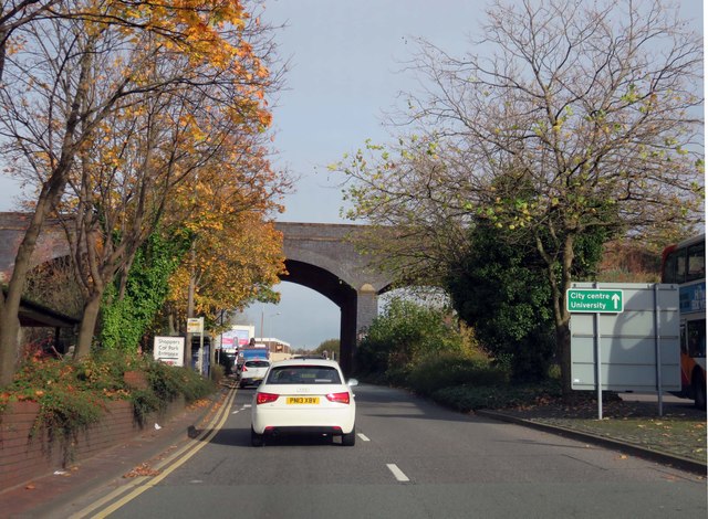
Higher Penwortham Images

Images are sourced within 2km of 53.749933/-2.729534 or Grid Reference SD5128. Thanks to Geograph Open Source API. All images are credited.

Industrial Units on Fylde Road View from Fylde Road Viaduct
Industrial Units on Fylde Road
View from Fylde Road Viaduct
The Watering Trough - Fylde Road
Preston Hanover Street Mill Dated 1796 built by Horrocks as a cotton spinning mill
Preston Hanover Street Mill
Dated 1796 built by Horrocks as a cotton spinning mill
Preston - Lancaster Canal A small marina
Preston - Lancaster Canal
A small marina
Preston - The Lime Kiln Aqueduct Street
Ashton Methodist Church
Church of the Sacred Heart Church on the corner of Newton Road and Beech Grove
Church of the Sacred Heart
Church on the corner of Newton Road and Beech Grove
Lancaster Canal,  Preston Looking back along the Canal towards the Roebuck Street Bridge
Lancaster Canal, Preston
Looking back along the Canal towards the Roebuck Street Bridge
One-time Lancaster Canal, Preston The two blue brick, stone-capped pillars are all that remain of the bridge that carried Fylde Road over the Lancaster Canal in north Preston.  In the foreground and for a couple of hundred yards behind the photographer the canal has been infilled but remains as a green space between houses.  Beyond the road it curved left following the trees.  The present southern terminus of the canal is about 400 yards distant.
One-time Lancaster Canal, Preston
The two blue brick, stone-capped pillars are all that remain of the bridge that carried Fylde Road over the Lancaster Canal in north Preston. In the foreground and for a couple of hundred yards behind the photographer the canal has been infilled but remains as a green space between houses. Beyond the road it curved left following the trees. The present southern terminus of the canal is about 400 yards distant.
Ashton Park
Ashton Park
The end of the canal Near Aqueduct Street, Preston. It's the northern arm of the Lancaster Canal and this is where it now terminates - the eponymous aqueduct is long gone.
The end of the canal
Near Aqueduct Street, Preston. It's the northern arm of the Lancaster Canal and this is where it now terminates - the eponymous aqueduct is long gone.
Water Lane in Preston The railway from Preston to Blackpool runs over the bridge.
Water Lane in Preston
The railway from Preston to Blackpool runs over the bridge.
Fylde Road in Preston The West Coast Mainline runs over the bridge.
Fylde Road in Preston
The West Coast Mainline runs over the bridge.
St Marks Road
St Marks Road
Tang Restaurant 
The Chinese restaurant was established on the corner of Carlton Street and Fylde Road (A583) in 2008. <span class="nowrap"><a title="http://www.tangktv.co.uk/" rel="nofollow ugc noopener" href="http://www.tangktv.co.uk/">Link</a><img style="margin-left:2px;" alt="External link" title="External link - shift click to open in new window" src="https://s1.geograph.org.uk/img/external.png" width="10" height="10"/></span> The premises had previously been a pub called The Doctor Syntax <span class="nowrap"><a title="http://www.closedpubs.co.uk/lancashire/preston_doctorsyntax.html" rel="nofollow ugc noopener" href="http://www.closedpubs.co.uk/lancashire/preston_doctorsyntax.html">Link</a><img style="margin-left:2px;" alt="External link" title="External link - shift click to open in new window" src="https://s1.geograph.org.uk/img/external.png" width="10" height="10"/></span> which dates from around 1839  <span class="nowrap"><a title="http://pubsinpreston.blogspot.co.uk/2012/02/doctor-syntax-fylde-road.html" rel="nofollow ugc noopener" href="http://pubsinpreston.blogspot.co.uk/2012/02/doctor-syntax-fylde-road.html">Link</a><img style="margin-left:2px;" alt="External link" title="External link - shift click to open in new window" src="https://s1.geograph.org.uk/img/external.png" width="10" height="10"/></span> and was named after a racehorse.
Tang Restaurant
The Chinese restaurant was established on the corner of Carlton Street and Fylde Road (A583) in 2008. LinkExternal link The premises had previously been a pub called The Doctor Syntax LinkExternal link which dates from around 1839 LinkExternal link and was named after a racehorse.
Carlton Street 
Off Fylde Road. St Marks is visible in the background.
Carlton Street
Off Fylde Road. St Marks is visible in the background.
Fylde Road The A583 into Preston.
Fylde Road
The A583 into Preston.
Fylde Road The A583 out of Preston.
Fylde Road
The A583 out of Preston.
Show me another place!

Higher Penwortham is located at Grid Ref: SD5128 (Lat: 53.749933, Lng: -2.729534)

Administrative County: Lancashire

District: South Ribble

Police Authority: Lancashire

What 3 Words

///kings.lively.vital. Near Preston, Lancashire

Related Wikis

Penwortham Priory

Penwortham Priory was first a Benedictine priory and, after the Dissolution of the Monasteries, a country house in the village of Penwortham, near Preston...

Penwortham Girls' High School

Penwortham Girls' High School is a secondary school located in Penwortham in the English county of Lancashire.Established in 1954 as Penwortham Girls'...

St Mary's Church, Penwortham

St Mary's Church is in Church Avenue, Penwortham, Lancashire, England. It is an active Anglican parish church in the deanery of Leyland, the archdeaconry...

Penwortham Castle

Penwortham Castle was built on the south bank of the River Ribble, at Penwortham to the west of Preston, Lancashire, England, at grid reference SD524291...

Related Videos

Preston | Lancashire | Travel Guide 🇬🇧

My name is Gabe and on this channel i'm showing you where to travel 2022 and how can you solo travel with a drone in Preston ...

Visiting Preston UK/ #TravelEngland #easterholidays #travel

Preston is a town in Lancashire, England and wow, it was beautiful to the eye. I hope you enjoy the short video as much as I ...

Preston UK, Walking Tour| Lancashire | Preston University | Preston 2020

Come with us on a Preston City Walking Tour to explore the real Preston in England UK. Preston is a city and non-metropolitan ...

Nearby Amenities

Located within 500m of 53.749933,-2.729534
Penwortham
Place: town
Source: npe
Lat/Long: 53.7498033/-2.7301703
Traffic Signals
Lat/Long: 53.7500036/-2.7298776
Barrier: bollard
Bicycle: yes
Foot: yes
Motor Vehicle: no
Lat/Long: 53.7521351/-2.7232782
Give Way
Lat/Long: 53.7511746/-2.7258256
Veterinary
Ribble Vets
Addr City: Preston
Addr Housenumber: 1
Addr Postcode: PR1 0HU
Addr Street: Crookings Lane
Website: https://www.ribblevets.co.uk
Lat/Long: 53.7490089/-2.735876
Turning Circle
Lat/Long: 53.7477914/-2.7335142
Speed Camera
Lat/Long: 53.7493419/-2.7334639
Speed Camera
Lat/Long: 53.7510468/-2.7255138
School
Source: OS OpenData StreetView
Lat/Long: 53.7475723/-2.7283894
Serendipity Boutique
Shop: gift
Lat/Long: 53.7500954/-2.7302251
Fast Food
Subway
Addr City: Preston
Addr Housenumber: 78
Addr Postcode: PR1 0DQ
Addr Street: Liverpool Road
Addr Suburb: Penwortham
Brand: Subway
Brand Wikidata: Q244457
Brand Wikipedia: en:Subway (restaurant)
Contact Website: https://restaurants.subway.com/united-kingdom/en/preston/78-liverpool-road
Cuisine: sandwich
Fhrs Id: 1216524
Takeaway: yes
Lat/Long: 53.7490506/-2.7352224
Cycleway: asl
Lat/Long: 53.7500821/-2.7284828
Post Box
Collection Times: Mo-Fr 16:45; Sa 11:15
Operator: Royal Mail
Post Box Type: pillar
Ref: PR1 211
Source: survey
Lat/Long: 53.7494286/-2.7325515
Atm
Brand: Post Office Money
Opening Hours: 24/7
Operator: Bank of Ireland
Lat/Long: 53.7493949/-2.7326061
Crossing
Crossing: traffic_signals
Crossing Ref: puffin
Lat/Long: 53.7495334/-2.7326186
Pub
Fleece Inn
Addr City: Preston
Addr Housenumber: 39
Addr Postcode: PR1 9XD
Addr Street: Liverpool Road
Addr Suburb: Penwortham
Brand: Greene King
Brand Wikidata: Q5564162
Fhrs Id: 1040362
Outdoor Seating: yes
Website: https://www.greeneking-pubs.co.uk/pubs/lancashire/fleece-inn/
Lat/Long: 53.7496557/-2.7306058
Spar
Addr City: Preston
Addr Housenumber: 40
Addr Postcode: PR1 0DQ
Addr Street: Liverpool Road
Addr Suburb: Penwortham
Brand: Spar
Brand Wikidata: Q610492
Fhrs Id: 771146
Shop: convenience
Lat/Long: 53.7500001/-2.7315663
Fast Food
Little India
Addr City: Preston
Addr Housenumber: 32
Addr Postcode: PR1 0DQ
Addr Street: Liverpool Road
Addr Suburb: Penwortham
Cuisine: indian
Drive Through: yes
Fhrs Id: 69919
Lat/Long: 53.750026/-2.7309963
Restaurant
Ristorante Salvatore
Addr City: Preston
Addr Housenumber: 61-63
Addr Postcode: PR1 9XD
Addr Street: Liverpool Road
Addr Suburb: Penwortham
Cuisine: italian
Fhrs Id: 1224220
Lat/Long: 53.7495039/-2.732119
Post Box
Collection Times: Mo-Fr 09:00; Sa 07:00
Operator: Royal Mail
Post Box Type: wall
Ref: PR1 309
Lat/Long: 53.7465981/-2.7292147
Collection Times: Mo-Fr 09:00; Sa 07:00
Disused Amenity: post_box
Operator: Royal Mail
Post Box Type: pillar
Ref: PR1 44
Lat/Long: 53.7504063/-2.7276577
Bar
Tap and Vine
Addr City: Preston
Addr Housenumber: 69
Addr Postcode: PR1 9XD
Addr Street: Liverpool Road
Addr Suburb: Penwortham
Air Conditioning: yes
Fhrs Id: 1046754
Internet Access: wlan
Outdoor Seating: yes
Payment American Express: yes
Payment Cash: yes
Payment Debit Cards: yes
Payment Mastercard: yes
Payment Visa: yes
Website: https://www.tapandvine.co.uk
Lat/Long: 53.7493026/-2.7327522
Bus Stop
Liverpool Road o/s Library
Bench: yes
Bus: yes
Departures Board: timetable
Lit: yes
Naptan AtcoCode: 25001136
Naptan NaptanCode: lanagdag
Operator: Lancashire County Council
Public Transport: platform
Ref: lanagdag
Shelter: yes
Tactile Paving: yes
Website: https://www.lancashire.gov.uk/roads-parking-and-travel/public-transport/bus-timetables/bus-timetable-stop/?stopref=25001136
Wheelchair: yes
Lat/Long: 53.7499462/-2.7286734
Post Box
Lat/Long: 53.7526427/-2.7353744
Historic: memorial
Memorial: war_memorial
Lat/Long: 53.7517743/-2.7243273
Bench
Lat/Long: 53.7512206/-2.7257124
Bench
Lat/Long: 53.7507704/-2.7260823
Bennetts MOT & Car Repair
Addr City: Preston
Addr Housenumber: 38
Addr Postcode: PR1 0DQ
Addr Street: Liverpool Road
Addr Suburb: Penwortham
Phone: +441772 745422
Service Vehicle Car Repair: yes
Service Vehicle New Car Sales: no
Service Vehicle Used Car Sales: no
Shop: car_repair
Website: http://www.bennettsgarage.co.uk
Lat/Long: 53.7501506/-2.7313427
Shop: tattoo
Lat/Long: 53.7497365/-2.7297704
Crossing
Bicycle: yes
Button Operated: yes
Crossing: traffic_signals
Crossing Ref: toucan
Kerb: lowered
Tactile Paving: yes
Lat/Long: 53.750004/-2.7298336
Shop: dry_cleaning
Lat/Long: 53.7492283/-2.7333316
Restaurant
The Lalbagh
Addr City: Preston
Addr Housenumber: 18
Addr Postcode: PR1 0DQ
Addr Street: Liverpool Road, Penwortham
Bar: no
Cuisine: indian
Delivery: no
Opening Hours: We-Mo 16:30-22:00
Outdoor Seating: no
Payment Cash: yes
Payment Credit Cards: yes
Payment Debit Cards: yes
Phone: +441772742207
Takeaway: only
Website: https://lalbaghpenwortham.co.uk
Lat/Long: 53.7501169/-2.7296613
Cafe
The Cow Shed
Cuisine: coffee_shop, ice_cream
Outdoor Seating: yes
Lat/Long: 53.7490141/-2.7339153
Bus Stop
Liverpool Road by Crookings Lane
Bench: yes
Bin: yes
Bus: yes
Departures Board: timetable
Lit: yes
Public Transport: platform
Ref: lanajmtg
Shelter: yes
Tactile Paving: no
Lat/Long: 53.7492642/-2.734007
Office: estate_agent
Lat/Long: 53.7500833/-2.7302954
A J Busfield
Shop: electrical
Lat/Long: 53.749379/-2.7339166
Bar
Gin Jar Ale
Lat/Long: 53.7501613/-2.7291448
Shop: kitchen
Lat/Long: 53.7489713/-2.7341581
Dentist
Healthcare: dentist
Lat/Long: 53.749541/-2.7334037
Bus Stop
Liverpool Road by Flyover
Bus: yes
Departures Board: no
Naptan AtcoCode: 2500DCL3222
Naptan Bearing: SW
Naptan CommonName: Flyover
Naptan Indicator: by
Naptan NaptanCode: landgwda
Operator: Lancashire County Council
Public Transport: platform
Ref: landgwda
Shelter: no
Website: https://www.lancashire.gov.uk/roads-parking-and-travel/public-transport/bus-timetables/bus-timetable-stop/?stopref=2500DCL3222
Lat/Long: 53.7517237/-2.7237377
Aphrodite Health Food
Addr City: Preston
Addr Housenumber: 1A
Addr Postcode: PR1 0AR
Addr Street: Priory Lane
Addr Suburb: Penwortham
Shop: health_food
Lat/Long: 53.7502444/-2.7296409
Cafe
Bread & Butter
Addr City: Penwortham
Addr Housenumber: 10
Addr Street: Liverpool Road
Contact Facebook: https://www.facebook.com/BreadandbutterFTLOF/
Email: breadandbutterbookings@gmail.com
Outdoor Seating: yes
Phone: +441772745457
Website: https://www.sugarvine.com/restaurant/bread-butter-preston/
Lat/Long: 53.7501695/-2.7289652
Bar
Lime Bar Lounge
Outdoor Seating: yes
Website: http://www.lime-bar.co.uk
Lat/Long: 53.7498276/-2.7322295
Shop: car
Lat/Long: 53.7496755/-2.7313343
Pharmacy
Penwortham Pharmacy
Addr City: Preston
Addr Housenumber: 22
Addr Postcode: PR1 0DQ
Addr Street: Liverpool Road
Addr Suburb: Penwortham
Dispensing: yes
Drive Through: no
Healthcare: pharmacy
Opening Hours: Mo-Fr 09:00-18:00, Sa 09:00-17:30
Phone: +441772743383
Lat/Long: 53.7500874/-2.7300021
Tribe
Leisure: fitness_centre
Sport: yoga
Lat/Long: 53.7495912/-2.7333005
Bus Stop
Liverpool Road opp Crookings Lane
Bench: no
Bus: yes
Departures Board: timetable
Public Transport: platform
Ref: landpajt
Shelter: no
Lat/Long: 53.7489888/-2.7344508
Shop: optician
Lat/Long: 53.7500591/-2.7305628
David Thomas Hairdressing
Shop: hairdresser
Lat/Long: 53.7501676/-2.7290701
Clothes: wedding
Shop: clothes
Lat/Long: 53.7489847/-2.7340983
Cafe
Costa
Addr City: Preston
Addr Country: GB
Addr Housenumber: 62
Addr Postcode: PR1 0DQ
Addr Street: Liverpool Road
Addr Suburb: Penwortham
Brand: Costa
Brand Wikidata: Q608845
Brand Wikipedia: en:Costa Coffee
Cuisine: coffee_shop
Fhrs Id: 1136623
Takeaway: yes
Lat/Long: 53.7492565/-2.7342856
Priory Car Sales
Shop: car
Lat/Long: 53.7494473/-2.7347044
Neil Buckley Funerals
Addr City: Preston
Addr Housenumber: 6
Addr Postcode: PR1 0AD
Addr Street: Liverpool Road
Addr Suburb: Penwortham
Opening Hours: 24/7
Operator: Longton Hutton & Penwortham Funeral Service Ltd
Phone: +441772747400
Shop: funeral_directors
Website: https://nealbuckleyfunerals.co.uk/
Lat/Long: 53.7502492/-2.728503
Fast Food
Penwortham Chop Suey House
Cuisine: chinese
Lat/Long: 53.7493644/-2.7340057
Restaurant
1260 - Craft & Crust
Cuisine: pizza
Lat/Long: 53.7501546/-2.729292
Restaurant
Pane e Vino
Addr City: Preston
Addr Housenumber: 7
Addr Postcode: PR1 0AR
Addr Street: Priory Lane
Addr Suburb: Penwortham
Cuisine: italian
Email: panevinoitalianrestaurant@gmail.com
Outdoor Seating: no
Phone: +447513973190
Takeaway: yes
Website: https://www.facebook.com/PeVrU
Lat/Long: 53.7508457/-2.7296649
Cafe
Bon Bons Coffee Bar
Outdoor Seating: yes
Website: https://www.bonbonscoffeebar.co.uk/
Lat/Long: 53.7496268/-2.7329921
Shop: hairdresser
Lat/Long: 53.7500115/-2.73115
Beauty: tanning
Shop: beauty
Lat/Long: 53.7501064/-2.7297568
Crossing
Bicycle: designated
Crossing: traffic_signals
Crossing Ref: toucan
Foot: designated
Lat/Long: 53.7488163/-2.7357605
My Smoking Shop
Shop: tobacco
Website: https://www.mysmokingshop.co.uk
Lat/Long: 53.7499113/-2.731858
Shop: hairdresser
Lat/Long: 53.7495141/-2.7335363
Upper Crust
Shop: bakery
Lat/Long: 53.7500811/-2.7301573
Emma Evans Funeral Service
Shop: funeral_directors
Lat/Long: 53.7493304/-2.734104
Fast Food
Cuisine: fish_and_chips
Lat/Long: 53.748953/-2.7343334
Office: lawyer
Lat/Long: 53.7491169/-2.7349158
Arts Centre
Lat/Long: 53.7501056/-2.7276101
Fast Food
Cuisine: chinese
Lat/Long: 53.7492405/-2.734404
Bar
No. 16 - On The Hill
Lat/Long: 53.7501465/-2.7294106
Preston Discount Electricals
Shop: appliance
Lat/Long: 53.7489093/-2.7344979
Chakra
Addr City: Preston
Addr Housenumber: 62A
Addr Postcode: PR1 0DQ
Addr Street: Liverpool Road
Leisure: fitness_centre
Note: Above Costa Coffee
Sport: yoga
Website: https://www.chakrastudio.co.uk
Lat/Long: 53.7493754/-2.7343621
Bench
Lat/Long: 53.7498474/-2.7302255
Bench
Lat/Long: 53.7498426/-2.7303524
Bus Stop
Cop Lane by St Marys Health Centre
Bus: yes
Departures Board: no
Public Transport: platform
Ref: langjwdp
Shelter: no
Lat/Long: 53.7489495/-2.7295497
Bus Stop
Cop Lane opp St Marys Health Centre
Bus: yes
Public Transport: platform
Ref: langjtat
Shelter: yes
Lat/Long: 53.7488226/-2.7294129
Crossing
Crossing: zebra
Crossing Island: no
Tactile Paving: no
Lat/Long: 53.7482734/-2.7294669
Waste Basket
Waste: trash;dog_excrement;cigarettes
Lat/Long: 53.7481176/-2.7293163
Bench
Backrest: yes
Lat/Long: 53.7464871/-2.7291862
Waste Basket
Waste: mixed;dog_excrement;cigarettes
Lat/Long: 53.7465204/-2.7291903
Bus Stop
Bus: yes
Naptan AtcoCode: 250020177
Naptan NaptanCode: lanatwjw
Public Transport: platform
Lat/Long: 53.7459565/-2.7293472
Waste Basket
Waste: trash;dog_excrement;cigarettes
Lat/Long: 53.7474816/-2.7292399
Atm
Cash In: no
Currency GBP: yes
Drive Through: no
Lat/Long: 53.7499796/-2.7313843
Bench
Backrest: yes
Lat/Long: 53.7498298/-2.7291648
Macmillans Gifts
Addr City: Preston
Addr Housenumber: 11-13
Addr Postcode: PR1 0AR
Addr Street: Priory Lane
Addr Suburb: Penwortham
Payment Cash: yes
Payment Credit Cards: yes
Payment Debit Cards: yes
Shop: gift
Website: https://macmillansgifts.co.uk
Lat/Long: 53.7509051/-2.7296637
Cafe
No. 15 Café House
Addr City: Preston
Addr Housenumber: 15
Addr Postcode: PR1 0AR
Addr Street: Priory Lane
Addr Suburb: Penwortham
Cuisine: coffee_shop
Outdoor Seating: no
Website: https://macmillansgifts.co.uk/no15-cafe-house/
Lat/Long: 53.7509495/-2.729669
Community Centre
Priory Lane Community Centre
Operator: Penwortham Town Council
Operator Type: government
Website: http://www.penworthamtowncouncil.gov.uk/priory-lane-community-centre/
Lat/Long: 53.7504824/-2.7296717
The Prestige Barber Shop
Shop: hairdresser
Website: https://www.theprestigebarbershop.co.uk
Lat/Long: 53.7503773/-2.7294825
Waste Basket
Lat/Long: 53.7526328/-2.7354814
Post Box
Lat/Long: 53.7539954/-2.7316173
Waste Basket
Lat/Long: 53.7517877/-2.7240837
Bench
Lat/Long: 53.7517157/-2.724324
Bench
Lat/Long: 53.7517722/-2.7241329
Waste Basket
Colour: red
Operator: Ribble Vets
Waste: dog_excrement
Lat/Long: 53.7490162/-2.7354697
Waste Basket
Colour: blue
Covered: no
Indoor: no
Material: metal
Operator: South Ribble Borough Council
Waste: mixed
Lat/Long: 53.7489883/-2.7351723
Cutting Crew
Addr City: Preston
Addr Housenumber: 5
Addr Street: Priory Lane
Addr Suburb: Penwortham
Phone: +441772745101
Shop: hairdresser
Website: https://sites.google.com/view/cutting-crew-and-co/
Lat/Long: 53.7507432/-2.7296669
Tesco
Addr City: Preston
Addr Country: GB
Addr Postcode: PR1 9XE
Addr Street: Liverpool Road
Addr Suburb: Penwortham
Brand: Tesco
Brand Wikidata: Q487494
Brand Wikipedia: en:Tesco
Contact Website: https://www.tesco.com/store-locator/lancashire/liverpool-road
Internet Access: wlan
Opening Hours: Mo-Sa 07:00-23:00, Su 10:00-16:00
Operator: Tesco PLC
Payment Cash: yes
Payment Coins: yes
Payment Credit Cards: yes
Payment Debit Cards: yes
Phone: +44 345 600 1408
Shop: supermarket
Wheelchair: yes
Lat/Long: 53.7487738/-2.7283762
Atm
Indoor: no
Opening Hours: 24/7
Operator: Tesco Bank
Wheelchair: yes
Lat/Long: 53.7487602/-2.7285842
Fuel
Addr City: Preston
Addr Country: GB
Addr Postcode: PR1 9XE
Addr Street: Liverpool Road
Addr Suburb: Penwortham
Fuel Diesel: yes
Fuel Gasoline: yes
Opening Hours: Mo-Sa 06:00-00:00, Su 06:00-22:00
Operator: Tesco PLC
Payment Cash: no
Payment Credit Cards: yes
Payment Debit Cards: yes
Self Service: yes
Wheelchair: yes
Lat/Long: 53.7497006/-2.7288509
Addr City: Preston
Addr Country: GB
Addr Housenumber: 2A
Addr Postcode: PR1 0AR
Addr Street: Priory Lane
Addr Suburb: Penwortham
Operator: St. Catherine’s Hospice Care
Shop: vacant
Lat/Long: 53.7503232/-2.7294817
Community Centre
Penwortham Over 60’s Club
Addr City: Preston
Addr Country: GB
Addr Postcode: PR1 0AR
Addr Street: Priory Lane
Addr Suburb: Penwortham
Phone: +441772750538
Lat/Long: 53.7508002/-2.7294033
Defibrillator
Emergency: defibrillator
Indoor: no
Lat/Long: 53.749998/-2.7312802
Doctors
Penwortham St. Mary's Medical Group
Addr City: Preston
Addr Postcode: PR1 0SR
Addr Street: Cop Lane
Phone: +441772 214800
Website: https://stmaryshealthcentre.co.uk
Lat/Long: 53.7483706/-2.7303627
Pharmacy
Rowlands Pharmacy
Addr City: Preston
Addr Postcode: PR1 0SR
Addr Street: Cop Lane
Brand: Rowlands Pharmacy
Brand Wikidata: Q62663235
Healthcare: pharmacy
Phone: +441772 742615
Website: https://rowlandspharmacy.co.uk/find-local-pharmacy#!/l/preston/cop-lane,-the-penwortham-health-centre/1533
Lat/Long: 53.7483991/-2.7301508
Pharmacy
Penwortham Pharmacy
Addr City: Preston
Addr Housename: St. Fillan's Medical Centre
Addr Housenumber: 2
Addr Postcode: PR1 0AD
Addr Street: Liverpool Road
Addr Suburb: Penwortham
Dispensing: yes
Drive Through: no
Healthcare: pharmacy
Opening Hours: Mo-Su 08:00-20:00
Phone: +441772746566
Lat/Long: 53.7511217/-2.7265437
M.E. French & Co
Addr City: Preston
Addr Housenumber: 8
Addr Postcode: PR1 0AD
Addr Street: Liverpool Road
Addr Suburb: Penwortham
Office: insurance
Phone: +441772752055
Lat/Long: 53.7502272/-2.7287431
Defibrillator
Access: yes
Emergency: defibrillator
Indoor: no
Opening Hours: 24/7
Lat/Long: 53.7515473/-2.7342255
Barrier: bollard
Bicycle: yes
Bollard: fixed
Foot: yes
Horse: no
Material: metal
Motor Vehicle: no
Lat/Long: 53.7526345/-2.7355633
19/6
Addr City: Preston
Addr Housenumber: 17
Addr Postcode: PR1 0AR
Addr Street: Priory Lane
Addr Suburb: Penwortham
Alt Name: Nineteen and Six Ltd.
Office: accountant
Phone: +441772751135
Website: https://www.nineteenandsix.co.uk
Lat/Long: 53.7510215/-2.7296749
Colour Me Beautiful
Addr City: Preston
Addr Housenumber: 9
Addr Postcode: PR1 0AR
Addr Street: Priory Lane
Addr Suburb: Penwortham
Phone: +441772750052
Shop: beauty
Website: https://colourmebeautifuldirect.co.uk
Lat/Long: 53.7508019/-2.7296605
Power: substation
Lat/Long: 53.7519863/-2.7344839
Power: substation
Lat/Long: 53.7511091/-2.7255525
Paul James Kelly Photography
Addr City: Preston
Addr Housenumber: 19
Addr Postcode: PR1 0AR
Addr Street: Priory Lane
Addr Suburb: Penwortham
Craft: photographer
Level: 0
Phone: +441772740040
Website: https://www.pauljameskelly.com/
Lat/Long: 53.7510869/-2.7296814
Power: substation
Lat/Long: 53.7500158/-2.7313493
Beccies Beauty
Addr City: Preston
Addr Housenumber: 19
Addr Postcode: PR1 0AR
Addr Street: Priory Lane
Addr Suburb: Penwortham
Level: 1
Shop: beauty
Lat/Long: 53.7510811/-2.7296819
Waste Basket
Colour: blue
Covered: no
Indoor: no
Material: metal
Operator: South Ribble Borough Council
Waste: mixed
Lat/Long: 53.7492561/-2.7340519
Waste Basket
Colour: blue
Covered: no
Indoor: no
Material: metal
Operator: South Ribble Borough Council
Waste: mixed
Lat/Long: 53.7495857/-2.7320743
Waste Basket
Colour: blue
Covered: no
Indoor: no
Material: metal
Operator: South Ribble Borough Council
Waste: mixed
Lat/Long: 53.7492113/-2.7336059
Waste Basket
Lat/Long: 53.748706/-2.7359306
Waste Basket
Colour: blue
Covered: no
Indoor: no
Material: metal
Operator: South Ribble Borough Council
Waste: mixed
Lat/Long: 53.7494602/-2.7325607
Waste Basket
Colour: blue
Covered: no
Indoor: no
Material: metal
Operator: South Ribble Borough Council
Waste: mixed
Lat/Long: 53.7499909/-2.730264
Waste Basket
Colour: blue
Covered: no
Indoor: no
Material: metal
Operator: South Ribble Borough Council
Waste: mixed
Lat/Long: 53.7493406/-2.7295745
Charging Station
Access: permissive
Capacity: 2
Covered: no
Fee: yes
Operator: Vend Electric
Website: https://app.vendelectric.com
Lat/Long: 53.7501504/-2.731455
Traffic Signals
Traffic Signals: signal
Traffic Signals Direction: backward
Lat/Long: 53.7497875/-2.7295195
Bus Stop
Liverpool Road opp Library
Bench: yes
Bus: yes
Departures Board: timetable
Lit: yes
Naptan AtcoCode: 25001140
Naptan NaptanCode: lanagdjm
Operator: Lancashire County Council
Public Transport: platform
Ref: lanagdjm
Shelter: yes
Tactile Paving: yes
Website: https://www.lancashire.gov.uk/roads-parking-and-travel/public-transport/bus-timetables/bus-timetable-stop/?stopref=25001140
Wheelchair: yes
Lat/Long: 53.7503928/-2.7274579
Crossing
Crossing: uncontrolled
Crossing Ref: zebra
Lat/Long: 53.7503868/-2.7275778
Crossing
Bicycle: yes
Button Operated: yes
Crossing: traffic_signals
Crossing Island: yes
Crossing Ref: toucan
Kerb: flush
Supervised: no
Tactile Paving: yes
Lat/Long: 53.7501918/-2.7280067
Give Way
Lat/Long: 53.7500462/-2.7303848
Give Way
Lat/Long: 53.7499916/-2.7303788
Waste Basket
Colour: blue
Covered: no
Indoor: no
Material: metal
Operator: South Ribble Borough Council
Waste: mixed
Lat/Long: 53.7500141/-2.7299262
Crossing
Crossing: uncontrolled
Crossing Ref: zebra
Lat/Long: 53.7502366/-2.7280426
Crossing
Bicycle: yes
Crossing: traffic_signals
Crossing Ref: toucan
Kerb: flush
Supervised: no
Tactile Paving: yes
Lat/Long: 53.7500555/-2.7295355
The Artisan Deli
Addr City: Preston
Addr Housenumber: 58
Addr Postcode: PR1 0DQ
Addr Street: Liverpool Road
Addr Suburb: Penwortham
Shop: deli
Lat/Long: 53.7493057/-2.7341951
Integrate Social Enterprise
Shop: charity
Lat/Long: 53.7490793/-2.7350509
RSPCA Preston and District Branch
Shop: charity
Lat/Long: 53.7490603/-2.7351302
Give Way
Lat/Long: 53.7512532/-2.7259478
Crossing
Crossing: unmarked
Kerb: lowered
Tactile Paving: yes
Lat/Long: 53.7508753/-2.7260996
Crossing
Crossing: unmarked
Kerb: lowered
Tactile Paving: yes
Lat/Long: 53.7509451/-2.7261883
Crossing
Crossing: uncontrolled
Crossing Island: yes
Crossing Ref: zebra
Kerb: lowered
Tactile Paving: yes
Lat/Long: 53.7512322/-2.725914
Crossing
Bicycle: yes
Button Operated: yes
Crossing: traffic_signals
Crossing Island: yes
Crossing Ref: toucan
Kerb: flush
Supervised: no
Tactile Paving: yes
Lat/Long: 53.7499551/-2.7293
Traffic Signals
Traffic Signals: signal
Lat/Long: 53.7499559/-2.7292678
Recycling
Lat/Long: 53.7494047/-2.7278106
Crossing
Crossing: uncontrolled
Crossing Ref: zebra
Kerb: lowered
Tactile Paving: yes
Lat/Long: 53.7491303/-2.7281957
Give Way
Lat/Long: 53.7496196/-2.7285227
Give Way
Lat/Long: 53.7494991/-2.7287185
Give Way
Lat/Long: 53.7495229/-2.7284798
Give Way
Lat/Long: 53.74948/-2.7289787
Give Way
Lat/Long: 53.7490851/-2.728858
Give Way
Lat/Long: 53.7491216/-2.7285925
Give Way
Lat/Long: 53.7491438/-2.7283591
Give Way
Lat/Long: 53.7492992/-2.7280372
Give Way
Lat/Long: 53.7492405/-2.727592
Give Way
Lat/Long: 53.7491422/-2.7278093
Crossing
Crossing: uncontrolled
Crossing Ref: zebra
Kerb: lowered
Tactile Paving: yes
Lat/Long: 53.7490661/-2.7287132
Give Way
Lat/Long: 53.7496561/-2.7282196
Give Way
Lat/Long: 53.7491501/-2.7280453
Crossing
Crossing: uncontrolled
Crossing Ref: zebra
Kerb: lowered
Tactile Paving: yes
Lat/Long: 53.7496228/-2.7283725
Give Way
Direction: backward
Lat/Long: 53.7525051/-2.7292509
Stop
Direction: forward
Lat/Long: 53.7524451/-2.7292722
Give Way
Direction: backward
Lat/Long: 53.7526211/-2.7317526
Give Way
Direction: forward
Lat/Long: 53.7525136/-2.7317278
Bicycle Parking
Bicycle Parking: Hoops
Capacity: 8
Covered: no
Fee: no
Indoor: no
Lat/Long: 53.7493871/-2.7343124
Restaurant
Turkish Grill
Addr City: Preston
Addr Country: GB
Addr Housenumber: 59
Addr Postcode: PR1 9XD
Addr Street: Liverpool Road
Addr Suburb: Penwortham
Cuisine: mediterranean;turkish
Diet Meat: yes
Diet Vegetarian: yes
Opening Hours: Mo-Fr 17:00-21:30, Sa 12:00-22:00, Su 12:00-21:00
Phone: +441772369100
Lat/Long: 53.7495519/-2.7319037
Pamela Jane Florist
Shop: florist
Lat/Long: 53.7495965/-2.7316916
Penwortham Carpets
Shop: carpet
Lat/Long: 53.7496202/-2.7315911
Ellen Fay Solicitors
Lat/Long: 53.7494698/-2.7337332
Home’s Best
Lat/Long: 53.7495094/-2.7335816
Lucy Lou’s Boutique
Lat/Long: 53.7495194/-2.7335034
All Aspects Health & Social Care
Lat/Long: 53.7498577/-2.7320021
A1 Barbers
Shop: hairdresser
Lat/Long: 53.7498029/-2.7320668
Charli Beauty
Lat/Long: 53.7495712/-2.7318213
Penwortham Skin & Laser Clinic
Lat/Long: 53.7500265/-2.7308931
The Hidden Hut
Shop: gift
Lat/Long: 53.7500196/-2.7309388
Crossing
Bicycle: yes
Button Operated: yes
Crossing: traffic_signals
Crossing Island: yes
Crossing Ref: toucan
Kerb: flush
Supervised: no
Tactile Paving: yes
Lat/Long: 53.7500113/-2.7293066
Crossing
Bicycle: yes
Button Operated: yes
Crossing: traffic_signals
Crossing Ref: toucan
Kerb: lowered
Tactile Paving: yes
Lat/Long: 53.7499157/-2.7297395
Cycleway: asl
Direction: backward
Lat/Long: 53.7498303/-2.7295206
Cycleway: asl
Direction: backward
Lat/Long: 53.7501123/-2.7295367
Traffic Signals
Traffic Signals: signal
Traffic Signals Direction: backward
Lat/Long: 53.7501507/-2.7295396
Crossing
Bicycle: yes
Button Operated: yes
Crossing: traffic_signals
Crossing Island: yes
Crossing Ref: toucan
Kerb: flush
Supervised: no
Tactile Paving: yes
Lat/Long: 53.7501226/-2.727954
Cycleway: asl
Lat/Long: 53.750172/-2.7277966
Traffic Signals
Traffic Signals: signal
Lat/Long: 53.7502054/-2.7276933
Traffic Signals
Traffic Signals: signal
Lat/Long: 53.7500673/-2.7285729
Traffic Signals
Traffic Signals: signal
Traffic Signals Direction: forward
Lat/Long: 53.749881/-2.7282139
Crossing
Crossing: unmarked
Lat/Long: 53.7509187/-2.7261547
Bar
Fairham’s Bar
Addr City: Preston
Addr Country: GB
Addr Housenumber: 14
Addr Postcode: PR1 0AD
Addr Street: Liverpool Road
Addr Suburb: Penwortham
Contact Facebook: https://www.facebook.com/fairhamsbarpenwortham
Dogs: yes
Email: sales@fairhamdistillery.com
Opening Hours: Th 16:00-23:00; Fr 16:00-23:00; Sa 13:00-23:00; Su 13:00-21:00
Outdoor Seating: yes
Phone: +441772 230263
Website: https://fairhamdistillery.com/fairhamsbar/
Lat/Long: 53.7501585/-2.7292042
The data included in this document is from www.openstreetmap.org. The data is made available under ODbL.

Have you been to Higher Penwortham?

Leave your review of Higher Penwortham below (or comments, questions and feedback).