Blashaw Dam Wood

Wood, Forest in Lancashire South Ribble

England

Blashaw Dam Wood

The River Ribble northwest of Nabsack Planting
The River Ribble northwest of Nabsack Planting Credit: Colin Park

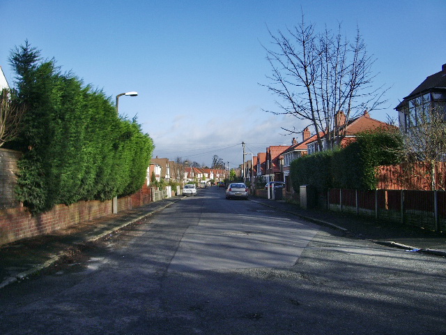
Blashaw Dam Wood is a picturesque forest located in Lancashire, England. It covers an area of approximately 50 acres and is known for its natural beauty and diverse flora and fauna. The wood is situated near the village of Blashaw and is a popular destination for nature enthusiasts and hikers.

The forest is predominantly composed of deciduous trees, including oak, beech, and birch, which create a dense canopy that offers shelter to a variety of wildlife. The woodland floor is covered in a rich carpet of ferns, wildflowers, and mosses, adding to the enchanting atmosphere of the area.

Blashaw Dam Wood is intersected by several walking trails, providing visitors with the opportunity to explore its natural wonders. These trails wind through the forest, leading to the tranquil Blashaw Dam, a small reservoir that provides a habitat for water birds and other aquatic creatures.

The wood is home to a diverse range of wildlife, including several species of birds such as woodpeckers, owls, and warblers. Deer, foxes, and squirrels are also commonly spotted within the forest.

Blashaw Dam Wood is managed by the local authorities to preserve its natural beauty and protect the fragile ecosystem. Visitors are encouraged to respect the environment and follow designated trails to minimize any impact on the forest's delicate balance. The wood offers a serene and peaceful retreat for nature lovers and provides an opportunity to immerse oneself in the beauty of Lancashire's countryside.

If you have any feedback on the listing, please let us know in the comments section below.

Blashaw Dam Wood Images

Images are sourced within 2km of 53.748103/-2.7423577 or Grid Reference SD5128. Thanks to Geograph Open Source API. All images are credited.

The River Ribble northwest of Nabsack Planting
Marsh Farm from Howick Cross Lane
Track through wasteland south of Riversway Motor Park
By The River Ribble The two sets of power lines are very much part of the landscape here. Viewed on a bright mid-February morning.
By The River Ribble
The two sets of power lines are very much part of the landscape here. Viewed on a bright mid-February morning.
Riverside View Looking upstream from the Ribble Way on the Penwortham side towards the old dock at Preston.
Riverside View
Looking upstream from the Ribble Way on the Penwortham side towards the old dock at Preston.
Beside The Pylons Viewed at a junction of paths right beside one of the power lines that are such a prominent feature of the landscape here.
Beside The Pylons
Viewed at a junction of paths right beside one of the power lines that are such a prominent feature of the landscape here.
The River Ribble Viewed from the Ribble Way where a double power line crosses the river. The power lines are a prominent feature of the landscape here.
The River Ribble
Viewed from the Ribble Way where a double power line crosses the river. The power lines are a prominent feature of the landscape here.
Ribble Shore The northern shore of the River Ribble, approximately 1000 yards downstream of Preston Docks.
Ribble Shore
The northern shore of the River Ribble, approximately 1000 yards downstream of Preston Docks.
The Anchor Inn, Hutton Large public house on Liverpool Road.
The Anchor Inn, Hutton
Large public house on Liverpool Road.
Hutton, Liverpool Road
Road & public footpath to the Ribble
Private road but public footpath Footpath and road from Marsh Farm to the River Ribble
Private road but public footpath
Footpath and road from Marsh Farm to the River Ribble
End of track off Howick Cross Lane
Short track off Howick Cross Lane
Townley Lane, Howick Cross
The Anchor, 88 Liverpool Road, Hutton
Stile on the Ribble Way where it meets the road from Howick
Tall pylons Four electricity lines crossing the River Ribble on very tall pylons.
(So the man in the crows nest on a sailing ship will not get electrocuted!!!!)
Tall pylons
Four electricity lines crossing the River Ribble on very tall pylons. (So the man in the crows nest on a sailing ship will not get electrocuted!!!!)
Show me another place!

Blashaw Dam Wood is located at Grid Ref: SD5128 (Lat: 53.748103, Lng: -2.7423577)

Administrative County: Lancashire

District: South Ribble

Police Authority: Lancashire

What 3 Words

///given.dame.unique. Near Preston, Lancashire

Related Wikis

Penwortham Priory Academy

Penwortham Priory Academy is a coeducational secondary school located in Penwortham in the English county of Lancashire.Previously a community school administered...

Howick Cross

Howick Cross is a landmark and small hamlet in Penwortham, South Ribble, Lancashire, England. It is located just over 2 miles south west of the city of...

Penwortham Priory

Penwortham Priory was first a Benedictine priory and, after the Dissolution of the Monasteries, a country house in the village of Penwortham, near Preston...

Penwortham Girls' High School

Penwortham Girls' High School is a secondary school located in Penwortham in the English county of Lancashire.Established in 1954 as Penwortham Girls'...

All Hallows Catholic High School

All Hallows Catholic High School is a coeducational secondary school located in Penwortham in the English county of Lancashire.Established in 1975, it...

Ribble Power Station

Ribble Power Station was a coal-fired electricity generating station on the River Ribble in Penwortham near Preston, Lancashire, England. The station was...

Preston Riverside railway station

Preston Riverside railway station is the only station on the heritage Ribble Steam Railway, in Riversway, Preston, Lancashire, England. It was built and...

Penwortham Cop Lane railway station

Penwortham Cop Lane was a railway station on the West Lancashire Railway in England. It served the town of Penwortham in Lancashire. It was between Higher...

Nearby Amenities

Located within 500m of 53.748103,-2.7423577
Turning Circle
Lat/Long: 53.7449257/-2.7449248
Veterinary
Ribble Vets
Addr City: Preston
Addr Housenumber: 1
Addr Postcode: PR1 0HU
Addr Street: Crookings Lane
Website: https://www.ribblevets.co.uk
Lat/Long: 53.7490089/-2.735876
Speed Camera
Lat/Long: 53.7442228/-2.742961
Fast Food
Subway
Addr City: Preston
Addr Housenumber: 78
Addr Postcode: PR1 0DQ
Addr Street: Liverpool Road
Addr Suburb: Penwortham
Brand: Subway
Brand Wikidata: Q244457
Brand Wikipedia: en:Subway (restaurant)
Contact Website: https://restaurants.subway.com/united-kingdom/en/preston/78-liverpool-road
Cuisine: sandwich
Fhrs Id: 1216524
Takeaway: yes
Lat/Long: 53.7490506/-2.7352224
Post Box
Lat/Long: 53.7505138/-2.738081
Crossing
Bicycle: designated
Crossing: traffic_signals
Crossing Ref: toucan
Foot: designated
Lat/Long: 53.7488163/-2.7357605
Waste Basket
Colour: red
Operator: Ribble Vets
Waste: dog_excrement
Lat/Long: 53.7490162/-2.7354697
Waste Basket
Colour: blue
Covered: no
Indoor: no
Material: metal
Operator: South Ribble Borough Council
Waste: mixed
Lat/Long: 53.7489883/-2.7351723
Waste Basket
Lat/Long: 53.748706/-2.7359306
Waste Basket
Colour: blue
Covered: no
Indoor: no
Material: metal
Operator: South Ribble Borough Council
Waste: mixed
Lat/Long: 53.7505797/-2.7381676
Integrate Social Enterprise
Shop: charity
Lat/Long: 53.7490793/-2.7350509
RSPCA Preston and District Branch
Shop: charity
Lat/Long: 53.7490603/-2.7351302
The data included in this document is from www.openstreetmap.org. The data is made available under ODbL.

Have you been to Blashaw Dam Wood?

Leave your review of Blashaw Dam Wood below (or comments, questions and feedback).