Cnoc Gàrradh Feòir

Hill, Mountain in Argyllshire

Scotland

Cnoc Gàrradh Feòir

Disused quarry at Rubha na h-Airde Mòire
Disused quarry at Rubha na h-Airde Mòire Credit: Mick Garratt

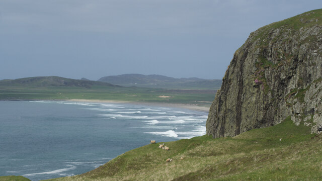
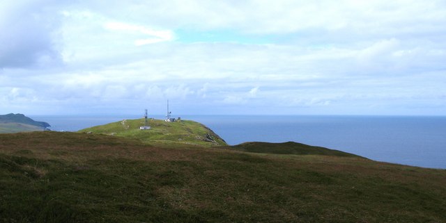
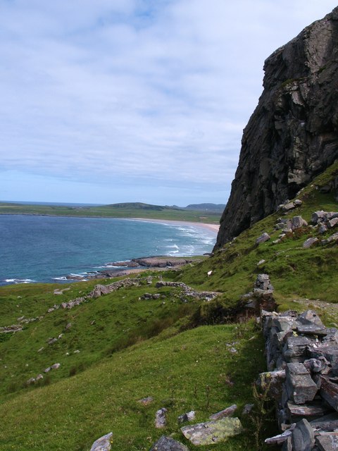
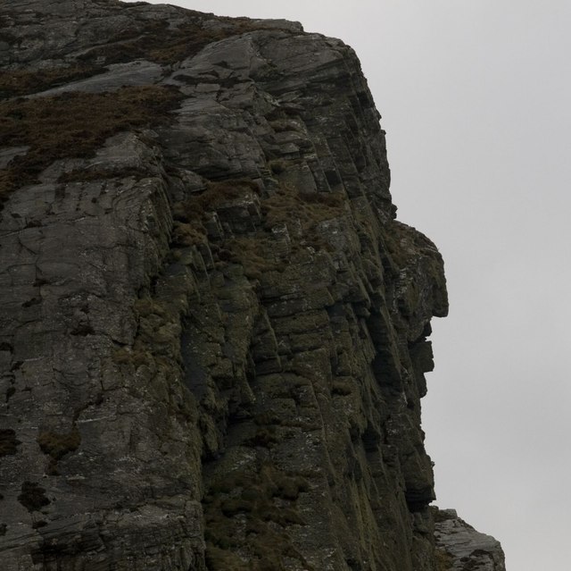
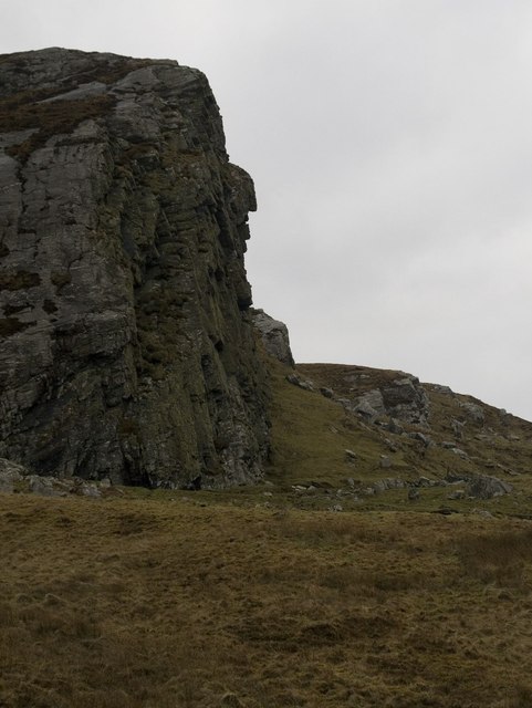
Cnoc Gàrradh Feòir is a prominent hill located in Argyllshire, Scotland. Situated in the western part of the county, it is part of the larger region known for its stunning natural landscapes and rugged terrain. Cnoc Gàrradh Feòir stands at an elevation of approximately 300 meters (984 feet) and offers breathtaking views of the surrounding countryside.

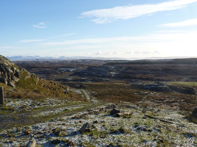
The hill is characterized by its gentle slopes and grassy terrain, making it an accessible and enjoyable destination for hikers and nature enthusiasts. Its name, Cnoc Gàrradh Feòir, translates to "Hill of the Grass Enclosure," which is reflective of the lush vegetation that covers its slopes.

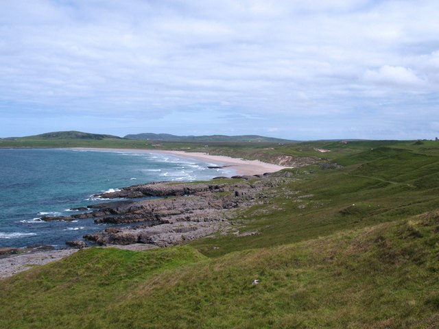
The area around Cnoc Gàrradh Feòir is rich in biodiversity, with a variety of plant species thriving in the fertile soil. The hill is home to a diverse range of wildlife, including birds, small mammals, and insects. Visitors often have the opportunity to spot local fauna while exploring the hill's trails.

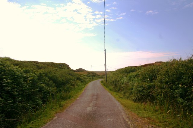
Hikers can access Cnoc Gàrradh Feòir via several well-marked paths, each offering a different level of difficulty. The ascent to the summit is not overly challenging, making it suitable for both experienced hikers and beginners looking to enjoy the picturesque surroundings.

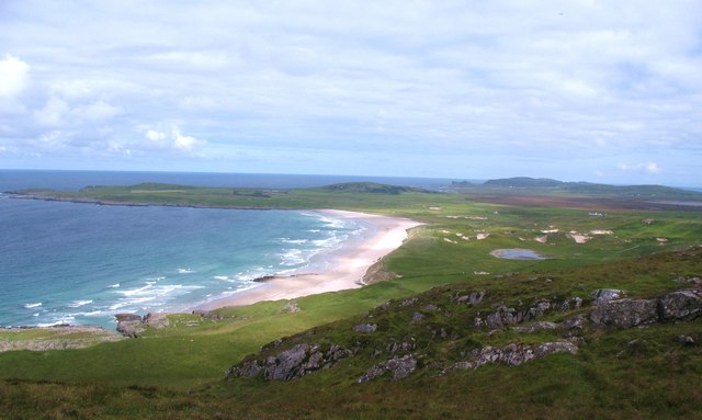
The hill's location also makes it an excellent vantage point for panoramic views of the surrounding area. On a clear day, visitors can see the vast expanse of Argyllshire, with its rolling hills, sparkling lochs, and distant mountains.

In conclusion, Cnoc Gàrradh Feòir is a captivating hill in Argyllshire, offering a blend of natural beauty, biodiversity, and stunning vistas that attract outdoor enthusiasts from near and far.

If you have any feedback on the listing, please let us know in the comments section below.

Cnoc Gàrradh Feòir Images

Images are sourced within 2km of 55.750378/-6.4549455 or Grid Reference NR2059. Thanks to Geograph Open Source API. All images are credited.

Disused quarry at Rubha na h-Airde Mòire
Kilchiaran Bay
Kilchiaran Bay
Creag Bealach na Caillich — Granny's Crag
Disused military buildings
Winter view south-east from Cnoc nam Muc-chlach, Islay
Kilchiaran Bay, Islay With ruined chapel in distance.
Kilchiaran Bay, Islay
With ruined chapel in distance.
Meall Riabhach Looking south west from near point 149 on the heathery ridge to the south of Kilchoman.
Meall Riabhach
Looking south west from near point 149 on the heathery ridge to the south of Kilchoman.
View north from Cnoc nam Muc-chlach The view north from near the hilltop transmitters above Machir Bay.
View north from Cnoc nam Muc-chlach
The view north from near the hilltop transmitters above Machir Bay.
Old Woman's Pass Old Woman's Pass is the name given to this old track which crosses the headland between Kilchoman and Kilchiaran. The splendid view northwards is along the beach at Machir Bay.
Old Woman's Pass
Old Woman's Pass is the name given to this old track which crosses the headland between Kilchoman and Kilchiaran. The splendid view northwards is along the beach at Machir Bay.
Machir Bay To the right is the path leading down to the beach from Old Woman's Pass. A fine stretch of sand backed by dunes and machair where the corncrake can often be heard, but rarely seen.
Machir Bay
To the right is the path leading down to the beach from Old Woman's Pass. A fine stretch of sand backed by dunes and machair where the corncrake can often be heard, but rarely seen.
Cill Chiarain The church of Saint Ciaron, this church originates from around 1200.
Cill Chiarain
The church of Saint Ciaron, this church originates from around 1200.
Kilchiaran Farm The farmstead of Kilchiaran on the Rinns of Islay.
Kilchiaran Farm
The farmstead of Kilchiaran on the Rinns of Islay.
Road to Kilchiaran The road passing through high banks close to Kilchiaran.
Road to Kilchiaran
The road passing through high banks close to Kilchiaran.
Granny Rock The profile of an old woman or 'Caillich' can be seen on this rock between Machir Bay and Kilchiaran. It is best viewed from the north. For a context photo, see <a href="https://www.geograph.org.uk/photo/2802956">NR2061 : Granny Rock, Islay</a>.
Granny Rock
The profile of an old woman or 'Caillich' can be seen on this rock between Machir Bay and Kilchiaran. It is best viewed from the north. For a context photo, see NR2061 : Granny Rock, Islay.
Granny Rock, Islay The profile of an old woman or 'Caillich' can be seen in this rock face between Machir Bay to the north and Kilchiaran to the south. It is best viewed from the north. For a closer picture, see <a href="https://www.geograph.org.uk/photo/2802952">NR2061 : Granny Rock</a>.
Granny Rock, Islay
The profile of an old woman or 'Caillich' can be seen in this rock face between Machir Bay to the north and Kilchiaran to the south. It is best viewed from the north. For a closer picture, see NR2061 : Granny Rock.
Footbridge across the Abhainn na Braid, Islay This footbridge is marked on my older version of the 1:25 000 Explorer map of Islay north, but not on the newer version that Geograph uses - the opposite way round of the water butt photo - see <a href="https://www.geograph.org.uk/photo/2802972">NR2162 : Farm Track near Machir Bay, Islay</a>
Footbridge across the Abhainn na Braid, Islay
This footbridge is marked on my older version of the 1:25 000 Explorer map of Islay north, but not on the newer version that Geograph uses - the opposite way round of the water butt photo - see NR2162 : Farm Track near Machir Bay, Islay
Ruin near Kilchiaran, Islay Marked as simply two rectangles on the Explorer map, with no name, the inhabitants of this erstwhile dwelling house surely enjoyed true tranquility. What stories could this lonely dwelling share?
Ruin near Kilchiaran, Islay
Marked as simply two rectangles on the Explorer map, with no name, the inhabitants of this erstwhile dwelling house surely enjoyed true tranquility. What stories could this lonely dwelling share?
Show me another place!

Cnoc Gàrradh Feòir is located at Grid Ref: NR2059 (Lat: 55.750378, Lng: -6.4549455)

Unitary Authority: Argyll and Bute

Police Authority: Argyll and West Dunbartonshire

What 3 Words

///monopoly.gourmet.operation. Near Port Charlotte, Argyll & Bute

Related Wikis

Rinns of Islay

The Rinns of Islay (Scottish Gaelic: Na Roinn Ìleach; alternative English spelling Rhinns of Islay) is an area on the west of the island of Islay in the...

RAF Kilchiaran

RAF Kilchiaran was a Royal Air Force radar station situated on the Isle of Islay in Scotland. It was originally active from 1940-1945. In 1954 the base...

Kilchoman

Kilchoman ( kil-(K)HOM-ən; Scottish Gaelic: Cill Chomain [kʲʰiːʎ ˈxɔmɛɲ]) is a small settlement and large parish on the Scottish island of Islay, within...

Kilchoman distillery

Kilchoman distillery (pronounced Kil-ho-man) is a distillery that produces single malt Scotch whisky on Islay, an island of the Inner Hebrides. Kilchoman...

Clark Cottage

Clark Cottage is a residential building in the Scottish village of Port Charlotte on the island of Islay. The building is on the eastern side of Main Street...

Port Charlotte distillery

Port Charlotte distillery (also known as Rhins distillery and Lochindaal distillery) was a Scotch whisky distillery on the island of Islay, off the west...

Port Charlotte, Islay

Port Charlotte (Scottish Gaelic: Port Sgioba) is a village on the island of Islay in the Inner Hebrides, Scotland. It was founded in 1828. In 1991 it...

A847 road

The A847 road is one of the two principal roads of Islay in the Inner Hebrides off the west coast of mainland Scotland. It connects Bridgend, at a junction...
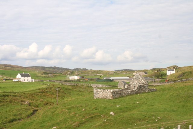
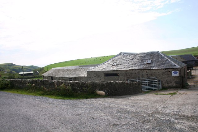
Nearby Amenities

Located within 500m of 55.750378,-6.4549455
Power: pole
Lat/Long: 55.7502034/-6.462066
Power: pole
Lat/Long: 55.7516146/-6.4607152
Power: pole
Lat/Long: 55.7527406/-6.4588296
Power: pole
Lat/Long: 55.7532449/-6.457959
Power: pole
Lat/Long: 55.754308/-6.4560829
Power: pole
Lat/Long: 55.749895/-6.4623438
Power: pole
Lat/Long: 55.7508829/-6.4613782
Power: pole
Lat/Long: 55.7519537/-6.4602505
Power: pole
Lat/Long: 55.7523184/-6.4595918
Power: pole
Lat/Long: 55.7537609/-6.4570485
Power: pole
Lat/Long: 55.7548033/-6.4538928
The data included in this document is from www.openstreetmap.org. The data is made available under ODbL.

Have you been to Cnoc Gàrradh Feòir?

Leave your review of Cnoc Gàrradh Feòir below (or comments, questions and feedback).