Gleann nan Cuilean

Valley in Argyllshire

Scotland

Gleann nan Cuilean

Disused quarry at Rubha na h-Airde Mòire
Disused quarry at Rubha na h-Airde Mòire Credit: Mick Garratt

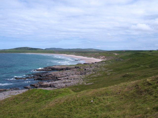
Gleann nan Cuilean, also known as the Valley of the Dogs, is a picturesque glen located in Argyllshire, Scotland. Nestled between rolling hills and surrounded by lush greenery, this valley is a haven of natural beauty and tranquility.

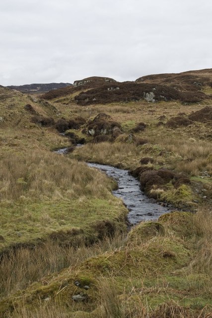
The glen stretches for approximately 10 miles, running from north to south. It is dominated by the mighty Cuillin Mountains, whose jagged peaks create a stunning backdrop against the clear blue sky. The valley is formed by the meandering River Cuilean, which winds its way through the landscape, adding to the scenic charm of the area.

The valley is renowned for its rich biodiversity, with a variety of plant and animal species thriving in its diverse habitats. Rare and protected species such as golden eagles, red deer, and otters can be spotted in the glen, making it a popular destination for wildlife enthusiasts and nature lovers.

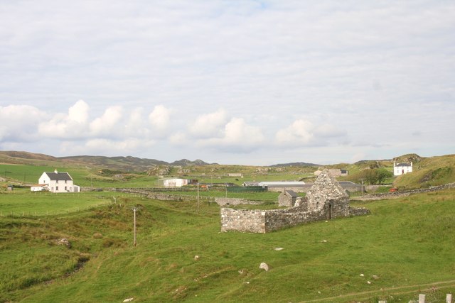
Gleann nan Cuilean is also steeped in history and folklore. Ancient ruins and archaeological sites dating back to prehistoric times can be found scattered throughout the valley, providing a glimpse into the area's past. Local legends tell tales of mythical creatures and ancient clans that once inhabited the glen, adding an air of mystery to the already enchanting landscape.

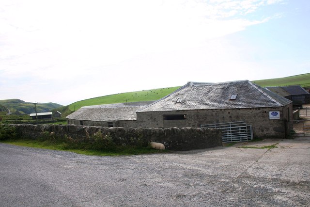
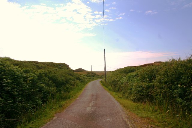
For outdoor enthusiasts, the valley offers a plethora of activities such as hiking, mountain biking, and fishing. The well-maintained trails and paths provide opportunities for both leisurely walks and challenging hikes, allowing visitors to explore the valley at their own pace.

Overall, Gleann nan Cuilean is a truly remarkable destination that offers breathtaking natural beauty, abundant wildlife, and a rich cultural heritage. Whether it's for a peaceful retreat or an adventure-filled getaway, this valley is sure to leave a lasting impression on all who visit.

If you have any feedback on the listing, please let us know in the comments section below.

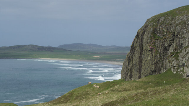
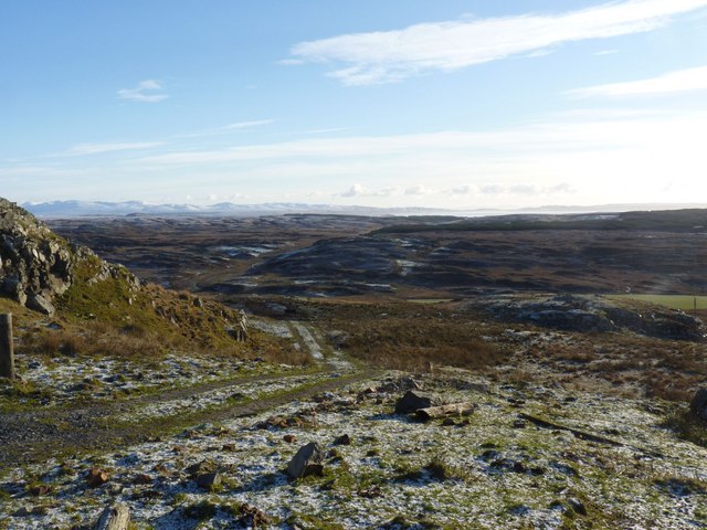
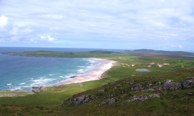
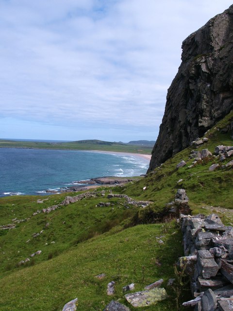
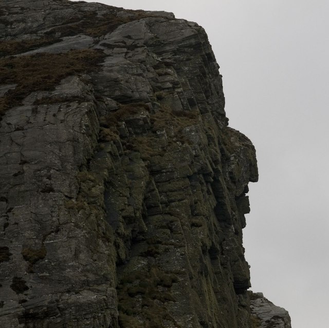
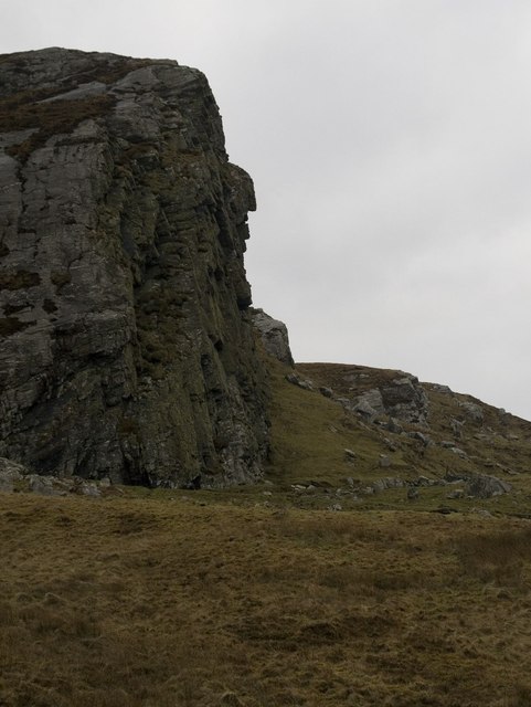
Gleann nan Cuilean Images

Images are sourced within 2km of 55.75015/-6.4567695 or Grid Reference NR2059. Thanks to Geograph Open Source API. All images are credited.

Disused quarry at Rubha na h-Airde Mòire
Kilchiaran Bay
Kilchiaran Bay
Creag Bealach na Caillich — Granny's Crag
Disused military buildings
Winter view south-east from Cnoc nam Muc-chlach, Islay
Kilchiaran Bay, Islay With ruined chapel in distance.
Kilchiaran Bay, Islay
With ruined chapel in distance.
View north from Cnoc nam Muc-chlach The view north from near the hilltop transmitters above Machir Bay.
View north from Cnoc nam Muc-chlach
The view north from near the hilltop transmitters above Machir Bay.
Old Woman's Pass Old Woman's Pass is the name given to this old track which crosses the headland between Kilchoman and Kilchiaran. The splendid view northwards is along the beach at Machir Bay.
Old Woman's Pass
Old Woman's Pass is the name given to this old track which crosses the headland between Kilchoman and Kilchiaran. The splendid view northwards is along the beach at Machir Bay.
Machir Bay To the right is the path leading down to the beach from Old Woman's Pass. A fine stretch of sand backed by dunes and machair where the corncrake can often be heard, but rarely seen.
Machir Bay
To the right is the path leading down to the beach from Old Woman's Pass. A fine stretch of sand backed by dunes and machair where the corncrake can often be heard, but rarely seen.
Cill Chiarain The church of Saint Ciaron, this church originates from around 1200.
Cill Chiarain
The church of Saint Ciaron, this church originates from around 1200.
Kilchiaran Farm The farmstead of Kilchiaran on the Rinns of Islay.
Kilchiaran Farm
The farmstead of Kilchiaran on the Rinns of Islay.
Road to Kilchiaran The road passing through high banks close to Kilchiaran.
Road to Kilchiaran
The road passing through high banks close to Kilchiaran.
Granny Rock The profile of an old woman or 'Caillich' can be seen on this rock between Machir Bay and Kilchiaran. It is best viewed from the north. For a context photo, see <a href="https://www.geograph.org.uk/photo/2802956">NR2061 : Granny Rock, Islay</a>.
Granny Rock
The profile of an old woman or 'Caillich' can be seen on this rock between Machir Bay and Kilchiaran. It is best viewed from the north. For a context photo, see NR2061 : Granny Rock, Islay.
Granny Rock, Islay The profile of an old woman or 'Caillich' can be seen in this rock face between Machir Bay to the north and Kilchiaran to the south. It is best viewed from the north. For a closer picture, see <a href="https://www.geograph.org.uk/photo/2802952">NR2061 : Granny Rock</a>.
Granny Rock, Islay
The profile of an old woman or 'Caillich' can be seen in this rock face between Machir Bay to the north and Kilchiaran to the south. It is best viewed from the north. For a closer picture, see NR2061 : Granny Rock.
Footbridge across the Abhainn na Braid, Islay This footbridge is marked on my older version of the 1:25 000 Explorer map of Islay north, but not on the newer version that Geograph uses - the opposite way round of the water butt photo - see <a href="https://www.geograph.org.uk/photo/2802972">NR2162 : Farm Track near Machir Bay, Islay</a>
Footbridge across the Abhainn na Braid, Islay
This footbridge is marked on my older version of the 1:25 000 Explorer map of Islay north, but not on the newer version that Geograph uses - the opposite way round of the water butt photo - see NR2162 : Farm Track near Machir Bay, Islay
Ruin near Kilchiaran, Islay Marked as simply two rectangles on the Explorer map, with no name, the inhabitants of this erstwhile dwelling house surely enjoyed true tranquility. What stories could this lonely dwelling share?
Ruin near Kilchiaran, Islay
Marked as simply two rectangles on the Explorer map, with no name, the inhabitants of this erstwhile dwelling house surely enjoyed true tranquility. What stories could this lonely dwelling share?
Allt Cnoc nan Gainimh, Islay
Show me another place!

Gleann nan Cuilean is located at Grid Ref: NR2059 (Lat: 55.75015, Lng: -6.4567695)

Unitary Authority: Argyll and Bute

Police Authority: Argyll and West Dunbartonshire

What 3 Words

///widest.attitudes.manual. Near Port Charlotte, Argyll & Bute

Related Wikis

Rinns of Islay

The Rinns of Islay (Scottish Gaelic: Na Roinn Ìleach; alternative English spelling Rhinns of Islay) is an area on the west of the island of Islay in the...

RAF Kilchiaran

RAF Kilchiaran was a Royal Air Force radar station situated on the Isle of Islay in Scotland. It was originally active from 1940-1945. In 1954 the base...

Kilchoman

Kilchoman ( kil-(K)HOM-ən; Scottish Gaelic: Cill Chomain [kʲʰiːʎ ˈxɔmɛɲ]) is a small settlement and large parish on the Scottish island of Islay, within...

Kilchoman distillery

Kilchoman distillery (pronounced Kil-ho-man) is a distillery that produces single malt Scotch whisky on Islay, an island of the Inner Hebrides. Kilchoman...

Nearby Amenities

Located within 500m of 55.75015,-6.4567695
Power: pole
Lat/Long: 55.7487318/-6.4633801
Power: pole
Lat/Long: 55.7492939/-6.4628852
Power: pole
Lat/Long: 55.7502034/-6.462066
Power: pole
Lat/Long: 55.7516146/-6.4607152
Power: pole
Lat/Long: 55.7527406/-6.4588296
Power: pole
Lat/Long: 55.7532449/-6.457959
Power: pole
Lat/Long: 55.754308/-6.4560829
Power: pole
Lat/Long: 55.749895/-6.4623438
Power: pole
Lat/Long: 55.7508829/-6.4613782
Power: pole
Lat/Long: 55.7519537/-6.4602505
Power: pole
Lat/Long: 55.7523184/-6.4595918
Power: pole
Lat/Long: 55.7537609/-6.4570485
Port Uamh nan Eun
Natural: bay
Lat/Long: 55.7508025/-6.4635482
The data included in this document is from www.openstreetmap.org. The data is made available under ODbL.

Have you been to Gleann nan Cuilean?

Leave your review of Gleann nan Cuilean below (or comments, questions and feedback).