Cnoc Dhonnachaidh

Hill, Mountain in Ross-shire

Scotland

Cnoc Dhonnachaidh

Postbox at Crulivig HS2 91. Royal Mail list this box as 'Crulivig'.
Postbox at Crulivig Credit: David Bremner

Cnoc Dhonnachaidh is a prominent hill located in the county of Ross-shire, in the Scottish Highlands. Standing at an elevation of approximately 600 meters (2,000 feet), it offers breathtaking views of the surrounding countryside and is a popular destination for outdoor enthusiasts and hikers.

Situated near the village of Contin, Cnoc Dhonnachaidh is part of the larger mountain range known as the Ben Wyvis, which stretches across this region of Scotland. The hill is characterized by its rugged terrain, with steep slopes and rocky paths that challenge even the most experienced climbers. However, the stunning vistas and the sense of accomplishment upon reaching the summit make the effort worthwhile.

Flora and fauna abound on Cnoc Dhonnachaidh, with the lower slopes covered in rich heather and grasses, while higher up, the vegetation becomes more sparse, giving way to mosses and lichens. The hill is also home to a variety of wildlife, including red deer, mountain hares, and numerous bird species, making it a haven for nature enthusiasts and birdwatchers.

The hill is easily accessible from Contin, with several well-marked trails leading to its summit. The most popular route begins at the car park near the village and ascends gradually, allowing hikers to appreciate the changing scenery as they make their way up. On clear days, the summit provides panoramic views of the surrounding mountains, lochs, and glens, creating a truly awe-inspiring experience.

In conclusion, Cnoc Dhonnachaidh is a stunning hill in Ross-shire, offering nature lovers, hikers, and climbers a chance to immerse themselves in the beauty of the Scottish Highlands.

If you have any feedback on the listing, please let us know in the comments section below.

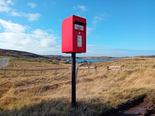
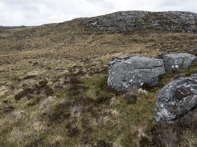
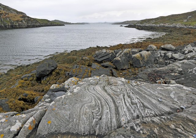
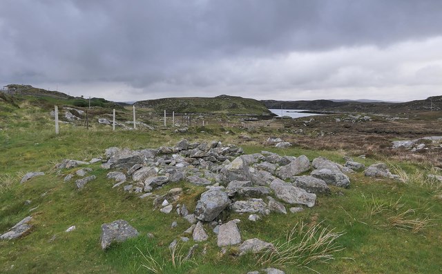
Cnoc Dhonnachaidh Images

Images are sourced within 2km of 58.193982/-6.7922435 or Grid Reference NB1832. Thanks to Geograph Open Source API. All images are credited.

Postbox at Crulivig HS2 91. Royal Mail list this box as 'Crulivig'.
Postbox at Crulivig
HS2 91. Royal Mail list this box as 'Crulivig'.
Telephone Box at Crulabhig Probably it's only the sheep that get calls here?
Telephone Box at Crulabhig
Probably it's only the sheep that get calls here?
Crulivig: the telephone box Pictured during heavy rain, this phone box has Hebridean doors, to keep the wind at bay.
Crulivig: the telephone box
Pictured during heavy rain, this phone box has Hebridean doors, to keep the wind at bay.
Crulivig: postbox № HS2 91 This postbox stands on the opposite side of the road to <a href="https://www.geograph.org.uk/photo/3286743">NB1733 : Crulivig: the telephone box</a>. It is emptied each morning except Sunday at a quarter to nine.
Crulivig: postbox № HS2 91
This postbox stands on the opposite side of the road to NB1733 : Crulivig: the telephone box. It is emptied each morning except Sunday at a quarter to nine.
Boggy and rocky Often in this type of country, getting up onto a bit of high ground reveals a lochan or just a little pool to add a bit of interest. Not here. The high ground is on the lower slopes of Beinn Sgarastaigh, but with a summit height of 98 m, and difficult navigation through peat hags, no one is likely to get excited about it.
Boggy and rocky
Often in this type of country, getting up onto a bit of high ground reveals a lochan or just a little pool to add a bit of interest. Not here. The high ground is on the lower slopes of Beinn Sgarastaigh, but with a summit height of 98 m, and difficult navigation through peat hags, no one is likely to get excited about it.
Abandoned croft house near Lundal
Low cloud over Great Bernera A thin bank of cloud over the sea. Looking northeast from the B8059 near Lundale.
Low cloud over Great Bernera
A thin bank of cloud over the sea. Looking northeast from the B8059 near Lundale.
Rough pasture near Lundale Looking east towards Callanish, across Loch Ròg.
Rough pasture near Lundale
Looking east towards Callanish, across Loch Ròg.
Beinn Scarastaigh from near Lundale A large rocky hill about 1km to the southeast,
Beinn Scarastaigh from near Lundale
A large rocky hill about 1km to the southeast,
Calanais/Callanish XV, Circebost, Great Bernera/Beàrnaraigh From Discovery and Excavation in Scotland, 1976: "On grassy ridge 100m N of road, 25m E of track through Croft 24, Kirkibost. A large prone slab approx. 3.55m x 1.35m, thickness varying from 0.25-0.45m, lying in peat on a grassy ridge. The lower end appears to be surrounded by packing stones and there is a void under the centre of the stone. This stone was brought to our notice by Mr Norman MacDonald of Kirkibost."
Calanais/Callanish XV, Circebost, Great Bernera/Beàrnaraigh
From Discovery and Excavation in Scotland, 1976: "On grassy ridge 100m N of road, 25m E of track through Croft 24, Kirkibost. A large prone slab approx. 3.55m x 1.35m, thickness varying from 0.25-0.45m, lying in peat on a grassy ridge. The lower end appears to be surrounded by packing stones and there is a void under the centre of the stone. This stone was brought to our notice by Mr Norman MacDonald of Kirkibost."
Possible fallen standing stone, Circebost, Great Bernera/Beàrnaraigh This stone lies approximately 80m ESE of <a href="https://www.geograph.org.uk/photo/5293759">NB1734 : Calanais/Callanish XV, Circebost, Great Bernera/Beàrnaraigh</a>.  The croft owner, who is the grandson of Norman MacDonald who originally brought Callanish XV to archaeologists' attention, believes it to be fallen standing stone.
Possible fallen standing stone, Circebost, Great Bernera/Beàrnaraigh
This stone lies approximately 80m ESE of NB1734 : Calanais/Callanish XV, Circebost, Great Bernera/Beàrnaraigh. The croft owner, who is the grandson of Norman MacDonald who originally brought Callanish XV to archaeologists' attention, believes it to be fallen standing stone.
Looking down at Circebost Circebost or Kirkibost is a tiny settlement on Great Bernera. This island is now connected to Lewis by a short pre-stressed concrete bridge. In 1953 when it was built it was and remains the first bridge of such material in Europe.  

The settlemenr is also important as it is the first planned crofting township in the Outer Hebrides, though I think town is a lofty description for such a small group of houses.
Looking down at Circebost
Circebost or Kirkibost is a tiny settlement on Great Bernera. This island is now connected to Lewis by a short pre-stressed concrete bridge. In 1953 when it was built it was and remains the first bridge of such material in Europe. The settlemenr is also important as it is the first planned crofting township in the Outer Hebrides, though I think town is a lofty description for such a small group of houses.
Tòb Lundale, Isle of Lewis Tòb Lundale is an inlet on Loch Ròg.  Tòb is a Gaelic word for bay or cove.
Tòb Lundale, Isle of Lewis
Tòb Lundale is an inlet on Loch Ròg. Tòb is a Gaelic word for bay or cove.
Building remains, Lundal, Isle of Lewis Looking towards the head of Tòb Lundale, an inlet on Loch Ròg.
Building remains, Lundal, Isle of Lewis
Looking towards the head of Tòb Lundale, an inlet on Loch Ròg.
Phonebox on the road to Great Bernera
End of the road at Tobhtaral Two houses at the end of the road in the SE corner of Great Bernera island.
End of the road at Tobhtaral
Two houses at the end of the road in the SE corner of Great Bernera island.
Am Port Mor A shallow bay on the south east coast of Great Bernera.
Am Port Mor
A shallow bay on the south east coast of Great Bernera.
Church ruin near Circebost. The ruin is presumed to be medieval, and is situated on a point of land on the north side of Am Port Mor.
Church ruin near Circebost.
The ruin is presumed to be medieval, and is situated on a point of land on the north side of Am Port Mor.
Show me another place!

Cnoc Dhonnachaidh is located at Grid Ref: NB1832 (Lat: 58.193982, Lng: -6.7922435)

Unitary Authority: Na h-Eileanan an Iar

Police Authority: Highlands and Islands

What 3 Words

///meanders.listings.revival. Near Carloway, Na h-Eileanan Siar

Related Wikis

Eilean Chearstaidh

Eilean Kearstay (Scottish Gaelic: Eilean Chearstaigh) is an uninhabited island in Loch Roag in the Outer Hebrides of Scotland. It lies south east of Great...

Callanish VIII

The Callanish VIII stone setting is one of many megalithic structures around the better-known (and larger) Calanais I on the west coast of the Isle of...

Ceabhaigh

Ceabhaigh is a small island in an arm of Loch Ròg on the west coast of Lewis in the Outer Hebrides of Scotland. It is about 25 hectares (62 acres) in extent...

Callanish Stones

The Callanish Stones (or "Callanish I": Scottish Gaelic: Clachan Chalanais or Tursachan Chalanais) are an arrangement of standing stones placed in a cruciform...

Nearby Amenities

Located within 500m of 58.193982,-6.7922435
Passing Place
Lat/Long: 58.1907069/-6.7920725
Passing Place
Lat/Long: 58.191848/-6.7924771
Lundal
Name En: Lundale
Name Gd: Lundal
Place: hamlet
Lat/Long: 58.1908796/-6.7913799
Power: pole
Lat/Long: 58.189813/-6.7896577
Power: pole
Lat/Long: 58.1899006/-6.7904563
Power: pole
Lat/Long: 58.1905679/-6.7916454
Power: pole
Lat/Long: 58.1910347/-6.7925544
Power: pole
Lat/Long: 58.1913161/-6.7947063
Power: pole
Lat/Long: 58.1914416/-6.7958036
Power: pole
Lat/Long: 58.1914781/-6.7964845
Power: pole
Lat/Long: 58.191516/-6.7979719
Power: pole
Lat/Long: 58.1915995/-6.7984956
Power: pole
Lat/Long: 58.1917475/-6.7861432
Power: pole
Lat/Long: 58.1921436/-6.7864214
Power: pole
Lat/Long: 58.1925013/-6.786661
Power: pole
Lat/Long: 58.1957857/-6.7945517
Power: pole
Lat/Long: 58.195254/-6.7942831
Power: pole
Lat/Long: 58.194557/-6.7939446
Power: pole
Lat/Long: 58.1939979/-6.7936602
Power: pole
Lat/Long: 58.1934122/-6.7938612
Power: pole
Lat/Long: 58.1926858/-6.7941526
Power: pole
Lat/Long: 58.1919434/-6.7944908
Passing Place
Lat/Long: 58.1898098/-6.7911958
Barrier: cattle_grid
Lat/Long: 58.1906755/-6.7921707
Power: pole
Lat/Long: 58.1911734/-6.7935988
Power: pole
Lat/Long: 58.1914184/-6.7859008
Passing Place
Lat/Long: 58.1904588/-6.7879435
Passing Place
Lat/Long: 58.1899509/-6.7894179
The data included in this document is from www.openstreetmap.org. The data is made available under ODbL.

Have you been to Cnoc Dhonnachaidh?

Leave your review of Cnoc Dhonnachaidh below (or comments, questions and feedback).