Ben Corkeval

Hill, Mountain in Inverness-shire

Scotland

Ben Corkeval

Duirinish moorland No roads, houses or people here, just birds and red deer, and acres and acres of moorland. Here the view is from the eastern slope of Beinn nan Corrafidheag across Bràigh na Cloiche to Ben Corkeval.
Duirinish moorland Credit: Richard Dorrell

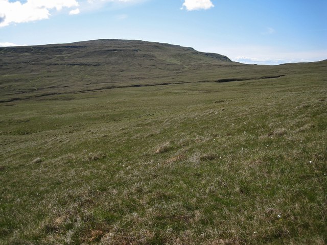
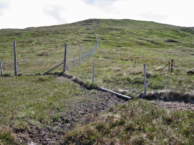
Ben Corkeval is a prominent hill located in the county of Inverness-shire, Scotland. With a height of approximately 1,022 meters (3,353 feet), it is considered one of the notable mountains in the region. The hill is situated in the western part of Inverness-shire, close to the village of Tomatin.

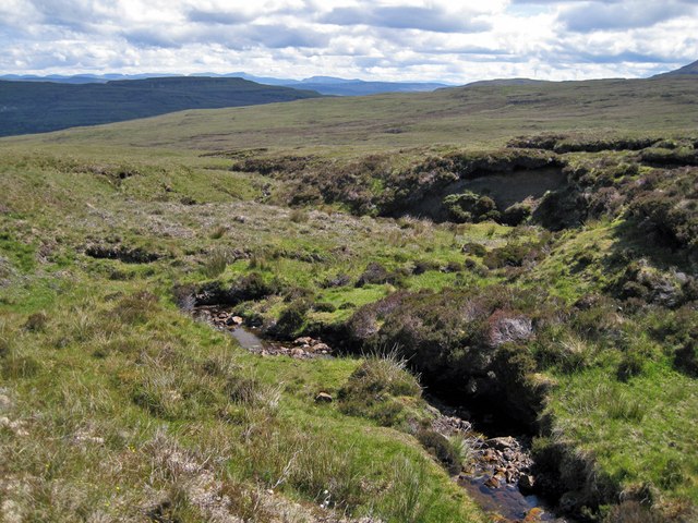
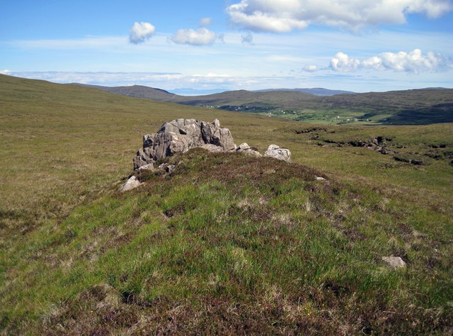
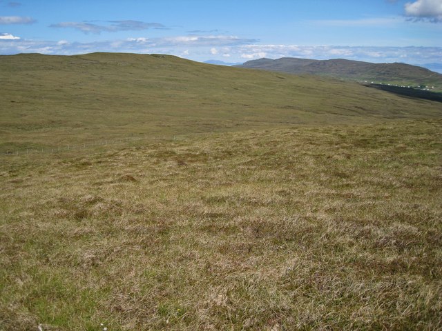
Ben Corkeval offers stunning panoramic views of the surrounding landscape, including the nearby Monadhliath Mountains and the picturesque valleys of the River Findhorn. It is a popular destination for outdoor enthusiasts, including hikers, mountaineers, and nature lovers, who are drawn to its challenging yet rewarding ascent.

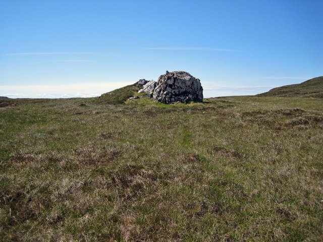
The hill's terrain is characterized by steep slopes and rocky outcrops, which provide a thrilling experience for climbers. The ascent to the summit can be demanding and requires a certain level of fitness and experience. However, the effort is rewarded with breathtaking vistas and a sense of accomplishment upon reaching the top.

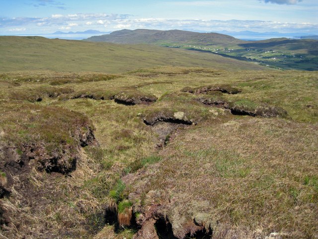
The surrounding area of Ben Corkeval is rich in wildlife, with opportunities to spot various species of birds, including golden eagles and peregrine falcons. Additionally, the hill is known for its diverse flora, with heather-clad slopes and patches of woodland adding to its natural beauty.

Overall, Ben Corkeval in Inverness-shire is a must-visit destination for those seeking outdoor adventures and a chance to immerse themselves in the stunning Scottish Highlands.

If you have any feedback on the listing, please let us know in the comments section below.
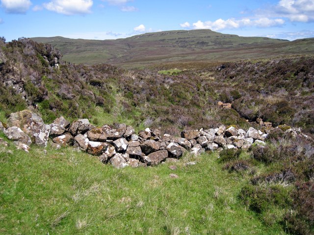
Ben Corkeval Images

Images are sourced within 2km of 57.406789/-6.6886534 or Grid Reference NG1844. Thanks to Geograph Open Source API. All images are credited.

Duirinish moorland No roads, houses or people here, just birds and red deer, and acres and acres of moorland. Here the view is from the eastern slope of Beinn nan Corrafidheag across Bràigh na Cloiche to Ben Corkeval.
Duirinish moorland
No roads, houses or people here, just birds and red deer, and acres and acres of moorland. Here the view is from the eastern slope of Beinn nan Corrafidheag across Bràigh na Cloiche to Ben Corkeval.
Allt Airigh Mhurchaidh The burn flows ENE from Ben Vratabreck.
Allt Airigh Mhurchaidh
The burn flows ENE from Ben Vratabreck.
An odd rock This outcrop, about the size of a Transit van, stands out from quite a distance away, as it lies within a flattish and otherwise largely featureless bealach.
An odd rock
This outcrop, about the size of a Transit van, stands out from quite a distance away, as it lies within a flattish and otherwise largely featureless bealach.
View over the rock Looking down Bràigh na Cloiche from on top of the hillock that lies behind an unusual rock outcrop. (See also <a href="https://www.geograph.org.uk/photo/3000816">NG1745 : An odd rock</a>). The entire feature has the look of being a burial mound, but its origin is actually quite natural.
View over the rock
Looking down Bràigh na Cloiche from on top of the hillock that lies behind an unusual rock outcrop. (See also NG1745 : An odd rock). The entire feature has the look of being a burial mound, but its origin is actually quite natural.
Fence junction in Bràigh na Cloiche Miles of fences cross the moorland here. The metal fence posts of an earlier fence can also be seen, so the boundary they mark must be deemed important. The hill is Ben Corkeval.
Fence junction in Bràigh na Cloiche
Miles of fences cross the moorland here. The metal fence posts of an earlier fence can also be seen, so the boundary they mark must be deemed important. The hill is Ben Corkeval.
Bràigh na Cloiche A largely featureless grassy bealach between Ben Corkeval and Beinn nan Corrafidheag.
Bràigh na Cloiche
A largely featureless grassy bealach between Ben Corkeval and Beinn nan Corrafidheag.
Peat hags on Ben Corkeval This would be a tricky place to be walking in wet weather. The distant buildings are in Glendale.
Peat hags on Ben Corkeval
This would be a tricky place to be walking in wet weather. The distant buildings are in Glendale.
Deer fence on Ben Corkeval An enormous area of land is enclosed by this deer fence, though I am not sure if it is meant to be keeping deer in or out - I saw deer on both sides of the fence... The Outer Hebridean island of North Uist lines up along the horizon.
Deer fence on Ben Corkeval
An enormous area of land is enclosed by this deer fence, though I am not sure if it is meant to be keeping deer in or out - I saw deer on both sides of the fence... The Outer Hebridean island of North Uist lines up along the horizon.
Drought on the hills It's not often we see peat bogs dry and cracked on the Isle of Skye. This is close to the summit of Ben Corkeval.
Drought on the hills
It's not often we see peat bogs dry and cracked on the Isle of Skye. This is close to the summit of Ben Corkeval.
Deer fence on the summit  This is close to the summit of Ben Corkeval. The flat topped hills in the background are Macleod's Tables. The deer fence continues for miles, enclosing a very large area of the north east facing slope of the hill. Parts of the enclosed hillside have been planted with broadleaf trees.
Deer fence on the summit
This is close to the summit of Ben Corkeval. The flat topped hills in the background are Macleod's Tables. The deer fence continues for miles, enclosing a very large area of the north east facing slope of the hill. Parts of the enclosed hillside have been planted with broadleaf trees.
Descending Ben Corkeval This is the east facing slope of the hill. In spite of a lack of rain recently, the grasses, mosses and heather have grown thickly here, and make for difficult walking. Parts of this hillside have been planted with trees, and are marked on some OS maps as woodland. The trees are only a couple of feet tall at the moment. The hill in cloud shadow in the background is Healabhal Mhòr, otherwise known as MacLeod's Table North, with summit in <a href="https://www.geograph.org.uk/gridref/NG2244">NG2244</a>.
Descending Ben Corkeval
This is the east facing slope of the hill. In spite of a lack of rain recently, the grasses, mosses and heather have grown thickly here, and make for difficult walking. Parts of this hillside have been planted with trees, and are marked on some OS maps as woodland. The trees are only a couple of feet tall at the moment. The hill in cloud shadow in the background is Healabhal Mhòr, otherwise known as MacLeod's Table North, with summit in NG2244.
North east slope of Ben Corkeval A very large area of this hillside has been planted with young trees, currently barely taller than the grass and heather and not visible in this image. However in time, they will transform the appearance of the hillside.
North east slope of Ben Corkeval
A very large area of this hillside has been planted with young trees, currently barely taller than the grass and heather and not visible in this image. However in time, they will transform the appearance of the hillside.
Woodland? Some OS maps mark parts of this hillside on the eastern slope of Ben Corkeval as woodland. Sure enough, trees have been planted here, and the whole hillside is surrounded by a deer fence to stop browsing deer from nibbling the trees. But just yet, the trees are barely taller than the heather, grasses and mosses among which they are growing. There is a young birch in this shot, slightly left and below the centre of the image.
Woodland?
Some OS maps mark parts of this hillside on the eastern slope of Ben Corkeval as woodland. Sure enough, trees have been planted here, and the whole hillside is surrounded by a deer fence to stop browsing deer from nibbling the trees. But just yet, the trees are barely taller than the heather, grasses and mosses among which they are growing. There is a young birch in this shot, slightly left and below the centre of the image.
It's that fence again A deer fence surrounds a very large area of hillside on the eastern slope of Ben Corkeval. Parts of the hillside have been planted with trees, which will transform the appearance of the hill once they are grown, though they are currently no more than a couple of feet tall. The fence has sturdy strainer posts at intervals, so it is not too difficult to climb over.
It's that fence again
A deer fence surrounds a very large area of hillside on the eastern slope of Ben Corkeval. Parts of the hillside have been planted with trees, which will transform the appearance of the hill once they are grown, though they are currently no more than a couple of feet tall. The fence has sturdy strainer posts at intervals, so it is not too difficult to climb over.
Miles of moorland Moorland below Ben Corkeval.
Miles of moorland
Moorland below Ben Corkeval.
Just moorland... ...and very little else. On the right is the lower end of a gorge through which the Allt na Banachaig flows.
Just moorland...
...and very little else. On the right is the lower end of a gorge through which the Allt na Banachaig flows.
Allt na Banachaig Flowing at little more than a trickle after several weeks with very little rainfall on Skye.
Allt na Banachaig
Flowing at little more than a trickle after several weeks with very little rainfall on Skye.
Tumbled wall in Sunagill Clearly a man made feature, this tumble of stones lie between the Allt na Banachaig and a natural rocky outcrop. They were almost certainly at one time part of an animal enclosure. What is surprising is that the stones have remained exposed, and have not been grassed over or buried within the heather.
Tumbled wall in Sunagill
Clearly a man made feature, this tumble of stones lie between the Allt na Banachaig and a natural rocky outcrop. They were almost certainly at one time part of an animal enclosure. What is surprising is that the stones have remained exposed, and have not been grassed over or buried within the heather.
Show me another place!

Ben Corkeval is located at Grid Ref: NG1844 (Lat: 57.406789, Lng: -6.6886534)

Unitary Authority: Highland

Police Authority: Highlands and Islands

What 3 Words

///marine.void.lake. Near Glendale, Highland

Nearby Locations

Ben Corkeval

Related Wikis

Ramasaig

Ramasaig is a small township on the western shore of the Duirinish peninsula, on Dunvegan, Isle of Skye and is in the Scottish Highlands and is in the...

Borrodale

Borrodale (Scottish Gaelic: Borodail) is small hamlet on the Isle of Skye, in the Inner Hebrides of Scotland. Borrodale is part of Glendale and the Glendale...

Duirinish, Skye

Duirinish (Scottish Gaelic: Diùirinis) is a peninsula and civil parish on the island of Skye in Scotland. It is situated in the north west between Loch...
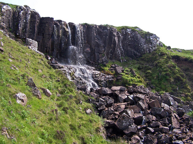
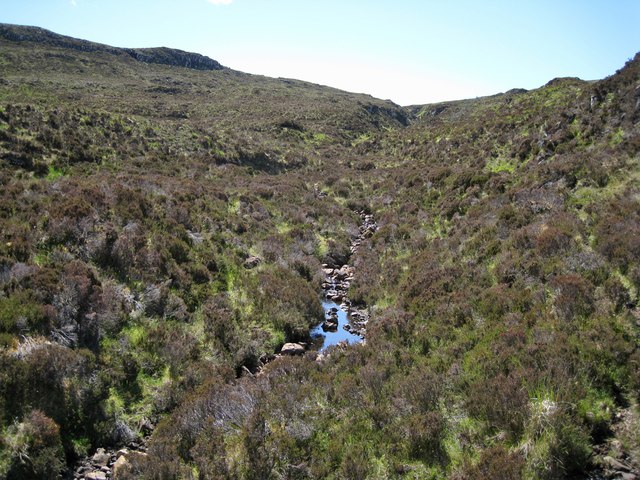
Eas Mòr, Durinish

Eas Mòr is a waterfall on the Duirinish peninsula of the island of Skye in Scotland. It lies on the Allt Mhicheil, a tributary of the Dibidal River below...

Nearby Amenities

Located within 500m of 57.406789,-6.6886534
Ben Corkeval
Ele: 350
Natural: peak
Lat/Long: 57.4071799/-6.6878789
The data included in this document is from www.openstreetmap.org. The data is made available under ODbL.

Have you been to Ben Corkeval?

Leave your review of Ben Corkeval below (or comments, questions and feedback).