Cnoc Ille Suardale

Hill, Mountain in Ross-shire

Scotland

Cnoc Ille Suardale

Great Bernera bridges The new bridge under construction and the old white bridge.
Great Bernera bridges Credit: Catherine Morgan

Cnoc Ille Suardale is a prominent hill located in Ross-shire, a county in the Scottish Highlands. Rising to a height of approximately 496 meters (1,627 feet), it is classified as a Marilyn, which is a hill with a prominence of at least 150 meters (492 feet). The name "Cnoc Ille Suardale" is derived from Gaelic, with "Cnoc" meaning hill and "Ille Suardale" referring to the specific area or features of the hill.

Situated in the northwest of Scotland, Cnoc Ille Suardale offers breathtaking panoramic views of the surrounding landscape. On a clear day, visitors can enjoy vistas of the rugged mountains, rolling hills, and shimmering lochs that characterize the picturesque Scottish Highlands. The hill is covered in heather and grass, creating a vibrant and colorful scene, particularly during the summer months when wildflowers bloom.

Cnoc Ille Suardale is a popular destination for hikers and outdoor enthusiasts, who are attracted by the challenge and beauty it presents. Several walking routes and trails traverse the hill, providing different levels of difficulty for various skill levels. The ascent to the summit can be steep and demanding, but the rewards of reaching the top are immeasurable. It is not uncommon to spot wildlife such as deer, eagles, and other bird species during the climb.

Overall, Cnoc Ille Suardale offers a unique opportunity to immerse oneself in the stunning natural surroundings of the Scottish Highlands, providing a memorable and invigorating experience for those who venture to its summit.

If you have any feedback on the listing, please let us know in the comments section below.

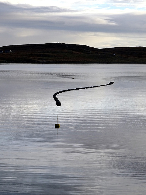
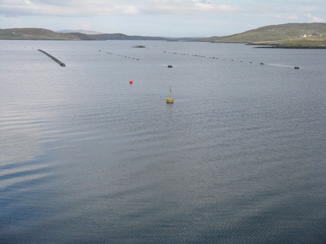
Cnoc Ille Suardale Images

Images are sourced within 2km of 58.219048/-6.8071872 or Grid Reference NB1735. Thanks to Geograph Open Source API. All images are credited.

Great Bernera bridges The new bridge under construction and the old white bridge.
Great Bernera bridges
The new bridge under construction and the old white bridge.
Old hardstandings at Tob Blar Meadha Abandoned lobster loading hardstandings at the lobster pond.
Old hardstandings at Tob Blar Meadha
Abandoned lobster loading hardstandings at the lobster pond.
Craft workshop in Kirkibost One of the old shellfish processing factories at Kirkibost (Circeabost) is now reborn as a craftshop.
Craft workshop in Kirkibost
One of the old shellfish processing factories at Kirkibost (Circeabost) is now reborn as a craftshop.
Cleibh ghiomaich aig cidhe Chirceabost Lobster creels at Kirkibost harbour
Cleibh ghiomaich aig cidhe Chirceabost
Lobster creels at Kirkibost harbour
Bernera Bridge Opened in 1953 and connecting Lewis with Great Bernera / Bearnaraigh.
<span class="nowrap"><a title="http://www.uigandbernera.com/" rel="nofollow ugc noopener" href="http://www.uigandbernera.com/">Link</a><img style="margin-left:2px;" alt="External link" title="External link - shift click to open in new window" src="https://s1.geograph.org.uk/img/external.png" width="10" height="10"/></span>
Bernera Bridge
Opened in 1953 and connecting Lewis with Great Bernera / Bearnaraigh. LinkExternal link
Sea Kayakers by Port a Chruidh Kayakers who have come from Miavaig / Miabhaig and are heading eastwards, having just passed below Bernera Bridge. The mainland of Lewis is on the far side of the 1953 bridge.
<span class="nowrap"><a title="http://www.uigandbernera.com/" rel="nofollow ugc noopener" href="http://www.uigandbernera.com/">Link</a><img style="margin-left:2px;" alt="External link" title="External link - shift click to open in new window" src="https://s1.geograph.org.uk/img/external.png" width="10" height="10"/></span>
Sea Kayakers by Port a Chruidh
Kayakers who have come from Miavaig / Miabhaig and are heading eastwards, having just passed below Bernera Bridge. The mainland of Lewis is on the far side of the 1953 bridge. LinkExternal link
Lewisian Gneiss Pink, folded Lewisian gneiss at the north end of Bernera Bridge. These are amongst the oldest rocks in the world.
<span class="nowrap"><a title="http://www.uigandbernera.com/" rel="nofollow ugc noopener" href="http://www.uigandbernera.com/">Link</a><img style="margin-left:2px;" alt="External link" title="External link - shift click to open in new window" src="https://s1.geograph.org.uk/img/external.png" width="10" height="10"/></span>
Lewisian Gneiss
Pink, folded Lewisian gneiss at the north end of Bernera Bridge. These are amongst the oldest rocks in the world. LinkExternal link
Stone Circle by Bernera Bridge Ancient stone circle on a mound above the north end of the bridge. the stones are part of the famous Callanish complex of standing stones.
Stone Circle by Bernera Bridge
Ancient stone circle on a mound above the north end of the bridge. the stones are part of the famous Callanish complex of standing stones.
Cleitir Stone Circle Calanais VIII - four standing stones above Bernera Bridge and the sound separating the island from Lewis.
Cleitir Stone Circle
Calanais VIII - four standing stones above Bernera Bridge and the sound separating the island from Lewis.
View towards Circebost Pier
Standing stones by Bernera Bridge
Great Bernera: the stores and post office The post office has been relocated to this village store since 1994 when it was in a wooden shed: <a href="https://www.geograph.org.uk/photo/104795">NB1536 : Great Bernara Post Office</a>. The shop also operates petrol pumps, which are in a layby across the road.
Great Bernera: the stores and post office
The post office has been relocated to this village store since 1994 when it was in a wooden shed: NB1536 : Great Bernara Post Office. The shop also operates petrol pumps, which are in a layby across the road.
Great Bernera: postbox № HS2 82 and a ruined croft house This postbox stands at the southern end of the island, a few hundred yards from the Bernera Bridge. Behind it, we see a ruined croft house, so common in the Scottish islands.
Great Bernera: postbox № HS2 82 and a ruined croft house
This postbox stands at the southern end of the island, a few hundred yards from the Bernera Bridge. Behind it, we see a ruined croft house, so common in the Scottish islands.
Callanish X
Callanish X
Standing Stones look over Sruth Iarsiadar  The name in this case means the current at Iarsiadar. It's a narrow tidal channel between Great Bernera and the rest of Lewis.
Standing Stones look over Sruth Iarsiadar
The name in this case means the current at Iarsiadar. It's a narrow tidal channel between Great Bernera and the rest of Lewis.
The Loch Barraglom Monster? Sadly not. They are lobster creels. Lobster fishing is an important contributor to the local economy.
The Loch Barraglom Monster?
Sadly not. They are lobster creels. Lobster fishing is an important contributor to the local economy.
Mussel farm at Iarsiadar To the east of the Bernara Bridge between Great Bernera/Beàrnaraigh and the Isle of Lewis.
Mussel farm at Iarsiadar
To the east of the Bernara Bridge between Great Bernera/Beàrnaraigh and the Isle of Lewis.
Coast at Bernera Bridge With a steep launching ramp into Sruth Iarsiadair and Port a Chruidh.
Coast at Bernera Bridge
With a steep launching ramp into Sruth Iarsiadair and Port a Chruidh.
Show me another place!

Cnoc Ille Suardale is located at Grid Ref: NB1735 (Lat: 58.219048, Lng: -6.8071872)

Unitary Authority: Na h-Eileanan an Iar

Police Authority: Highlands and Islands

What 3 Words

///accordion.sweetener.scarcely. Near Carloway, Na h-Eileanan Siar

Related Wikis

Ceabhaigh

Ceabhaigh is a small island in an arm of Loch Ròg on the west coast of Lewis in the Outer Hebrides of Scotland. It is about 25 hectares (62 acres) in extent...

Callanish VIII

The Callanish VIII stone setting is one of many megalithic structures around the better-known (and larger) Calanais I on the west coast of the Isle of...

Breaclete

Breacleit (or Roulanish; Scottish Gaelic: Breacleit; Old Norse: Breiðiklettr) is the central village on Great Bernera in the Outer Hebrides, Scotland....

Dun Bharabhat, Great Bernera

Dun Bharabhat (or Dun Baravat) is an Iron Age galleried dun or "semi-broch" situated on the island of Great Bernera near Lewis in Scotland (grid reference...

Nearby Amenities

Located within 500m of 58.219048,-6.8071872
Passing Place
Lat/Long: 58.2202945/-6.7992196
Barrier: cattle_grid
Lat/Long: 58.2197238/-6.7988753
The data included in this document is from www.openstreetmap.org. The data is made available under ODbL.

Have you been to Cnoc Ille Suardale?

Leave your review of Cnoc Ille Suardale below (or comments, questions and feedback).