Cnoc a' Leum

Hill, Mountain in Ross-shire

Scotland

Cnoc a' Leum

Great Bernera bridges The new bridge under construction and the old white bridge.
Great Bernera bridges Credit: Catherine Morgan

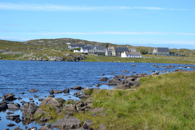
Cnoc a' Leum is a prominent hill located in the county of Ross-shire, in the Scottish Highlands. Rising to an elevation of 685 meters (2,247 feet), it is renowned for its breathtaking views and challenging hiking trails. The hill is situated near the picturesque village of Strathpeffer, approximately 25 miles northwest of Inverness.

Cnoc a' Leum is characterized by its rugged and rocky terrain, typical of the Scottish Highlands. Its slopes are covered with heather, grasses, and scattered patches of woodland. The hill offers a diverse range of flora and fauna, including various species of birds such as golden eagles, buzzards, and peregrine falcons. Red deer and mountain hares are also commonly spotted in the area.

The hill attracts outdoor enthusiasts and hikers from all over, thanks to its well-marked trails and stunning panoramic views. The ascent can be challenging, but the effort is rewarded with breathtaking vistas of the surrounding countryside, including the Cromarty Firth, the Black Isle, and the Moray Firth.

For those seeking a longer and more adventurous hike, Cnoc a' Leum can be combined with nearby Munros (mountains over 3,000 feet) such as Ben Wyvis and Little Wyvis. The hill is easily accessible by car, and there is parking available at its base. It is recommended to check the weather conditions before setting off, as the Scottish Highlands can experience rapid changes in weather, including mist, wind, and rain.

Overall, Cnoc a' Leum is a captivating and challenging destination for outdoor enthusiasts, offering stunning views and a rewarding hiking experience in the heart of the Scottish Highlands.

If you have any feedback on the listing, please let us know in the comments section below.

Cnoc a' Leum Images

Images are sourced within 2km of 58.21796/-6.8114552 or Grid Reference NB1735. Thanks to Geograph Open Source API. All images are credited.

Great Bernera bridges The new bridge under construction and the old white bridge.
Great Bernera bridges
The new bridge under construction and the old white bridge.
Old hardstandings at Tob Blar Meadha Abandoned lobster loading hardstandings at the lobster pond.
Old hardstandings at Tob Blar Meadha
Abandoned lobster loading hardstandings at the lobster pond.
Craft workshop in Kirkibost One of the old shellfish processing factories at Kirkibost (Circeabost) is now reborn as a craftshop.
Craft workshop in Kirkibost
One of the old shellfish processing factories at Kirkibost (Circeabost) is now reborn as a craftshop.
Cleibh ghiomaich aig cidhe Chirceabost Lobster creels at Kirkibost harbour
Cleibh ghiomaich aig cidhe Chirceabost
Lobster creels at Kirkibost harbour
"The Bridge Across the Atlantic" Bernera Bridge is one of several bridges which claim to span the Atlantic Ocean. This one connects the Lewis mainland with the island of Great Bernera / Bearnaraigh. Note the standing stones on the far side of the bridge.
<span class="nowrap"><a title="http://www.uigandbernera.com/" rel="nofollow ugc noopener" href="http://www.uigandbernera.com/">Link</a><img style="margin-left:2px;" alt="External link" title="External link - shift click to open in new window" src="https://s1.geograph.org.uk/img/external.png" width="10" height="10"/></span>
"The Bridge Across the Atlantic"
Bernera Bridge is one of several bridges which claim to span the Atlantic Ocean. This one connects the Lewis mainland with the island of Great Bernera / Bearnaraigh. Note the standing stones on the far side of the bridge. LinkExternal link
Bernera Bridge Opened in 1953 and connecting Lewis with Great Bernera / Bearnaraigh.
<span class="nowrap"><a title="http://www.uigandbernera.com/" rel="nofollow ugc noopener" href="http://www.uigandbernera.com/">Link</a><img style="margin-left:2px;" alt="External link" title="External link - shift click to open in new window" src="https://s1.geograph.org.uk/img/external.png" width="10" height="10"/></span>
Bernera Bridge
Opened in 1953 and connecting Lewis with Great Bernera / Bearnaraigh. LinkExternal link
Sea Kayakers by Port a Chruidh Kayakers who have come from Miavaig / Miabhaig and are heading eastwards, having just passed below Bernera Bridge. The mainland of Lewis is on the far side of the 1953 bridge.
<span class="nowrap"><a title="http://www.uigandbernera.com/" rel="nofollow ugc noopener" href="http://www.uigandbernera.com/">Link</a><img style="margin-left:2px;" alt="External link" title="External link - shift click to open in new window" src="https://s1.geograph.org.uk/img/external.png" width="10" height="10"/></span>
Sea Kayakers by Port a Chruidh
Kayakers who have come from Miavaig / Miabhaig and are heading eastwards, having just passed below Bernera Bridge. The mainland of Lewis is on the far side of the 1953 bridge. LinkExternal link
Lewisian Gneiss Pink, folded Lewisian gneiss at the north end of Bernera Bridge. These are amongst the oldest rocks in the world.
<span class="nowrap"><a title="http://www.uigandbernera.com/" rel="nofollow ugc noopener" href="http://www.uigandbernera.com/">Link</a><img style="margin-left:2px;" alt="External link" title="External link - shift click to open in new window" src="https://s1.geograph.org.uk/img/external.png" width="10" height="10"/></span>
Lewisian Gneiss
Pink, folded Lewisian gneiss at the north end of Bernera Bridge. These are amongst the oldest rocks in the world. LinkExternal link
Stone Circle by Bernera Bridge Ancient stone circle on a mound above the north end of the bridge. the stones are part of the famous Callanish complex of standing stones.
Stone Circle by Bernera Bridge
Ancient stone circle on a mound above the north end of the bridge. the stones are part of the famous Callanish complex of standing stones.
Cleitir Stone Circle Calanais VIII - four standing stones above Bernera Bridge and the sound separating the island from Lewis.
Cleitir Stone Circle
Calanais VIII - four standing stones above Bernera Bridge and the sound separating the island from Lewis.
Breacleit church and war memorial Breacleit (or Breaclete) is the largest settlement on Great Bernera, an island off the west coast of Lewis attached to that larger island by a bridge. The little church seen here looks to date from the late C19th or early C20th. To its right can be seen the Bernera War Memorial <span class="nowrap"><a title="http://warmemscot.s4.bizhat.com/viewtopic.php?t=323" rel="nofollow ugc noopener" href="http://warmemscot.s4.bizhat.com/viewtopic.php?t=323">Link</a><img style="margin-left:2px;" alt="External link" title="External link - shift click to open in new window" src="https://s1.geograph.org.uk/img/external.png" width="10" height="10"/></span> 
Behind the church can be seen a little of Loch Breacleit.
Breacleit church and war memorial
Breacleit (or Breaclete) is the largest settlement on Great Bernera, an island off the west coast of Lewis attached to that larger island by a bridge. The little church seen here looks to date from the late C19th or early C20th. To its right can be seen the Bernera War Memorial LinkExternal link Behind the church can be seen a little of Loch Breacleit.
View across Loch Geal towards Breacleit
View towards Circebost Pier
Bernera Bridge
Bernera Bridge
Standing stones by Bernera Bridge
Great Bernera: the stores and post office The post office has been relocated to this village store since 1994 when it was in a wooden shed: <a href="https://www.geograph.org.uk/photo/104795">NB1536 : Great Bernara Post Office</a>. The shop also operates petrol pumps, which are in a layby across the road.
Great Bernera: the stores and post office
The post office has been relocated to this village store since 1994 when it was in a wooden shed: NB1536 : Great Bernara Post Office. The shop also operates petrol pumps, which are in a layby across the road.
Great Bernera: postbox № HS2 82 and a ruined croft house This postbox stands at the southern end of the island, a few hundred yards from the Bernera Bridge. Behind it, we see a ruined croft house, so common in the Scottish islands.
Great Bernera: postbox № HS2 82 and a ruined croft house
This postbox stands at the southern end of the island, a few hundred yards from the Bernera Bridge. Behind it, we see a ruined croft house, so common in the Scottish islands.
Great Bernera Road Bridge Great Bernera lies in Loch Roag on the north-west coast of Lewis and is linked to it by a road bridge. Built in 1953, the bridge was the first pre-stressed concrete bridge in Europe. The main settlement on the island is Breaclete (Gaelic: Breacleit).
I was here bagging the island of Great Bernera with George Morl and its high point a TuMP called Middle Shalaval, at 87 metres and a P87 hill.
Great Bernera Road Bridge
Great Bernera lies in Loch Roag on the north-west coast of Lewis and is linked to it by a road bridge. Built in 1953, the bridge was the first pre-stressed concrete bridge in Europe. The main settlement on the island is Breaclete (Gaelic: Breacleit). I was here bagging the island of Great Bernera with George Morl and its high point a TuMP called Middle Shalaval, at 87 metres and a P87 hill.
Show me another place!

Cnoc a' Leum is located at Grid Ref: NB1735 (Lat: 58.21796, Lng: -6.8114552)

Unitary Authority: Na h-Eileanan an Iar

Police Authority: Highlands and Islands

What 3 Words

///protected.remotes.minds. Near Carloway, Na h-Eileanan Siar

Related Wikis

Callanish VIII

The Callanish VIII stone setting is one of many megalithic structures around the better-known (and larger) Calanais I on the west coast of the Isle of...

Dun Bharabhat, Great Bernera

Dun Bharabhat (or Dun Baravat) is an Iron Age galleried dun or "semi-broch" situated on the island of Great Bernera near Lewis in Scotland (grid reference...

Breaclete

Breacleit (or Roulanish; Scottish Gaelic: Breacleit; Old Norse: Breiðiklettr) is the central village on Great Bernera in the Outer Hebrides, Scotland....

Ceabhaigh

Ceabhaigh is a small island in an arm of Loch Ròg on the west coast of Lewis in the Outer Hebrides of Scotland. It is about 25 hectares (62 acres) in extent...

Nearby Amenities

Located within 500m of 58.21796,-6.8114552
Passing Place
Lat/Long: 58.2144554/-6.8115159
Passing Place
Lat/Long: 58.2154333/-6.814103
Passing Place
Lat/Long: 58.216601/-6.8172196
Passing Place
Lat/Long: 58.2171394/-6.8193556
Ford: yes
Lat/Long: 58.2168638/-6.817538
The data included in this document is from www.openstreetmap.org. The data is made available under ODbL.

Have you been to Cnoc a' Leum?

Leave your review of Cnoc a' Leum below (or comments, questions and feedback).