Cnoc Corrach

Hill, Mountain in Ross-shire

Scotland

Cnoc Corrach

Telephone Box at Crulabhig Probably it's only the sheep that get calls here?
Telephone Box at Crulabhig Credit: Jo and Steve Turner

Cnoc Corrach is a prominent hill located in Ross-shire, Scotland. Situated in the northern part of the country, it is part of the Scottish Highlands and offers breathtaking views of the surrounding landscape. With an elevation of approximately 537 meters (1,762 feet), it is classified as a hill rather than a mountain.

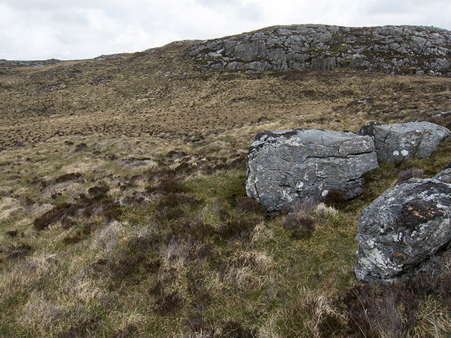
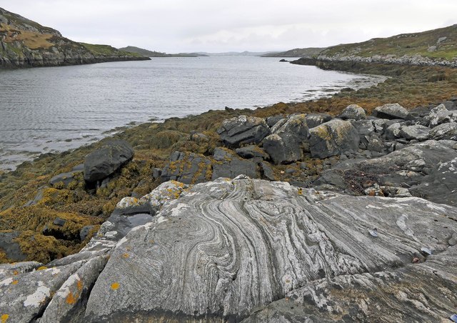
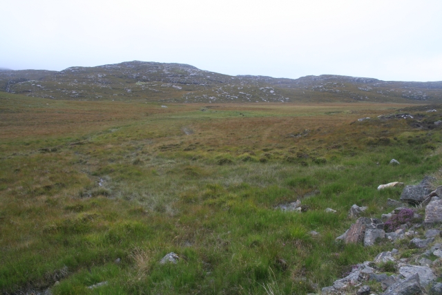
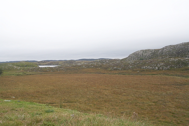
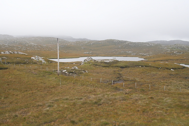
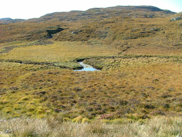
Cnoc Corrach is known for its distinctive shape and rugged terrain. It features steep slopes, rocky outcrops, and scattered patches of grass and heather. The hill is predominantly composed of ancient rocks such as gneiss and granite, which contribute to its unique geological character.

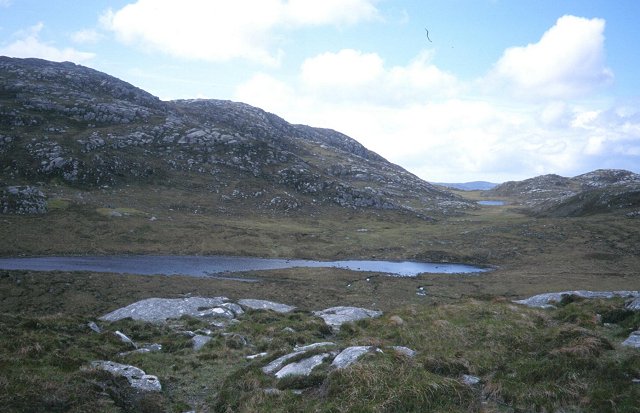
The summit of Cnoc Corrach provides a rewarding experience for hikers and outdoor enthusiasts. From the top, visitors can enjoy panoramic vistas of the surrounding area, including nearby lochs, rivers, and rolling hills. On clear days, it is even possible to catch a glimpse of the towering peaks of the Highlands in the distance.

Access to Cnoc Corrach is typically gained via well-defined footpaths and trails that lead up the hill. These routes may vary in difficulty, but the hill is generally considered accessible to most walkers with a moderate level of fitness. However, it is always recommended to come prepared with suitable clothing, sturdy footwear, and a map or guidebook.

Overall, Cnoc Corrach offers a fantastic opportunity for nature lovers and outdoor adventurers to appreciate the natural beauty and tranquility of the Scottish Highlands. Whether you are looking for a challenging hike or simply wish to enjoy the breathtaking scenery, this hill is definitely worth a visit.

If you have any feedback on the listing, please let us know in the comments section below.
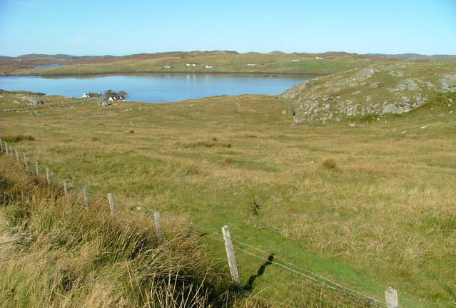
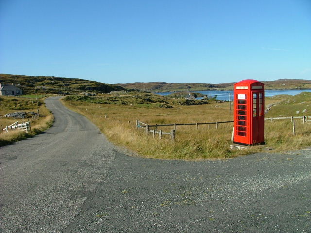
Cnoc Corrach Images

Images are sourced within 2km of 58.183872/-6.8027334 or Grid Reference NB1731. Thanks to Geograph Open Source API. All images are credited.

Telephone Box at Crulabhig Probably it's only the sheep that get calls here?
Telephone Box at Crulabhig
Probably it's only the sheep that get calls here?
Crulivig: the telephone box Pictured during heavy rain, this phone box has Hebridean doors, to keep the wind at bay.
Crulivig: the telephone box
Pictured during heavy rain, this phone box has Hebridean doors, to keep the wind at bay.
Crulivig: postbox № HS2 91 This postbox stands on the opposite side of the road to <a href="https://www.geograph.org.uk/photo/3286743">NB1733 : Crulivig: the telephone box</a>. It is emptied each morning except Sunday at a quarter to nine.
Crulivig: postbox № HS2 91
This postbox stands on the opposite side of the road to NB1733 : Crulivig: the telephone box. It is emptied each morning except Sunday at a quarter to nine.
Boggy and rocky Often in this type of country, getting up onto a bit of high ground reveals a lochan or just a little pool to add a bit of interest. Not here. The high ground is on the lower slopes of Beinn Sgarastaigh, but with a summit height of 98 m, and difficult navigation through peat hags, no one is likely to get excited about it.
Boggy and rocky
Often in this type of country, getting up onto a bit of high ground reveals a lochan or just a little pool to add a bit of interest. Not here. The high ground is on the lower slopes of Beinn Sgarastaigh, but with a summit height of 98 m, and difficult navigation through peat hags, no one is likely to get excited about it.
Abandoned croft house near Lundal
Low cloud over Great Bernera A thin bank of cloud over the sea. Looking northeast from the B8059 near Lundale.
Low cloud over Great Bernera
A thin bank of cloud over the sea. Looking northeast from the B8059 near Lundale.
Rough pasture near Lundale Looking east towards Callanish, across Loch Ròg.
Rough pasture near Lundale
Looking east towards Callanish, across Loch Ròg.
Beinn Scarastaigh from near Lundale A large rocky hill about 1km to the southeast,
Beinn Scarastaigh from near Lundale
A large rocky hill about 1km to the southeast,
Tòb Lundale, Isle of Lewis Tòb Lundale is an inlet on Loch Ròg.  Tòb is a Gaelic word for bay or cove.
Tòb Lundale, Isle of Lewis
Tòb Lundale is an inlet on Loch Ròg. Tòb is a Gaelic word for bay or cove.
Building remains, Lundal, Isle of Lewis Looking towards the head of Tòb Lundale, an inlet on Loch Ròg.
Building remains, Lundal, Isle of Lewis
Looking towards the head of Tòb Lundale, an inlet on Loch Ròg.
Loch Ruadh Under the small but very rocky peak of Teathabhal.
Loch Ruadh
Under the small but very rocky peak of Teathabhal.
Phonebox on the road to Great Bernera
Peat Bogs at the Source of the Lundale River The various streams form the river Lundale which flows north to Tob Lundale and into Loch Rog. Beyond the valley is the hill of Cnoc Mhi Neil.
Peat Bogs at the Source of the Lundale River
The various streams form the river Lundale which flows north to Tob Lundale and into Loch Rog. Beyond the valley is the hill of Cnoc Mhi Neil.
Druim a Chruidh The flat peat bog hides the small Lundale river and several tributaries which flow into Tob Lundale.
Druim a Chruidh
The flat peat bog hides the small Lundale river and several tributaries which flow into Tob Lundale.
Loch Aird A small inland loch that drains into Loch na Faing.
Loch Aird
A small inland loch that drains into Loch na Faing.
Lundale River Beneath Cleite na Cloich Ard.
Lundale River
Beneath Cleite na Cloich Ard.
Grazing Land by the Road to Bearnaraigh (Great Bernera) Looking towards Loch Barraglom and Bearnaraigh.
Grazing Land by the Road to Bearnaraigh (Great Bernera)
Looking towards Loch Barraglom and Bearnaraigh.
Telephone Box at Crulabhig Loch Barraglom in the background.
Telephone Box at Crulabhig
Loch Barraglom in the background.
Show me another place!

Cnoc Corrach is located at Grid Ref: NB1731 (Lat: 58.183872, Lng: -6.8027334)

Unitary Authority: Na h-Eileanan an Iar

Police Authority: Highlands and Islands

What 3 Words

///pizzeria.snap.shades. Near Carloway, Na h-Eileanan Siar

Nearby Locations

Cnoc Corrach

Related Wikis

Eilean Chearstaidh

Eilean Kearstay (Scottish Gaelic: Eilean Chearstaigh) is an uninhabited island in Loch Roag in the Outer Hebrides of Scotland. It lies south east of Great...

Callanish VIII

The Callanish VIII stone setting is one of many megalithic structures around the better-known (and larger) Calanais I on the west coast of the Isle of...

Callanish Stones

The Callanish Stones (or "Callanish I": Scottish Gaelic: Clachan Chalanais or Tursachan Chalanais) are an arrangement of standing stones placed in a cruciform...

Ceabhaigh

Ceabhaigh is a small island in an arm of Loch Ròg on the west coast of Lewis in the Outer Hebrides of Scotland. It is about 25 hectares (62 acres) in extent...

Nearby Amenities

Located within 500m of 58.183872,-6.8027334
Cleite Beag a´Bhraghad
Place: locality
Lat/Long: 58.1797689/-6.803333
The data included in this document is from www.openstreetmap.org. The data is made available under ODbL.

Have you been to Cnoc Corrach?

Leave your review of Cnoc Corrach below (or comments, questions and feedback).