Cnoc Beag Loch a' Chip

Hill, Mountain in Ross-shire

Scotland

Cnoc Beag Loch a' Chip

The road to Bostadh With Siaram Bostadh in mid view on the left side.
The road to Bostadh Credit: John Lucas

Cnoc Beag Loch a' Chip is a prominent hill located in the county of Ross-shire, Scotland. Situated near the village of Aultbea, it forms part of the scenic landscape of the Northwest Highlands. Standing at an elevation of approximately 482 meters (1,581 feet), the hill offers breathtaking views of the surrounding area.

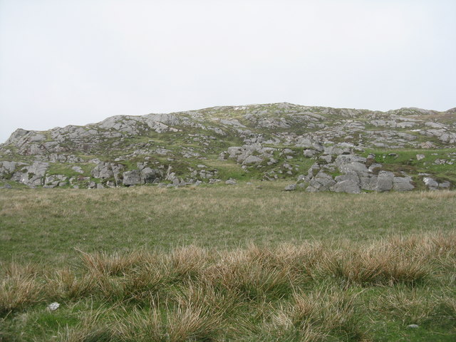
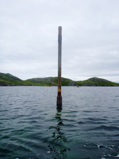
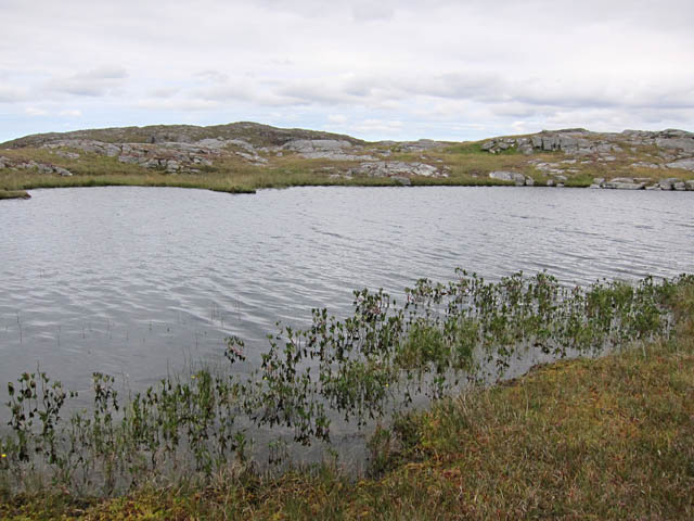
Cnoc Beag Loch a' Chip features a relatively gentle slope, making it accessible for hikers of various skill levels. The terrain consists of heather-covered moorland, rocky outcrops, and scattered patches of woodland. The hill is also home to a small loch, Loch a' Chip, which adds to its natural beauty.

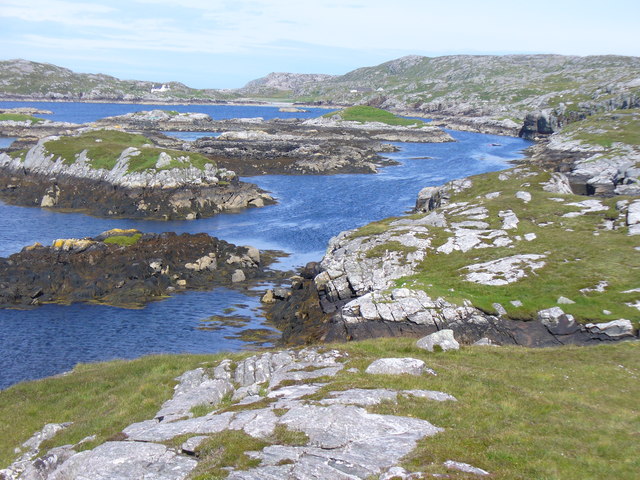
The summit of Cnoc Beag Loch a' Chip provides panoramic vistas, allowing visitors to admire the rugged coastline, nearby mountains, and the sparkling waters of the loch. On clear days, it is even possible to see the distant Isle of Skye and the Outer Hebrides.

The area surrounding the hill is rich in flora and fauna, with a variety of bird species, including golden eagles and peregrine falcons, often spotted soaring above. In addition, red deer, mountain hares, and other wildlife can be encountered while exploring the hillside.

Hiking enthusiasts can access Cnoc Beag Loch a' Chip via several well-marked trails, offering options for both shorter walks and longer, more challenging routes. The hill provides an excellent opportunity for outdoor activities such as hillwalking, birdwatching, and photography, with its stunning landscapes and diverse ecosystems.

If you have any feedback on the listing, please let us know in the comments section below.

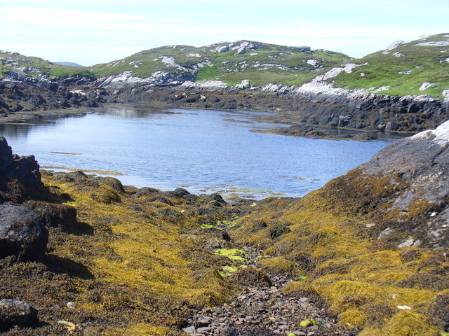
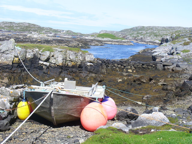
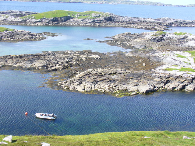
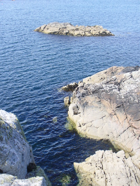
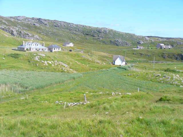
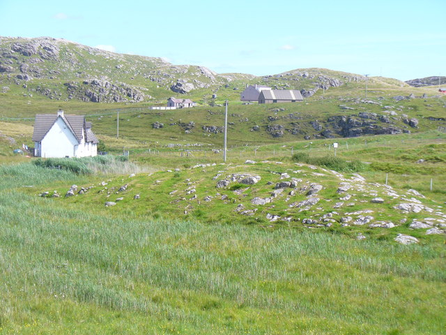
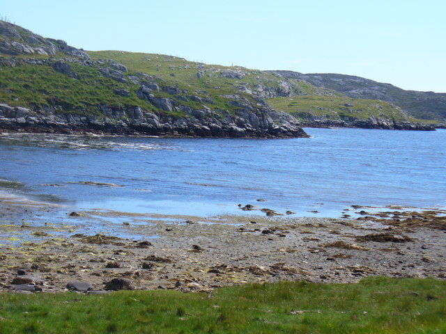
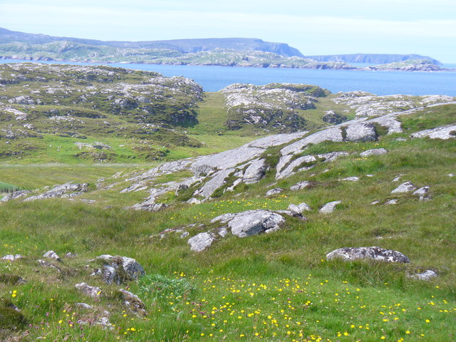
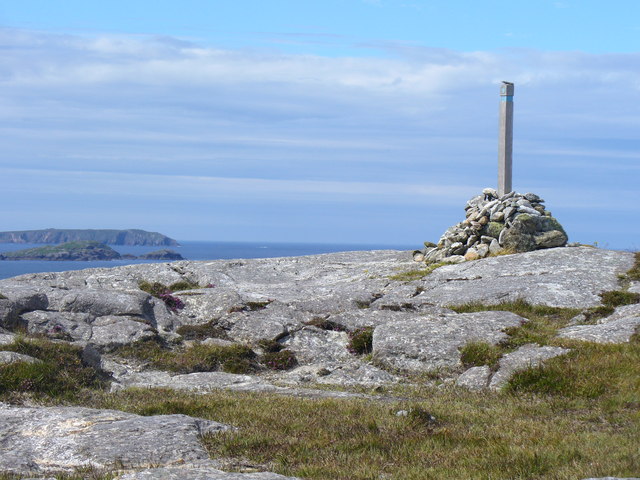
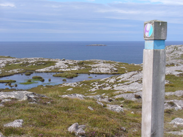
Cnoc Beag Loch a' Chip Images

Images are sourced within 2km of 58.245072/-6.8497008 or Grid Reference NB1538. Thanks to Geograph Open Source API. All images are credited.

The road to Bostadh With Siaram Bostadh in mid view on the left side.
The road to Bostadh
With Siaram Bostadh in mid view on the left side.
Cnoc Ruinagaidh A rocky out crop near the roadend at Bostadh.
Cnoc Ruinagaidh
A rocky out crop near the roadend at Bostadh.
Perch in Caolas Bearnaraigh Beag I was intrigued as I paddled along Caolas Bearnaraigh Beag to see this rusting metal pillar, looking for all the world like a misplaced lamppost. The large-scale map shows rocks here, which certainly weren't obvious from the water in these calm conditions, so this perch fulfils the important purpose of marking the rocks for the benefit of those in boats not of a sufficiently shallow draught to pass over them. There is no light, and I imagine it would be pretty hard to see in the dark, but I suspect that, sea kayakers apart, there is not much other than local traffic here, with skippers who know the water.
Perch in Caolas Bearnaraigh Beag
I was intrigued as I paddled along Caolas Bearnaraigh Beag to see this rusting metal pillar, looking for all the world like a misplaced lamppost. The large-scale map shows rocks here, which certainly weren't obvious from the water in these calm conditions, so this perch fulfils the important purpose of marking the rocks for the benefit of those in boats not of a sufficiently shallow draught to pass over them. There is no light, and I imagine it would be pretty hard to see in the dark, but I suspect that, sea kayakers apart, there is not much other than local traffic here, with skippers who know the water.
Camas Sanndaig Looking across the bay. In the distance is the low island of Pabaigh Mor with the headland of Bhaltos beyond.

A bundle of fencing wire is abandoned in the rocky gully above the sea.
Camas Sanndaig
Looking across the bay. In the distance is the low island of Pabaigh Mor with the headland of Bhaltos beyond. A bundle of fencing wire is abandoned in the rocky gully above the sea.
Sea loch west of Loch Veiravat Although it isn't obvious from here, this is the start of a long channel that leads out to the sea.
Sea loch west of Loch Veiravat
Although it isn't obvious from here, this is the start of a long channel that leads out to the sea.
Small loch on Great Bernera The waymarked path to Bosta passes right by this loch.
Small loch on Great Bernera
The waymarked path to Bosta passes right by this loch.
West coast of Great Bernera A complicated coastline with many interesting features.
West coast of Great Bernera
A complicated coastline with many interesting features.
Coast North of Poll Ula West coast of Great Bernera / Bearnaraigh - with many small skerries close to shore.
<span class="nowrap"><a title="http://www.uigandbernera.com/" rel="nofollow ugc noopener" href="http://www.uigandbernera.com/">Link</a><img style="margin-left:2px;" alt="External link" title="External link - shift click to open in new window" src="https://s1.geograph.org.uk/img/external.png" width="10" height="10"/></span>
Coast North of Poll Ula
West coast of Great Bernera / Bearnaraigh - with many small skerries close to shore. LinkExternal link
Tob Lathach, Bearnaraigh Small tidal lagoon on the west coast of Great Bernera.
<span class="nowrap"><a title="http://www.uigandbernera.com/" rel="nofollow ugc noopener" href="http://www.uigandbernera.com/">Link</a><img style="margin-left:2px;" alt="External link" title="External link - shift click to open in new window" src="https://s1.geograph.org.uk/img/external.png" width="10" height="10"/></span>
Tob Lathach, Bearnaraigh
Small tidal lagoon on the west coast of Great Bernera. LinkExternal link
Tob Liongaim Well-tethered boat, with floats, at the head of a tidal lagoon on Bearnaraigh's western coast.
<span class="nowrap"><a title="http://www.uigandbernera.com/" rel="nofollow ugc noopener" href="http://www.uigandbernera.com/">Link</a><img style="margin-left:2px;" alt="External link" title="External link - shift click to open in new window" src="https://s1.geograph.org.uk/img/external.png" width="10" height="10"/></span>
Tob Liongaim
Well-tethered boat, with floats, at the head of a tidal lagoon on Bearnaraigh's western coast. LinkExternal link
Tob Liongaim, Bearnaraigh Tidal lagoon, skerries and RIB on the west coast of Great Bernera, south of Tobson.
Tob Liongaim, Bearnaraigh
Tidal lagoon, skerries and RIB on the west coast of Great Bernera, south of Tobson.
Skerry in Camas Sanndaig Rocky shore and small islet on the west coast of Great Bernera / Bearnaraigh, south of Tobson.
<span class="nowrap"><a title="http://www.uigandbernera.com/" rel="nofollow ugc noopener" href="http://www.uigandbernera.com/">Link</a><img style="margin-left:2px;" alt="External link" title="External link - shift click to open in new window" src="https://s1.geograph.org.uk/img/external.png" width="10" height="10"/></span>
Skerry in Camas Sanndaig
Rocky shore and small islet on the west coast of Great Bernera / Bearnaraigh, south of Tobson. LinkExternal link
Tobson The oldest inhabited settlement on the island of Great Bernera / Bearnaraigh.
<span class="nowrap"><a title="http://www.uigandbernera.com/" rel="nofollow ugc noopener" href="http://www.uigandbernera.com/">Link</a><img style="margin-left:2px;" alt="External link" title="External link - shift click to open in new window" src="https://s1.geograph.org.uk/img/external.png" width="10" height="10"/></span>
Tobson
The oldest inhabited settlement on the island of Great Bernera / Bearnaraigh. LinkExternal link
Concentric Rock Formation, Tobson Unusual rock pattern showing through the grass at Tobson, the oldest inhabited settlement on Great Bernera / Bearnaraigh.
<span class="nowrap"><a title="http://www.uigandbernera.com/" rel="nofollow ugc noopener" href="http://www.uigandbernera.com/">Link</a><img style="margin-left:2px;" alt="External link" title="External link - shift click to open in new window" src="https://s1.geograph.org.uk/img/external.png" width="10" height="10"/></span>
Concentric Rock Formation, Tobson
Unusual rock pattern showing through the grass at Tobson, the oldest inhabited settlement on Great Bernera / Bearnaraigh. LinkExternal link
Ceann a' Stiogha Head of the tidal lagoon, Tob Bhalasaigh at Tobson on Great Bernera, Bearnaraigh.
<span class="nowrap"><a title="http://www.uigandbernera.com/" rel="nofollow ugc noopener" href="http://www.uigandbernera.com/">Link</a><img style="margin-left:2px;" alt="External link" title="External link - shift click to open in new window" src="https://s1.geograph.org.uk/img/external.png" width="10" height="10"/></span>
Ceann a' Stiogha
Head of the tidal lagoon, Tob Bhalasaigh at Tobson on Great Bernera, Bearnaraigh. LinkExternal link
Beinn an Toib On the grassy and rocky hill above Tobson, Great Bernera / Bearnaraigh with views across the sound towards Gallan Head.
<span class="nowrap"><a title="http://www.uigandbernera.com/" rel="nofollow ugc noopener" href="http://www.uigandbernera.com/">Link</a><img style="margin-left:2px;" alt="External link" title="External link - shift click to open in new window" src="https://s1.geograph.org.uk/img/external.png" width="10" height="10"/></span>
Beinn an Toib
On the grassy and rocky hill above Tobson, Great Bernera / Bearnaraigh with views across the sound towards Gallan Head. LinkExternal link
Cairn on Carnan Gibegeo With wooden marker post on the Tobson-Bosta path on Great Bernera's north-west coast.
<span class="nowrap"><a title="http://www.uigandbernera.com/" rel="nofollow ugc noopener" href="http://www.uigandbernera.com/">Link</a><img style="margin-left:2px;" alt="External link" title="External link - shift click to open in new window" src="https://s1.geograph.org.uk/img/external.png" width="10" height="10"/></span>
Cairn on Carnan Gibegeo
With wooden marker post on the Tobson-Bosta path on Great Bernera's north-west coast. LinkExternal link
Stiogha Chnap Marker post on a cairn with view across the north-west corner of Great Bernera / Bearnaraigh.
<span class="nowrap"><a title="http://www.uigandbernera.com/" rel="nofollow ugc noopener" href="http://www.uigandbernera.com/">Link</a><img style="margin-left:2px;" alt="External link" title="External link - shift click to open in new window" src="https://s1.geograph.org.uk/img/external.png" width="10" height="10"/></span>
Stiogha Chnap
Marker post on a cairn with view across the north-west corner of Great Bernera / Bearnaraigh. LinkExternal link
Show me another place!

Cnoc Beag Loch a' Chip is located at Grid Ref: NB1538 (Lat: 58.245072, Lng: -6.8497008)

Unitary Authority: Na h-Eileanan an Iar

Police Authority: Highlands and Islands

What 3 Words

///suppers.emailed.prowling. Near Carloway, Na h-Eileanan Siar

Related Wikis

Bernera Riot

The Bernera Riot occurred in 1874, on the island of Great Bernera, in Scotland in response to the Highland Clearances. The use of the term 'Bernera Riot...

Great Bernera

Great Bernera (; Scottish Gaelic: Beàrnaraigh Mòr), often known just as Bernera (Scottish Gaelic: Beàrnaraigh), is an island and community in the Outer...

Breaclete

Breacleit (or Roulanish; Scottish Gaelic: Breacleit; Old Norse: Breiðiklettr) is the central village on Great Bernera in the Outer Hebrides, Scotland....

Little Bernera

Little Bernera (Scottish Gaelic: Beàrnaraigh Beag) is a small island situated off the west coast of the Isle of Lewis in the Outer Hebrides.Little Bernera...

Nearby Amenities

Located within 500m of 58.245072,-6.8497008
Barrier: cattle_grid
Source: Bing
Lat/Long: 58.2433863/-6.8540232
Passing Place
Lat/Long: 58.2476411/-6.8545505
Passing Place
Lat/Long: 58.2461901/-6.8566128
Bus Stop
Croir, Road End
Naptan AtcoCode: 60101256
Naptan NaptanCode: 94727958
Lat/Long: 58.245124/-6.855168
Passing Place
Lat/Long: 58.2417082/-6.8538002
Passing Place
Lat/Long: 58.2448009/-6.8549747
Passing Place
Lat/Long: 58.2459473/-6.8542098
Passing Place
Lat/Long: 58.2465303/-6.8536707
Power: pole
Lat/Long: 58.2453838/-6.8543709
Power: pole
Lat/Long: 58.2456308/-6.8542582
Power: pole
Lat/Long: 58.2464425/-6.8539122
Power: pole
Lat/Long: 58.243296/-6.8530861
Power: pole
Lat/Long: 58.2437759/-6.8526999
Power: pole
Lat/Long: 58.2443971/-6.8533356
Power: pole
Lat/Long: 58.2450139/-6.8539712
Power: pole
Lat/Long: 58.24248/-6.853762
Power: pole
Lat/Long: 58.241585/-6.8540195
Power: pole
Lat/Long: 58.2482845/-6.8539552
Power: pole
Lat/Long: 58.2475463/-6.853931
The data included in this document is from www.openstreetmap.org. The data is made available under ODbL.

Have you been to Cnoc Beag Loch a' Chip?

Leave your review of Cnoc Beag Loch a' Chip below (or comments, questions and feedback).