Loch a' Chip

Lake, Pool, Pond, Freshwater Marsh in Ross-shire

Scotland

Loch a' Chip

The road to Bostadh With Siaram Bostadh in mid view on the left side.
The road to Bostadh Credit: John Lucas

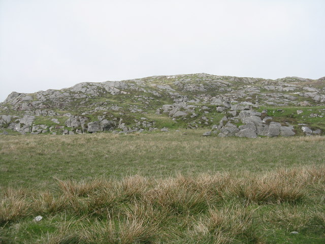
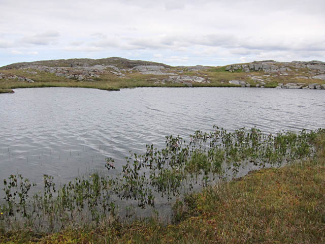
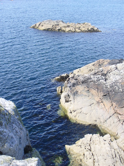
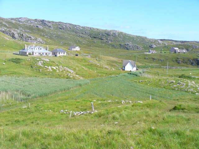
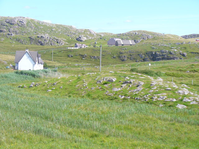
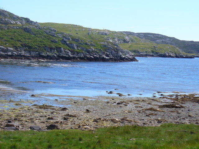
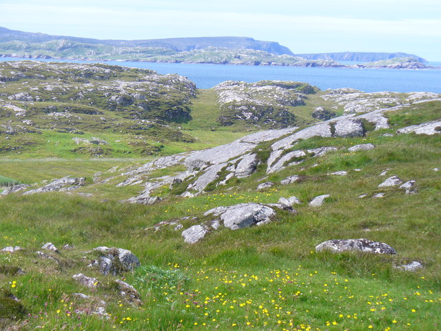
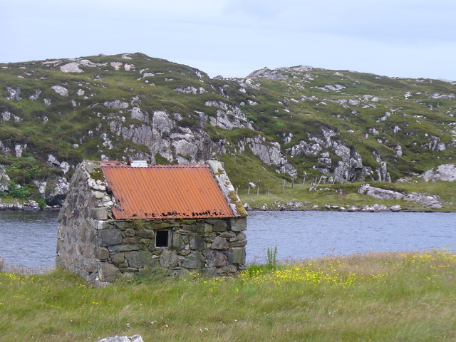
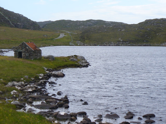
Loch a' Chip, located in Ross-shire, Scotland, is a picturesque freshwater loch surrounded by breathtaking natural beauty. This tranquil body of water is often referred to as a lake, pool, pond, or freshwater marsh due to its diverse characteristics.

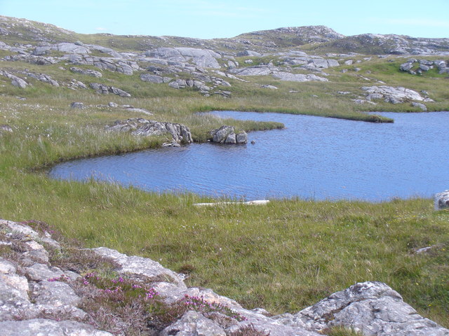
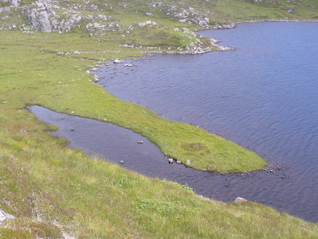
Covering an area of approximately 10 acres, Loch a' Chip is nestled amidst rolling hills and dense forests. Its crystal-clear waters are fed by several small streams and springs, creating a thriving ecosystem. The loch's depth varies, with the deepest parts reaching around 20 feet, providing a suitable habitat for a wide array of aquatic flora and fauna.

The lush vegetation surrounding Loch a' Chip further enhances its charm. The area is home to various species of water lilies, reeds, and rushes, which not only add to the aesthetic appeal but also serve as important nesting sites for numerous bird species. Visitors can often spot graceful swans, ducks, and herons gliding across the calm waters or perched on the shore.

The loch is also a popular spot for fishing enthusiasts. It is known for its abundant population of brown trout, which provides an exciting challenge for anglers. Loch a' Chip offers a peaceful and serene environment, perfect for those seeking solitude or a quiet day of fishing.

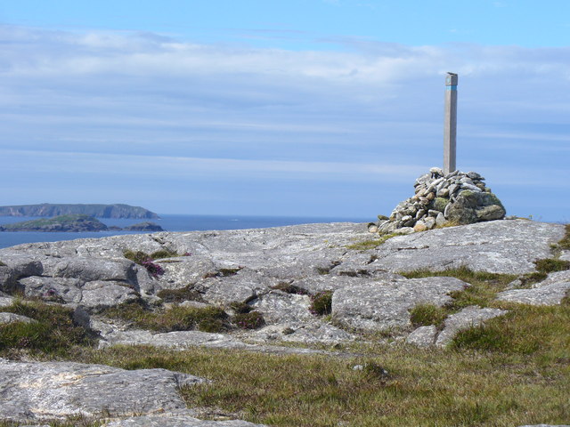
Nature lovers and outdoor enthusiasts are drawn to Loch a' Chip for its serene atmosphere and stunning natural surroundings. Whether it's birdwatching, fishing, or simply taking in the tranquil beauty, Loch a' Chip offers a captivating experience for all who visit.

If you have any feedback on the listing, please let us know in the comments section below.

Loch a' Chip Images

Images are sourced within 2km of 58.247279/-6.8482112 or Grid Reference NB1538. Thanks to Geograph Open Source API. All images are credited.

The road to Bostadh With Siaram Bostadh in mid view on the left side.
The road to Bostadh
With Siaram Bostadh in mid view on the left side.
Cnoc Ruinagaidh A rocky out crop near the roadend at Bostadh.
Cnoc Ruinagaidh
A rocky out crop near the roadend at Bostadh.
Perch in Caolas Bearnaraigh Beag I was intrigued as I paddled along Caolas Bearnaraigh Beag to see this rusting metal pillar, looking for all the world like a misplaced lamppost. The large-scale map shows rocks here, which certainly weren't obvious from the water in these calm conditions, so this perch fulfils the important purpose of marking the rocks for the benefit of those in boats not of a sufficiently shallow draught to pass over them. There is no light, and I imagine it would be pretty hard to see in the dark, but I suspect that, sea kayakers apart, there is not much other than local traffic here, with skippers who know the water.
Perch in Caolas Bearnaraigh Beag
I was intrigued as I paddled along Caolas Bearnaraigh Beag to see this rusting metal pillar, looking for all the world like a misplaced lamppost. The large-scale map shows rocks here, which certainly weren't obvious from the water in these calm conditions, so this perch fulfils the important purpose of marking the rocks for the benefit of those in boats not of a sufficiently shallow draught to pass over them. There is no light, and I imagine it would be pretty hard to see in the dark, but I suspect that, sea kayakers apart, there is not much other than local traffic here, with skippers who know the water.
East side of Bearnaraigh Beag Setting out from Bostadh on a tour of the islands north of Great Bernera, we quickly passed through Caolas Bearnaraigh and onto the east coast of Little Bernera (Bearnaraigh Beag) and headed for Seildeim (the skerry on the right). This side of the island being low and sheltered, there was not a lot to detain us - the beach came too early in the day for a stop and we were eager to make our way out to islands with more exciting cliff and cave scenery.
East side of Bearnaraigh Beag
Setting out from Bostadh on a tour of the islands north of Great Bernera, we quickly passed through Caolas Bearnaraigh and onto the east coast of Little Bernera (Bearnaraigh Beag) and headed for Seildeim (the skerry on the right). This side of the island being low and sheltered, there was not a lot to detain us - the beach came too early in the day for a stop and we were eager to make our way out to islands with more exciting cliff and cave scenery.
Camas Sanndaig Looking across the bay. In the distance is the low island of Pabaigh Mor with the headland of Bhaltos beyond.

A bundle of fencing wire is abandoned in the rocky gully above the sea.
Camas Sanndaig
Looking across the bay. In the distance is the low island of Pabaigh Mor with the headland of Bhaltos beyond. A bundle of fencing wire is abandoned in the rocky gully above the sea.
Small loch on Great Bernera The waymarked path to Bosta passes right by this loch.
Small loch on Great Bernera
The waymarked path to Bosta passes right by this loch.
Skerry in Camas Sanndaig Rocky shore and small islet on the west coast of Great Bernera / Bearnaraigh, south of Tobson.
<span class="nowrap"><a title="http://www.uigandbernera.com/" rel="nofollow ugc noopener" href="http://www.uigandbernera.com/">Link</a><img style="margin-left:2px;" alt="External link" title="External link - shift click to open in new window" src="https://s1.geograph.org.uk/img/external.png" width="10" height="10"/></span>
Skerry in Camas Sanndaig
Rocky shore and small islet on the west coast of Great Bernera / Bearnaraigh, south of Tobson. LinkExternal link
Tobson The oldest inhabited settlement on the island of Great Bernera / Bearnaraigh.
<span class="nowrap"><a title="http://www.uigandbernera.com/" rel="nofollow ugc noopener" href="http://www.uigandbernera.com/">Link</a><img style="margin-left:2px;" alt="External link" title="External link - shift click to open in new window" src="https://s1.geograph.org.uk/img/external.png" width="10" height="10"/></span>
Tobson
The oldest inhabited settlement on the island of Great Bernera / Bearnaraigh. LinkExternal link
Concentric Rock Formation, Tobson Unusual rock pattern showing through the grass at Tobson, the oldest inhabited settlement on Great Bernera / Bearnaraigh.
<span class="nowrap"><a title="http://www.uigandbernera.com/" rel="nofollow ugc noopener" href="http://www.uigandbernera.com/">Link</a><img style="margin-left:2px;" alt="External link" title="External link - shift click to open in new window" src="https://s1.geograph.org.uk/img/external.png" width="10" height="10"/></span>
Concentric Rock Formation, Tobson
Unusual rock pattern showing through the grass at Tobson, the oldest inhabited settlement on Great Bernera / Bearnaraigh. LinkExternal link
Ceann a' Stiogha Head of the tidal lagoon, Tob Bhalasaigh at Tobson on Great Bernera, Bearnaraigh.
<span class="nowrap"><a title="http://www.uigandbernera.com/" rel="nofollow ugc noopener" href="http://www.uigandbernera.com/">Link</a><img style="margin-left:2px;" alt="External link" title="External link - shift click to open in new window" src="https://s1.geograph.org.uk/img/external.png" width="10" height="10"/></span>
Ceann a' Stiogha
Head of the tidal lagoon, Tob Bhalasaigh at Tobson on Great Bernera, Bearnaraigh. LinkExternal link
Beinn an Toib On the grassy and rocky hill above Tobson, Great Bernera / Bearnaraigh with views across the sound towards Gallan Head.
<span class="nowrap"><a title="http://www.uigandbernera.com/" rel="nofollow ugc noopener" href="http://www.uigandbernera.com/">Link</a><img style="margin-left:2px;" alt="External link" title="External link - shift click to open in new window" src="https://s1.geograph.org.uk/img/external.png" width="10" height="10"/></span>
Beinn an Toib
On the grassy and rocky hill above Tobson, Great Bernera / Bearnaraigh with views across the sound towards Gallan Head. LinkExternal link
Cairn on Carnan Gibegeo With wooden marker post on the Tobson-Bosta path on Great Bernera's north-west coast.
<span class="nowrap"><a title="http://www.uigandbernera.com/" rel="nofollow ugc noopener" href="http://www.uigandbernera.com/">Link</a><img style="margin-left:2px;" alt="External link" title="External link - shift click to open in new window" src="https://s1.geograph.org.uk/img/external.png" width="10" height="10"/></span>
Cairn on Carnan Gibegeo
With wooden marker post on the Tobson-Bosta path on Great Bernera's north-west coast. LinkExternal link
Loch Talamn Mhic Mhamein Moorland lochan above the north-west coast of Great Bernera / Bearnaraigh.
<span class="nowrap"><a title="http://www.uigandbernera.com/" rel="nofollow ugc noopener" href="http://www.uigandbernera.com/">Link</a><img style="margin-left:2px;" alt="External link" title="External link - shift click to open in new window" src="https://s1.geograph.org.uk/img/external.png" width="10" height="10"/></span>
Loch Talamn Mhic Mhamein
Moorland lochan above the north-west coast of Great Bernera / Bearnaraigh. LinkExternal link
Spit on Loch a' Sgail Grassy spit at the northern end of this loch on Great Bernera / Bearnaraigh.
<span class="nowrap"><a title="http://www.uigandbernera.com/" rel="nofollow ugc noopener" href="http://www.uigandbernera.com/">Link</a><img style="margin-left:2px;" alt="External link" title="External link - shift click to open in new window" src="https://s1.geograph.org.uk/img/external.png" width="10" height="10"/></span>
Spit on Loch a' Sgail
Grassy spit at the northern end of this loch on Great Bernera / Bearnaraigh. LinkExternal link
Bothy, Loch na Muilne Fishermen's bothy on the east shore of freshwater Loch na Muilne / Mill Loch on Great Bernera / Bearnaraigh.
<span class="nowrap"><a title="http://www.uigandbernera.com/" rel="nofollow ugc noopener" href="http://www.uigandbernera.com/">Link</a><img style="margin-left:2px;" alt="External link" title="External link - shift click to open in new window" src="https://s1.geograph.org.uk/img/external.png" width="10" height="10"/></span>
Bothy, Loch na Muilne
Fishermen's bothy on the east shore of freshwater Loch na Muilne / Mill Loch on Great Bernera / Bearnaraigh. LinkExternal link
Loch na Muilne Freshwater loch (Mill Loch), with fishing bothy, on Great Bernera / Bearnaraidh.
<span class="nowrap"><a title="http://www.uigandbernera.com/" rel="nofollow ugc noopener" href="http://www.uigandbernera.com/">Link</a><img style="margin-left:2px;" alt="External link" title="External link - shift click to open in new window" src="https://s1.geograph.org.uk/img/external.png" width="10" height="10"/></span>
Loch na Muilne
Freshwater loch (Mill Loch), with fishing bothy, on Great Bernera / Bearnaraidh. LinkExternal link
Loch Geal Freshwater loch in the north of Great Bernera / Bearnaraigh.
<span class="nowrap"><a title="http://www.uigandbernera.com/" rel="nofollow ugc noopener" href="http://www.uigandbernera.com/">Link</a><img style="margin-left:2px;" alt="External link" title="External link - shift click to open in new window" src="https://s1.geograph.org.uk/img/external.png" width="10" height="10"/></span>
Loch Geal
Freshwater loch in the north of Great Bernera / Bearnaraigh. LinkExternal link
Loch Geal, South End A wall has been built at the end of this small freshwater loch on Great Bernera / Bearnaraigh.
<span class="nowrap"><a title="http://www.uigandbernera.com/" rel="nofollow ugc noopener" href="http://www.uigandbernera.com/">Link</a><img style="margin-left:2px;" alt="External link" title="External link - shift click to open in new window" src="https://s1.geograph.org.uk/img/external.png" width="10" height="10"/></span>
Loch Geal, South End
A wall has been built at the end of this small freshwater loch on Great Bernera / Bearnaraigh. LinkExternal link
Show me another place!

Loch a' Chip is located at Grid Ref: NB1538 (Lat: 58.247279, Lng: -6.8482112)

Unitary Authority: Na h-Eileanan an Iar

Police Authority: Highlands and Islands

What 3 Words

///worth.thatched.handrail. Near Carloway, Na h-Eileanan Siar

Related Wikis

Bernera Riot

The Bernera Riot occurred in 1874, on the island of Great Bernera, in Scotland in response to the Highland Clearances. The use of the term 'Bernera Riot...

Great Bernera

Great Bernera (; Scottish Gaelic: Beàrnaraigh Mòr), often known just as Bernera (Scottish Gaelic: Beàrnaraigh), is an island and community in the Outer...

Breaclete

Breacleit (or Roulanish; Scottish Gaelic: Breacleit; Old Norse: Breiðiklettr) is the central village on Great Bernera in the Outer Hebrides, Scotland....

Little Bernera

Little Bernera (Scottish Gaelic: Beàrnaraigh Beag) is a small island situated off the west coast of the Isle of Lewis in the Outer Hebrides. Little Bernera...

Related Videos

Outer Hebrides, Bostadh Beach

Bostadh Beach, Isle of Lewis, June 19th 2021.

Outer Hebrides, Scotland, June 18th 2021

Ferry from Ullapool to Stornoway, car from Isle of Harris to Isle of Lewis and finally ending at Bosta Beach,

Nearby Amenities

Located within 500m of 58.247279,-6.8482112
Passing Place
Lat/Long: 58.2476411/-6.8545505
Passing Place
Lat/Long: 58.2492163/-6.8546363
Barrier: cattle_grid
Source: Bing
Lat/Long: 58.2498147/-6.8541833
Bus Stop
Croir, Road End
Naptan AtcoCode: 60101256
Naptan NaptanCode: 94727958
Lat/Long: 58.245124/-6.855168
Passing Place
Lat/Long: 58.2448009/-6.8549747
Passing Place
Lat/Long: 58.2459473/-6.8542098
Passing Place
Lat/Long: 58.2465303/-6.8536707
Power: pole
Lat/Long: 58.2453838/-6.8543709
Power: pole
Lat/Long: 58.2456308/-6.8542582
Power: pole
Lat/Long: 58.2464425/-6.8539122
Power: pole
Lat/Long: 58.2437759/-6.8526999
Power: pole
Lat/Long: 58.2443971/-6.8533356
Power: pole
Lat/Long: 58.2450139/-6.8539712
Power: pole
Lat/Long: 58.2482845/-6.8539552
Power: pole
Lat/Long: 58.2475463/-6.853931
The data included in this document is from www.openstreetmap.org. The data is made available under ODbL.

Have you been to Loch a' Chip?

Leave your review of Loch a' Chip below (or comments, questions and feedback).