Geodha Ghainmhich

Coastal Feature, Headland, Point in Ross-shire

Scotland

Geodha Ghainmhich

Tobson The oldest inhabited settlement on the island of Great Bernera / Bearnaraigh.
<span class="nowrap"><a title="http://www.uigandbernera.com/" rel="nofollow ugc noopener" href="http://www.uigandbernera.com/">Link</a><img style="margin-left:2px;" alt="External link" title="External link - shift click to open in new window" src="https://s1.geograph.org.uk/img/external.png" width="10" height="10"/></span>
Tobson Credit: Colin Smith

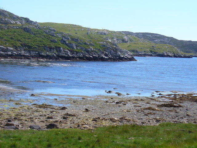
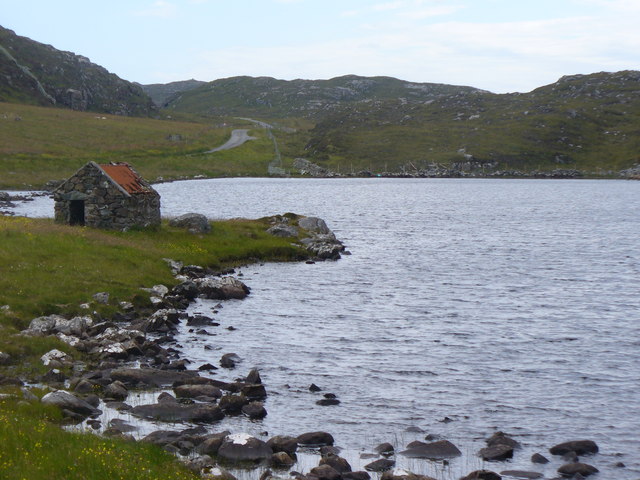
Geodha Ghainmhich, also known as Geodha Ghàinmheich, is a stunning coastal feature located in Ross-shire, Scotland. It is a prominent headland that stretches out into the North Atlantic Ocean, forming a distinct point on the coastline.

The name Geodha Ghainmhich is derived from Scottish Gaelic, with "Geodha" meaning "bay" and "Ghainmhich" referring to a specific clan or family name. This suggests a historical connection to the area, possibly indicating a settlement or important site in the past.

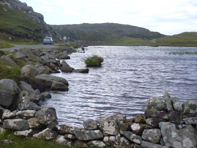
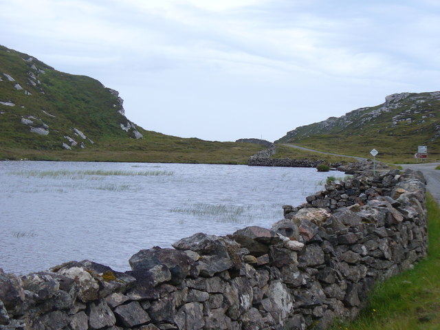
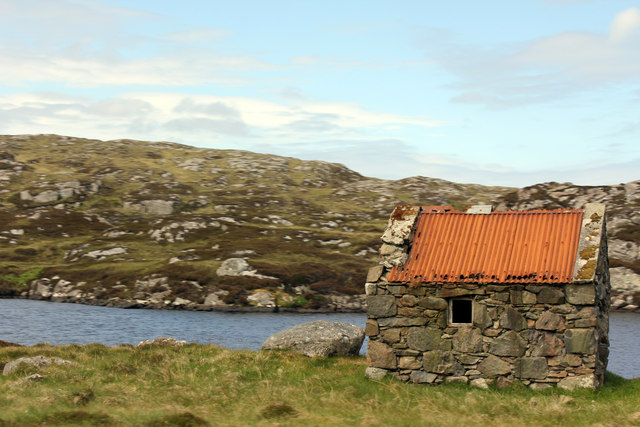
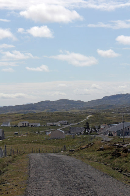
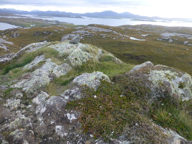
The headland itself is characterized by rugged cliffs and dramatic rock formations, which have been shaped by the relentless forces of wind and waves over centuries. These geological features create a picturesque and awe-inspiring landscape, attracting visitors from near and far.

Geodha Ghainmhich offers breathtaking views of the surrounding sea and coastline, making it a popular spot for nature enthusiasts and photographers. The crashing waves, sea spray, and occasional seabirds add to the wild and untamed atmosphere of the place.

Due to its exposed position on the coast, Geodha Ghainmhich can experience unpredictable weather conditions, including strong winds and rough seas. Visitors are advised to take necessary precautions and be mindful of their safety when exploring the area.

In summary, Geodha Ghainmhich is a remarkable headland, forming a distinctive point along the Ross-shire coastline. Its rugged cliffs, unique rock formations, and stunning views make it a must-visit destination for those seeking natural beauty and tranquility.

If you have any feedback on the listing, please let us know in the comments section below.

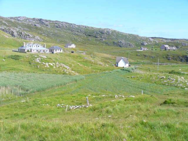
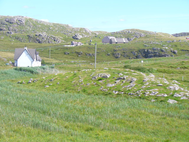
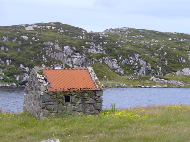
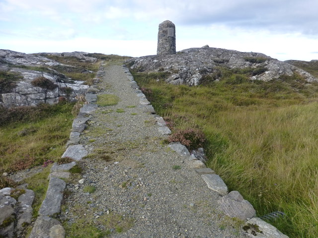
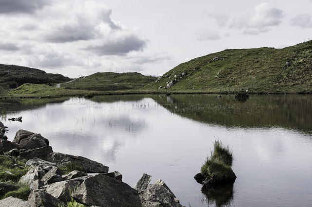
Geodha Ghainmhich Images

Images are sourced within 2km of 58.245901/-6.8425631 or Grid Reference NB1538. Thanks to Geograph Open Source API. All images are credited.

Tobson The oldest inhabited settlement on the island of Great Bernera / Bearnaraigh.
<span class="nowrap"><a title="http://www.uigandbernera.com/" rel="nofollow ugc noopener" href="http://www.uigandbernera.com/">Link</a><img style="margin-left:2px;" alt="External link" title="External link - shift click to open in new window" src="https://s1.geograph.org.uk/img/external.png" width="10" height="10"/></span>
Tobson
The oldest inhabited settlement on the island of Great Bernera / Bearnaraigh. LinkExternal link
Concentric Rock Formation, Tobson Unusual rock pattern showing through the grass at Tobson, the oldest inhabited settlement on Great Bernera / Bearnaraigh.
<span class="nowrap"><a title="http://www.uigandbernera.com/" rel="nofollow ugc noopener" href="http://www.uigandbernera.com/">Link</a><img style="margin-left:2px;" alt="External link" title="External link - shift click to open in new window" src="https://s1.geograph.org.uk/img/external.png" width="10" height="10"/></span>
Concentric Rock Formation, Tobson
Unusual rock pattern showing through the grass at Tobson, the oldest inhabited settlement on Great Bernera / Bearnaraigh. LinkExternal link
Ceann a' Stiogha Head of the tidal lagoon, Tob Bhalasaigh at Tobson on Great Bernera, Bearnaraigh.
<span class="nowrap"><a title="http://www.uigandbernera.com/" rel="nofollow ugc noopener" href="http://www.uigandbernera.com/">Link</a><img style="margin-left:2px;" alt="External link" title="External link - shift click to open in new window" src="https://s1.geograph.org.uk/img/external.png" width="10" height="10"/></span>
Ceann a' Stiogha
Head of the tidal lagoon, Tob Bhalasaigh at Tobson on Great Bernera, Bearnaraigh. LinkExternal link
Bothy, Loch na Muilne Fishermen's bothy on the east shore of freshwater Loch na Muilne / Mill Loch on Great Bernera / Bearnaraigh.
<span class="nowrap"><a title="http://www.uigandbernera.com/" rel="nofollow ugc noopener" href="http://www.uigandbernera.com/">Link</a><img style="margin-left:2px;" alt="External link" title="External link - shift click to open in new window" src="https://s1.geograph.org.uk/img/external.png" width="10" height="10"/></span>
Bothy, Loch na Muilne
Fishermen's bothy on the east shore of freshwater Loch na Muilne / Mill Loch on Great Bernera / Bearnaraigh. LinkExternal link
Loch na Muilne Freshwater loch (Mill Loch), with fishing bothy, on Great Bernera / Bearnaraidh.
<span class="nowrap"><a title="http://www.uigandbernera.com/" rel="nofollow ugc noopener" href="http://www.uigandbernera.com/">Link</a><img style="margin-left:2px;" alt="External link" title="External link - shift click to open in new window" src="https://s1.geograph.org.uk/img/external.png" width="10" height="10"/></span>
Loch na Muilne
Freshwater loch (Mill Loch), with fishing bothy, on Great Bernera / Bearnaraidh. LinkExternal link
Loch Geal Freshwater loch in the north of Great Bernera / Bearnaraigh.
<span class="nowrap"><a title="http://www.uigandbernera.com/" rel="nofollow ugc noopener" href="http://www.uigandbernera.com/">Link</a><img style="margin-left:2px;" alt="External link" title="External link - shift click to open in new window" src="https://s1.geograph.org.uk/img/external.png" width="10" height="10"/></span>
Loch Geal
Freshwater loch in the north of Great Bernera / Bearnaraigh. LinkExternal link
Loch Geal, South End A wall has been built at the end of this small freshwater loch on Great Bernera / Bearnaraigh.
<span class="nowrap"><a title="http://www.uigandbernera.com/" rel="nofollow ugc noopener" href="http://www.uigandbernera.com/">Link</a><img style="margin-left:2px;" alt="External link" title="External link - shift click to open in new window" src="https://s1.geograph.org.uk/img/external.png" width="10" height="10"/></span>
Loch Geal, South End
A wall has been built at the end of this small freshwater loch on Great Bernera / Bearnaraigh. LinkExternal link
Loch Tana Small freshwater loch on Great Bernera / Bearnaraigh with a single track road running alongside it.
<span class="nowrap"><a title="http://www.uigandbernera.com/" rel="nofollow ugc noopener" href="http://www.uigandbernera.com/">Link</a><img style="margin-left:2px;" alt="External link" title="External link - shift click to open in new window" src="https://s1.geograph.org.uk/img/external.png" width="10" height="10"/></span>
Loch Tana
Small freshwater loch on Great Bernera / Bearnaraigh with a single track road running alongside it. LinkExternal link
Loch Tana from the South Freshwater loch with drystane dyke and single track road, Great Bernera / Bearnaraigh.
<span class="nowrap"><a title="http://www.uigandbernera.com/" rel="nofollow ugc noopener" href="http://www.uigandbernera.com/">Link</a><img style="margin-left:2px;" alt="External link" title="External link - shift click to open in new window" src="https://s1.geograph.org.uk/img/external.png" width="10" height="10"/></span>
Loch Tana from the South
Freshwater loch with drystane dyke and single track road, Great Bernera / Bearnaraigh. LinkExternal link
Loch Ruig Sanndabhat Small and reedy freshwater loch below the slopes of Beinn Breacleit, Great Bernera / Bearnaraigh.
<span class="nowrap"><a title="http://www.uigandbernera.com/" rel="nofollow ugc noopener" href="http://www.uigandbernera.com/">Link</a><img style="margin-left:2px;" alt="External link" title="External link - shift click to open in new window" src="https://s1.geograph.org.uk/img/external.png" width="10" height="10"/></span>
Loch Ruig Sanndabhat
Small and reedy freshwater loch below the slopes of Beinn Breacleit, Great Bernera / Bearnaraigh. LinkExternal link
Crofters' Memorial Cairn, Great Bernera Erected in memory of April 1874 when local crofters marched to Lews Castle in Stornoway. They were protesting to Sir James Matheson that they had received eviction notices after using the moorland for centuries. The gentry wanted to use it for leisure / sport.
<span class="nowrap"><a title="http://www.uigandbernera.com/" rel="nofollow ugc noopener" href="http://www.uigandbernera.com/">Link</a><img style="margin-left:2px;" alt="External link" title="External link - shift click to open in new window" src="https://s1.geograph.org.uk/img/external.png" width="10" height="10"/></span>
Crofters' Memorial Cairn, Great Bernera
Erected in memory of April 1874 when local crofters marched to Lews Castle in Stornoway. They were protesting to Sir James Matheson that they had received eviction notices after using the moorland for centuries. The gentry wanted to use it for leisure / sport. LinkExternal link
Lochan Below Beinn Breacleit Reedy lochan with rocky hillside, south-east of the Crofters' Memorial on Great Bernera / Bearnaraigh.
<span class="nowrap"><a title="http://www.uigandbernera.com/" rel="nofollow ugc noopener" href="http://www.uigandbernera.com/">Link</a><img style="margin-left:2px;" alt="External link" title="External link - shift click to open in new window" src="https://s1.geograph.org.uk/img/external.png" width="10" height="10"/></span>
Lochan Below Beinn Breacleit
Reedy lochan with rocky hillside, south-east of the Crofters' Memorial on Great Bernera / Bearnaraigh. LinkExternal link
Shed by Loch na Muilne
Road into Breacleit from Bostadh
Breacleit explosion sunset
Middle Shalaval On the island of Great Bernera with George Morl and its high point a TuMP called Middle Shalaval, at 87 metres and a P87 hill.  This is a view back towards some of the hills of Lewis.
Middle Shalaval
On the island of Great Bernera with George Morl and its high point a TuMP called Middle Shalaval, at 87 metres and a P87 hill. This is a view back towards some of the hills of Lewis.
Path To Memorial Cairn This cairn was erected in 1992 to commemorate the Bernera Riot of 1874, which ultimately led to the passing of the Crofters Act.
Path To Memorial Cairn
This cairn was erected in 1992 to commemorate the Bernera Riot of 1874, which ultimately led to the passing of the Crofters Act.
Loch Tana
Loch Tana
Show me another place!

Geodha Ghainmhich is located at Grid Ref: NB1538 (Lat: 58.245901, Lng: -6.8425631)

Unitary Authority: Na h-Eileanan an Iar

Police Authority: Highlands and Islands

What 3 Words

///wrong.smashes.polishing. Near Carloway, Na h-Eileanan Siar

Related Wikis

Breaclete

Breacleit (or Roulanish; Scottish Gaelic: Breacleit; Old Norse: Breiðiklettr) is the central village on Great Bernera in the Outer Hebrides, Scotland....

Great Bernera

Great Bernera (; Scottish Gaelic: Beàrnaraigh Mòr), often known just as Bernera (Scottish Gaelic: Beàrnaraigh), is an island and community in the Outer...

Bernera Riot

The Bernera Riot occurred in 1874, on the island of Great Bernera, in Scotland in response to the Highland Clearances. The use of the term 'Bernera Riot...

Little Bernera

Little Bernera (Scottish Gaelic: Beàrnaraigh Beag) is a small island situated off the west coast of the Isle of Lewis in the Outer Hebrides.Little Bernera...

Have you been to Geodha Ghainmhich?

Leave your review of Geodha Ghainmhich below (or comments, questions and feedback).