Geodha na Crìch

Coastal Feature, Headland, Point in Ross-shire

Scotland

Geodha na Crìch

Old hardstandings at Tob Blar Meadha Abandoned lobster loading hardstandings at the lobster pond.
Old hardstandings at Tob Blar Meadha Credit: Gus Macdonald

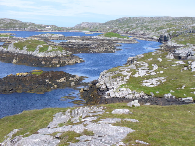
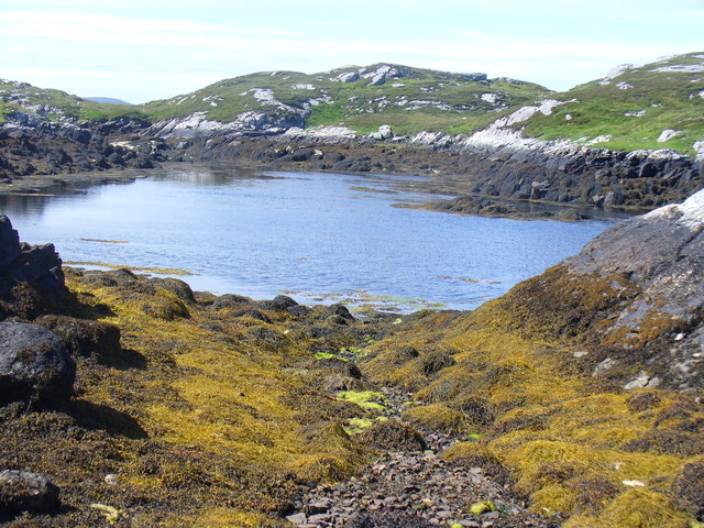
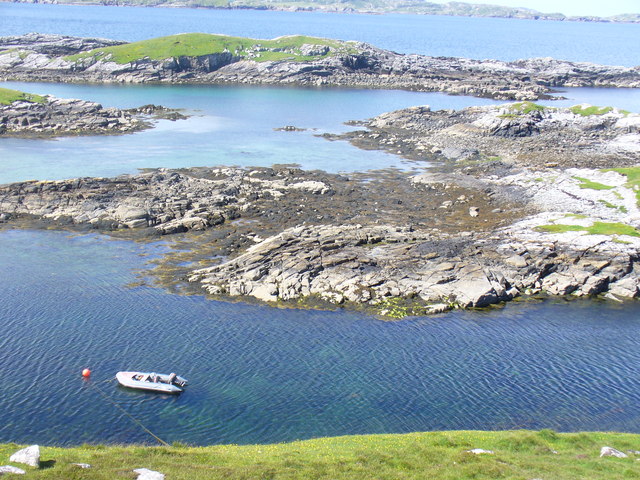
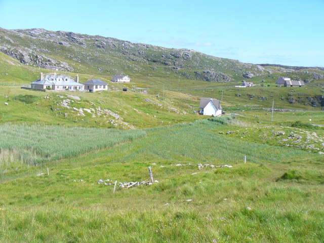
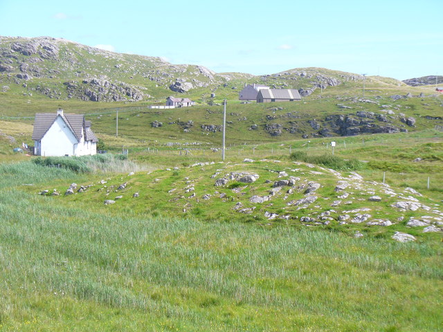
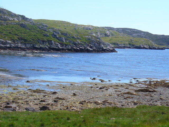
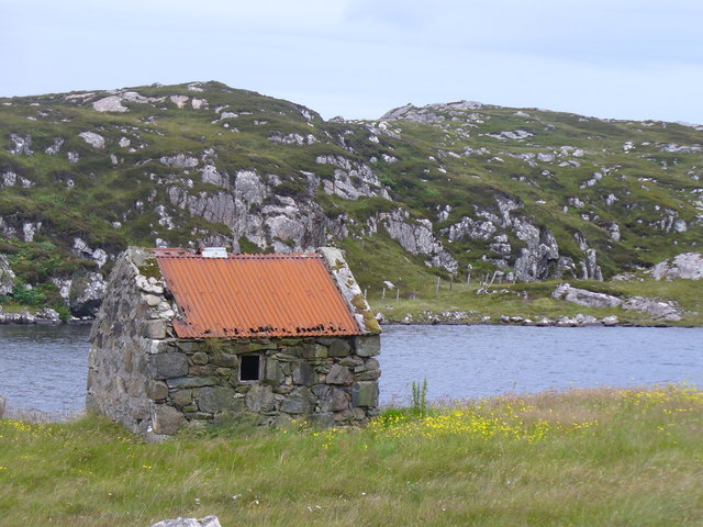
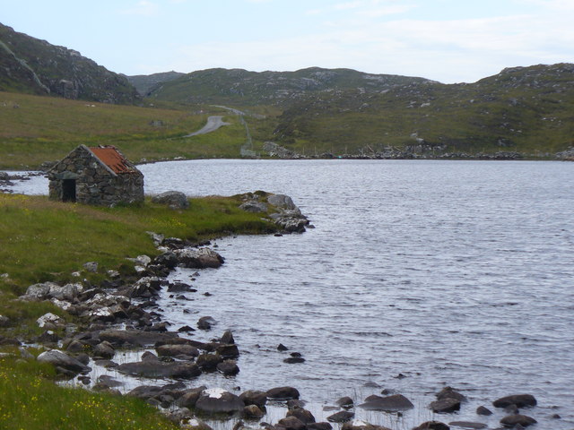
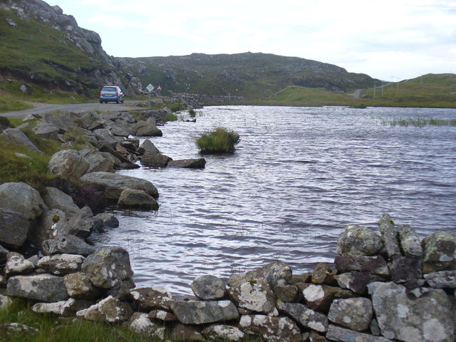
Geodha na Crìch is a picturesque coastal feature located in Ross-shire, Scotland. This stunning headland, also known as the Point, is situated on the northwest coast of Scotland, offering breathtaking views of the surrounding landscape.

The headland is characterized by its rugged cliffs, which tower above the crashing waves of the Atlantic Ocean. These cliffs are made up of ancient rocks, showcasing a variety of geological formations and providing a fascinating insight into the area's geological history.

Geodha na Crìch is home to a diverse range of flora and fauna, including various seabirds such as gannets, fulmars, and puffins. The headland is an important breeding ground for these species, making it a popular spot for birdwatching enthusiasts.

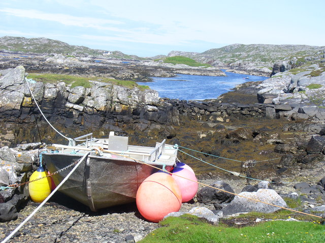
Visitors to Geodha na Crìch can enjoy a peaceful walk along the coastal path, taking in the stunning views and immersing themselves in the natural beauty of the area. On a clear day, it is even possible to spot dolphins, seals, and other marine life in the surrounding waters.

The headland is also steeped in history, with evidence of prehistoric settlements and ancient burial grounds in the vicinity. This adds a sense of mystery and intrigue to the already captivating landscape.

Overall, Geodha na Crìch is a must-visit destination for nature lovers, outdoor enthusiasts, and those seeking a tranquil escape in the heart of Scotland's rugged coastline.

If you have any feedback on the listing, please let us know in the comments section below.

Geodha na Crìch Images

Images are sourced within 2km of 58.243097/-6.8448754 or Grid Reference NB1538. Thanks to Geograph Open Source API. All images are credited.

Old hardstandings at Tob Blar Meadha Abandoned lobster loading hardstandings at the lobster pond.
Old hardstandings at Tob Blar Meadha
Abandoned lobster loading hardstandings at the lobster pond.
Camas Sanndaig Looking across the bay. In the distance is the low island of Pabaigh Mor with the headland of Bhaltos beyond.

A bundle of fencing wire is abandoned in the rocky gully above the sea.
Camas Sanndaig
Looking across the bay. In the distance is the low island of Pabaigh Mor with the headland of Bhaltos beyond. A bundle of fencing wire is abandoned in the rocky gully above the sea.
Sea loch west of Loch Veiravat Although it isn't obvious from here, this is the start of a long channel that leads out to the sea.
Sea loch west of Loch Veiravat
Although it isn't obvious from here, this is the start of a long channel that leads out to the sea.
West coast of Great Bernera A complicated coastline with many interesting features.
West coast of Great Bernera
A complicated coastline with many interesting features.
War Memorial, Breacleit The memorial stands on a mound at the crossroads in the centre of Breacleit / Breaclete, the capital of Great Bernera / Bearnaraigh. On the skyline is the Bernera Community Centre.
<span class="nowrap"><a title="http://www.uigandbernera.com/" rel="nofollow ugc noopener" href="http://www.uigandbernera.com/">Link</a><img style="margin-left:2px;" alt="External link" title="External link - shift click to open in new window" src="https://s1.geograph.org.uk/img/external.png" width="10" height="10"/></span>
War Memorial, Breacleit
The memorial stands on a mound at the crossroads in the centre of Breacleit / Breaclete, the capital of Great Bernera / Bearnaraigh. On the skyline is the Bernera Community Centre. LinkExternal link
Breacleit, Bernera Summer flowers, church and school in the village centre.
<span class="nowrap"><a title="http://www.uigandbernera.com/" rel="nofollow ugc noopener" href="http://www.uigandbernera.com/">Link</a><img style="margin-left:2px;" alt="External link" title="External link - shift click to open in new window" src="https://s1.geograph.org.uk/img/external.png" width="10" height="10"/></span>
Breacleit, Bernera
Summer flowers, church and school in the village centre. LinkExternal link
Coast North of Poll Ula West coast of Great Bernera / Bearnaraigh - with many small skerries close to shore.
<span class="nowrap"><a title="http://www.uigandbernera.com/" rel="nofollow ugc noopener" href="http://www.uigandbernera.com/">Link</a><img style="margin-left:2px;" alt="External link" title="External link - shift click to open in new window" src="https://s1.geograph.org.uk/img/external.png" width="10" height="10"/></span>
Coast North of Poll Ula
West coast of Great Bernera / Bearnaraigh - with many small skerries close to shore. LinkExternal link
Tob Lathach, Bearnaraigh Small tidal lagoon on the west coast of Great Bernera.
<span class="nowrap"><a title="http://www.uigandbernera.com/" rel="nofollow ugc noopener" href="http://www.uigandbernera.com/">Link</a><img style="margin-left:2px;" alt="External link" title="External link - shift click to open in new window" src="https://s1.geograph.org.uk/img/external.png" width="10" height="10"/></span>
Tob Lathach, Bearnaraigh
Small tidal lagoon on the west coast of Great Bernera. LinkExternal link
Tob Liongaim Well-tethered boat, with floats, at the head of a tidal lagoon on Bearnaraigh's western coast.
<span class="nowrap"><a title="http://www.uigandbernera.com/" rel="nofollow ugc noopener" href="http://www.uigandbernera.com/">Link</a><img style="margin-left:2px;" alt="External link" title="External link - shift click to open in new window" src="https://s1.geograph.org.uk/img/external.png" width="10" height="10"/></span>
Tob Liongaim
Well-tethered boat, with floats, at the head of a tidal lagoon on Bearnaraigh's western coast. LinkExternal link
Tob Liongaim, Bearnaraigh Tidal lagoon, skerries and RIB on the west coast of Great Bernera, south of Tobson.
Tob Liongaim, Bearnaraigh
Tidal lagoon, skerries and RIB on the west coast of Great Bernera, south of Tobson.
Tobson The oldest inhabited settlement on the island of Great Bernera / Bearnaraigh.
<span class="nowrap"><a title="http://www.uigandbernera.com/" rel="nofollow ugc noopener" href="http://www.uigandbernera.com/">Link</a><img style="margin-left:2px;" alt="External link" title="External link - shift click to open in new window" src="https://s1.geograph.org.uk/img/external.png" width="10" height="10"/></span>
Tobson
The oldest inhabited settlement on the island of Great Bernera / Bearnaraigh. LinkExternal link
Concentric Rock Formation, Tobson Unusual rock pattern showing through the grass at Tobson, the oldest inhabited settlement on Great Bernera / Bearnaraigh.
<span class="nowrap"><a title="http://www.uigandbernera.com/" rel="nofollow ugc noopener" href="http://www.uigandbernera.com/">Link</a><img style="margin-left:2px;" alt="External link" title="External link - shift click to open in new window" src="https://s1.geograph.org.uk/img/external.png" width="10" height="10"/></span>
Concentric Rock Formation, Tobson
Unusual rock pattern showing through the grass at Tobson, the oldest inhabited settlement on Great Bernera / Bearnaraigh. LinkExternal link
Ceann a' Stiogha Head of the tidal lagoon, Tob Bhalasaigh at Tobson on Great Bernera, Bearnaraigh.
<span class="nowrap"><a title="http://www.uigandbernera.com/" rel="nofollow ugc noopener" href="http://www.uigandbernera.com/">Link</a><img style="margin-left:2px;" alt="External link" title="External link - shift click to open in new window" src="https://s1.geograph.org.uk/img/external.png" width="10" height="10"/></span>
Ceann a' Stiogha
Head of the tidal lagoon, Tob Bhalasaigh at Tobson on Great Bernera, Bearnaraigh. LinkExternal link
Bothy, Loch na Muilne Fishermen's bothy on the east shore of freshwater Loch na Muilne / Mill Loch on Great Bernera / Bearnaraigh.
<span class="nowrap"><a title="http://www.uigandbernera.com/" rel="nofollow ugc noopener" href="http://www.uigandbernera.com/">Link</a><img style="margin-left:2px;" alt="External link" title="External link - shift click to open in new window" src="https://s1.geograph.org.uk/img/external.png" width="10" height="10"/></span>
Bothy, Loch na Muilne
Fishermen's bothy on the east shore of freshwater Loch na Muilne / Mill Loch on Great Bernera / Bearnaraigh. LinkExternal link
Loch na Muilne Freshwater loch (Mill Loch), with fishing bothy, on Great Bernera / Bearnaraidh.
<span class="nowrap"><a title="http://www.uigandbernera.com/" rel="nofollow ugc noopener" href="http://www.uigandbernera.com/">Link</a><img style="margin-left:2px;" alt="External link" title="External link - shift click to open in new window" src="https://s1.geograph.org.uk/img/external.png" width="10" height="10"/></span>
Loch na Muilne
Freshwater loch (Mill Loch), with fishing bothy, on Great Bernera / Bearnaraidh. LinkExternal link
Loch Geal Freshwater loch in the north of Great Bernera / Bearnaraigh.
<span class="nowrap"><a title="http://www.uigandbernera.com/" rel="nofollow ugc noopener" href="http://www.uigandbernera.com/">Link</a><img style="margin-left:2px;" alt="External link" title="External link - shift click to open in new window" src="https://s1.geograph.org.uk/img/external.png" width="10" height="10"/></span>
Loch Geal
Freshwater loch in the north of Great Bernera / Bearnaraigh. LinkExternal link
Loch Geal, South End A wall has been built at the end of this small freshwater loch on Great Bernera / Bearnaraigh.
<span class="nowrap"><a title="http://www.uigandbernera.com/" rel="nofollow ugc noopener" href="http://www.uigandbernera.com/">Link</a><img style="margin-left:2px;" alt="External link" title="External link - shift click to open in new window" src="https://s1.geograph.org.uk/img/external.png" width="10" height="10"/></span>
Loch Geal, South End
A wall has been built at the end of this small freshwater loch on Great Bernera / Bearnaraigh. LinkExternal link
Loch Tana Small freshwater loch on Great Bernera / Bearnaraigh with a single track road running alongside it.
<span class="nowrap"><a title="http://www.uigandbernera.com/" rel="nofollow ugc noopener" href="http://www.uigandbernera.com/">Link</a><img style="margin-left:2px;" alt="External link" title="External link - shift click to open in new window" src="https://s1.geograph.org.uk/img/external.png" width="10" height="10"/></span>
Loch Tana
Small freshwater loch on Great Bernera / Bearnaraigh with a single track road running alongside it. LinkExternal link
Show me another place!

Geodha na Crìch is located at Grid Ref: NB1538 (Lat: 58.243097, Lng: -6.8448754)

Unitary Authority: Na h-Eileanan an Iar

Police Authority: Highlands and Islands

What 3 Words

///lazy.pats.boosted. Near Carloway, Na h-Eileanan Siar

Related Wikis

Great Bernera

Great Bernera (; Scottish Gaelic: Beàrnaraigh Mòr), often known just as Bernera (Scottish Gaelic: Beàrnaraigh), is an island and community in the Outer...

Breaclete

Breacleit (or Roulanish; Scottish Gaelic: Breacleit; Old Norse: Breiðiklettr) is the central village on Great Bernera in the Outer Hebrides, Scotland....

Bernera Riot

The Bernera Riot occurred in 1874, on the island of Great Bernera, in Scotland in response to the Highland Clearances. The use of the term 'Bernera Riot...

Dun Bharabhat, Great Bernera

Dun Bharabhat (or Dun Baravat) is an Iron Age galleried dun or "semi-broch" situated on the island of Great Bernera near Lewis in Scotland (grid reference...

Nearby Amenities

Located within 500m of 58.243097,-6.8448754
Power: pole
Lat/Long: 58.243296/-6.8530861
Power: pole
Lat/Long: 58.2437759/-6.8526999
The data included in this document is from www.openstreetmap.org. The data is made available under ODbL.

Have you been to Geodha na Crìch?

Leave your review of Geodha na Crìch below (or comments, questions and feedback).