Aird Harmasaig

Coastal Feature, Headland, Point in Inverness-shire

Scotland

Aird Harmasaig

Collam A handful of houses beside Loch Ghreosabhaigh.
Collam Credit: Anne Burgess

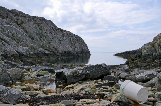
Aird Harmasaig is a prominent coastal feature located in Inverness-shire, Scotland. It is a headland that juts out into the North Atlantic Ocean, forming a distinct point along the rugged coastline. The name Aird Harmasaig is derived from Gaelic, with "Aird" meaning point or headland, and "Harmasaig" believed to refer to a specific clan or family name.

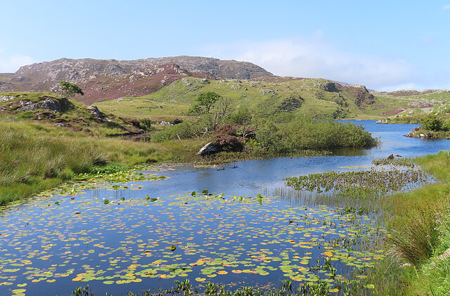
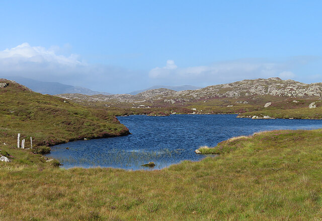
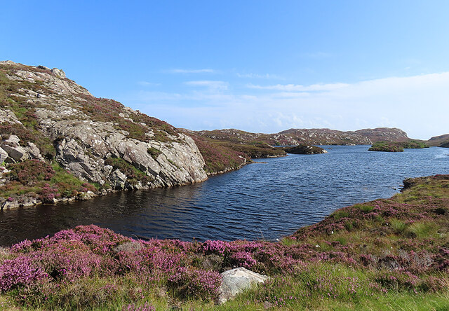
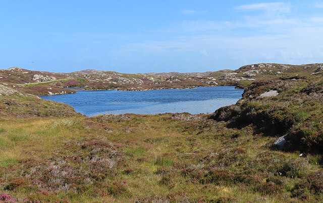
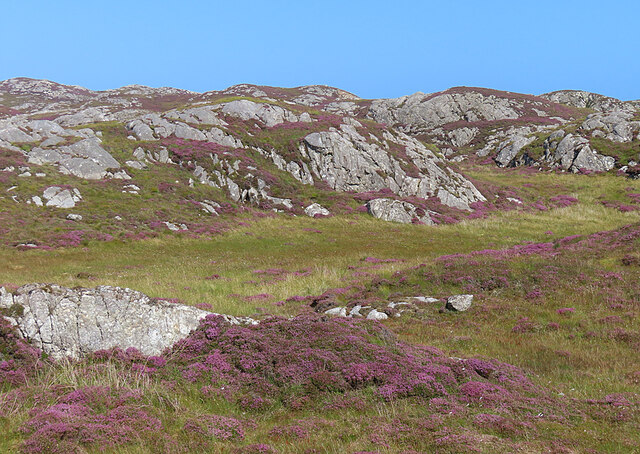
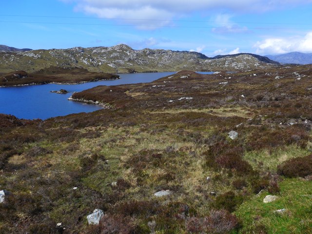
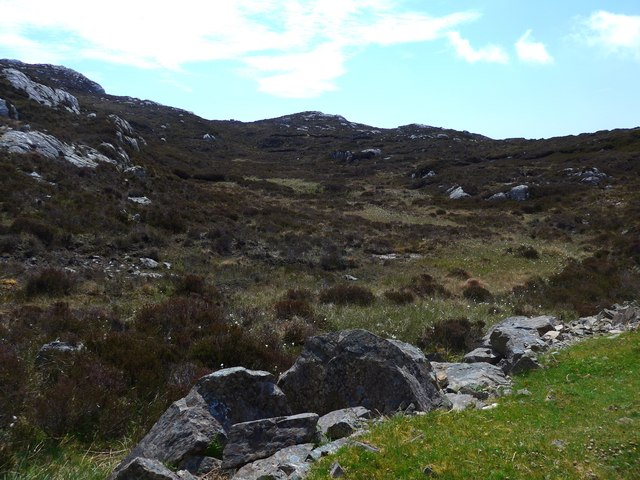
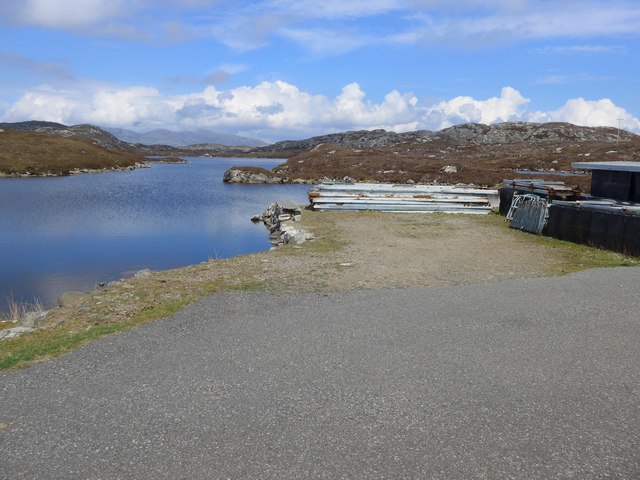
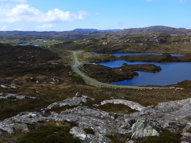
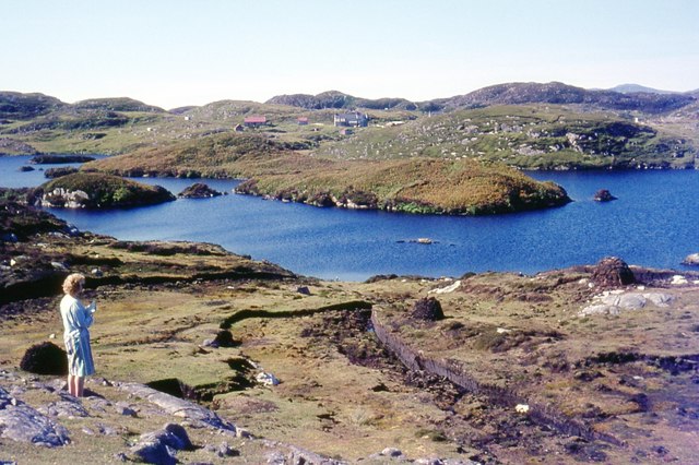
This headland is characterized by its dramatic cliffs and stunning panoramic views of the surrounding ocean and nearby islands. The rugged terrain of Aird Harmasaig is a result of millions of years of erosion by wind and water, giving it a unique and striking appearance. The cliffs are composed of various types of rock, including sandstone and shale, which add to the visual appeal of this coastal feature.

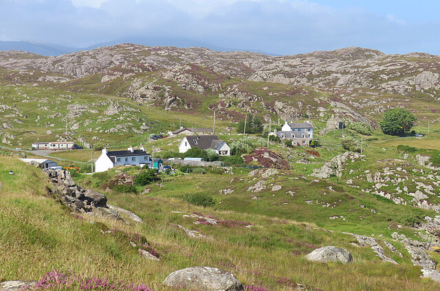
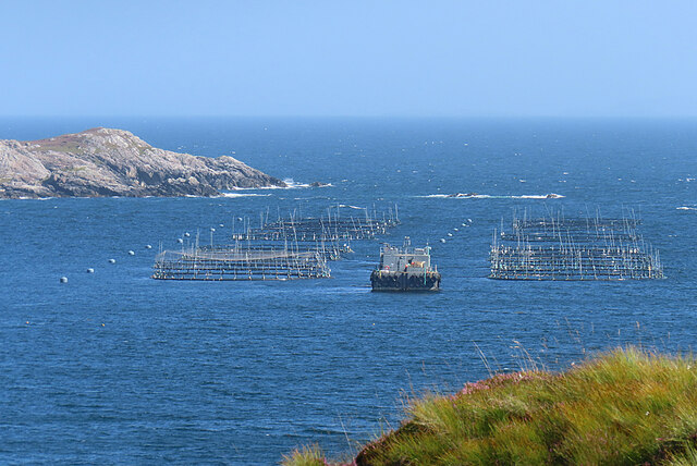
The location of Aird Harmasaig makes it a popular destination for nature enthusiasts and hikers. The headland is part of a larger coastal trail that offers breathtaking vistas and opportunities to spot local wildlife, such as seabirds and marine mammals. Visitors can also explore the surrounding beaches and coves, some of which are accessible only by foot, adding to the sense of adventure and seclusion.

In addition to its natural beauty, Aird Harmasaig is also steeped in history and folklore. It is believed to have been a site of ancient settlements and may have played a role in maritime trade and defense throughout the centuries. Today, it stands as a testament to the power and beauty of nature, attracting visitors from near and far who seek to immerse themselves in the rugged charm of Scotland's coastline.

If you have any feedback on the listing, please let us know in the comments section below.

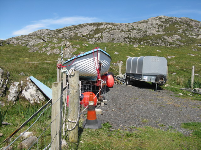
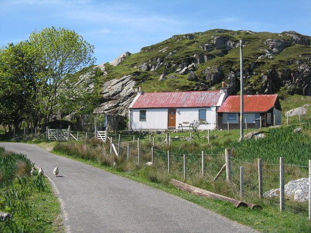
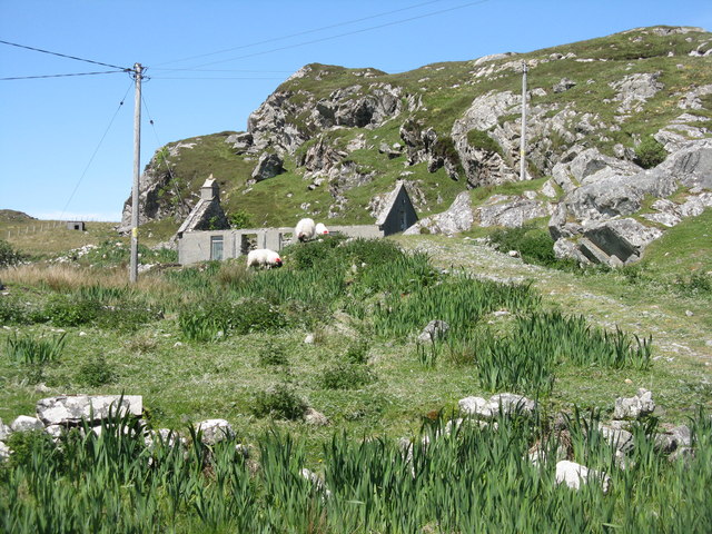
Aird Harmasaig Images

Images are sourced within 2km of 57.831186/-6.789479 or Grid Reference NG1592. Thanks to Geograph Open Source API. All images are credited.

Collam A handful of houses beside Loch Ghreosabhaigh.
Collam
A handful of houses beside Loch Ghreosabhaigh.
Fish Farm In the outer part of Loch Ghreosabhagh. I take it that the poles and nets are to discourage birds form taking the fish.
Fish Farm
In the outer part of Loch Ghreosabhagh. I take it that the poles and nets are to discourage birds form taking the fish.
Lochan near Greosabhagh A lochan liberally sprinkled with water-lily leaves.
Lochan near Greosabhagh
A lochan liberally sprinkled with water-lily leaves.
Loch Harmasaig Most of this loch is hidden behind the knoll on the left.
Loch Harmasaig
Most of this loch is hidden behind the knoll on the left.
Loch nan Uidhean Typical 'Cnoc and Lochan' topography, with a small loch hemmed in by steeply dipping hummocky Lewisian gneiss.
Loch nan Uidhean
Typical 'Cnoc and Lochan' topography, with a small loch hemmed in by steeply dipping hummocky Lewisian gneiss.
Nameless Lochan That is to say, the map doesn't name it.
Nameless Lochan
That is to say, the map doesn't name it.
Loch Phlocrapoil This is one of the larger lochs on the route of the Golden Road.
Loch Phlocrapoil
This is one of the larger lochs on the route of the Golden Road.
Lewisian Gneiss This is classic Lewisian Gneiss, in irregular outcrops smoothed by the glaciers of the last (and no doubt previous) Ice Ages.
Lewisian Gneiss
This is classic Lewisian Gneiss, in irregular outcrops smoothed by the glaciers of the last (and no doubt previous) Ice Ages.
Loch Harmasaig
Loch Harmasaig
Rough ground at Druim nan-Uidhean
Old pontoon equipment at Loch Harmasaig
The road to Greosabhagh A typical East Harris view - water and rock, rock and water.

Shots of parts of the island were used by Stanley Kubrick as the surface of Jupiter in the film 2001: A Space Odyssey.
The road to Greosabhagh
A typical East Harris view - water and rock, rock and water. Shots of parts of the island were used by Stanley Kubrick as the surface of Jupiter in the film 2001: A Space Odyssey.
Houses at Greosabhagh On The Golden Road.
Houses at Greosabhagh
On The Golden Road.
Boat and trailer at Greosabhagh With Cnoc Soilleir beyond.
Boat and trailer at Greosabhagh
With Cnoc Soilleir beyond.
House at Greosabhagh Restored, compared to its condition on Google Street View in 2009.
House at Greosabhagh
Restored, compared to its condition on Google Street View in 2009.
Ruined house at Greosabhagh One of several on this part of the Golden Road.
Ruined house at Greosabhagh
One of several on this part of the Golden Road.
Loch Plocrapol at Scadabay
Mol Bhi, Harris Mol Bhi (or Mol Vee) is an inlet on Loch Ghreosabhagh.
Mol Bhi, Harris
Mol Bhi (or Mol Vee) is an inlet on Loch Ghreosabhagh.
Show me another place!

Aird Harmasaig is located at Grid Ref: NG1592 (Lat: 57.831186, Lng: -6.789479)

Unitary Authority: Na h-Eileanan an Iar

Police Authority: Highlands and Islands

What 3 Words

///armful.chitchat.upholding. Near Tarbert, Na h-Eileanan Siar

Related Wikis

Stockinish Island

Stockinish Island (Scottish Gaelic: Eilean Stocainis) is an uninhabited island off Harris, in the Outer Hebrides. == Geography and geology == Stockinish...

East Loch Tarbert

East Loch Tarbert (Scottish Gaelic: Loch an Tairbeairt) is a sea loch that lies to the east of Harris in the Outer Hebrides of Scotland. The loch contains...

Sgeotasaigh

Scotasay (Scottish Gaelic: Sgeotasaigh) is small island in the Outer Hebrides of Scotland. It lies 1 kilometre (0.6 miles) off the east coast of Harris...

Harris distillery

Harris distillery is a Scotch whisky and Gin distillery in Tarbert on the Isle of Harris, Scotland. The distillery was the first legal distillery ever...

Scalpay, Outer Hebrides

Scalpay (; Scottish Gaelic: Sgalpaigh or Sgalpaigh na Hearadh; i.e. "Scalpay of Harris" to distinguish it from Scalpay off Skye) is an island in the Outer...

Tarbert, Harris

Tarbert (Scottish Gaelic: An Tairbeart [ən̪ˠ ˈt̪ɛrʲɛbərˠʃt̪]) is the main community on Harris in the Western Isles of Scotland. The name means "isthmus...

Harris, Outer Hebrides

Harris (Scottish Gaelic: Na Hearadh, pronounced [nə ˈhɛɾəɣ] ) is the southern and more mountainous part of Lewis and Harris, the largest island in the...

Eilean Glas, Scalpay

Eilean Glas is a peninsula of Scalpay in the Outer Hebrides, Scotland. Eilean Glas is home to a historic lighthouse. Eilean Glas means Grey/Green Island...

Nearby Amenities

Located within 500m of 57.831186,-6.789479
Created By: dmgroom_coastlines
Lat/Long: 57.83091/-6.78904
Created By: dmgroom_coastlines
Lat/Long: 57.83431/-6.79316
Passing Place
Lat/Long: 57.8348327/-6.7938906
Passing Place
Lat/Long: 57.8346793/-6.7911181
Passing Place
Lat/Long: 57.8352954/-6.7895026
Harmasaig Bay
Natural: bay
Lat/Long: 57.830436/-6.788509
Material: wood
Power: pole
Lat/Long: 57.834655/-6.7903975
Material: wood
Power: pole
Lat/Long: 57.8348813/-6.7934439
Material: wood
Power: pole
Lat/Long: 57.8345783/-6.7925899
Material: wood
Power: pole
Lat/Long: 57.8345093/-6.7911982
Material: wood
Power: pole
Lat/Long: 57.8348293/-6.7894347
Material: wood
Power: pole
Lat/Long: 57.8350848/-6.7885307
Material: wood
Power: pole
Lat/Long: 57.8353318/-6.7875866
Material: wood
Power: pole
Lat/Long: 57.8346581/-6.7938818
Passing Place
Lat/Long: 57.8348078/-6.7933656
The data included in this document is from www.openstreetmap.org. The data is made available under ODbL.

Have you been to Aird Harmasaig?

Leave your review of Aird Harmasaig below (or comments, questions and feedback).