Gob na Hoe

Coastal Feature, Headland, Point in Inverness-shire

Scotland

Gob na Hoe

Ramasaig Bay, Skye
Ramasaig Bay, Skye Credit: Helen Baker

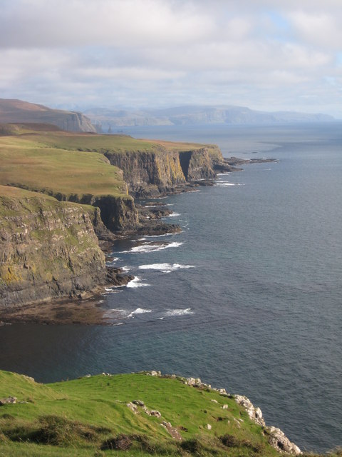
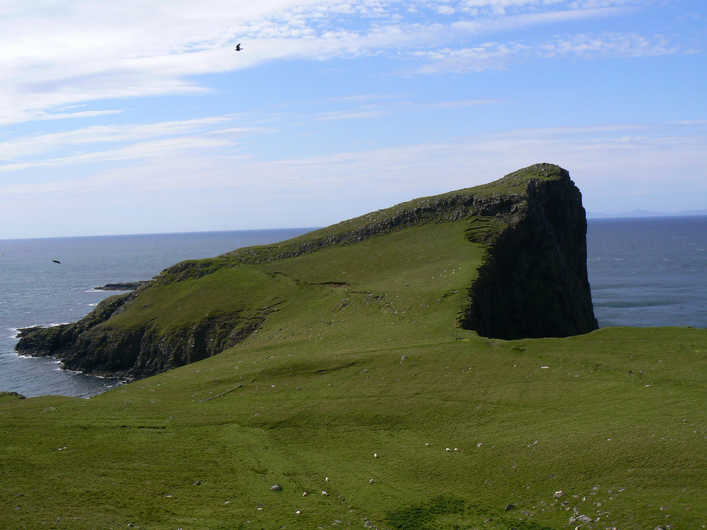
Gob na Hoe is a prominent headland located in Inverness-shire, Scotland. Situated along the beautiful coastline, it serves as a notable point of interest for both locals and tourists. The name "Gob na Hoe" translates to "the mouth of the bay" in English, which accurately describes its geographical location and shape.

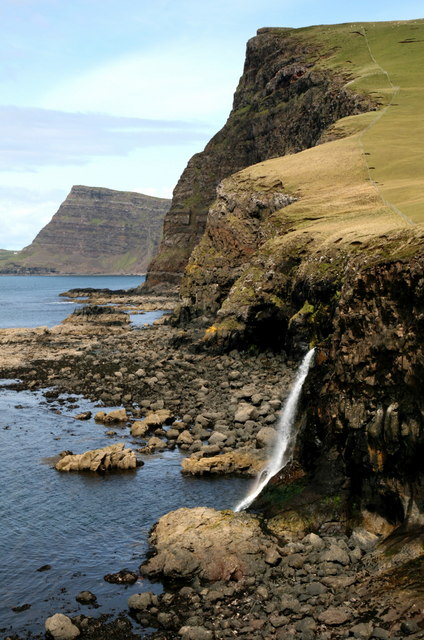
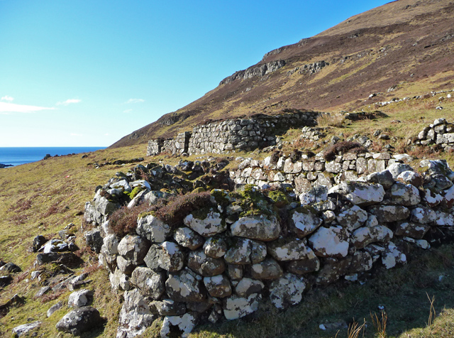
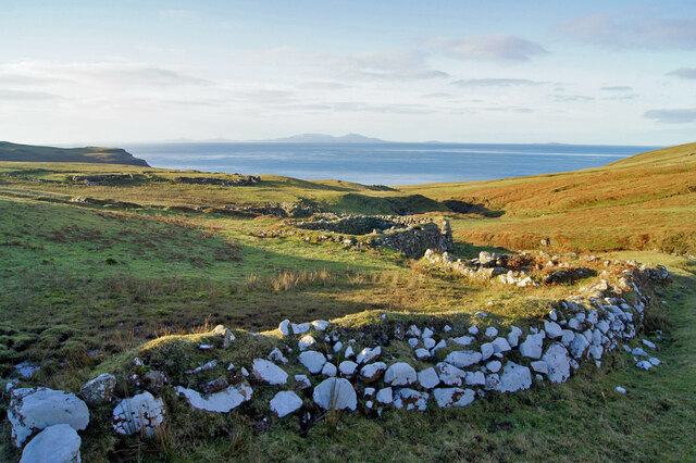
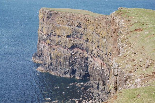
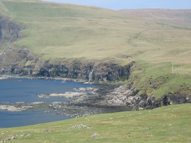
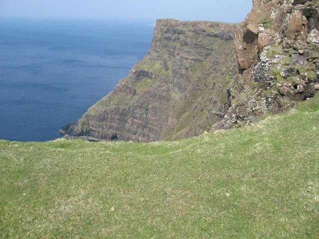
This headland is characterized by its rugged and rocky terrain, jutting out into the North Atlantic Ocean. The cliff faces of Gob na Hoe are formed from a combination of ancient rock formations, including sandstone and shale, which have been eroded over time by the relentless crashing waves. The result is a striking coastal feature that showcases the power and beauty of nature.

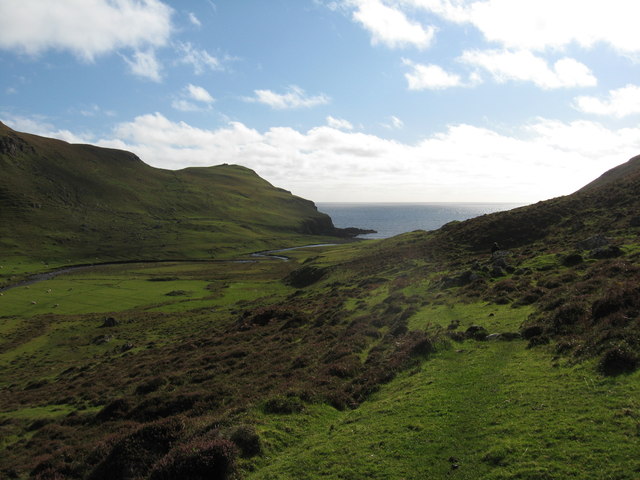
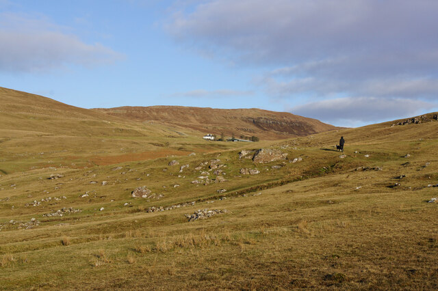
Gob na Hoe offers breathtaking panoramic views of the surrounding landscape. From its elevated position, visitors can admire the vast expanse of the ocean, the nearby sandy beaches, and the rolling hills of Inverness-shire. On a clear day, it is even possible to catch a glimpse of the distant mountains in the Scottish Highlands.

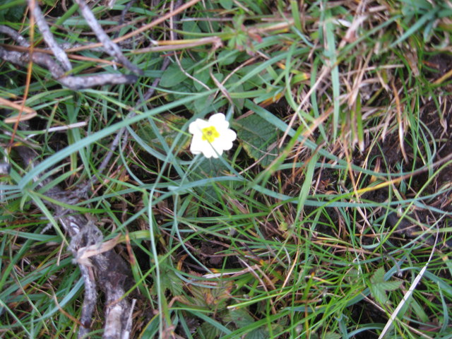
The headland is also home to a variety of plant and animal species, making it an important ecological site. Seabirds such as gulls and fulmars can often be seen nesting on the cliffs, while seals and dolphins occasionally swim in the waters below.

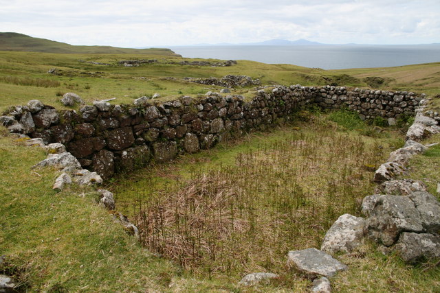
Overall, Gob na Hoe is a captivating coastal feature that combines stunning natural beauty with diverse wildlife. It is a must-visit destination for anyone exploring the Inverness-shire area, offering a glimpse into the untamed and awe-inspiring Scottish coastline.

If you have any feedback on the listing, please let us know in the comments section below.

Gob na Hoe Images

Images are sourced within 2km of 57.382489/-6.730748 or Grid Reference NG1542. Thanks to Geograph Open Source API. All images are credited.

Ramasaig Bay, Skye
Ramasaig Bay, Skye
Ramasaig Clearance Village, Skye Remains of steadings at Ramasaig that were deserted or cleared.
Ramasaig Clearance Village, Skye
Remains of steadings at Ramasaig that were deserted or cleared.
How very odd! This is a primrose,flowering in the wild in early October. Things have really gone to pot!
How very odd!
This is a primrose,flowering in the wild in early October. Things have really gone to pot!
Heather on valley sides at Lorgill
Along the coast This is looking along the coast in a south-easterly direction from The Hoe. The Maidens are just visible in the far distance.
Along the coast
This is looking along the coast in a south-easterly direction from The Hoe. The Maidens are just visible in the far distance.
Ruins in Lorgill Two of the houses from which the residents were removed in the clearance of 1830.
Ruins in Lorgill
Two of the houses from which the residents were removed in the clearance of 1830.
Remains of Ramasaig A thriving community of some twenty-two families once lived here, though Ramasaig has been depopulated since around the turn of the 20th century. The ruins of houses, outbuildings and walls remain.
Remains of Ramasaig
A thriving community of some twenty-two families once lived here, though Ramasaig has been depopulated since around the turn of the 20th century. The ruins of houses, outbuildings and walls remain.
Ramasaig Burn Ruins of many buildings and walls scatter the hillside, mostly to the south of the Ramasaig Burn.
Ramasaig Burn
Ruins of many buildings and walls scatter the hillside, mostly to the south of the Ramasaig Burn.
Ramasaig Bay Looking north, with Ramasaig Cliff nearest the camera, Waterstein Head beyond, and Neist Point stretching out to the left.
Ramasaig Bay
Looking north, with Ramasaig Cliff nearest the camera, Waterstein Head beyond, and Neist Point stretching out to the left.
Former farmland, Ramasaig In the 1800s, when Ramasaig was a thriving community with a population of maybe more than a hundred people, the land here would have been cultivated. Today, the homes are all ruins, and a few sheep graze the grass.
Former farmland, Ramasaig
In the 1800s, when Ramasaig was a thriving community with a population of maybe more than a hundred people, the land here would have been cultivated. Today, the homes are all ruins, and a few sheep graze the grass.
Lazybeds at Ramasaig The stripes in the grassland are evidence of former cultivation, when the hillside was farmed in strips known as lazybeds. The crop, often potatoes, was planted on the ridge, with the furrow providing drainage.
Lazybeds at Ramasaig
The stripes in the grassland are evidence of former cultivation, when the hillside was farmed in strips known as lazybeds. The crop, often potatoes, was planted on the ridge, with the furrow providing drainage.
Ramasaig The remains of the remote village of Ramasaig, once a very much larger community.
Ramasaig
The remains of the remote village of Ramasaig, once a very much larger community.
Hoe Rape Not so high as the cliff to the north and south of it, but still pretty impressive. Impossible to photograph sensibly "in square".
Hoe Rape
Not so high as the cliff to the north and south of it, but still pretty impressive. Impossible to photograph sensibly "in square".
Gob na Hoe Looking south along the cliff edge.
Gob na Hoe
Looking south along the cliff edge.
Ramasaig Bay The area in the foreground was once cultivated by the villagers of Ramasaig - before the Clearances. That, and the rocky shore beyond, are in the square.
Ramasaig Bay
The area in the foreground was once cultivated by the villagers of Ramasaig - before the Clearances. That, and the rocky shore beyond, are in the square.
Cliff at The Hoe Just below the summit of The Hoe (231m) are these sea cliffs.
Cliff at The Hoe
Just below the summit of The Hoe (231m) are these sea cliffs.
Stone lined hollows Came upon a row of six of these hollows on the northern slopes of The Hoe. They may be shielings, but I suspect they are much older than that. They are very exposed and the view from here is huge, which may support my theory that they are some sort of burial site.
Stone lined hollows
Came upon a row of six of these hollows on the northern slopes of The Hoe. They may be shielings, but I suspect they are much older than that. They are very exposed and the view from here is huge, which may support my theory that they are some sort of burial site.
Ramasaig The abandoned buildings at Ramasaig, another village emptied during the 19th century clearances.
Ramasaig
The abandoned buildings at Ramasaig, another village emptied during the 19th century clearances.
Show me another place!

Gob na Hoe is located at Grid Ref: NG1542 (Lat: 57.382489, Lng: -6.730748)

Unitary Authority: Highland

Police Authority: Highlands and Islands

What 3 Words

///pens.nanny.extremes. Near Glendale, Highland

Nearby Locations

Gob na Hoe

Related Wikis

Ramasaig

Ramasaig is a small township on the western shore of the Duirinish peninsula, on Dunvegan, Isle of Skye and is in the Scottish Highlands and is in the...

Borrodale

Borrodale (Scottish Gaelic: Borodail) is small hamlet on the Isle of Skye, in the Inner Hebrides of Scotland. Borrodale is part of Glendale and the Glendale...
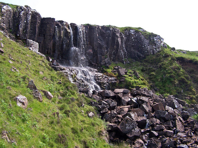
Eas Mòr, Durinish

Eas Mòr is a waterfall on the Duirinish peninsula of the island of Skye in Scotland. It lies on the Allt Mhicheil, a tributary of the Dibidal River below...

Neist Point

Neist Point (Scottish Gaelic: Rubha na h-Eist) is a viewpoint on the most westerly point of Skye. Neist Point Lighthouse has been located there since...

Have you been to Gob na Hoe?

Leave your review of Gob na Hoe below (or comments, questions and feedback).