Cnoc Leoba Mhic Cùbhaig

Hill, Mountain in Ross-shire

Scotland

Cnoc Leoba Mhic Cùbhaig

West coast of Great Bernera This is the west side of a spit of land extending south of Tobson. The ground is rocky with a thin covering of grass.

In the distance, on the left is the tip of the island of Pabaigh Mor .. and on the right Geodha Mor (west of Tobson).
West coast of Great Bernera Credit: Rob Burke

Cnoc Leoba Mhic Cùbhaig is a prominent hill/mountain located in Ross-shire, in the Scottish Highlands, United Kingdom. It stands at an elevation of approximately 869 meters (2,851 feet). The name "Cnoc Leoba Mhic Cùbhaig" is derived from Gaelic, with "Cnoc" meaning hill and "Leoba Mhic Cùbhaig" referring to a person's name.

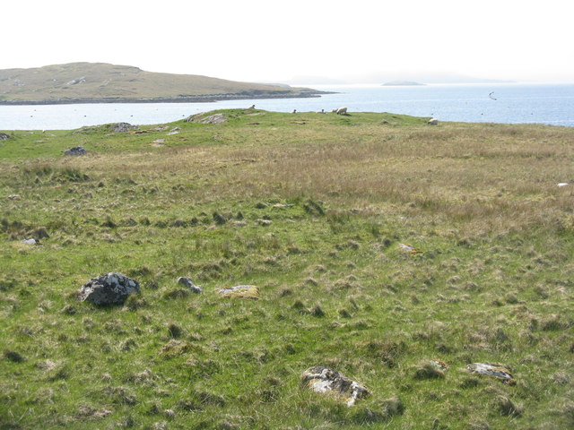
The hill/mountain offers stunning panoramic views of the surrounding landscape, including the nearby Loch Broom and the surrounding mountain ranges. It is part of the larger Fannichs mountain range and is located within the Fannichs Wild Land area, renowned for its rugged and untouched natural beauty.

Cnoc Leoba Mhic Cùbhaig is a popular destination for outdoor enthusiasts, particularly hikers and hillwalkers. There are several routes to reach the summit, varying in difficulty and length. The ascent can be challenging at times, with steep and rocky sections, but the rewarding views make it worthwhile.

The hill/mountain is also home to a variety of flora and fauna, including heather, mosses, and wildflowers. Wildlife enthusiasts may spot birds of prey such as golden eagles, as well as deer and other smaller mammals.

Visitors are advised to come prepared with appropriate clothing and equipment, as the weather conditions can be unpredictable, with strong winds and low temperatures even during the summer months. It is also recommended to check the local weather forecast and inform someone of your planned route before embarking on a hike to Cnoc Leoba Mhic Cùbhaig.

If you have any feedback on the listing, please let us know in the comments section below.

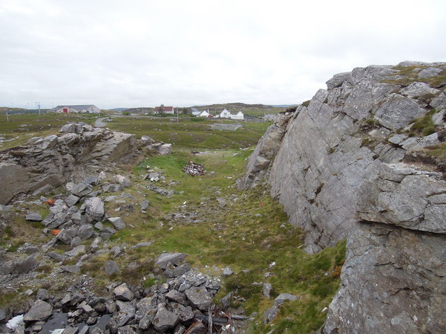
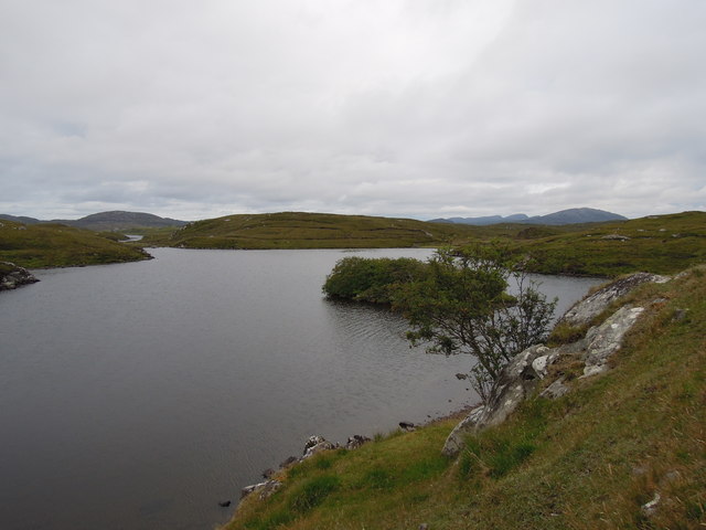
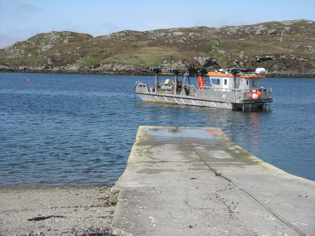
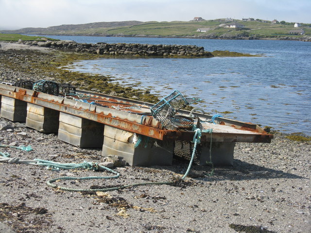
Cnoc Leoba Mhic Cùbhaig Images

Images are sourced within 2km of 58.212534/-6.8643273 or Grid Reference NB1435. Thanks to Geograph Open Source API. All images are credited.

West coast of Great Bernera This is the west side of a spit of land extending south of Tobson. The ground is rocky with a thin covering of grass.

In the distance, on the left is the tip of the island of Pabaigh Mor .. and on the right Geodha Mor (west of Tobson).
West coast of Great Bernera
This is the west side of a spit of land extending south of Tobson. The ground is rocky with a thin covering of grass. In the distance, on the left is the tip of the island of Pabaigh Mor .. and on the right Geodha Mor (west of Tobson).
Beach north of Bhalasaigh
Moorland and loch on Great Bernera The loch is unnamed on the map, but the Allt Loch an Fheoir flows into it, so this must be Loch an Fheoir.

The houses in the distance are on the road south of Bhalasaigh.
Moorland and loch on Great Bernera
The loch is unnamed on the map, but the Allt Loch an Fheoir flows into it, so this must be Loch an Fheoir. The houses in the distance are on the road south of Bhalasaigh.
Bridge at Bhalasaigh Looking back to the road end on the main island of Great Bernera.
Bridge at Bhalasaigh
Looking back to the road end on the main island of Great Bernera.
Loch Ionail Freshwater loch on the island of Great Bernera / Bearnaraigh.
<span class="nowrap"><a title="http://www.uigandbernera.com/" rel="nofollow ugc noopener" href="http://www.uigandbernera.com/">Link</a><img style="margin-left:2px;" alt="External link" title="External link - shift click to open in new window" src="https://s1.geograph.org.uk/img/external.png" width="10" height="10"/></span>
Loch Ionail
Freshwater loch on the island of Great Bernera / Bearnaraigh. LinkExternal link
Tob Bhalasaigh Tidal lagoon with a mix of rare seaweeds on Great Bernera / Bearnaraigh.
<span class="nowrap"><a title="http://www.uigandbernera.com/" rel="nofollow ugc noopener" href="http://www.uigandbernera.com/">Link</a><img style="margin-left:2px;" alt="External link" title="External link - shift click to open in new window" src="https://s1.geograph.org.uk/img/external.png" width="10" height="10"/></span>
Tob Bhalasaigh
Tidal lagoon with a mix of rare seaweeds on Great Bernera / Bearnaraigh. LinkExternal link
Valasay Bridge Carrying the single track road across an outlet of the tidal lagoon, Tob Bhalasaigh on Great Bernera / Bearnaraigh.
<span class="nowrap"><a title="http://www.uigandbernera.com/" rel="nofollow ugc noopener" href="http://www.uigandbernera.com/">Link</a><img style="margin-left:2px;" alt="External link" title="External link - shift click to open in new window" src="https://s1.geograph.org.uk/img/external.png" width="10" height="10"/></span>
Valasay Bridge
Carrying the single track road across an outlet of the tidal lagoon, Tob Bhalasaigh on Great Bernera / Bearnaraigh. LinkExternal link
Shoreline at Tob Bhalasaigh Rocks and heather at the edge of the tidal lagoon in Valasay.
<span class="nowrap"><a title="http://www.uigandbernera.com/" rel="nofollow ugc noopener" href="http://www.uigandbernera.com/">Link</a><img style="margin-left:2px;" alt="External link" title="External link - shift click to open in new window" src="https://s1.geograph.org.uk/img/external.png" width="10" height="10"/></span>
Shoreline at Tob Bhalasaigh
Rocks and heather at the edge of the tidal lagoon in Valasay. LinkExternal link
Valasay Footbridge The bridge across the tidal Tob Bhalasaigh was built in 1898.
<span class="nowrap"><a title="http://www.uigandbernera.com/" rel="nofollow ugc noopener" href="http://www.uigandbernera.com/">Link</a><img style="margin-left:2px;" alt="External link" title="External link - shift click to open in new window" src="https://s1.geograph.org.uk/img/external.png" width="10" height="10"/></span>
Valasay Footbridge
The bridge across the tidal Tob Bhalasaigh was built in 1898. LinkExternal link
Tidal Lagoon, Valasay Tob Bhalasaigh, on the island of Great Bernera / Bearnaraigh.
<span class="nowrap"><a title="http://www.uigandbernera.com/" rel="nofollow ugc noopener" href="http://www.uigandbernera.com/">Link</a><img style="margin-left:2px;" alt="External link" title="External link - shift click to open in new window" src="https://s1.geograph.org.uk/img/external.png" width="10" height="10"/></span>
Tidal Lagoon, Valasay
Tob Bhalasaigh, on the island of Great Bernera / Bearnaraigh. LinkExternal link
Tob Bhalasaigh from the Footbridge View northwards, along the narrow tidal lagoon, to Tobson 2 kilometres away in the distance.
Tob Bhalasaigh from the Footbridge
View northwards, along the narrow tidal lagoon, to Tobson 2 kilometres away in the distance.
Poll Ula On the indistinct coastal path along the west coast of great Bernera / Bearnaraigh. Well placed wooden marker posts are easy to follow.
<span class="nowrap"><a title="http://www.uigandbernera.com/" rel="nofollow ugc noopener" href="http://www.uigandbernera.com/">Link</a><img style="margin-left:2px;" alt="External link" title="External link - shift click to open in new window" src="https://s1.geograph.org.uk/img/external.png" width="10" height="10"/></span>
Poll Ula
On the indistinct coastal path along the west coast of great Bernera / Bearnaraigh. Well placed wooden marker posts are easy to follow. LinkExternal link
Quarry at Buaile Chruidh An old quarry where hard Lewisian gneiss was extracted to construct not only many houses in the village but also public buildings seen in the background such as Bernera School, The Church of Scotland and the Free Kirk.
Quarry at Buaile Chruidh
An old quarry where hard Lewisian gneiss was extracted to construct not only many houses in the village but also public buildings seen in the background such as Bernera School, The Church of Scotland and the Free Kirk.
Loch Ional A very peaceful place
Loch Ional
A very peaceful place
Great Bernera: the stores and post office The post office has been relocated to this village store since 1994 when it was in a wooden shed: <a href="https://www.geograph.org.uk/photo/104795">NB1536 : Great Bernara Post Office</a>. The shop also operates petrol pumps, which are in a layby across the road.
Great Bernera: the stores and post office
The post office has been relocated to this village store since 1994 when it was in a wooden shed: NB1536 : Great Bernara Post Office. The shop also operates petrol pumps, which are in a layby across the road.
Eileen Louise at Ãird Iarsiadar Mussel farm service boat. Moored at its jetty on the Atlantic coast of Lewis; looking across to Great Bernera/Breàrnaraigh
Eileen Louise at Ãird Iarsiadar
Mussel farm service boat. Moored at its jetty on the Atlantic coast of Lewis; looking across to Great Bernera/Breàrnaraigh
Pontoon at Ãird Iarsiadar On shore at the mussel farm, with an old wall or jetty beyond. Great Bernera/Beàrnaraigh is beyond.
Pontoon at Ãird Iarsiadar
On shore at the mussel farm, with an old wall or jetty beyond. Great Bernera/Beàrnaraigh is beyond.
Loch Ròg Looking from Ãird Iarsiadar to Ãird Tòranais.
Loch Ròg
Looking from Ãird Iarsiadar to Ãird Tòranais.
Show me another place!

Cnoc Leoba Mhic Cùbhaig is located at Grid Ref: NB1435 (Lat: 58.212534, Lng: -6.8643273)

Unitary Authority: Na h-Eileanan an Iar

Police Authority: Highlands and Islands

What 3 Words

///cheetahs.haggis.crew. Near Carloway, Na h-Eileanan Siar

Related Wikis

Dun Bharabhat, Great Bernera

Dun Bharabhat (or Dun Baravat) is an Iron Age galleried dun or "semi-broch" situated on the island of Great Bernera near Lewis in Scotland (grid reference...

Fuaigh Mòr

Fuaigh Mòr (sometimes anglicised as Vuia Mor) is an island in the Outer Hebrides of Scotland. It is off the west coast of Lewis near Great Bernera in...

Great Bernera

Great Bernera (; Scottish Gaelic: Beàrnaraigh Mòr), often known just as Bernera (Scottish Gaelic: Beàrnaraigh), is an island and community in the Outer...

Loch Ròg

Loch Ròg or Loch Roag is a large sea loch on the west coast of Lewis, Outer Hebrides. It is broadly divided into East Loch Roag and West Loch Roag with...

Nearby Amenities

Located within 500m of 58.212534,-6.8643273
Bus Stop
Hacklete
Bus: yes
Naptan AtcoCode: 6010731555
Naptan Bearing: NE
Naptan BusStopType: CUS
Naptan CommonName: Township
Naptan Indicator: at
Naptan NaptanCode: 94723879
Naptan Street: Minor Road
Naptan Verified: no
Public Transport: platform
Lat/Long: 58.2090776/-6.8595746
Power: pole
Lat/Long: 58.2142202/-6.8566132
Power: pole
Lat/Long: 58.2137269/-6.8578117
Power: pole
Lat/Long: 58.2097925/-6.857832
Power: pole
Lat/Long: 58.2094596/-6.8585813
Power: pole
Lat/Long: 58.2092455/-6.8594323
Power: pole
Lat/Long: 58.2091076/-6.8593962
Power: pole
Lat/Long: 58.2110875/-6.857197
Power: pole
Lat/Long: 58.2106427/-6.8571391
Generator Method: wind_turbine
Generator Source: wind
Generator Type: horizontal_axis
Power: generator
Lat/Long: 58.2120003/-6.8559736
The data included in this document is from www.openstreetmap.org. The data is made available under ODbL.

Have you been to Cnoc Leoba Mhic Cùbhaig?

Leave your review of Cnoc Leoba Mhic Cùbhaig below (or comments, questions and feedback).