Cnoc an Teine
Hill, Mountain in Ross-shire
Scotland
Cnoc an Teine

Cnoc an Teine, also known as the "Hill of Fire," is a prominent hill located in Ross-shire, Scotland. Situated in the Scottish Highlands, it stands at an elevation of approximately 315 meters (1,033 feet) above sea level. The hill is characterized by its distinctive conical shape, making it a notable landmark in the area.
Cnoc an Teine is surrounded by rolling hills and offers breathtaking panoramic views of the surrounding countryside. From its summit, visitors can enjoy vistas of the nearby Loch Carron, the Torridon Mountains, and the Isle of Skye, providing a magnificent display of Scotland's natural beauty.
The hill is named after its historical association with fire. Legend has it that the hill was the site of ancient ritual fires during pagan times. It is believed that these fires were lit to honor the local gods and to bring good fortune to the community. Today, the name Cnoc an Teine serves as a reminder of this ancient tradition and adds to the hill's allure.
The area surrounding Cnoc an Teine is rich in biodiversity, with a variety of flora and fauna. The hill is home to several species of birds, including raptors such as buzzards and kestrels. During the summer months, wildflowers dot the hillside, adding color to the landscape.
Cnoc an Teine attracts outdoor enthusiasts, hikers, and nature lovers who come to explore its scenic trails. The hill offers a range of hiking options, from gentle walks to more challenging routes for experienced climbers. It provides an opportunity for visitors to immerse themselves in the tranquility of the Scottish Highlands and experience the beauty of nature firsthand.
If you have any feedback on the listing, please let us know in the comments section below.
Cnoc an Teine Images
Images are sourced within 2km of 58.112822/-6.8507049 or Grid Reference NB1424. Thanks to Geograph Open Source API. All images are credited.
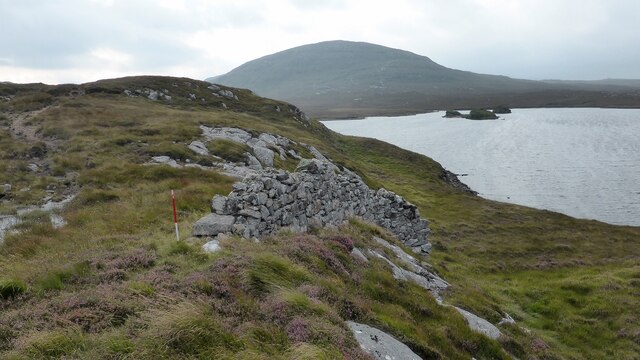
![Caultrashal Beag [Coltraiseal Beag] First HuMP of four today with Michael Earnshaw, Jim Bloomer and Martin Richardson in mixed weather.
Name: Caultrashal Beag [Coltraiseal Beag]
Hill number: 4941
Height: 226m / 741ft
Area: 24A: Lewis and Nearby Islands
Class: Hu,2
Grid ref: NB149241 (est)
Drop: 108m
Col: 118m NB161233](https://s1.geograph.org.uk/geophotos/03/69/32/3693277_9b2650d0.jpg)

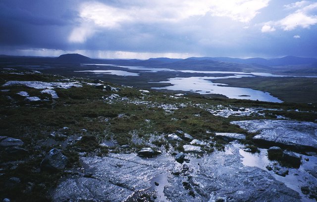
![Caultrashal Mor [Coltraiseal Mòr] Caultrashal Mor [Coltraiseal Mòr] summit cairn looking towards Caultrashal Beag [Coltraiseal Beag]. Third of four HuMPs today with Michael Earnshaw, Jim Bloomer and Martin Richardson in mixed weather.
Name: Caultrashal Mor [Coltraiseal Mòr]
Hill number: 1581
Height: 228m / 748ft
Area: 24A: Lewis and Nearby Islands
Class: Ma,2
Grid ref: NB 15875 22787
Summit feature: cairn
Drop: 162m
Col: 66m NB162258](https://s1.geograph.org.uk/geophotos/03/69/37/3693777_beb9a4d3.jpg)

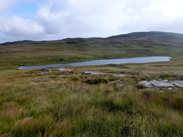
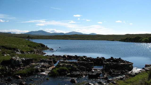
![Heading For Loch Ruah Descending from Coltraiseal Beag heading for Loch Ruadh and then Ben Mohal [Beinn Mothal].](https://s1.geograph.org.uk/geophotos/03/69/47/3694781_172fbdd9.jpg)


Cnoc an Teine is located at Grid Ref: NB1424 (Lat: 58.112822, Lng: -6.8507049)
Unitary Authority: Na h-Eileanan an Iar
Police Authority: Highlands and Islands
What 3 Words
///interacts.kickbacks.stacks. Near Carloway, Na h-Eileanan Siar
Related Wikis

Gisla Hydro-Electric Scheme
Gisla Hydro-Electric Scheme was a small scheme promoted by the North of Scotland Hydro-Electric Board on the Isle of Lewis, Outer Hebrides, Scotland. It...

Eilean Mòr, Loch Langavat
Eilean Mòr is an island in Loch Langavat on the Isle of Lewis in the Outer Hebrides of Scotland. == Footnotes ==

Fuaigh Beag
Fuaigh Beag or Vuia Be(a)g is an island in the Outer Hebrides. It is off the west coast of Lewis near Great Bernera in Loch Roag. Its name means "little...
Nearby Amenities
Located within 500m of 58.112822,-6.8507049Have you been to Cnoc an Teine?
Leave your review of Cnoc an Teine below (or comments, questions and feedback).