Dromannan a' Loin
Coastal Feature, Headland, Point in Ross-shire
Scotland
Dromannan a' Loin

Dromannan a' Loin is a prominent coastal feature located in Ross-shire, Scotland. It is a picturesque headland or point that juts out into the sea, offering breathtaking views of the surrounding landscape.
Situated on the east coast of Ross-shire, Dromannan a' Loin is known for its rugged beauty and diverse wildlife. The headland consists of towering cliffs that are carved by the relentless waves of the North Sea, creating a dramatic and awe-inspiring sight. The cliffs are made up of ancient rock formations, showcasing the geological history of the region.
Visitors to Dromannan a' Loin can enjoy a variety of activities. The headland is a popular spot for birdwatching enthusiasts, as it is home to a wide range of seabirds including gannets, puffins, and guillemots. The surrounding waters are also frequented by seals, dolphins, and occasionally even whales, providing an opportunity for marine life observation.
For those seeking outdoor adventures, Dromannan a' Loin offers several walking trails that allow visitors to explore the headland and appreciate its natural beauty up close. The paths wind through heather-covered moorland and offer panoramic views of the coastline, making it a paradise for hikers and nature lovers.
Additionally, Dromannan a' Loin is steeped in history. The headland is said to have played a role in the defense of the region during medieval times, and remnants of ancient fortifications can still be seen. The area also boasts archaeological sites, including standing stones and burial mounds, which provide insights into its ancient past.
Overall, Dromannan a' Loin is a stunning coastal feature that offers a blend of natural beauty, wildlife, and historical significance. It is a must-visit destination for anyone exploring the Ross-shire region of Scotland.
If you have any feedback on the listing, please let us know in the comments section below.
Dromannan a' Loin Images
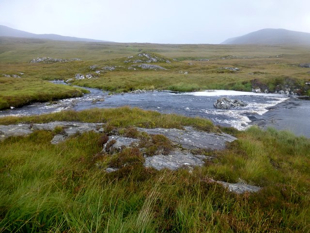
Images are sourced within 2km of 58.120487/-6.8589235 or Grid Reference NB1424. Thanks to Geograph Open Source API. All images are credited.


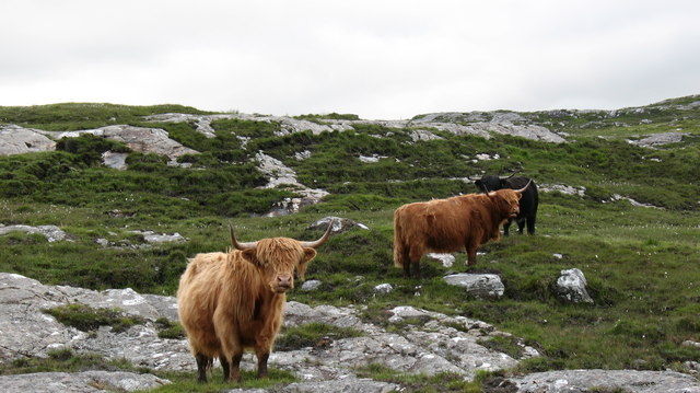
![Caultrashal Beag [Coltraiseal Beag] First HuMP of four today with Michael Earnshaw, Jim Bloomer and Martin Richardson in mixed weather.
Name: Caultrashal Beag [Coltraiseal Beag]
Hill number: 4941
Height: 226m / 741ft
Area: 24A: Lewis and Nearby Islands
Class: Hu,2
Grid ref: NB149241 (est)
Drop: 108m
Col: 118m NB161233](https://s1.geograph.org.uk/geophotos/03/69/32/3693277_9b2650d0.jpg)


Dromannan a' Loin is located at Grid Ref: NB1424 (Lat: 58.120487, Lng: -6.8589235)
Unitary Authority: Na h-Eileanan an Iar
Police Authority: Highlands and Islands
What 3 Words
///rejoins.measure.teaching. Near Carloway, Na h-Eileanan Siar
Related Wikis

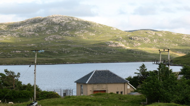
Gisla Hydro-Electric Scheme
Gisla Hydro-Electric Scheme was a small scheme promoted by the North of Scotland Hydro-Electric Board on the Isle of Lewis, Outer Hebrides, Scotland. It...

Eilean Mòr, Loch Langavat
Eilean Mòr is an island in Loch Langavat on the Isle of Lewis in the Outer Hebrides of Scotland. == Footnotes ==

Fuaigh Beag
Fuaigh Beag or Vuia Be(a)g is an island in the Outer Hebrides. It is off the west coast of Lewis near Great Bernera in Loch Roag. Its name means "little...
Flodaigh, Lewis
Flodaigh is a small island in Loch Roag on the west coast of Lewis in the Outer Hebrides of Scotland. It is about 33 hectares (82 acres) in extent and...
Nearby Amenities
Located within 500m of 58.120487,-6.8589235Have you been to Dromannan a' Loin?
Leave your review of Dromannan a' Loin below (or comments, questions and feedback).