Loch na Muilne

Lake, Pool, Pond, Freshwater Marsh in Ross-shire

Scotland

Loch na Muilne

Gisla Power Station Small HEP station on the western shore of Loch Rog Beag at Giosla.
Gisla Power Station Credit: Colin Smith

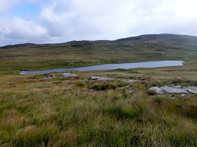
Loch na Muilne is a picturesque freshwater loch situated in Ross-shire, Scotland. Nestled amidst the stunning Highland scenery, it is known for its tranquil atmosphere and natural beauty.

With a surface area of approximately 10 acres, Loch na Muilne is a relatively small body of water. It is surrounded by rolling hills covered in lush green vegetation, creating a serene and idyllic setting. The loch is fed by several small streams and springs, ensuring a constant flow of freshwater.

The water in Loch na Muilne is crystal clear and exhibits a deep blue color, adding to its visual appeal. It is home to a variety of aquatic plants, including water lilies and reeds, which provide shelter and food for a diverse range of wildlife.

The loch is a haven for birdwatchers, as it attracts numerous species of waterfowl. Visitors can spot graceful swans, elegant herons, and colorful ducks among others. The surrounding marshland is also a habitat for many small mammals, such as otters and water voles.

Fishing enthusiasts are drawn to Loch na Muilne, as it offers opportunities for angling. The loch is abundant in brown trout, making it an ideal spot for a peaceful day of fishing. Anglers can enjoy the solitude and tranquility of the surroundings while trying their luck at catching these prized fish.

Overall, Loch na Muilne is a hidden gem in Ross-shire, offering a peaceful escape into nature. Its breathtaking scenery, diverse wildlife, and fishing opportunities make it a must-visit destination for nature lovers and outdoor enthusiasts.

If you have any feedback on the listing, please let us know in the comments section below.

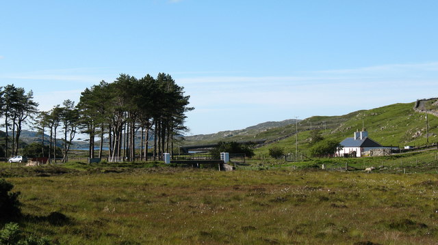
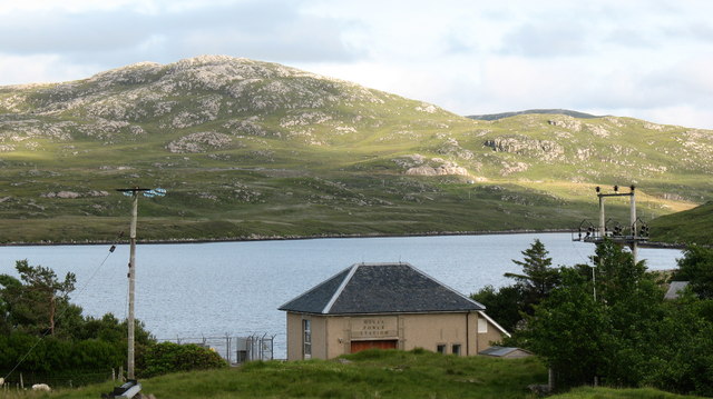
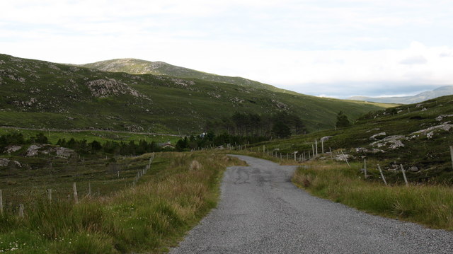
Loch na Muilne Images

Images are sourced within 2km of 58.121194/-6.8535964 or Grid Reference NB1424. Thanks to Geograph Open Source API. All images are credited.

Gisla Power Station Small HEP station on the western shore of Loch Rog Beag at Giosla.
Gisla Power Station
Small HEP station on the western shore of Loch Rog Beag at Giosla.
B8011 cut through the hillside By the bottom of Loch Ròg Beag
B8011 cut through the hillside
By the bottom of Loch Ròg Beag
Gisla Power Station A small hydroelectric power station, using water piped from Loch Coirceabhat.
Gisla Power Station
A small hydroelectric power station, using water piped from Loch Coirceabhat.
Caultrashal Beag [Coltraiseal Beag] First HuMP of four today with Michael Earnshaw, Jim Bloomer and Martin Richardson in mixed weather.

Name: Caultrashal Beag [Coltraiseal Beag]
Hill number: 4941
Height: 226m / 741ft
Area: 24A: Lewis and Nearby Islands
Class: Hu,2
Grid ref: NB149241 (est)
Drop: 108m
Col: 118m  NB161233
Caultrashal Beag [Coltraiseal Beag]
First HuMP of four today with Michael Earnshaw, Jim Bloomer and Martin Richardson in mixed weather. Name: Caultrashal Beag [Coltraiseal Beag] Hill number: 4941 Height: 226m / 741ft Area: 24A: Lewis and Nearby Islands Class: Hu,2 Grid ref: NB149241 (est) Drop: 108m Col: 118m NB161233
View From Bridge View from the road bridge towards Loch Rog Beag.
View From Bridge
View from the road bridge towards Loch Rog Beag.
Loch Ruadh Loch Ruadh on route to Beinn Mothal.
Loch Ruadh
Loch Ruadh on route to Beinn Mothal.
River Morsgail View A tributary joins the River Morsgail at a strange angle.
River Morsgail View
A tributary joins the River Morsgail at a strange angle.
Heading For Loch Ruah Descending from Coltraiseal Beag heading for Loch Ruadh and then Ben Mohal [Beinn Mothal].
Heading For Loch Ruah
Descending from Coltraiseal Beag heading for Loch Ruadh and then Ben Mohal [Beinn Mothal].
Old road bridge at Giosla
Rock on moorland near Loch Fuarail, Isle of Lewis Looking towards Loch Fuarail and Coduinn.
Rock on moorland near Loch Fuarail, Isle of Lewis
Looking towards Loch Fuarail and Coduinn.
Loch Sùrstabhat at sunset Although looking almost due north, the sun was setting just off the left of this view, taken after 10 pm (summer time). The sunset hadn't yet developed the spectacular underlit cloudscape that followed 20 minutes or so later, but the little loch caught our eye as we became increasingly distracted from the road looking for a suitable foreground. Fortunately, there are sections of the old road to safely get off the highway and wander about with a camera !
Loch Sùrstabhat at sunset
Although looking almost due north, the sun was setting just off the left of this view, taken after 10 pm (summer time). The sunset hadn't yet developed the spectacular underlit cloudscape that followed 20 minutes or so later, but the little loch caught our eye as we became increasingly distracted from the road looking for a suitable foreground. Fortunately, there are sections of the old road to safely get off the highway and wander about with a camera !
Sunset over Loch Sùrstabhat As the sky cleared from the west, the sun started to underlight the cloud cover as we passed by the upper end of Loch Sùrstabhat. The perspective and the direction of clearance has produced one of those views where the horizon looks tilted one way when seen "broad-brush" but then seems tilted the other way when the water is looked at more closely. I find the effect somewhat disturbing, but have tried to get the real horizon as level as possible. It's not helped by those electric poles all leaning towards the long span of cable across the loch...
Sunset over Loch Sùrstabhat
As the sky cleared from the west, the sun started to underlight the cloud cover as we passed by the upper end of Loch Sùrstabhat. The perspective and the direction of clearance has produced one of those views where the horizon looks tilted one way when seen "broad-brush" but then seems tilted the other way when the water is looked at more closely. I find the effect somewhat disturbing, but have tried to get the real horizon as level as possible. It's not helped by those electric poles all leaning towards the long span of cable across the loch...
Looking towards Giosla from the B8011
Road leading to Mhorsgail Lodge
Old road bridge near Giosla. This bridge once carried the B8011 over the river that issues from Loch Morsgail. A new concrete bridge can be seen in the background.
Old road bridge near Giosla.
This bridge once carried the B8011 over the river that issues from Loch Morsgail. A new concrete bridge can be seen in the background.
Power Station at Giosla. This appears to be a small hydro-electric plant using water from Loch More Coirgavat, which is half a mile away and 50 metres higher up the hillside.
Power Station at Giosla.
This appears to be a small hydro-electric plant using water from Loch More Coirgavat, which is half a mile away and 50 metres higher up the hillside.
The old road. This section of the B8011 in West Lewis has now been by passed, so now it just leads to a cottage and the entrance to a private estate road.
The old road.
This section of the B8011 in West Lewis has now been by passed, so now it just leads to a cottage and the entrance to a private estate road.
Highland cattle. Contented cattle near the roadside in West Lewis.
Highland cattle.
Contented cattle near the roadside in West Lewis.
Show me another place!

Loch na Muilne is located at Grid Ref: NB1424 (Lat: 58.121194, Lng: -6.8535964)

Unitary Authority: Na h-Eileanan an Iar

Police Authority: Highlands and Islands

What 3 Words

///revamping.decide.remind. Near Carloway, Na h-Eileanan Siar

Related Wikis

Gisla Hydro-Electric Scheme

Gisla Hydro-Electric Scheme was a small scheme promoted by the North of Scotland Hydro-Electric Board on the Isle of Lewis, Outer Hebrides, Scotland. It...

Eilean Mòr, Loch Langavat

Eilean Mòr is an island in Loch Langavat on the Isle of Lewis in the Outer Hebrides of Scotland. == Footnotes ==

Fuaigh Beag

Fuaigh Beag or Vuia Be(a)g is an island in the Outer Hebrides. It is off the west coast of Lewis near Great Bernera in Loch Roag. Its name means "little...

Flodaigh, Lewis

Flodaigh is a small island in Loch Roag on the west coast of Lewis in the Outer Hebrides of Scotland. It is about 33 hectares (82 acres) in extent and...

Nearby Amenities

Located within 500m of 58.121194,-6.8535964
Noexit: yes
Lat/Long: 58.1213573/-6.8477362
Passing Place
Lat/Long: 58.1223495/-6.8454809
Power: pole
Lat/Long: 58.1227888/-6.8458718
Power: pole
Lat/Long: 58.122393/-6.8471358
Power: pole
Lat/Long: 58.1218817/-6.8487789
Power: pole
Lat/Long: 58.1214597/-6.8501196
Power: pole
Lat/Long: 58.1210282/-6.8514806
Power: pole
Lat/Long: 58.1206027/-6.8528484
Power: pole
Lat/Long: 58.1201688/-6.8542207
Power: pole
Lat/Long: 58.1195429/-6.854891
Power: pole
Lat/Long: 58.1186954/-6.8557961
Power: pole
Lat/Long: 58.1178358/-6.8567012
Power: pole
Lat/Long: 58.117508/-6.8578659
Power: pole
Lat/Long: 58.1225311/-6.8459852
Power: pole
Lat/Long: 58.1221656/-6.8471546
Power: pole
Lat/Long: 58.1217733/-6.848426
Power: pole
Lat/Long: 58.1213611/-6.8496678
Power: pole
Lat/Long: 58.1210962/-6.8505583
Power: pole
Lat/Long: 58.1208157/-6.8514408
Power: pole
Lat/Long: 58.1204063/-6.8527443
Power: pole
Lat/Long: 58.1200267/-6.8539916
Power: pole
Lat/Long: 58.1194402/-6.8545334
Power: pole
Lat/Long: 58.1187035/-6.8552442
Power: pole
Lat/Long: 58.1181312/-6.8557994
Power: pole
Lat/Long: 58.1174909/-6.8563895
The data included in this document is from www.openstreetmap.org. The data is made available under ODbL.

Have you been to Loch na Muilne?

Leave your review of Loch na Muilne below (or comments, questions and feedback).