Loch na Faing

Lake, Pool, Pond, Freshwater Marsh in Inverness-shire

Scotland

Loch na Faing

The old road to Tarbert, Harris The remains of the old road just show here, at a passing place on the newer road, which is still pretty narrow and tortuous - known as "The Golden Road".
The old road to Tarbert, Harris Credit: Gordon Brown

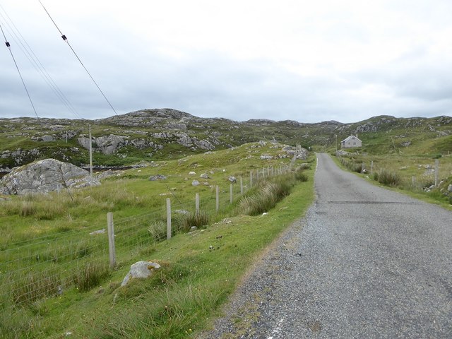
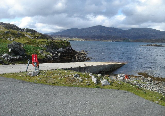
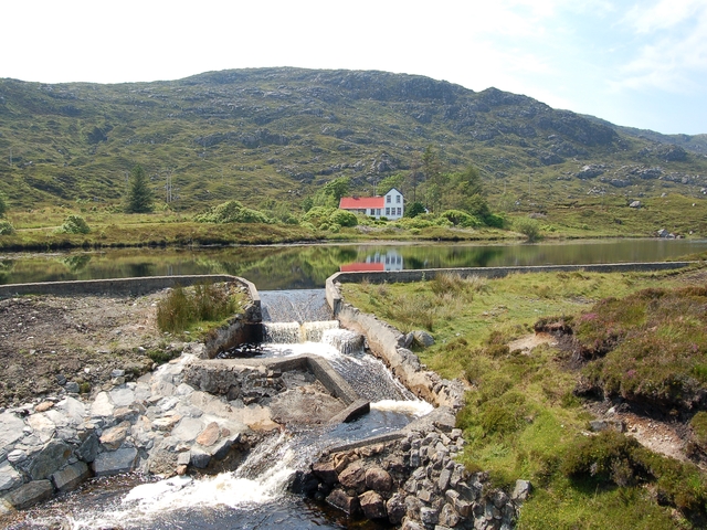
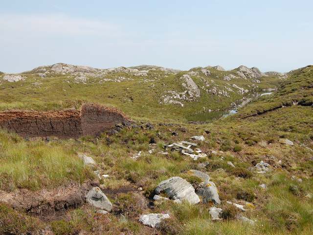
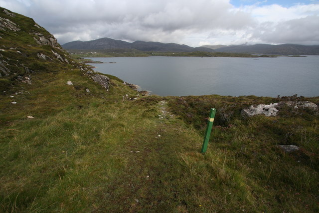
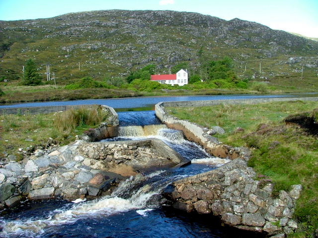
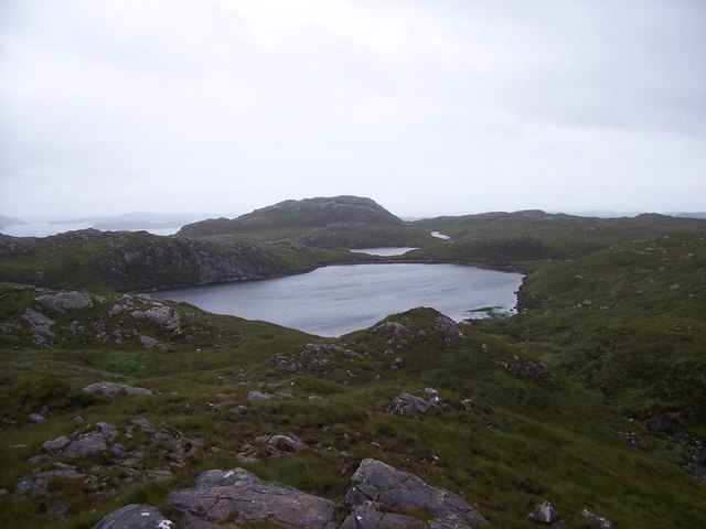
Loch na Faing is a picturesque freshwater loch located in Inverness-shire, Scotland. Nestled amidst the stunning Scottish Highlands, this body of water spans an area of approximately 10 hectares. It is situated at an elevation of 500 meters above sea level, providing visitors with breathtaking views of the surrounding mountain ranges.

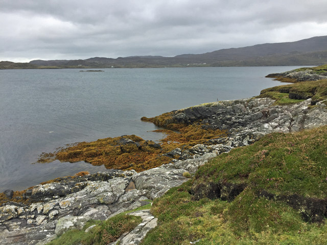
The loch is known for its tranquil atmosphere and crystal-clear waters. It serves as a haven for various species of aquatic life, making it a popular spot for fishing enthusiasts. Anglers can often be seen casting their lines in search of brown trout, which are abundant in the loch.

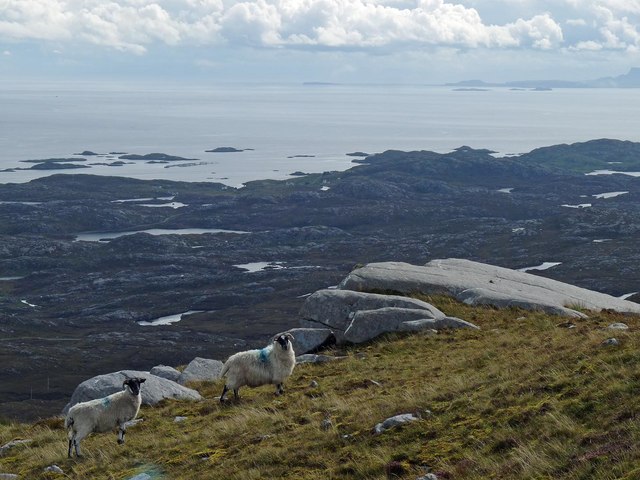
Surrounded by lush greenery and heather-covered hills, Loch na Faing offers visitors a chance to immerse themselves in the natural beauty of the Scottish countryside. The area is home to a wide variety of bird species, including golden eagles, ospreys, and herons, making it a haven for birdwatchers.

Aside from its natural beauty, Loch na Faing also holds historical significance. Ruins of an ancient castle can be found on its shores, providing a glimpse into Scotland's rich history and heritage.

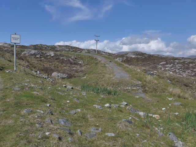
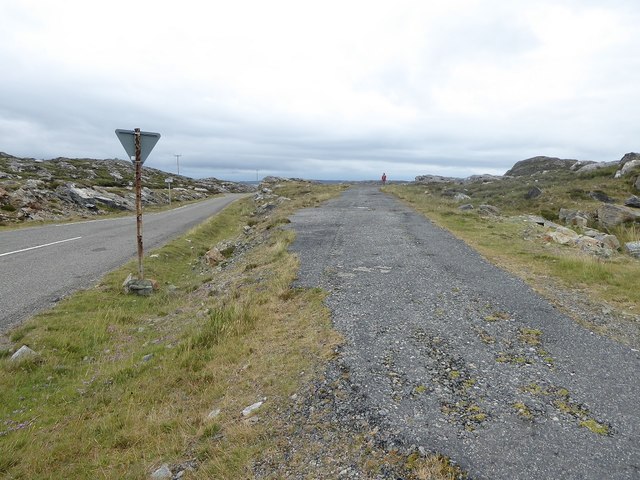
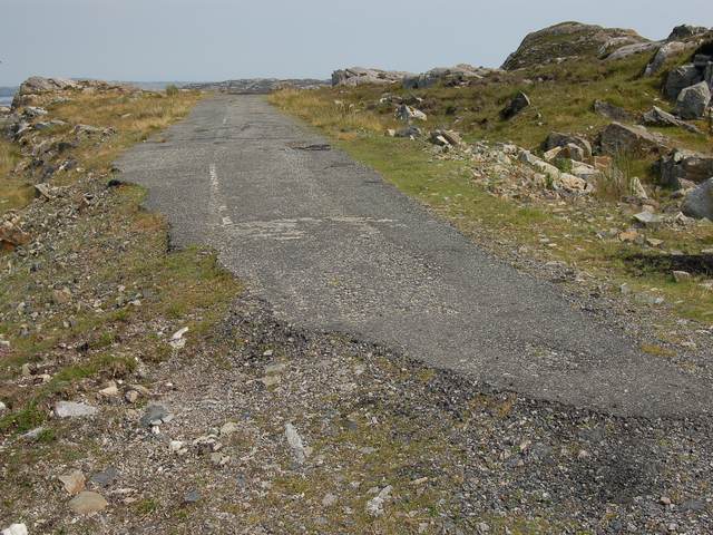
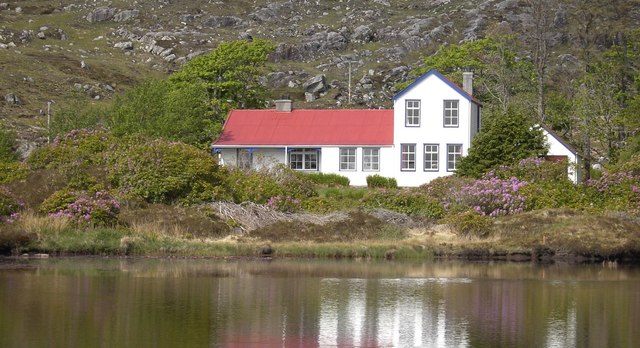
The loch is easily accessible by car, with a parking area nearby for visitors. Whether you're seeking a peaceful day of fishing, a scenic picnic spot, or simply a chance to connect with nature, Loch na Faing offers a serene and idyllic setting for all.

If you have any feedback on the listing, please let us know in the comments section below.

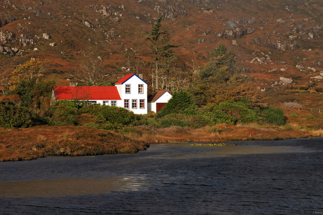
Loch na Faing Images

Images are sourced within 2km of 57.874052/-6.8200403 or Grid Reference NG1497. Thanks to Geograph Open Source API. All images are credited.

The old road to Tarbert, Harris The remains of the old road just show here, at a passing place on the newer road, which is still pretty narrow and tortuous - known as "The Golden Road".
The old road to Tarbert, Harris
The remains of the old road just show here, at a passing place on the newer road, which is still pretty narrow and tortuous - known as "The Golden Road".
Rock slab, Beul na Bearnadh, Harris
Aird Dhirecleit The point that lies between Ob Liceasto and Bàgh Diracleit, two inlets of Loch Ceann Dibig.
Aird Dhirecleit
The point that lies between Ob Liceasto and Bàgh Diracleit, two inlets of Loch Ceann Dibig.
Isolated cottage at Ceann Dibig, from the A859 This is the same cunningly positioned cottage described as derelict in Graham Maxwell's 2005 picture <a href="https://www.geograph.org.uk/photo/413005">NG1498 : Cottage at Ceann Dibig</a>, now clearly refurbished with a smart new deck outside.
Isolated cottage at Ceann Dibig, from the A859
This is the same cunningly positioned cottage described as derelict in Graham Maxwell's 2005 picture NG1498 : Cottage at Ceann Dibig, now clearly refurbished with a smart new deck outside.
Disused road section next to start of the 'Golden Road'
Minor road among rock outcrops east of Meavag
Slipway at Miavaig This local authority-owned slipway leads into Loch Ceann Dibig and is mainly used by leisure craft.
Slipway at Miavaig
This local authority-owned slipway leads into Loch Ceann Dibig and is mainly used by leisure craft.
Horsacleit The artificially enhanced loch in front of Horsacleit was designed as part of the Horsacleit fishery. The lodge itself was probably erected around the 1890s to house fishermen who came to flyfish on this loch and the associated river system.
Horsacleit
The artificially enhanced loch in front of Horsacleit was designed as part of the Horsacleit fishery. The lodge itself was probably erected around the 1890s to house fishermen who came to flyfish on this loch and the associated river system.
The end of the Miabhag road The old road to Miabhag ends here. Although the current road and the line of this old road both are shown on the 25k map, neither appears on the 1940s OS. This must have been a relatively short-lived road.
The end of the Miabhag road
The old road to Miabhag ends here. Although the current road and the line of this old road both are shown on the 25k map, neither appears on the 1940s OS. This must have been a relatively short-lived road.
Peat cutting Part of a large complex of peat banks that are actively worked for fuel in Harris.
Peat cutting
Part of a large complex of peat banks that are actively worked for fuel in Harris.
Shed by Loch Direcleit A crofter's shed, probably used in connection with his sheep.
Shed by Loch Direcleit
A crofter's shed, probably used in connection with his sheep.
Cottage at Ceann Dibig Derelict Cottage at Cean Dibig from A859
Cottage at Ceann Dibig
Derelict Cottage at Cean Dibig from A859
Horsacleit Horsacleit house near Tarbert.
Horsacleit
Horsacleit house near Tarbert.
The Harris walkway beside Loch Ceann Dibig The path follows the shore of Loch Ceann Dibig between Miabhaig & Ceann Dibig. As the picture shows, the views are stunning.
The Harris walkway beside Loch Ceann Dibig
The path follows the shore of Loch Ceann Dibig between Miabhaig & Ceann Dibig. As the picture shows, the views are stunning.
Dilapidating house at Miabhaig This house has rapidly deteriorated in the Hebridean weather.
Dilapidating house at Miabhaig
This house has rapidly deteriorated in the Hebridean weather.
Horsacleit Set in a stunning location west of the township of Miabhaig.
Horsacleit
Set in a stunning location west of the township of Miabhaig.
The red & white house This lovely building, Horsacleit House, sits next to its own lochan which in turn is next to the A859 which runs from Tarbert to Rodel.
The red & white house
This lovely building, Horsacleit House, sits next to its own lochan which in turn is next to the A859 which runs from Tarbert to Rodel.
Loch Uamadail, Langracleit, Harris Looking south-west over Loch Uamadail in rather gloomy weather, notice the curious thin strip of a lochan at the far end of the square. A dipper was seen here.
Loch Uamadail, Langracleit, Harris
Looking south-west over Loch Uamadail in rather gloomy weather, notice the curious thin strip of a lochan at the far end of the square. A dipper was seen here.
Show me another place!

Loch na Faing is located at Grid Ref: NG1497 (Lat: 57.874052, Lng: -6.8200403)

Unitary Authority: Na h-Eileanan an Iar

Police Authority: Highlands and Islands

What 3 Words

///typed.vibe.expand. Near Tarbert, Na h-Eileanan Siar

Nearby Locations

Loch na Faing

Related Wikis

Harris distillery

Harris distillery is a Scotch whisky and Gin distillery in Tarbert on the Isle of Harris, Scotland. The distillery was the first legal distillery ever...

Tarbert, Harris

Tarbert (Scottish Gaelic: An Tairbeart [ən̪ˠ ˈt̪ɛrʲɛbərˠʃt̪]) is the main community on Harris in the Western Isles of Scotland. The name means "isthmus...

East Loch Tarbert

East Loch Tarbert (Scottish Gaelic: Loch an Tairbeairt) is a sea loch that lies to the east of Harris in the Outer Hebrides of Scotland. The loch contains...

Harris, Outer Hebrides

Harris (Scottish Gaelic: Na Hearadh, pronounced [nə ˈhɛɾəɣ] ) is the southern and more mountainous part of Lewis and Harris, the largest island in the...

Nearby Amenities

Located within 500m of 57.874052,-6.8200403
Bus Stop
Meavag South Harris
Bus: yes
Naptan AtcoCode: 6010731750
Naptan Bearing: S
Naptan CommonName: Meavag South Harris
Naptan Indicator: A859 Junction
Naptan Landmark: A859 Junction
Naptan NaptanCode: 94723672
Naptan Street: A859 Junction
Naptan Verified: no
Public Transport: platform
Source: naptan_import
Lat/Long: 57.8716378/-6.8172105
Passing Place
Lat/Long: 57.8750371/-6.819439
Passing Place
Lat/Long: 57.8761185/-6.8194943
Passing Place
Lat/Long: 57.8772395/-6.8195531
Board Type: nature
Information: board
Tourism: information
Lat/Long: 57.8719919/-6.8172044
Power: pole
Lat/Long: 57.8709501/-6.822314
Power: pole
Lat/Long: 57.8714855/-6.8216007
Power: pole
Lat/Long: 57.8720432/-6.8208522
Power: pole
Lat/Long: 57.8725583/-6.8201847
Power: pole
Lat/Long: 57.8735367/-6.8203023
Power: pole
Lat/Long: 57.8752141/-6.8204742
Power: pole
Lat/Long: 57.8765916/-6.8206074
Power: pole
Lat/Long: 57.8773478/-6.8207234
Power: pole
Lat/Long: 57.8781036/-6.8207824
Power: pole
Lat/Long: 57.8703009/-6.8231717
Power: pole
Lat/Long: 57.874373/-6.820378
Passing Place
Lat/Long: 57.8714937/-6.8149261
Passing Place
Lat/Long: 57.8755778/-6.8194666
Power: pole
Lat/Long: 57.8752605/-6.8211217
Power: pole
Lat/Long: 57.8758738/-6.8211753
Power: pole
Lat/Long: 57.875871/-6.8205584
Power: pole
Lat/Long: 57.8770034/-6.8202111
Power: pole
Lat/Long: 57.8775835/-6.8202821
Power: pole
Lat/Long: 57.8781048/-6.8203251
Power: pole
Lat/Long: 57.8781935/-6.8214637
Power: pole
Lat/Long: 57.8773406/-6.821343
Power: pole
Lat/Long: 57.8766318/-6.8212599
Power: pole
Lat/Long: 57.8738733/-6.8209702
Power: pole
Lat/Long: 57.8731259/-6.8208293
Power: pole
Lat/Long: 57.8724191/-6.8207663
Power: pole
Lat/Long: 57.8718935/-6.8215925
Power: pole
Lat/Long: 57.8714827/-6.8222094
Passing Place
Lat/Long: 57.8720233/-6.8174406
Power: pole
Lat/Long: 57.876102/-6.8201278
Power: pole
Lat/Long: 57.8755039/-6.8200618
Power: pole
Lat/Long: 57.875008/-6.8199755
Power: pole
Lat/Long: 57.8741527/-6.8199239
Power: pole
Lat/Long: 57.8733373/-6.8198293
Power: pole
Lat/Long: 57.8726403/-6.8193347
Power: pole
Lat/Long: 57.8717004/-6.8186919
Power: pole
Lat/Long: 57.8707929/-6.8180775
Power: pole
Lat/Long: 57.8703229/-6.8183237
Power: pole
Lat/Long: 57.8697773/-6.8185438
Power: pole
Lat/Long: 57.8718497/-6.8161061
Power: pole
Lat/Long: 57.8716759/-6.8145042
Fast Food
Lorna's Larder
Contact Facebook: https://www.facebook.com/lornaslarder/
Contact Phone: +44 7740 918795
Cuisine: scottish;seafood
Drive Through: no
Lat/Long: 57.8712434/-6.8156543
Man Made: tower
Tower Construction: lattice
Tower Type: communication
Lat/Long: 57.8711064/-6.8143026
Power: pole
Lat/Long: 57.8745743/-6.8210022
Power: pole
Lat/Long: 57.8710277/-6.822834
Power: pole
Lat/Long: 57.8704827/-6.8237231
The data included in this document is from www.openstreetmap.org. The data is made available under ODbL.

Have you been to Loch na Faing?

Leave your review of Loch na Faing below (or comments, questions and feedback).