Cnoc a' Chaolais

Hill, Mountain in Ross-shire

Scotland

Cnoc a' Chaolais

Camas Bastadh/Bostadh Spelled differently on the map and gazetteer.
Camas Bastadh/Bostadh Credit: John Lucas

Cnoc a' Chaolais, located in Ross-shire, Scotland, is a prominent hill/mountain standing at an elevation of 785 meters (2,575 feet). It is situated in the beautiful and rugged Scottish Highlands, offering breathtaking views of the surrounding landscape.

Cnoc a' Chaolais is part of the Torridon Mountains range, known for its dramatic and craggy peaks. The hill/mountain is characterized by its steep slopes, rocky terrain, and distinctive ridges, making it a challenging but rewarding destination for hikers and climbers.

The summit of Cnoc a' Chaolais offers stunning panoramic views of Loch Torridon, Loch Maree, and the surrounding mountains, including the iconic Beinn Alligin and Liathach. On clear days, it is even possible to catch a glimpse of the Isle of Skye in the distance.

This area is known for its rich wildlife, with frequent sightings of red deer, golden eagles, and mountain hares. The hill/mountain is also home to various rare alpine plants, adding to its natural beauty and ecological significance.

Access to Cnoc a' Chaolais is generally via well-defined trails, although the final ascent to the summit can be steep and challenging. It is important for visitors to be adequately prepared with appropriate clothing, footwear, and navigation equipment due to the unpredictable and changeable weather conditions in the area.

If you have any feedback on the listing, please let us know in the comments section below.

Cnoc a' Chaolais Images

Images are sourced within 2km of 58.256088/-6.8701015 or Grid Reference NB1440. Thanks to Geograph Open Source API. All images are credited.

Camas Bastadh/Bostadh Spelled differently on the map and gazetteer.
Camas Bastadh/Bostadh
Spelled differently on the map and gazetteer.
The cemetery at Bostadh Perhaps not a surprising number of burials for such a remote location, as it is a very desirable place to be laid to rest.
The cemetery at Bostadh
Perhaps not a surprising number of burials for such a remote location, as it is a very desirable place to be laid to rest.
The road to Bostadh With Siaram Bostadh in mid view on the left side.
The road to Bostadh
With Siaram Bostadh in mid view on the left side.
Beehive Cell - Eilean Fir Chrothair The beautiful little beehive cell on the island of Eilean Fir Chrothair.
Beehive Cell - Eilean Fir Chrothair
The beautiful little beehive cell on the island of Eilean Fir Chrothair.
Bostadh Iron Age House The reconstructed house, viewed looking south.
Bostadh Iron Age House
The reconstructed house, viewed looking south.
Information about Bostadh Iron Age Village The Gaelic version.
Information about Bostadh Iron Age Village
The Gaelic version.
Information about Bostadh Iron Age Village The English version.
Information about Bostadh Iron Age Village
The English version.
Public convenience at Bostadh Near the end of the road at the cemetery and Iron Age Village.
Public convenience at Bostadh
Near the end of the road at the cemetery and Iron Age Village.
Camas Bostadh Sand dunes at Bostadh, looking to a cloud-covered Flodaigh.
Camas Bostadh
Sand dunes at Bostadh, looking to a cloud-covered Flodaigh.
Rocky coast at Bostadh Looking across Camas Bostadh from near the cemetery wall.
Rocky coast at Bostadh
Looking across Camas Bostadh from near the cemetery wall.
Beach at Bostadh Looking across Camas Bostadh, with part of Flodaigh on the right.
Beach at Bostadh
Looking across Camas Bostadh, with part of Flodaigh on the right.
Traigh Bostadh Looking across to Cnoc Urraman.
Traigh Bostadh
Looking across to Cnoc Urraman.
Iron Age Village at Bostadh A reconstructed house and, farther up the valley, traces of other houses.
Iron Age Village at Bostadh
A reconstructed house and, farther up the valley, traces of other houses.
View from an Iron Age house Looking over Traigh Bosdtadh to Camus Bostadh and Flodaigh, from the enclosure surrounding the reconstructed house.
View from an Iron Age house
Looking over Traigh Bosdtadh to Camus Bostadh and Flodaigh, from the enclosure surrounding the reconstructed house.
Garden Tiger Moth larva A larva of Arctia caja on the path close to the Iron Age house at Bostadh. Thin plant growth on sand, with clear signs of rabbit grazing.
Garden Tiger Moth larva
A larva of Arctia caja on the path close to the Iron Age house at Bostadh. Thin plant growth on sand, with clear signs of rabbit grazing.
Iron Age House at Bostadh The inland end. Beyond is the path down from the car park.
Iron Age House at Bostadh
The inland end. Beyond is the path down from the car park.
Entrance to the Iron Age House A gap in the surrounding wall leads to the top of steps leading down to an underground entrance.
Entrance to the Iron Age House
A gap in the surrounding wall leads to the top of steps leading down to an underground entrance.
Iron Age House Underground doorway at the foot of the entrance steps. It is possible to go inside when the site is open.
Iron Age House
Underground doorway at the foot of the entrance steps. It is possible to go inside when the site is open.
Show me another place!

Cnoc a' Chaolais is located at Grid Ref: NB1440 (Lat: 58.256088, Lng: -6.8701015)

Unitary Authority: Na h-Eileanan an Iar

Police Authority: Highlands and Islands

What 3 Words

///alternate.visits.roadblock. Near Carloway, Na h-Eileanan Siar

Related Wikis

Little Bernera

Little Bernera (Scottish Gaelic: Beàrnaraigh Beag) is a small island situated off the west coast of the Isle of Lewis in the Outer Hebrides.Little Bernera...

Bernera Riot

The Bernera Riot occurred in 1874, on the island of Great Bernera, in Scotland in response to the Highland Clearances. The use of the term 'Bernera Riot...

Cealasaigh

Cealasaigh or Kealasay is an islet in outer Loch Ròg, Lewis, Scotland that lies north of Traigh Mhór on Little Bernera and south of Campaigh. To the west...

Flodaigh (Outer Loch Ròg)

Flodaigh is an islet in outer Loch Ròg, Lewis, Scotland. It lies north west of Great Bernera and Little Bernera, south of Bearasaigh and Seanna Chnoc and...

Campaigh

Campaigh or Campay is a steep and rocky islet in outer Loch Ròg, Lewis, Scotland that lies north of Cealasaigh and Little Bernera. A huge natural arch...

Great Bernera

Great Bernera (; Scottish Gaelic: Beàrnaraigh Mòr), often known just as Bernera (Scottish Gaelic: Beàrnaraigh), is an island and community in the Outer...

Bearasaigh

Bearasaigh or Bearasay (and sometimes Berisay) is an islet in outer Loch Ròg, Lewis, Scotland. During the late 16th and early 17th centuries it was used...

Breaclete

Breacleit (or Roulanish; Scottish Gaelic: Breacleit; Old Norse: Breiðiklettr) is the central village on Great Bernera in the Outer Hebrides, Scotland....

Related Videos

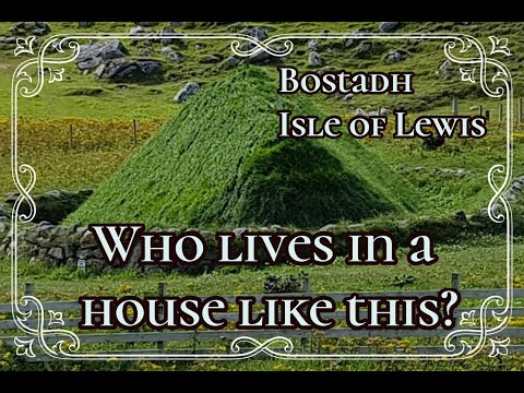
Outer Hebrides, Bostadh Beach

Bostadh Beach, Isle of Lewis, June 19th 2021.

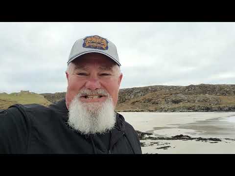
Outer Hebrides, Scotland, June 18th 2021

Ferry from Ullapool to Stornoway, car from Isle of Harris to Isle of Lewis and finally ending at Bosta Beach,

Nearby Amenities

Located within 500m of 58.256088,-6.8701015
Passing Place
Lat/Long: 58.2565739/-6.8686546
Passing Place
Lat/Long: 58.2566115/-6.8750443
Passing Place
Lat/Long: 58.2574779/-6.8713253
Passing Place
Lat/Long: 58.2570087/-6.8764952
Barrier: cattle_grid
Lat/Long: 58.2554224/-6.8669872
Bostadh
Name En: Bosta
Name Gd: Bostadh
Place: locality
Lat/Long: 58.2563843/-6.8734925
Barrier: cattle_grid
Lat/Long: 58.2572351/-6.8721527
Passing Place
Lat/Long: 58.2568485/-6.8744865
Passing Place
Lat/Long: 58.2575146/-6.8692889
Passing Place
Lat/Long: 58.2548915/-6.8659675
Man Made: mast
Tower Construction: mast
Lat/Long: 58.2563919/-6.86197
Passing Place
Lat/Long: 58.2534435/-6.8632751
Barrier: cattle_grid
Lat/Long: 58.2545568/-6.8645745
The data included in this document is from www.openstreetmap.org. The data is made available under ODbL.

Have you been to Cnoc a' Chaolais?

Leave your review of Cnoc a' Chaolais below (or comments, questions and feedback).