Carnan Mòr

Coastal Feature, Headland, Point in Ross-shire

Scotland

Carnan Mòr

West coast of Great Bernera This is the west side of a spit of land extending south of Tobson. The ground is rocky with a thin covering of grass.

In the distance, on the left is the tip of the island of Pabaigh Mor .. and on the right Geodha Mor (west of Tobson).
West coast of Great Bernera Credit: Rob Burke

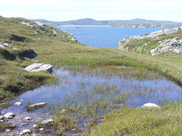
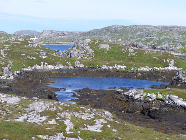
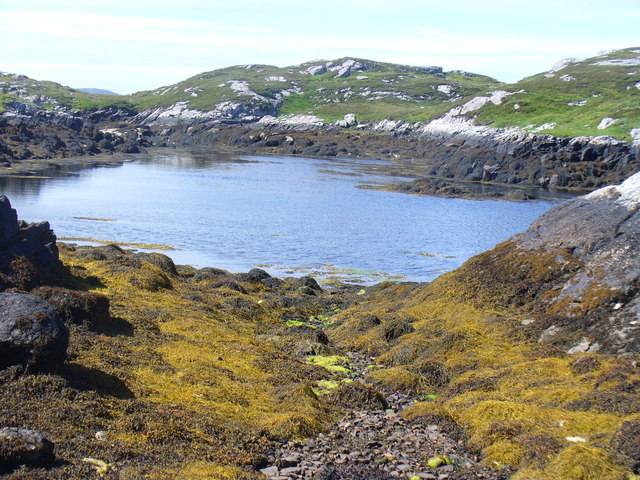
Carnan Mòr is a prominent coastal feature located in Ross-shire, Scotland. It is a headland or point that juts out into the North Atlantic Ocean, offering stunning views and a unique geographical setting. Situated on the western coast of Scotland, Carnan Mòr is known for its rugged beauty and dramatic cliffs.

The headland is characterized by its towering cliffs, which rise steeply from the sea, creating a striking and picturesque landscape. These cliffs are composed of ancient rock formations, showcasing the region's geological history. The exposed nature of Carnan Mòr makes it susceptible to the powerful forces of wind and waves, resulting in the formation of sea caves and arches along its coastline.

The headland is also home to a diverse range of flora and fauna, with seabird colonies nesting on the cliffs and marine life thriving in the surrounding waters. Visitors to Carnan Mòr can often spot species such as puffins, guillemots, and seals, making it a popular spot for wildlife enthusiasts and birdwatchers.

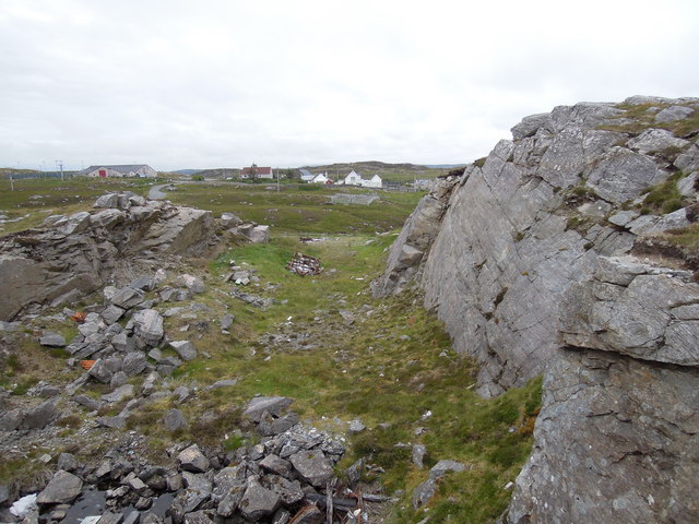
In addition to its natural beauty, Carnan Mòr holds historical significance as well. The headland is dotted with archaeological remains, including ancient settlements and burial sites, providing a glimpse into the area's rich cultural past.

Overall, Carnan Mòr is a captivating coastal feature that offers visitors a chance to immerse themselves in Scotland's natural and historical heritage. Whether it is exploring the rugged cliffs, observing the diverse wildlife, or delving into its archaeological treasures, Carnan Mòr promises a memorable experience for all who visit.

If you have any feedback on the listing, please let us know in the comments section below.

Carnan Mòr Images

Images are sourced within 2km of 58.214707/-6.8691426 or Grid Reference NB1435. Thanks to Geograph Open Source API. All images are credited.

West coast of Great Bernera This is the west side of a spit of land extending south of Tobson. The ground is rocky with a thin covering of grass.

In the distance, on the left is the tip of the island of Pabaigh Mor .. and on the right Geodha Mor (west of Tobson).
West coast of Great Bernera
This is the west side of a spit of land extending south of Tobson. The ground is rocky with a thin covering of grass. In the distance, on the left is the tip of the island of Pabaigh Mor .. and on the right Geodha Mor (west of Tobson).
Beach north of Bhalasaigh
Sea loch west of Loch Veiravat Although it isn't obvious from here, this is the start of a long channel that leads out to the sea.
Sea loch west of Loch Veiravat
Although it isn't obvious from here, this is the start of a long channel that leads out to the sea.
Moorland and loch on Great Bernera The loch is unnamed on the map, but the Allt Loch an Fheoir flows into it, so this must be Loch an Fheoir.

The houses in the distance are on the road south of Bhalasaigh.
Moorland and loch on Great Bernera
The loch is unnamed on the map, but the Allt Loch an Fheoir flows into it, so this must be Loch an Fheoir. The houses in the distance are on the road south of Bhalasaigh.
Waymarked coastal walk There are clear waymarks on the route from the community centre to Bosta on Great Bernera. Return by the same route or on the road.
Waymarked coastal walk
There are clear waymarks on the route from the community centre to Bosta on Great Bernera. Return by the same route or on the road.
Bridge at Bhalasaigh Looking back to the road end on the main island of Great Bernera.
Bridge at Bhalasaigh
Looking back to the road end on the main island of Great Bernera.
Loch Ionail Freshwater loch on the island of Great Bernera / Bearnaraigh.
<span class="nowrap"><a title="http://www.uigandbernera.com/" rel="nofollow ugc noopener" href="http://www.uigandbernera.com/">Link</a><img style="margin-left:2px;" alt="External link" title="External link - shift click to open in new window" src="https://s1.geograph.org.uk/img/external.png" width="10" height="10"/></span>
Loch Ionail
Freshwater loch on the island of Great Bernera / Bearnaraigh. LinkExternal link
Tob Bhalasaigh Tidal lagoon with a mix of rare seaweeds on Great Bernera / Bearnaraigh.
<span class="nowrap"><a title="http://www.uigandbernera.com/" rel="nofollow ugc noopener" href="http://www.uigandbernera.com/">Link</a><img style="margin-left:2px;" alt="External link" title="External link - shift click to open in new window" src="https://s1.geograph.org.uk/img/external.png" width="10" height="10"/></span>
Tob Bhalasaigh
Tidal lagoon with a mix of rare seaweeds on Great Bernera / Bearnaraigh. LinkExternal link
Valasay Bridge Carrying the single track road across an outlet of the tidal lagoon, Tob Bhalasaigh on Great Bernera / Bearnaraigh.
<span class="nowrap"><a title="http://www.uigandbernera.com/" rel="nofollow ugc noopener" href="http://www.uigandbernera.com/">Link</a><img style="margin-left:2px;" alt="External link" title="External link - shift click to open in new window" src="https://s1.geograph.org.uk/img/external.png" width="10" height="10"/></span>
Valasay Bridge
Carrying the single track road across an outlet of the tidal lagoon, Tob Bhalasaigh on Great Bernera / Bearnaraigh. LinkExternal link
Shoreline at Tob Bhalasaigh Rocks and heather at the edge of the tidal lagoon in Valasay.
<span class="nowrap"><a title="http://www.uigandbernera.com/" rel="nofollow ugc noopener" href="http://www.uigandbernera.com/">Link</a><img style="margin-left:2px;" alt="External link" title="External link - shift click to open in new window" src="https://s1.geograph.org.uk/img/external.png" width="10" height="10"/></span>
Shoreline at Tob Bhalasaigh
Rocks and heather at the edge of the tidal lagoon in Valasay. LinkExternal link
Valasay Footbridge The bridge across the tidal Tob Bhalasaigh was built in 1898.
<span class="nowrap"><a title="http://www.uigandbernera.com/" rel="nofollow ugc noopener" href="http://www.uigandbernera.com/">Link</a><img style="margin-left:2px;" alt="External link" title="External link - shift click to open in new window" src="https://s1.geograph.org.uk/img/external.png" width="10" height="10"/></span>
Valasay Footbridge
The bridge across the tidal Tob Bhalasaigh was built in 1898. LinkExternal link
Tidal Lagoon, Valasay Tob Bhalasaigh, on the island of Great Bernera / Bearnaraigh.
<span class="nowrap"><a title="http://www.uigandbernera.com/" rel="nofollow ugc noopener" href="http://www.uigandbernera.com/">Link</a><img style="margin-left:2px;" alt="External link" title="External link - shift click to open in new window" src="https://s1.geograph.org.uk/img/external.png" width="10" height="10"/></span>
Tidal Lagoon, Valasay
Tob Bhalasaigh, on the island of Great Bernera / Bearnaraigh. LinkExternal link
Tob Bhalasaigh from the Footbridge View northwards, along the narrow tidal lagoon, to Tobson 2 kilometres away in the distance.
Tob Bhalasaigh from the Footbridge
View northwards, along the narrow tidal lagoon, to Tobson 2 kilometres away in the distance.
Poll Ula On the indistinct coastal path along the west coast of great Bernera / Bearnaraigh. Well placed wooden marker posts are easy to follow.
<span class="nowrap"><a title="http://www.uigandbernera.com/" rel="nofollow ugc noopener" href="http://www.uigandbernera.com/">Link</a><img style="margin-left:2px;" alt="External link" title="External link - shift click to open in new window" src="https://s1.geograph.org.uk/img/external.png" width="10" height="10"/></span>
Poll Ula
On the indistinct coastal path along the west coast of great Bernera / Bearnaraigh. Well placed wooden marker posts are easy to follow. LinkExternal link
Above Geodha nan Uan On the Bernera coastal path with view across the sound to Traigh na Beirigh at Valtos.
<span class="nowrap"><a title="http://www.uigandbernera.com/" rel="nofollow ugc noopener" href="http://www.uigandbernera.com/">Link</a><img style="margin-left:2px;" alt="External link" title="External link - shift click to open in new window" src="https://s1.geograph.org.uk/img/external.png" width="10" height="10"/></span>
Above Geodha nan Uan
On the Bernera coastal path with view across the sound to Traigh na Beirigh at Valtos. LinkExternal link
Tob Lathach Small tidal lagoon on the west coast of Great Bernera / Bearnaraigh.
<span class="nowrap"><a title="http://www.uigandbernera.com/" rel="nofollow ugc noopener" href="http://www.uigandbernera.com/">Link</a><img style="margin-left:2px;" alt="External link" title="External link - shift click to open in new window" src="https://s1.geograph.org.uk/img/external.png" width="10" height="10"/></span>
Tob Lathach
Small tidal lagoon on the west coast of Great Bernera / Bearnaraigh. LinkExternal link
Tob Lathach, Bearnaraigh Small tidal lagoon on the west coast of Great Bernera.
<span class="nowrap"><a title="http://www.uigandbernera.com/" rel="nofollow ugc noopener" href="http://www.uigandbernera.com/">Link</a><img style="margin-left:2px;" alt="External link" title="External link - shift click to open in new window" src="https://s1.geograph.org.uk/img/external.png" width="10" height="10"/></span>
Tob Lathach, Bearnaraigh
Small tidal lagoon on the west coast of Great Bernera. LinkExternal link
Quarry at Buaile Chruidh An old quarry where hard Lewisian gneiss was extracted to construct not only many houses in the village but also public buildings seen in the background such as Bernera School, The Church of Scotland and the Free Kirk.
Quarry at Buaile Chruidh
An old quarry where hard Lewisian gneiss was extracted to construct not only many houses in the village but also public buildings seen in the background such as Bernera School, The Church of Scotland and the Free Kirk.
Show me another place!

Carnan Mòr is located at Grid Ref: NB1435 (Lat: 58.214707, Lng: -6.8691426)

Unitary Authority: Na h-Eileanan an Iar

Police Authority: Highlands and Islands

What 3 Words

///flow.drift.bypasses. Near Carloway, Na h-Eileanan Siar

Related Wikis

Fuaigh Mòr

Fuaigh Mòr (sometimes anglicised as Vuia Mor) is an island in the Outer Hebrides of Scotland. It is off the west coast of Lewis near Great Bernera in...

Dun Bharabhat, Great Bernera

Dun Bharabhat (or Dun Baravat) is an Iron Age galleried dun or "semi-broch" situated on the island of Great Bernera near Lewis in Scotland (grid reference...

Great Bernera

Great Bernera (; Scottish Gaelic: Beàrnaraigh Mòr), often known just as Bernera (Scottish Gaelic: Beàrnaraigh), is an island and community in the Outer...

Loch Ròg

Loch Ròg or Loch Roag is a large sea loch on the west coast of Lewis, Outer Hebrides. It is broadly divided into East Loch Roag and West Loch Roag with...

Nearby Amenities

Located within 500m of 58.214707,-6.8691426
The data included in this document is from www.openstreetmap.org. The data is made available under ODbL.

Have you been to Carnan Mòr?

Leave your review of Carnan Mòr below (or comments, questions and feedback).