Cnoc a' Chotain

Hill, Mountain in Ross-shire

Scotland

Cnoc a' Chotain

On the northern slopes of Coduinn The rocky hillside offers a view over Loch Ròg Beag, a long sea loch, and, to its west, moorland lochs and lochans.
On the northern slopes of Coduinn Credit: eswales

Cnoc a' Chotain is a prominent hill located in the county of Ross-shire, Scotland. Rising to an elevation of approximately 550 meters (1,800 feet), it is a notable feature of the stunning landscape in the area. Situated near the village of Achnasheen, Cnoc a' Chotain is part of the larger mountain range known as the Northwest Highlands.

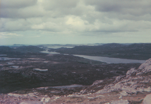
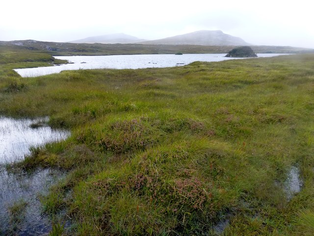
The hill offers breathtaking panoramic views of the surrounding countryside, with its position providing an excellent vantage point. On a clear day, visitors can see the picturesque hills and glens stretching out for miles, including the nearby peaks of Slioch and Beinn Eighe.

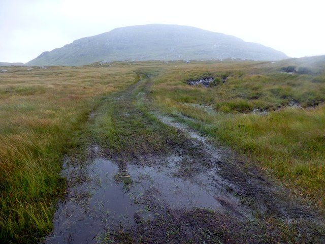
Cnoc a' Chotain is a popular destination for outdoor enthusiasts, attracting hikers, mountaineers, and nature lovers from far and wide. Its relatively easy accessibility, thanks to nearby roads and trails, makes it a desirable location for those seeking to explore the Scottish Highlands.

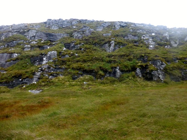
The hill is covered in a mixture of heather, grasses, and scattered rocky outcrops, creating a diverse and picturesque landscape. Wildlife is abundant in the area, with sightings of red deer, mountain hares, and various bird species being common.

Overall, Cnoc a' Chotain offers a memorable and rewarding experience for anyone looking to immerse themselves in the natural beauty of the Scottish Highlands. Whether it be for a challenging hike or a peaceful stroll, this hill provides a captivating glimpse into the rugged and enchanting landscape of Ross-shire.

If you have any feedback on the listing, please let us know in the comments section below.

Cnoc a' Chotain Images

Images are sourced within 2km of 58.099646/-6.8633375 or Grid Reference NB1322. Thanks to Geograph Open Source API. All images are credited.
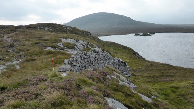
On the northern slopes of Coduinn The rocky hillside offers a view over Loch Ròg Beag, a long sea loch, and, to its west, moorland lochs and lochans.
On the northern slopes of Coduinn
The rocky hillside offers a view over Loch Ròg Beag, a long sea loch, and, to its west, moorland lochs and lochans.
View From Bridge View from the road bridge towards Loch Rog Beag.
View From Bridge
View from the road bridge towards Loch Rog Beag.
View Back Towards Sgalabhal Mula A photo taken after descending the steep and rocky slopes of Sgalabhal Mula.
View Back Towards Sgalabhal Mula
A photo taken after descending the steep and rocky slopes of Sgalabhal Mula.
Wet Track Wet track and view back towards Sgalabhal Mula.
Wet Track
Wet track and view back towards Sgalabhal Mula.
Loch Morsgail A view towards Loch Morsgail.
Loch Morsgail
A view towards Loch Morsgail.
Weir View A view across Loch Morsgail towards Loidse Mhorsgail.
Weir View
A view across Loch Morsgail towards Loidse Mhorsgail.
River Morsgail The River Morsgail divides again to form another island.
River Morsgail
The River Morsgail divides again to form another island.
River Morsgail View A tributary joins the River Morsgail at a strange angle.
River Morsgail View
A tributary joins the River Morsgail at a strange angle.
Cairn Near Summit Of Codiunn Coduinn, Beinn a' Tuath, Beinn Mheadhanach and Sgeun with Jim Fothergill on a damp grey misty morning.
Name: Coduinn
Hill number: 4940
Height: 241m / 791ft
Parent (Ma/M): 1570 Beinn Mheadhanach [Beinn Mheadhonach]
Section: 24A: Lewis and Nearby Islands
County/UA: Na h-Eileanan Siar [Western Isles] (UA)
Island: Lewis and Harris
Class: HuMP, Tump (200-299m)
Grid ref: NB120232 (est)
Drop: 103m
Col: 138m NB116233
Cairn Near Summit Of Codiunn
Coduinn, Beinn a' Tuath, Beinn Mheadhanach and Sgeun with Jim Fothergill on a damp grey misty morning. Name: Coduinn Hill number: 4940 Height: 241m / 791ft Parent (Ma/M): 1570 Beinn Mheadhanach [Beinn Mheadhonach] Section: 24A: Lewis and Nearby Islands County/UA: Na h-Eileanan Siar [Western Isles] (UA) Island: Lewis and Harris Class: HuMP, Tump (200-299m) Grid ref: NB120232 (est) Drop: 103m Col: 138m NB116233
Unnamed lochan below Sgalabhal
Outflow of Loch Beag an Fhorsa, Isle of Lewis The outflow is the source of the Allt Dubh which flows into Loch Fuarail below.
Outflow of Loch Beag an Fhorsa, Isle of Lewis
The outflow is the source of the Allt Dubh which flows into Loch Fuarail below.
Fence to the south of Loch Gainmhich, Isle of Lewis The highest hill in the background is Stulabhal.

Although not particularly new looking, the fence is not currently shown on the OS map (as viewed on OS Maps 23/09/16).
Fence to the south of Loch Gainmhich, Isle of Lewis
The highest hill in the background is Stulabhal. Although not particularly new looking, the fence is not currently shown on the OS map (as viewed on OS Maps 23/09/16).
Shieling, Airighean An Fhorsa, Isle of Lewis This shieling was still in use by people from Bhaltos at the time of the writing of the OS Name Book in 1849.
Shieling, Airighean An Fhorsa, Isle of Lewis
This shieling was still in use by people from Bhaltos at the time of the writing of the OS Name Book in 1849.
Road leading to Mhorsgail Lodge
Southern shore of Loch Morsgail
Footbridge next to Loch Morsgail
Drystone wall A fragment of drystone walling above Loch Morsgail.
Drystone wall
A fragment of drystone walling above Loch Morsgail.
Loch Morsgail
Loch Morsgail
Show me another place!

Cnoc a' Chotain is located at Grid Ref: NB1322 (Lat: 58.099646, Lng: -6.8633375)

Unitary Authority: Na h-Eileanan an Iar

Police Authority: Highlands and Islands

What 3 Words

///mirroring.inhabited.catch. Near Carloway, Na h-Eileanan Siar

Related Wikis

Gisla Hydro-Electric Scheme

Gisla Hydro-Electric Scheme was a small scheme promoted by the North of Scotland Hydro-Electric Board on the Isle of Lewis, Outer Hebrides, Scotland. It...

Eilean Mòr, Loch Langavat

Eilean Mòr is an island in Loch Langavat on the Isle of Lewis in the Outer Hebrides of Scotland. == Footnotes ==

Nearby Amenities

Located within 500m of 58.099646,-6.8633375
Passing Place
Lat/Long: 58.101119/-6.8593785
Loidse Mhorsgail
Name En: Morsgail Lodge
Name Gd: Loidse Mhorsgail
Place: hamlet
Lat/Long: 58.0983141/-6.8621394
Generator Method: wind_turbine
Generator Output Electricity: small_installation
Generator Source: wind
Generator Type: horizontal_axis
Power: generator
Lat/Long: 58.0994366/-6.8627816
Power: pole
Lat/Long: 58.1002945/-6.8618407
Power: pole
Lat/Long: 58.0993775/-6.8623276
Power: pole
Lat/Long: 58.1009402/-6.8614722
Power: pole
Lat/Long: 58.1018641/-6.861006
Power: pole
Lat/Long: 58.0986937/-6.8626852
Power: pole
Lat/Long: 58.0982751/-6.8626615
Power: pole
Lat/Long: 58.1027675/-6.8605219
Power: pole
Lat/Long: 58.1036787/-6.860035
Passing Place
Lat/Long: 58.0984074/-6.8580991
Passing Place
Lat/Long: 58.0999473/-6.8581205
The data included in this document is from www.openstreetmap.org. The data is made available under ODbL.

Have you been to Cnoc a' Chotain?

Leave your review of Cnoc a' Chotain below (or comments, questions and feedback).