Cnoc na Mòine

Hill, Mountain in Ross-shire

Scotland

Cnoc na Mòine

Footbridge over the Abhainn Ghascleit This footbridge over the Abhainn Ghascleit is a welcome sight to a weary hiker. The stream is often difficult to ford, and the bridge can be the only safe way across.
Footbridge over the Abhainn Ghascleit Credit: Marc Calhoun

Cnoc na Mòine is a prominent hill located in the county of Ross-shire, in the northern part of Scotland. It is situated in the vicinity of the small village of Contin, near the banks of the River Blackwater. The hill is part of the wider Highland region and forms a distinct feature in the local landscape.

Rising to an elevation of approximately 365 meters (1,198 feet), Cnoc na Mòine offers stunning panoramic views of the surrounding countryside. Its summit is characteristically rocky and covered in heather, giving the hill a distinct reddish hue during the summer months. The terrain is relatively steep in places, providing an enjoyable challenge for hikers and climbers.

Cnoc na Mòine is a popular destination for outdoor enthusiasts and nature lovers. The hill is easily accessible from various points in the area, with well-defined paths leading to the summit. The ascent typically takes around one to two hours, depending on the chosen route and individual fitness levels.

The hill is home to a variety of wildlife, including red deer, mountain hares, and various bird species. The surrounding area is rich in biodiversity, with several nature reserves and protected habitats nearby.

Overall, Cnoc na Mòine offers a rewarding outdoor experience, combining breathtaking views, diverse wildlife, and a sense of tranquility in the heart of the Scottish Highlands. It is a must-visit destination for those seeking to immerse themselves in the natural beauty of Ross-shire.

If you have any feedback on the listing, please let us know in the comments section below.

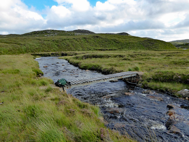
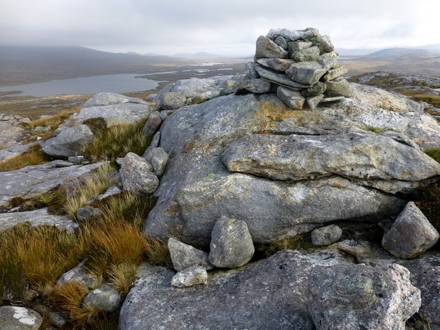
Cnoc na Mòine Images

Images are sourced within 2km of 58.066786/-7.0264878 or Grid Reference NB0319. Thanks to Geograph Open Source API. All images are credited.

Footbridge over the Abhainn Ghascleit This footbridge over the Abhainn Ghascleit is a welcome sight to a weary hiker. The stream is often difficult to ford, and the bridge can be the only safe way across.
Footbridge over the Abhainn Ghascleit
This footbridge over the Abhainn Ghascleit is a welcome sight to a weary hiker. The stream is often difficult to ford, and the bridge can be the only safe way across.
Mullach na h-Airde Bige Second HuMP around the northern edge of Loch Resort on an Alan Holmes RIB trip. What a brilliant day.
Name: Mullach na h-Airde Bige
Hill number: 4947
Height: 182m / 597ft
Area: 24A: Lewis and Nearby Islands
Class: Hu,1
Grid ref: NB026188 (est)
Drop: 128m
Col: 54m  NB044194
Mullach na h-Airde Bige
Second HuMP around the northern edge of Loch Resort on an Alan Holmes RIB trip. What a brilliant day. Name: Mullach na h-Airde Bige Hill number: 4947 Height: 182m / 597ft Area: 24A: Lewis and Nearby Islands Class: Hu,1 Grid ref: NB026188 (est) Drop: 128m Col: 54m NB044194
Steep Climb From Landing Point For Mullach na h-Airde Bige Our boatman Neil was a little worried by the steep climb up from our landing point. It proved to be no problem for Douglas Law, Alan Holmes, George Morl, Michael Earnshaw, Jim Bloomer, Martin Richardson, Mark Smith, Richard Tibbetts and Colin Crawford who were soon on top of the HuMP, Mullach na h-Airde Bige.
Steep Climb From Landing Point For Mullach na h-Airde Bige
Our boatman Neil was a little worried by the steep climb up from our landing point. It proved to be no problem for Douglas Law, Alan Holmes, George Morl, Michael Earnshaw, Jim Bloomer, Martin Richardson, Mark Smith, Richard Tibbetts and Colin Crawford who were soon on top of the HuMP, Mullach na h-Airde Bige.
Eoranish More Bagged on a RIB trip with 8 others to the HuMPs north of Loch Resort. Looking west towards Mullach na h-Airde Bige.
Name: Eoranish More
Hill number: 104363
Height: 158m / 518ft
Area: 24A: Lewis and Nearby Islands
Class: 1
Grid ref: NB032188 (est)
Drop: 79m
Col: 79m
Eoranish More
Bagged on a RIB trip with 8 others to the HuMPs north of Loch Resort. Looking west towards Mullach na h-Airde Bige. Name: Eoranish More Hill number: 104363 Height: 158m / 518ft Area: 24A: Lewis and Nearby Islands Class: 1 Grid ref: NB032188 (est) Drop: 79m Col: 79m
Aineabhal Summit Cairn Bagged with Jim Bloomer, Colin Crawford and George Morl. on a lovely day for September. Only 4 out of 9 of Alan Holmes RIB trip bagged this P98 today.
Name: Aineabhal
Hill number: 7098
Height: 166m / 545ft
Area: 24A: Lewis and Nearby Islands
Class: 1,sHu
Grid ref: NB053197 (est)
Drop: 98m
Col: 68m  NB063198
Aineabhal Summit Cairn
Bagged with Jim Bloomer, Colin Crawford and George Morl. on a lovely day for September. Only 4 out of 9 of Alan Holmes RIB trip bagged this P98 today. Name: Aineabhal Hill number: 7098 Height: 166m / 545ft Area: 24A: Lewis and Nearby Islands Class: 1,sHu Grid ref: NB053197 (est) Drop: 98m Col: 68m NB063198
View Across Loch Gruineabhat View across Loch Gruineabhat and beyond to the subHuMP Aineabhal which is the next hill on our bagging list today.
View Across Loch Gruineabhat
View across Loch Gruineabhat and beyond to the subHuMP Aineabhal which is the next hill on our bagging list today.
Crossing Damp Moorland Crossing damp moorland after descending from Eoranish More and heading towards Aineabhal.
Crossing Damp Moorland
Crossing damp moorland after descending from Eoranish More and heading towards Aineabhal.
House and Outbuildings at Tamnabhaigh
Loch Tamnabhaigh Aird Bheag to left of image and Tamana Sear to right
Loch Tamnabhaigh
Aird Bheag to left of image and Tamana Sear to right
Loch Cheann Chuisil This sheltered loch offers anchorage during stormy weather
Loch Cheann Chuisil
This sheltered loch offers anchorage during stormy weather
The head of Gleann Sgaladail The lower picture shows ruined shielings with a burn running through.
The head of Gleann Sgaladail
The lower picture shows ruined shielings with a burn running through.
Ruined shielings in Gleann Sgaladail
Gleann Sgaladail burn meets Loch Tamnabhaigh
Moorland above Loch Tamnabhaigh
Bridge over Abhainn Tamnabhaig
Mol Tealasbhaigh Even in this remote inlet on the Atlantic Western Seaboard of Harris there is much evidence of plastic litter
Mol Tealasbhaigh
Even in this remote inlet on the Atlantic Western Seaboard of Harris there is much evidence of plastic litter
Aird Bheag Number 1 Aird Bheag on the shore of Loch Hamnaway
Aird Bheag
Number 1 Aird Bheag on the shore of Loch Hamnaway
Ard Bheag Landing Place This is the point where stores etc are landed for the house at Ard Bheag. A rough and very ancient and fairly steep path leads from the sea up to the house.
Ard Bheag Landing Place
This is the point where stores etc are landed for the house at Ard Bheag. A rough and very ancient and fairly steep path leads from the sea up to the house.
Show me another place!

Cnoc na Mòine is located at Grid Ref: NB0319 (Lat: 58.066786, Lng: -7.0264878)

Unitary Authority: Na h-Eileanan an Iar

Police Authority: Highlands and Islands

What 3 Words

///scramble.evoke.dragons. Near Tarbert, Na h-Eileanan Siar

Related Wikis

Game pieces of the Lewis chessmen hoard

Game pieces of the Lewis chessmen hoard include the ninety-three game pieces of the Lewis chessmen hoard found on the Isle of Lewis in the Outer Hebrides...

Mealista

Mealista (Scottish Gaelic: Mealasta) was a township in the west of the Isle of Lewis. It is currently largely uninhabited due to the Highland Clearances...

Eilean Mhealasta

Eilean Mhealasta (Mealista Island) is an uninhabited island off the west coast of Lewis in the Outer Hebrides of Scotland. It takes its name from Mealista...

Scarp, Scotland

Scarp (Scottish Gaelic: An Sgarp) is an uninhabited island in the Outer Hebrides of Scotland, west of Hushinish on Harris. Once inhabited, the island was...

Uladail

Uladail is a location near Amhuinnsuidhe, on Harris in the Outer Hebrides, Scotland. Sron Ulladail is a sheer cliff which at 370 metres (1,210 ft) is one...

Brenish

Brenish (Scottish Gaelic: Brèinis) is a small village situated on the west coast of the Isle of Lewis, which is part of the Outer Hebrides of Scotland...

Tiorga Mor

Tiorga Mor (679 m) is a mountain in Harris, in the Outer Hebrides of Scotland. The most westerly peak of the high mountains of Harris, it is a very rugged...

Hushinish

Huisinish or Hushinish (Scottish Gaelic Hùisinis) is a remote place on the west coast of Harris in the Outer Hebrides of Scotland. It lies at the end of...

Nearby Amenities

Located within 500m of 58.066786,-7.0264878
Tatarol
Place: locality
Lat/Long: 58.0653219/-7.0328126
The data included in this document is from www.openstreetmap.org. The data is made available under ODbL.

Have you been to Cnoc na Mòine?

Leave your review of Cnoc na Mòine below (or comments, questions and feedback).