Gearraidh Ghuinnesbridh

Downs, Moorland in Ross-shire

Scotland

Gearraidh Ghuinnesbridh

Mullach na h-Airde Bige Second HuMP around the northern edge of Loch Resort on an Alan Holmes RIB trip. What a brilliant day.
Name: Mullach na h-Airde Bige
Hill number: 4947
Height: 182m / 597ft
Area: 24A: Lewis and Nearby Islands
Class: Hu,1
Grid ref: NB026188 (est)
Drop: 128m
Col: 54m  NB044194
Mullach na h-Airde Bige Credit: Rude Health

Gearraidh Ghuinnesbridh is a small village located in the northwestern part of Ross-shire, Scotland. Situated amidst the stunning Scottish Highlands, it is known for its picturesque surroundings and captivating natural beauty. The village is nestled in the heart of the region's downs and moorland, offering residents and visitors a tranquil escape from the bustling city life.

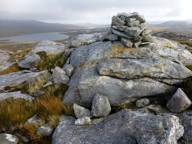
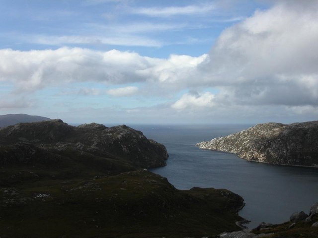
Surrounded by rolling hills, vast open spaces, and heather-covered moors, Gearraidh Ghuinnesbridh provides ample opportunities for outdoor enthusiasts to explore and indulge in various recreational activities. The area is a haven for hikers, with numerous trails meandering through the scenic landscape, showcasing breathtaking panoramic views at every turn.

The village itself is characterized by its quaint charm and traditional Scottish architecture. Stone cottages dot the landscape, exuding a peaceful ambiance that is synonymous with rural Scotland. The community is tight-knit, with a small population that values the preservation of their cultural heritage and the natural environment.

Despite its remote location, Gearraidh Ghuinnesbridh is well-connected to nearby towns and cities, ensuring residents have access to essential amenities and services. The village boasts a few local shops and establishments, catering to the needs of its inhabitants. Additionally, the surrounding area is home to several historic sites and attractions, allowing visitors to immerse themselves in the rich history and culture of the region.

In summary, Gearraidh Ghuinnesbridh is a charming village nestled in the downs and moorland of Ross-shire. With its stunning landscapes, outdoor activities, and close-knit community, it offers a peaceful and idyllic retreat for nature lovers and those seeking a slower pace of life.

If you have any feedback on the listing, please let us know in the comments section below.

Gearraidh Ghuinnesbridh Images

Images are sourced within 2km of 58.066994/-7.028962 or Grid Reference NB0319. Thanks to Geograph Open Source API. All images are credited.

Mullach na h-Airde Bige Second HuMP around the northern edge of Loch Resort on an Alan Holmes RIB trip. What a brilliant day.
Name: Mullach na h-Airde Bige
Hill number: 4947
Height: 182m / 597ft
Area: 24A: Lewis and Nearby Islands
Class: Hu,1
Grid ref: NB026188 (est)
Drop: 128m
Col: 54m  NB044194
Mullach na h-Airde Bige
Second HuMP around the northern edge of Loch Resort on an Alan Holmes RIB trip. What a brilliant day. Name: Mullach na h-Airde Bige Hill number: 4947 Height: 182m / 597ft Area: 24A: Lewis and Nearby Islands Class: Hu,1 Grid ref: NB026188 (est) Drop: 128m Col: 54m NB044194
Steep Climb From Landing Point For Mullach na h-Airde Bige Our boatman Neil was a little worried by the steep climb up from our landing point. It proved to be no problem for Douglas Law, Alan Holmes, George Morl, Michael Earnshaw, Jim Bloomer, Martin Richardson, Mark Smith, Richard Tibbetts and Colin Crawford who were soon on top of the HuMP, Mullach na h-Airde Bige.
Steep Climb From Landing Point For Mullach na h-Airde Bige
Our boatman Neil was a little worried by the steep climb up from our landing point. It proved to be no problem for Douglas Law, Alan Holmes, George Morl, Michael Earnshaw, Jim Bloomer, Martin Richardson, Mark Smith, Richard Tibbetts and Colin Crawford who were soon on top of the HuMP, Mullach na h-Airde Bige.
Eoranish More Bagged on a RIB trip with 8 others to the HuMPs north of Loch Resort. Looking west towards Mullach na h-Airde Bige.
Name: Eoranish More
Hill number: 104363
Height: 158m / 518ft
Area: 24A: Lewis and Nearby Islands
Class: 1
Grid ref: NB032188 (est)
Drop: 79m
Col: 79m
Eoranish More
Bagged on a RIB trip with 8 others to the HuMPs north of Loch Resort. Looking west towards Mullach na h-Airde Bige. Name: Eoranish More Hill number: 104363 Height: 158m / 518ft Area: 24A: Lewis and Nearby Islands Class: 1 Grid ref: NB032188 (est) Drop: 79m Col: 79m
Aineabhal Summit Cairn Bagged with Jim Bloomer, Colin Crawford and George Morl. on a lovely day for September. Only 4 out of 9 of Alan Holmes RIB trip bagged this P98 today.
Name: Aineabhal
Hill number: 7098
Height: 166m / 545ft
Area: 24A: Lewis and Nearby Islands
Class: 1,sHu
Grid ref: NB053197 (est)
Drop: 98m
Col: 68m  NB063198
Aineabhal Summit Cairn
Bagged with Jim Bloomer, Colin Crawford and George Morl. on a lovely day for September. Only 4 out of 9 of Alan Holmes RIB trip bagged this P98 today. Name: Aineabhal Hill number: 7098 Height: 166m / 545ft Area: 24A: Lewis and Nearby Islands Class: 1,sHu Grid ref: NB053197 (est) Drop: 98m Col: 68m NB063198
View Across Loch Gruineabhat View across Loch Gruineabhat and beyond to the subHuMP Aineabhal which is the next hill on our bagging list today.
View Across Loch Gruineabhat
View across Loch Gruineabhat and beyond to the subHuMP Aineabhal which is the next hill on our bagging list today.
Crossing Damp Moorland Crossing damp moorland after descending from Eoranish More and heading towards Aineabhal.
Crossing Damp Moorland
Crossing damp moorland after descending from Eoranish More and heading towards Aineabhal.
House and Outbuildings at Tamnabhaigh
Loch Tamnabhaigh Aird Bheag to left of image and Tamana Sear to right
Loch Tamnabhaigh
Aird Bheag to left of image and Tamana Sear to right
Loch Cheann Chuisil This sheltered loch offers anchorage during stormy weather
Loch Cheann Chuisil
This sheltered loch offers anchorage during stormy weather
The head of Gleann Sgaladail The lower picture shows ruined shielings with a burn running through.
The head of Gleann Sgaladail
The lower picture shows ruined shielings with a burn running through.
Ruined shielings in Gleann Sgaladail
Gleann Sgaladail burn meets Loch Tamnabhaigh
Moorland above Loch Tamnabhaigh
Bridge over Abhainn Tamnabhaig
Mol Tealasbhaigh Even in this remote inlet on the Atlantic Western Seaboard of Harris there is much evidence of plastic litter
Mol Tealasbhaigh
Even in this remote inlet on the Atlantic Western Seaboard of Harris there is much evidence of plastic litter
Aird Bheag Number 1 Aird Bheag on the shore of Loch Hamnaway
Aird Bheag
Number 1 Aird Bheag on the shore of Loch Hamnaway
Ard Bheag Landing Place This is the point where stores etc are landed for the house at Ard Bheag. A rough and very ancient and fairly steep path leads from the sea up to the house.
Ard Bheag Landing Place
This is the point where stores etc are landed for the house at Ard Bheag. A rough and very ancient and fairly steep path leads from the sea up to the house.
Loch Thamnabhaigh Entrance A sheltered sealoch and anchorage in south west Lewis.
Loch Thamnabhaigh Entrance
A sheltered sealoch and anchorage in south west Lewis.
Show me another place!

Gearraidh Ghuinnesbridh is located at Grid Ref: NB0319 (Lat: 58.066994, Lng: -7.028962)

Unitary Authority: Na h-Eileanan an Iar

Police Authority: Highlands and Islands

What 3 Words

///incomes.boils.usage. Near Tarbert, Na h-Eileanan Siar

Related Wikis

Mealista

Mealista (Scottish Gaelic: Mealasta) was a township in the west of the Isle of Lewis. It is currently largely uninhabited due to the Highland Clearances...

Game pieces of the Lewis chessmen hoard

Game pieces of the Lewis chessmen hoard include the ninety-three game pieces of the Lewis chessmen hoard found on the Isle of Lewis in the Outer Hebrides...

Eilean Mhealasta

Eilean Mhealasta (Mealista Island) is an uninhabited island off the west coast of Lewis in the Outer Hebrides of Scotland. It takes its name from Mealista...

Scarp, Scotland

Scarp (Scottish Gaelic: An Sgarp) is an uninhabited island in the Outer Hebrides of Scotland, west of Hushinish on Harris. Once inhabited, the island was...

Nearby Amenities

Located within 500m of 58.066994,-7.028962
Tob Cul na h-Airde Bige
Natural: bay
Lat/Long: 58.066964/-7.035142
Tatarol
Place: locality
Lat/Long: 58.0653219/-7.0328126
The data included in this document is from www.openstreetmap.org. The data is made available under ODbL.

Have you been to Gearraidh Ghuinnesbridh?

Leave your review of Gearraidh Ghuinnesbridh below (or comments, questions and feedback).