Marabhal

Hill, Mountain in Inverness-shire

Scotland

Marabhal

Southern shore of South Uist White sandy beach and gneiss outcrops on the Sound of Eriskay.
Southern shore of South Uist Credit: Richard Webb

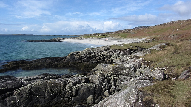
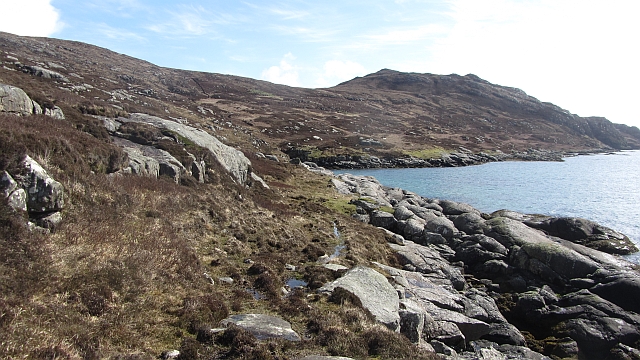
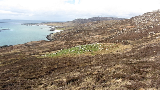
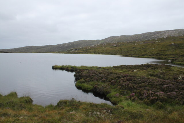
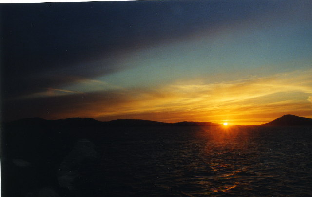
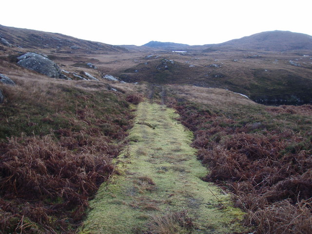
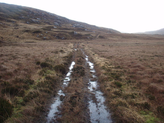
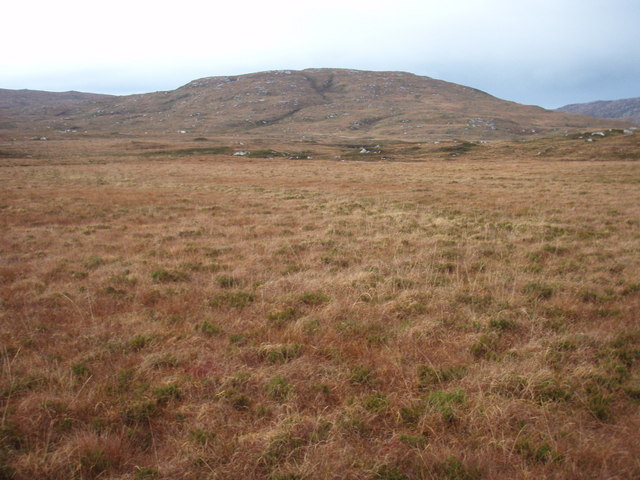
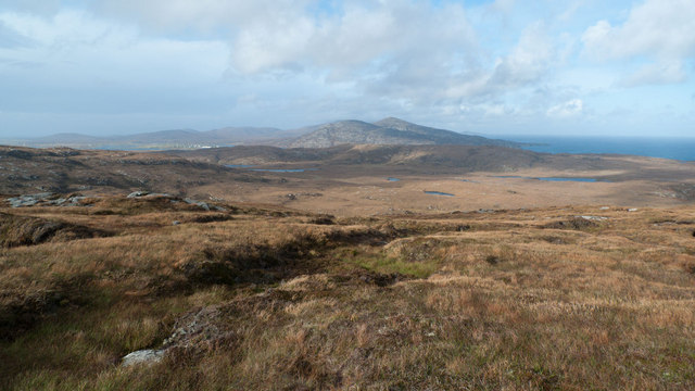
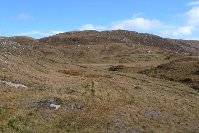
Marabhal is an imposing hill located in the county of Inverness-shire, Scotland. With an elevation of 1,230 feet (375 meters), it offers breathtaking panoramic views of the surrounding landscape. Situated in the remote and rugged countryside, Marabhal is a popular destination for hikers and nature enthusiasts.

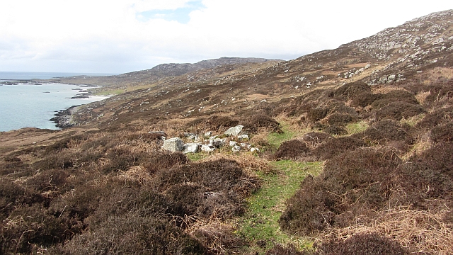
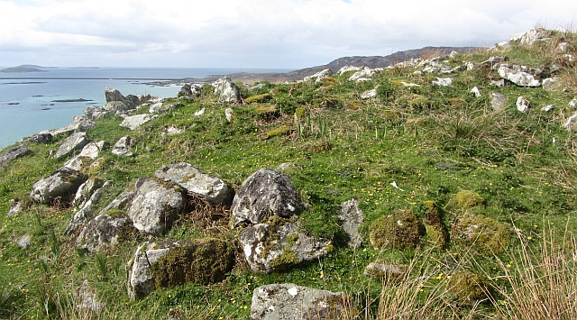
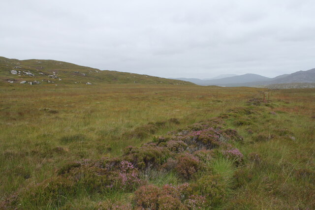
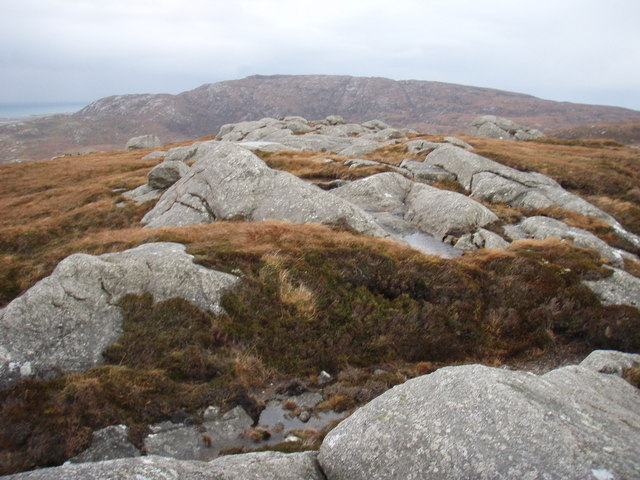
The hill is characterized by its distinctive cone-shaped peak, which stands out against the skyline. Its slopes are covered in heather and moss, creating a rich tapestry of colors throughout the year. Marabhal is part of the larger Highlands region, known for its dramatic landscapes and unspoiled wilderness.

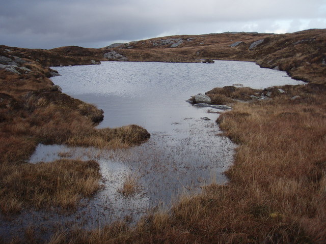
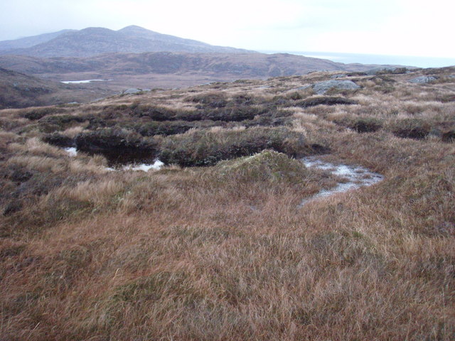
Reaching the summit of Marabhal requires a moderate level of fitness and navigation skills, as there are no marked trails. However, the effort is well worth it, as those who make the climb are rewarded with stunning vistas of rolling hills, lochs, and distant mountains.

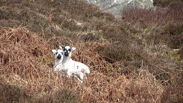
Marabhal is also home to a diverse range of flora and fauna. Visitors may encounter red deer, golden eagles, and various species of wildflowers during their ascent. The hill is particularly striking during the autumn months when the foliage transforms into a vibrant display of reds, oranges, and yellows.

For those seeking a peaceful and secluded escape, Marabhal offers a serene and tranquil setting. It is a place where one can immerse themselves in the beauty of nature and experience the tranquility of the Scottish Highlands.

If you have any feedback on the listing, please let us know in the comments section below.

Marabhal Images

Images are sourced within 2km of 57.120759/-7.2952759 or Grid Reference NF7915. Thanks to Geograph Open Source API. All images are credited.

Southern shore of South Uist White sandy beach and gneiss outcrops on the Sound of Eriskay.
Southern shore of South Uist
White sandy beach and gneiss outcrops on the Sound of Eriskay.
Shieling ruin Ruin in moorland above Caolas Eirisgeigh
Shieling ruin
Ruin in moorland above Caolas Eirisgeigh
Path, south coast of South Uist A faint path speeds progress along the coast.
Path, south coast of South Uist
A faint path speeds progress along the coast.
Blackface lambs Moorland grazing on the south coast of South Uist.
Blackface lambs
Moorland grazing on the south coast of South Uist.
Fishbox Washed up on the shores of the Sound of Eriskay, a Royal Greenland fishbox, property of the government of Kalaallit Nunaat.  There were quite a few here from several places.
Fishbox
Washed up on the shores of the Sound of Eriskay, a Royal Greenland fishbox, property of the government of Kalaallit Nunaat. There were quite a few here from several places.
Cairn, Roineabhal A burial cairn on the southern shore of South Uist.
Cairn, Roineabhal
A burial cairn on the southern shore of South Uist.
Cairn, Roineabhal A green mound amongst brown moorland.
Cairn, Roineabhal
A green mound amongst brown moorland.
Moorland to the west of the path from South to North Glendale Boggy moorland punctuated with the line of an old fence to the right. On the map it is marked as Gàradh Ur "garden wall".
Moorland to the west of the path from South to North Glendale
Boggy moorland punctuated with the line of an old fence to the right. On the map it is marked as Gàradh Ur "garden wall".
Lochan above South Glendale Lochan near the top of the path between North and South Glendale
Lochan above South Glendale
Lochan near the top of the path between North and South Glendale
Sunset over South Uist from the CalMac ferry from Oban
Sunset over South Uist
from the CalMac ferry from Oban
Gleann dail bho Tuath path A lot of the path is very boggy, but this is one of the good bits.
Gleann dail bho Tuath path
A lot of the path is very boggy, but this is one of the good bits.
Gleann dail bho Tuath path The path in this section is like more like walking up twin streams.
Gleann dail bho Tuath path
The path in this section is like more like walking up twin streams.
View across Gleann Dail bho Tuath Looking towards Marabhal the grassy hill in the background.
View across Gleann Dail bho Tuath
Looking towards Marabhal the grassy hill in the background.
Lochan below summit of Cruachan This is the more northerly of the pair marked on the map.
Lochan below summit of Cruachan
This is the more northerly of the pair marked on the map.
Summit of Cruachan Top of the hill anyway.  Too windy to really appreciate the view.
Summit of Cruachan
Top of the hill anyway. Too windy to really appreciate the view.
Moorland slopes of Cruachan Looking towards Gleann dail bho Tuath over where we walked earlier in the day.  The vicious showers making sure not only feet were wet after squelching through a lot of boggy ground.
Moorland slopes of Cruachan
Looking towards Gleann dail bho Tuath over where we walked earlier in the day. The vicious showers making sure not only feet were wet after squelching through a lot of boggy ground.
On Cruachan This is the view north, to Beinn Ruigh Choinnich and Triuirebheinn.
On Cruachan
This is the view north, to Beinn Ruigh Choinnich and Triuirebheinn.
Gleann dail bho Tuath The path here follows the 20m contour to avoid the wettest ground. This is the view from the path looking towards Beinn Bheag.
Gleann dail bho Tuath
The path here follows the 20m contour to avoid the wettest ground. This is the view from the path looking towards Beinn Bheag.
Show me another place!

Marabhal is located at Grid Ref: NF7915 (Lat: 57.120759, Lng: -7.2952759)

Unitary Authority: Na h-Eileanan an Iar

Police Authority: Highlands and Islands

What 3 Words

///activates.encrusted.spell. Near Lochboisdale, Na h-Eileanan Siar

Related Wikis

Easaval

Easaval (Scottish Gaelic: Easabhal) is one of the smallest hills on the island of South Uist in the Outer Hebrides of Scotland, with a height of 243 metres...

Eileanan Iasgaich

Na h-Eileanan Iasgaich comprise a small uninhabited archipelago in Loch Boisdale, in the south east of the island of South Uist, in the Outer Hebrides...

Calvay Castle

Calvay Castle (Scottish Gaelic: Caisteal Calbhaigh) is a ruined castle on an islet close to the island of Calbhaigh, at the eastern approaches to Loch...

SS Politician

SS Politician was a cargo ship that ran aground off the coast of the Hebridean island of Eriskay in 1941. Her cargo included 22,000 cases of scotch whisky...

Nearby Amenities

Located within 500m of 57.120759,-7.2952759
Marabhal
Ele: 162
Natural: peak
Lat/Long: 57.1211808/-7.2950721
The data included in this document is from www.openstreetmap.org. The data is made available under ODbL.

Have you been to Marabhal?

Leave your review of Marabhal below (or comments, questions and feedback).