Maola Breac

Hill, Mountain in Inverness-shire

Scotland

Maola Breac

Glendorchay River A quiet meandering section of the burn.
Glendorchay River Credit: Rupert Fleetingly

Maola Breac is a prominent hill located in Inverness-shire, Scotland. Rising to an elevation of approximately 1,203 feet (366 meters), it is part of the broader range known as the Monadhliath Mountains, which stretch across the Highlands region. Maola Breac is situated in the southeastern section of the Monadhliath range, offering breathtaking panoramic views of the surrounding landscape.

The hill is characterized by its rugged terrain, featuring steep slopes and rocky outcrops that provide a challenging yet rewarding climb for outdoor enthusiasts. Its location within the Monadhliath Mountains also means that Maola Breac is often covered in a blanket of snow during the winter months, adding to its allure for winter sports enthusiasts and hikers seeking a more adventurous experience.

The summit of Maola Breac offers stunning vistas across the surrounding countryside, with rolling hills, expansive moorland, and distant lochs dotting the landscape. On clear days, it is possible to see as far as the Cairngorms National Park to the southeast and the Great Glen to the northwest.

Access to Maola Breac is primarily via foot, with several established hiking trails leading to the summit. The hill is a popular destination for both locals and visitors looking to immerse themselves in the natural beauty of the Scottish Highlands. Its remote location and challenging terrain make it an ideal spot for those seeking solitude and a true wilderness experience.

Overall, Maola Breac is a captivating hill in Inverness-shire, offering outdoor enthusiasts a chance to explore the rugged beauty of the Scottish Highlands while enjoying breathtaking views of the surrounding landscape.

If you have any feedback on the listing, please let us know in the comments section below.
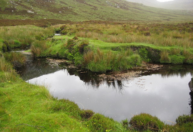
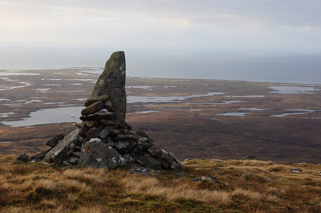
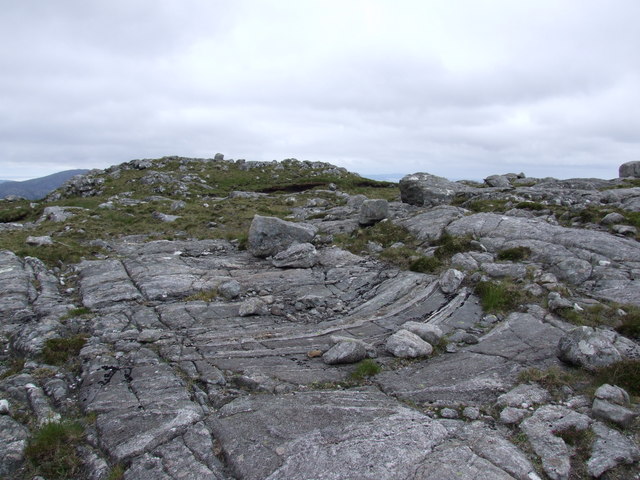
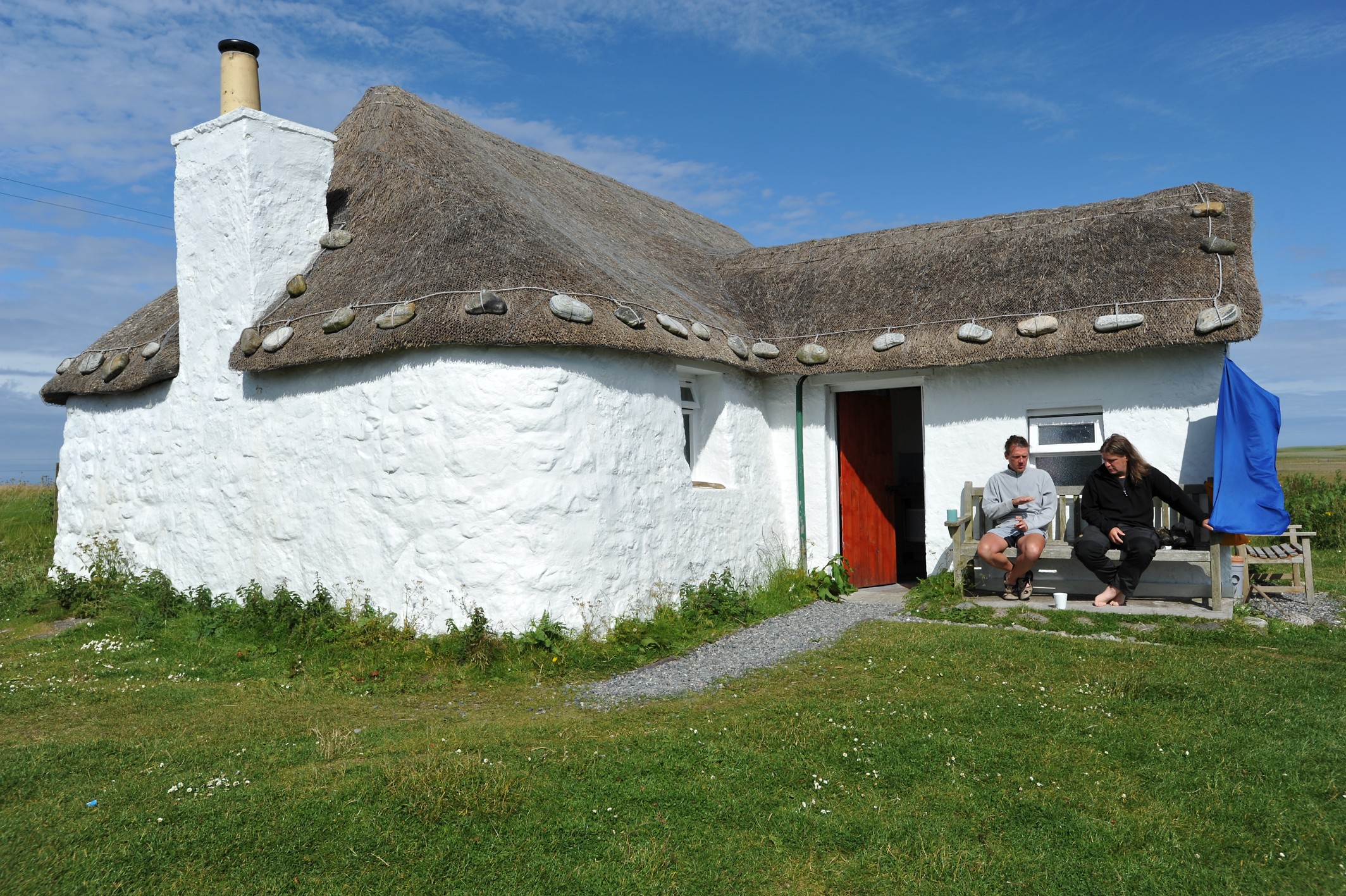
Maola Breac Images

Images are sourced within 2km of 57.276798/-7.318053 or Grid Reference NF7933. Thanks to Geograph Open Source API. All images are credited.

Glendorchay River A quiet meandering section of the burn.
Glendorchay River
A quiet meandering section of the burn.
Cairn, Beinn Mhor North West Ridge Not marked on the map but a well constructed standing stone/cairn that serves no purpose!
Cairn, Beinn Mhor North West Ridge
Not marked on the map but a well constructed standing stone/cairn that serves no purpose!
North Ridge of Ben Corrodale The broad sprawling north ridge has many small pools and lochans. All perfect for a dip on a summer day but not in February!
North Ridge of Ben Corrodale
The broad sprawling north ridge has many small pools and lochans. All perfect for a dip on a summer day but not in February!
North Ridge of Ben Corrodale Low outcrops and ridges of rock make a welcome change from the very wet walking on the approach.
North Ridge of Ben Corrodale
Low outcrops and ridges of rock make a welcome change from the very wet walking on the approach.
Gleann Dorchaidh Blanket bog between Hecla and the fertile western strip of South Uist.
Gleann Dorchaidh
Blanket bog between Hecla and the fertile western strip of South Uist.
North ridge of Beinn Mhòr View on a clear evening from Tobha Mòr.
North ridge of Beinn Mhòr
View on a clear evening from Tobha Mòr.
Bog, Glen Dorchaidh Rough ground on South Uist.
Bog, Glen Dorchaidh
Rough ground on South Uist.
North east ridge of Beinn Mhor. Ridge falling to Bealach Sheilliosdail (Halisdale) the pass connecting Beinn Corradail and Beinn Mhor. Beinn Corradail is sunlit. The ridge is rocky, but easy going.
North east ridge of Beinn Mhor.
Ridge falling to Bealach Sheilliosdail (Halisdale) the pass connecting Beinn Corradail and Beinn Mhor. Beinn Corradail is sunlit. The ridge is rocky, but easy going.
Beinn Mhor The narrow summit ridge of Beinn Mhor just below the top. Beinn Bhor is the highest hill on South Uist, and is rather a quality day out. The buttresses of the Sheiliosdale face can be seen, as well as some rocks and islands off the east coast.
Beinn Mhor
The narrow summit ridge of Beinn Mhor just below the top. Beinn Bhor is the highest hill on South Uist, and is rather a quality day out. The buttresses of the Sheiliosdale face can be seen, as well as some rocks and islands off the east coast.
Hecla from bealach below Beinn Corradail. Morning off from survey, so a run over some magnificent wild Uist mountains.
St Kilda could clearly be seen from the tops.
Hecla from bealach below Beinn Corradail.
Morning off from survey, so a run over some magnificent wild Uist mountains. St Kilda could clearly be seen from the tops.
NW Ridge of Beinn Mhor
Abhainn a' Choire Dhuibh Waterfall on the burn running off the west slope of Beinn Mhor.
Under the right conditions sea trout (and possibly even salmon) can be seen trying to jump this waterfall.
Abhainn a' Choire Dhuibh
Waterfall on the burn running off the west slope of Beinn Mhor. Under the right conditions sea trout (and possibly even salmon) can be seen trying to jump this waterfall.
Moorland View across a bit of featureless moorland towards Coire Dubh and Beinn Mhor.
Moorland
View across a bit of featureless moorland towards Coire Dubh and Beinn Mhor.
Slopes of Beinn Mhor The lower slopes of Beinn Mhor looking across the peat bogs to Thatharsal and the green machair strip beyond.
Slopes of Beinn Mhor
The lower slopes of Beinn Mhor looking across the peat bogs to Thatharsal and the green machair strip beyond.
Beinn Mhor. Taken from just below the top of Beinn Mhor's outling top Maola Bhreac, this shows the smooth slopes of the northern end of Beinn Mhor, a contrast with the steep craggy southern side of the hill. The interior of South Uist is tough going on peat, but the higher ground of Beinn Mhor is a delight to walk on, with thin soils and springy turf.
Beinn Mhor.
Taken from just below the top of Beinn Mhor's outling top Maola Bhreac, this shows the smooth slopes of the northern end of Beinn Mhor, a contrast with the steep craggy southern side of the hill. The interior of South Uist is tough going on peat, but the higher ground of Beinn Mhor is a delight to walk on, with thin soils and springy turf.
Gleann Dorchaidh View from the lower slopes of Beinn Mhòr towards Hecla.
Gleann Dorchaidh
View from the lower slopes of Beinn Mhòr towards Hecla.
On top of Spin Poor Spin didn't even have a summit cairn until I arrived.  No jokes about being on top of Spin...
On top of Spin
Poor Spin didn't even have a summit cairn until I arrived. No jokes about being on top of Spin...
Coire Dubh from the slopes of Bheinn Mhor
Show me another place!

Maola Breac is located at Grid Ref: NF7933 (Lat: 57.276798, Lng: -7.318053)

Unitary Authority: Na h-Eileanan an Iar

Police Authority: Highlands and Islands

What 3 Words

///nurture.driftwood.snacking. Near Lochboisdale, Na h-Eileanan Siar

Nearby Locations

Maola Breac

Related Wikis

South Uist

South Uist (Scottish Gaelic: Uibhist a Deas, [ˈɯ.ɪʃtʲ ə ˈtʲes̪] ; Scots: Sooth Uist) is the second-largest island of the Outer Hebrides in Scotland. At...

Beinn Mhòr (South Uist)

Beinn Mhòr is a mountain on the island of South Uist in the Outer Hebrides of Scotland. With a height of 620 metres (2,034 ft), it is the highest point...

Hecla (South Uist)

Hecla or Thacla is a mountain on the island of South Uist in the Outer Hebrides of Scotland. With a height of 606 metres (1,988 ft), it is the second-highest...

Howmore

Howmore (Scottish Gaelic: Togh Mòr / Tobha Mor) lies on the island of South Uist to the southwest of Loch Druidibeg. The mountain of Haarsal rises to 139...

Nearby Amenities

Located within 500m of 57.276798,-7.318053
Maola Breac
Natural: peak
Lat/Long: 57.2759457/-7.3156715
The data included in this document is from www.openstreetmap.org. The data is made available under ODbL.

Have you been to Maola Breac?

Leave your review of Maola Breac below (or comments, questions and feedback).