Bushend Common

Downs, Moorland in Essex Uttlesford

England

Bushend Common

Road junction between Brickkiln Spring and Canfield Hart These are each the names of woods nearby. The B183 runs across ahead in the shot.
Road junction between Brickkiln Spring and Canfield Hart Credit: Trevor Harris

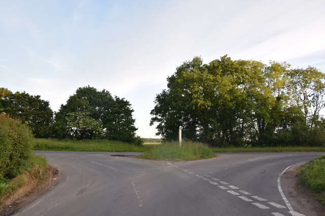
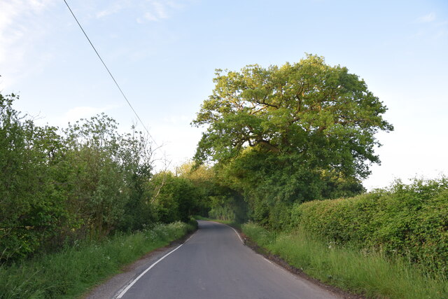
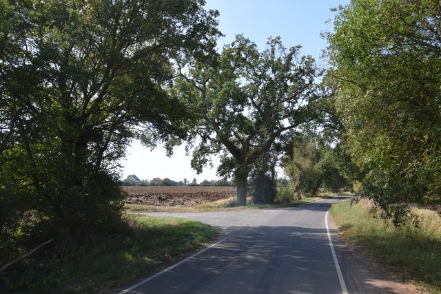
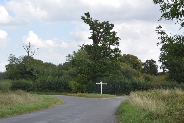
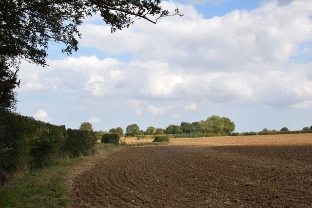
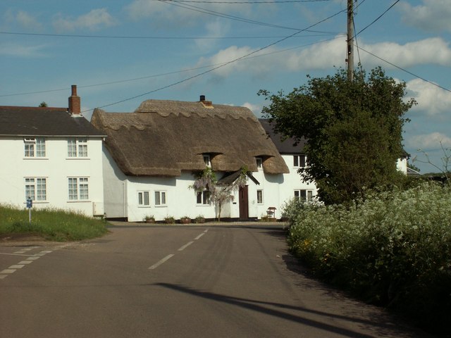
Bushend Common is a picturesque area located in the county of Essex, England. Spread across a vast expanse, it is primarily known for its stunning downs and moorland landscapes. The common is situated in close proximity to the charming village of Bushend, which adds to its allure.

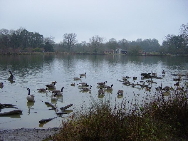
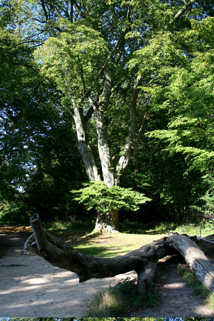
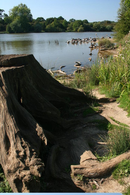
The terrain of Bushend Common is characterized by rolling hills covered in lush green grass, interspersed with patches of heather and gorse. This unique combination creates a striking visual contrast, especially when the heather blooms in vibrant shades of purple during the summer months. The area is also home to a variety of wildlife, including rabbits, foxes, and a diverse range of bird species.

Hikers and nature enthusiasts are drawn to this area due to its extensive network of footpaths and trails. These well-maintained paths offer breathtaking views of the surrounding countryside and provide opportunities for visitors to explore the common at their own pace. Additionally, the common is intersected by several streams and small rivers, adding to its natural beauty.

Bushend Common is a popular destination for birdwatching, with several bird hides strategically placed for optimal viewing. Ornithologists and bird enthusiasts flock to this area to catch a glimpse of some rare and migratory bird species that call the common their home.

Overall, Bushend Common is a haven for nature lovers, offering stunning landscapes, diverse wildlife, and ample opportunities for outdoor activities. It is a place where visitors can immerse themselves in the tranquility of nature and experience the beauty of the Essex countryside.

If you have any feedback on the listing, please let us know in the comments section below.

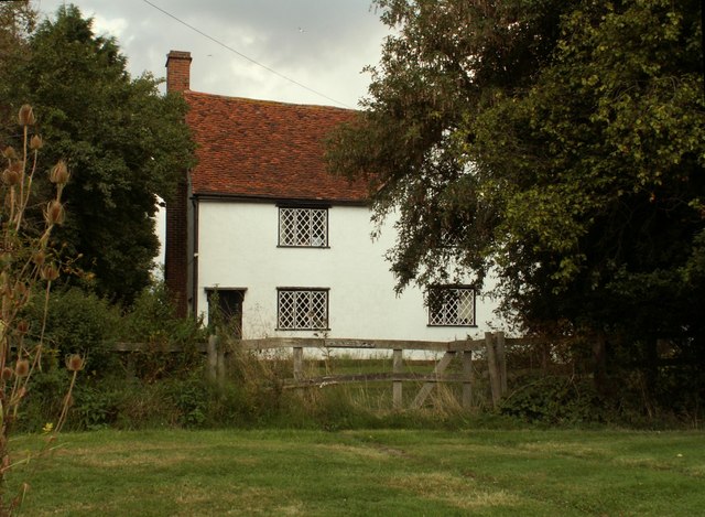
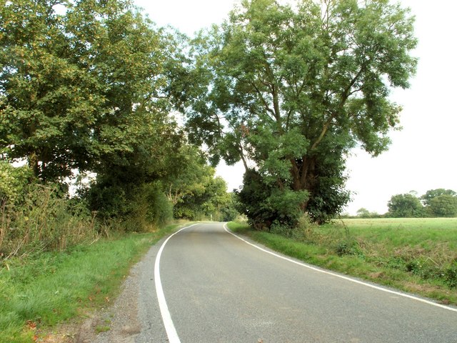
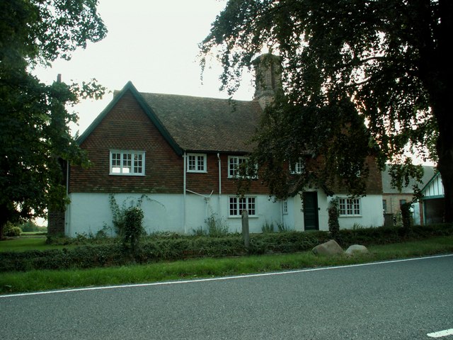
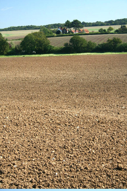
Bushend Common Images

Images are sourced within 2km of 51.85603/0.25834048 or Grid Reference TL5519. Thanks to Geograph Open Source API. All images are credited.

Road junction between Brickkiln Spring and Canfield Hart These are each the names of woods nearby. The B183 runs across ahead in the shot.
Road junction between Brickkiln Spring and Canfield Hart
These are each the names of woods nearby. The B183 runs across ahead in the shot.
Lane to Great Canfield
Junction and Sign The meeting of Hatfield Forest Road/ Wood Row/ Greenhill.
Junction and Sign
The meeting of Hatfield Forest Road/ Wood Row/ Greenhill.
Road junction at Taverners Green With the lane called Crabbs Green on the left ahead.
Road junction at Taverners Green
With the lane called Crabbs Green on the left ahead.
Finger post at junction near Bridgefoot Farm Directions shown are left to Takeley and Hatfield Forest, right to Hatfield Broad Oak, and towards the photographer, to Woodside Green and Hallingbury. For a close-up see photo from contributor David Bremner <a href="https://www.geograph.org.uk/photo/7329457">TL5418 : Junction and Sign</a>
Finger post at junction near Bridgefoot Farm
Directions shown are left to Takeley and Hatfield Forest, right to Hatfield Broad Oak, and towards the photographer, to Woodside Green and Hallingbury. For a close-up see photo from contributor David Bremner TL5418 : Junction and Sign
Little Barrington Hall Farm
Field south of Greenhill Is beside, or was part of Brumsted Common.
Field south of Greenhill
Is beside, or was part of Brumsted Common.
Hatfield Forest. Now a popular park cared for by the National Trust.
Hatfield Forest.
Now a popular park cared for by the National Trust.
The Shell House, Hatfield Forest Jacob Houblon III built The Shell House in about 1754. It was attached to a cottage by his new lake and was occupied by a housekeeper who kept poultry and peacocks. The cottage was later demolished. The Shell House has recently been restored by The National Trust.
The Shell House, Hatfield Forest
Jacob Houblon III built The Shell House in about 1754. It was attached to a cottage by his new lake and was occupied by a housekeeper who kept poultry and peacocks. The cottage was later demolished. The Shell House has recently been restored by The National Trust.
The Lake, Hatfield Forest Looking SW across to the Shell House. This lake was created by Jacob Houblon III in circa 1750 from marshland fed by the Shermore Brook.
The Lake, Hatfield Forest
Looking SW across to the Shell House. This lake was created by Jacob Houblon III in circa 1750 from marshland fed by the Shermore Brook.
Cottages at Greenhill, near Hatfield Broad Oak, Essex
House at Bush End, near Hatfield Forest, Essex
Country road near Great Canfield, Essex
Peckers farmhouse, near Hellman's Cross, Essex Hellman's Cross is close to Great Canfield. The road in the photo is Green Street.
Peckers farmhouse, near Hellman's Cross, Essex
Hellman's Cross is close to Great Canfield. The road in the photo is Green Street.
Bridgefoot Farm and footbridge The farm gets its name from standing by the footbridge, which is used when the small stream running beneath floods the road.
Bridgefoot Farm and footbridge
The farm gets its name from standing by the footbridge, which is used when the small stream running beneath floods the road.
High House Farm, Bush End
Hatfield Forest In Gravelpit Coppice near the lake.
Hatfield Forest
In Gravelpit Coppice near the lake.
The Lake, Hatfield Forest
Show me another place!

Bushend Common is located at Grid Ref: TL5519 (Lat: 51.85603, Lng: 0.25834048)

Administrative County: Essex

District: Uttlesford

Police Authority: Essex

What 3 Words

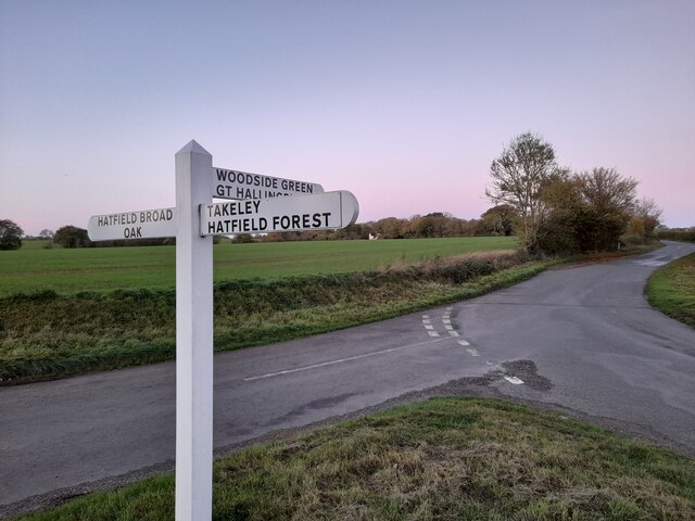
///rationed.adopt.catchers. Near Takeley, Essex

Nearby Locations

Bush End Bushend Common

Related Wikis

Takeley F.C.

Takeley Football Club is an English football club based in Takeley, Essex. The club are currently members of the Essex Senior League and play at Station...

Takeley railway station

Takeley railway station was a station serving the Hockerill area of Takeley in Bishop's Stortford, England. The station was 5 miles 11 chains (8.27 km...

The Christian School, Takeley

The Christian School (Takeley) is an independent Christian school located in Takeley, Bishop's Stortford, Essex. The school caters for children of 7 through...

Takeley

Takeley is a village and civil parish in the Uttlesford district of Essex, England. == History == A number of theories have arisen over the origin of the...

Stane Street Halt railway station

Stane Street Halt railway station was a station serving the community of Takeley Street to the west of the village of Takeley near Bishop's Stortford,...

Takeley Priory

Takeley Priory, dedicated to Saint Valery, was a Benedictine monastery in Takeley, Essex, England, founded by William the Conqueror between 1066 and 1086...

Taverners Green

Taverners Green is a hamlet in the Hatfield Broad Oak civil parish of the Uttlesford district, in the county of Essex, England. Nearby settlements include...

Hatfield Forest

Hatfield Forest is a 403.2-hectare (996-acre) biological Site of Special Scientific Interest in Essex, three miles east of Bishop's Stortford. It is also...

Nearby Amenities

Located within 500m of 51.85603,0.25834048
Bus Stop
Canfield Hart
Bus: yes
Naptan AtcoCode: 150020013002
Naptan Bearing: SW
Naptan BusStopType: CUS
Naptan CommonName: Canfield Hart
Naptan Crossing: Green Street
Naptan Indicator: SW-bound
Naptan Landmark: Canfield Hart
Naptan NaptanCode: esxdgjdw
Naptan Street: Dunmow Road
Naptan Verified: no
Public Transport: platform
Source: naptan_import
Lat/Long: 51.8529887/0.2634328
Bus Stop
Canfield Hart
Bus: yes
Naptan AtcoCode: 1500200130Y2
Naptan Bearing: NE
Naptan BusStopType: CUS
Naptan CommonName: Canfield Hart
Naptan Crossing: Green Street
Naptan Indicator: NE-bound
Naptan Landmark: Canfield Hart
Naptan NaptanCode: esxgtgpj
Naptan Street: Dunmow Road
Naptan Verified: no
Public Transport: platform
Source: naptan_import
Lat/Long: 51.8530272/0.263304
Bushend Common
Place: locality
Lat/Long: 51.8569016/0.2588135
Colour: red and white
Marker: aerial
Utility: gas
Lat/Long: 51.8526741/0.2536683
Colour: yellow
Marker: post
Utility: gas
Lat/Long: 51.8526404/0.2536322
Marker: aerial
Utility: gas
Lat/Long: 51.8563559/0.2578033
The data included in this document is from www.openstreetmap.org. The data is made available under ODbL.

Have you been to Bushend Common?

Leave your review of Bushend Common below (or comments, questions and feedback).