Wood Fen

Downs, Moorland in Cambridgeshire East Cambridgeshire

England

Wood Fen

Fields west of Redmoor Plantation, from the railway Redmoor Plantation is on the right of the picture.
Fields west of Redmoor Plantation, from the railway Credit: Christopher Hilton

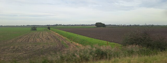
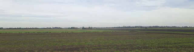
Wood Fen is a unique area located in Cambridgeshire, England. It is characterized by its diverse natural landscapes, incorporating both woodlands and fenland habitats. The region is known for its significant ecological value, particularly in terms of its plant and bird species.

The woodlands in Wood Fen are composed of a mixture of deciduous and coniferous trees, creating a rich and varied ecosystem. Ancient woodlands are scattered throughout the area, providing habitat for a plethora of wildlife species. These woodlands are also home to a number of rare and protected plant species, such as the wood anemone and the yellow archangel.

In contrast to the woodlands, the fenland areas of Wood Fen are characterized by wet and marshy conditions. This unique habitat supports a wide range of wetland plants, including the iconic fen orchids and the carnivorous sundew. The fenland also provides a breeding ground for numerous bird species, including water rails, bitterns, and marsh harriers.

Wood Fen is a popular destination for nature enthusiasts and birdwatchers, who come to witness the diverse range of bird species that inhabit the area. The surrounding moorland offers additional opportunities for outdoor activities such as hiking and wildlife observation. The area is well-maintained and offers several walking trails and bird hides to facilitate exploration and appreciation of the natural surroundings.

Overall, Wood Fen in Cambridgeshire is a haven for biodiversity, boasting a unique combination of woodlands, fenland, and moorland habitats. It is a place of immense ecological importance, providing a sanctuary for a variety of plant and bird species, and offering visitors a chance to immerse themselves in the natural beauty of this remarkable region.

If you have any feedback on the listing, please let us know in the comments section below.
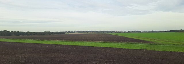
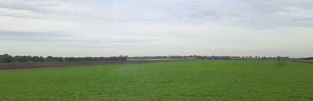
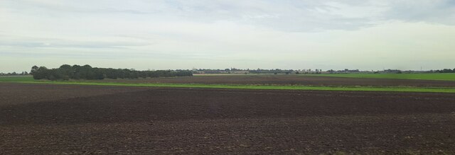
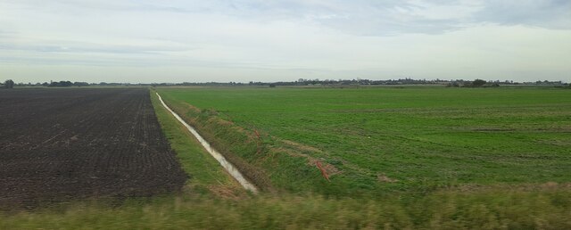
Wood Fen Images

Images are sourced within 2km of 52.439795/0.28865399 or Grid Reference TL5584. Thanks to Geograph Open Source API. All images are credited.

Fields west of Redmoor Plantation, from the railway Redmoor Plantation is on the right of the picture.
Fields west of Redmoor Plantation, from the railway
Redmoor Plantation is on the right of the picture.
Wood Fen, from the railway line The broad green stripe across the field on the left marks the line of Coffue Drove, a public right of way.
Wood Fen, from the railway line
The broad green stripe across the field on the left marks the line of Coffue Drove, a public right of way.
Wood Fen, from the railway line
Wood Fen, from the railway line The broad green stripe across the field in the middle distance marks the line of Coffue Drove, a public right of way.
Wood Fen, from the railway line
The broad green stripe across the field in the middle distance marks the line of Coffue Drove, a public right of way.
Ditch in North Fen, from the railway
Ditch in Wood Fen, from the railway
Beild Drove and Wood Fen, from the railway
North Fen, from the railway line North Fen Drove can just been seen running from the right of the picture towards the central distance.
North Fen, from the railway line
North Fen Drove can just been seen running from the right of the picture towards the central distance.
Railway bridge over drainage channel
Path along the River Great Ouse
Train heading towards Littleport
St. Michael and All Angels, Chettisham Chettisham is a small village on the old A10 Ely to Littleport road. The new A10 road now bypasses Ely and Littleport to the west. The church is near the end of a road leading west off the old A10.
St. Michael and All Angels, Chettisham
Chettisham is a small village on the old A10 Ely to Littleport road. The new A10 road now bypasses Ely and Littleport to the west. The church is near the end of a road leading west off the old A10.
Littleport Croft Park Road.
Littleport
Croft Park Road.
Great Ouse and Lark Rivers Confluence of Great Ouse and Lark Rivers taken from Branch Bank
Great Ouse and Lark Rivers
Confluence of Great Ouse and Lark Rivers taken from Branch Bank
Pill Box Pill Box by the side of Branch Bank road between Queen Adelaide and Littleport
Pill Box
Pill Box by the side of Branch Bank road between Queen Adelaide and Littleport
Bield Drove, Wood Fen This farm road carries the status of "Byway open to all traffic".
Bield Drove, Wood Fen
This farm road carries the status of "Byway open to all traffic".
Farm bridge, Wood Fen On the track linking Bield Drove to Wood Fen Road.
Farm bridge, Wood Fen
On the track linking Bield Drove to Wood Fen Road.
Roundabout near Littleport What appears to be a brand new roundabout on the A10.
Roundabout near Littleport
What appears to be a brand new roundabout on the A10.
Show me another place!

Wood Fen is located at Grid Ref: TL5584 (Lat: 52.439795, Lng: 0.28865399)

Division: Isle of Ely

Administrative County: Cambridgeshire

District: East Cambridgeshire

Police Authority: Cambridgeshire

What 3 Words

///disprove.deriving.roofed. Near Littleport, Cambridgeshire

Related Wikis

Chettisham railway station

Chettisham railway station is a former railway station in Chettisham, Cambridgeshire. It was on the Great Eastern Railway route between Ely and March....

River Lark

The River Lark crosses the border between Suffolk and Cambridgeshire in England. It is a tributary of the River Great Ouse, and was extended when that...

Littleport

Littleport is a village in East Cambridgeshire, in the Isle of Ely, Cambridgeshire, England. It lies about 6 miles (10 km) north-east of Ely and 6 miles...

Chettisham Meadow

Chettisham Meadow is a 0.7-hectare (1.7-acre) biological Site of Special Scientific Interest west of Chettisham, 3 km (2 mi) north of Ely in Cambridgeshire...

Nearby Amenities

Located within 500m of 52.439795,0.28865399
Power: pole
Lat/Long: 52.4436258/0.2900392
Power: pole
Lat/Long: 52.4422541/0.288328
Power: pole
Lat/Long: 52.4421413/0.2886217
Power: pole
Lat/Long: 52.4373546/0.2843302
Power: pole
Lat/Long: 52.4385416/0.2851697
Power: pole
Lat/Long: 52.4429081/0.2893217
Power: pole
Lat/Long: 52.4394605/0.2860575
Power: pole
Lat/Long: 52.4411251/0.2901693
Power: pole
Lat/Long: 52.4411365/0.2876292
Power: pole
Lat/Long: 52.4416222/0.2894666
Power: pole
Lat/Long: 52.4410009/0.2908224
Power: pole
Lat/Long: 52.4403663/0.2869023
Place: farm
Lat/Long: 52.4394727/0.2957515
Place: farm
Lat/Long: 52.4423634/0.2875869
Place: farm
Lat/Long: 52.4408593/0.2912132
The data included in this document is from www.openstreetmap.org. The data is made available under ODbL.

Have you been to Wood Fen?

Leave your review of Wood Fen below (or comments, questions and feedback).