Great Fendike Field

Downs, Moorland in Norfolk King's Lynn and West Norfolk

England

Great Fendike Field

Ancient orchard The orchard seems well tended, but I suspect the trees are a little past their best.
Ancient orchard Credit: Ben Harris

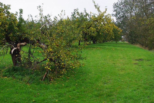
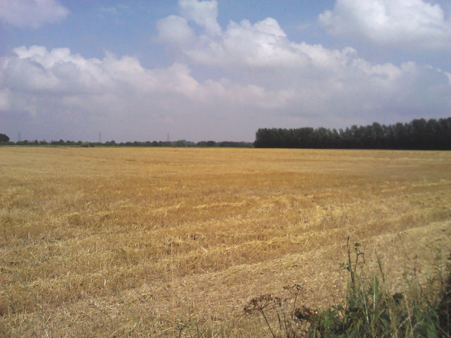
Great Fendike Field, located in Norfolk, England, is a vast and picturesque expanse of downs and moorland. Spanning over several hectares, it is renowned for its natural beauty and rich biodiversity. The field is characterized by gently rolling hills, interspersed with patches of heathland and heather, creating a unique and enchanting landscape.

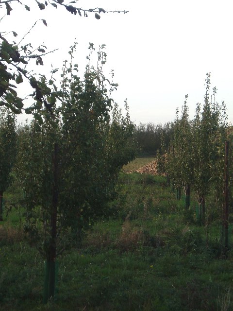
The area is home to a diverse range of flora and fauna, with a variety of plant species flourishing in the fertile soil. Visitors can expect to encounter vibrant wildflowers such as purple heather, yellow gorse, and delicate harebells, which add a pop of color to the otherwise serene surroundings. The field also supports a wide array of animal life, including rabbits, foxes, and various bird species, making it a haven for wildlife enthusiasts and birdwatchers.

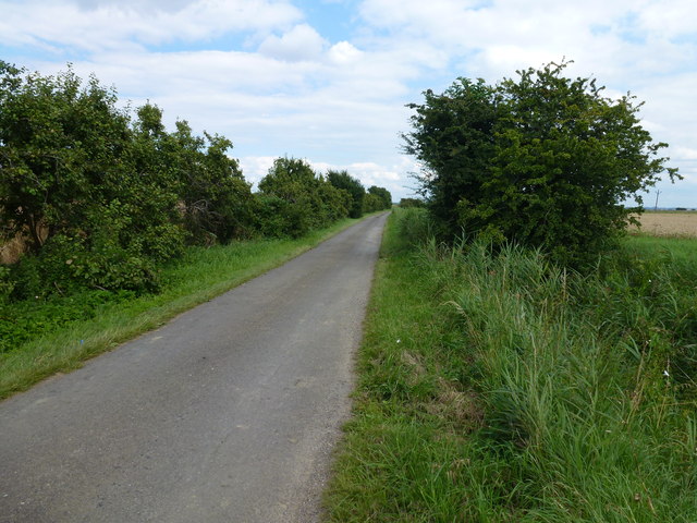
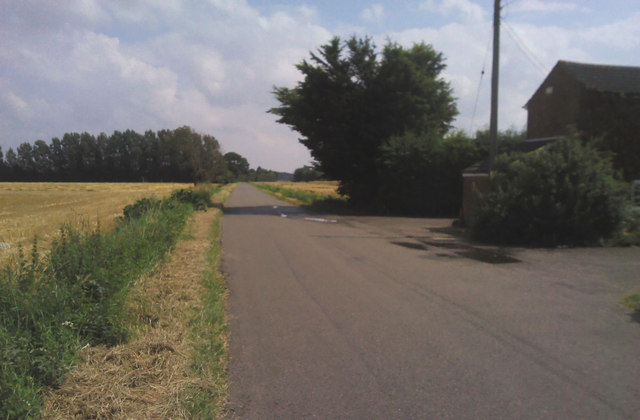
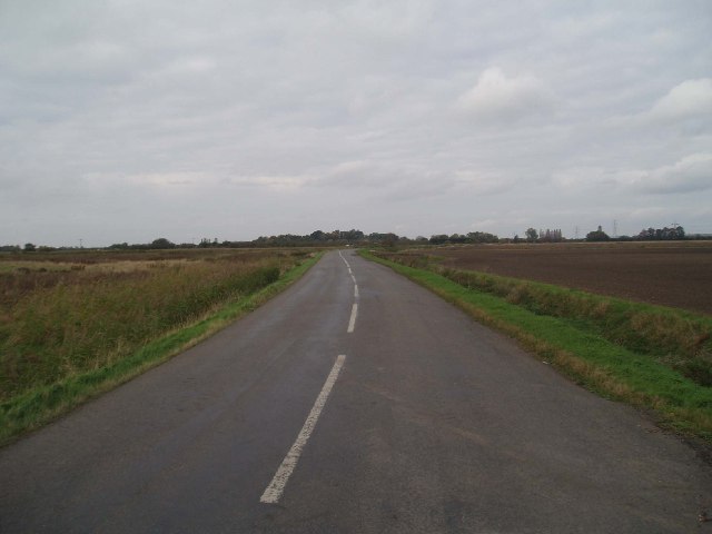
Great Fendike Field offers visitors a tranquil and peaceful setting, ideal for leisurely walks and exploration. The undulating terrain provides breathtaking views of the surrounding countryside, with panoramic vistas stretching as far as the eye can see. The field is crisscrossed by footpaths and trails, allowing visitors to navigate the area easily and discover its hidden gems.

In addition to its natural beauty, Great Fendike Field holds historical significance. The field is dotted with ancient burial mounds and remnants of ancient settlements, bearing testament to its long human history and cultural heritage.

Overall, Great Fendike Field is a captivating destination that offers a beautiful blend of nature, history, and tranquility. Whether one seeks solitude, wildlife encounters, or a delightful stroll, this Norfolk gem provides a remarkable experience for all who venture to explore its wonders.

If you have any feedback on the listing, please let us know in the comments section below.

Great Fendike Field Images

Images are sourced within 2km of 52.642273/0.23010856 or Grid Reference TF5007. Thanks to Geograph Open Source API. All images are credited.

Ancient orchard The orchard seems well tended, but I suspect the trees are a little past their best.
Ancient orchard
The orchard seems well tended, but I suspect the trees are a little past their best.
On the edge of Edge Bank, Emneth Hungate This is one of several roads in the area which form a large semi-circle on OS maps. With names such as Edge Bank, Marshland St James and Old Podike Bank they most probably were the edge of Marshland Fen before it was drained a few centuries ago.
On the edge of Edge Bank, Emneth Hungate
This is one of several roads in the area which form a large semi-circle on OS maps. With names such as Edge Bank, Marshland St James and Old Podike Bank they most probably were the edge of Marshland Fen before it was drained a few centuries ago.
Spraying a wheatfield on Edge Bank In Great Fendike Field south of Emneth Hungate, Norfolk
Spraying a wheatfield on Edge Bank
In Great Fendike Field south of Emneth Hungate, Norfolk
Sugar beet, Hall Dike, Outwell It should be a bumper crop due to high summer rainfall
Sugar beet, Hall Dike, Outwell
It should be a bumper crop due to high summer rainfall
Fendike Road, Holly End, Emneth A quiet country lane which passes between Little Fendike Field and Great Fendike Field
Fendike Road, Holly End, Emneth
A quiet country lane which passes between Little Fendike Field and Great Fendike Field
Mobile pea viners near Emneth Hungate Just finished vining on Great Fendike Field
Mobile pea viners near Emneth Hungate
Just finished vining on Great Fendike Field
Large shed on Fendike Road near Outwell
Harvesting on The Edge A view from Edge Bank near Outwell
Harvesting on The Edge
A view from Edge Bank near Outwell
Dike full of reeds off Edge bank, Outwell
Crop field. Chequers Corner Recently harvested.
Crop field. Chequers Corner
Recently harvested.
Walsoken Road Heading south east.
Walsoken Road
Heading south east.
Hall Dike at  Willow Farm Land being prepared probably for winter wheat.
Hall Dike at Willow Farm
Land being prepared probably for winter wheat.
The Edge - flat fenland to a flat horizon. Looking east towards Poppylots Farm.
The Edge - flat fenland to a flat horizon.
Looking east towards Poppylots Farm.
Edge Bank: an empty Fen road. There is little else of interest in this square!
Edge Bank: an empty Fen road.
There is little else of interest in this square!
Fenland sky and pylon chain. Moyse's Bank near Marshland House.
Fenland sky and pylon chain.
Moyse's Bank near Marshland House.
Italian poplars at Emneth Hungate. The locality is Poplar Tree Farm, but the buildings are derelict.
Italian poplars at Emneth Hungate.
The locality is Poplar Tree Farm, but the buildings are derelict.
Abandoned building, Emneth Hungate. Poplar Tree Farm is marked on the map at this point.
Abandoned building, Emneth Hungate.
Poplar Tree Farm is marked on the map at this point.
Recently planted apple trees, Fendyke. A somewhat unusual sight; orchards are usually grubbed out and the land used for other crops. Sugar beet in the background.
Recently planted apple trees, Fendyke.
A somewhat unusual sight; orchards are usually grubbed out and the land used for other crops. Sugar beet in the background.
Show me another place!

Great Fendike Field is located at Grid Ref: TF5007 (Lat: 52.642273, Lng: 0.23010856)

Administrative County: Norfolk

District: King's Lynn and West Norfolk

Police Authority: Norfolk

What 3 Words

///reference.yappy.radiated. Near Emneth, Norfolk

Related Wikis

Emneth Hungate

Emneth Hungate is a small settlement near the village of Emneth in Norfolk, England, near the border with Cambridgeshire. It once had its own Emneth railway...

Marshland Rural District

Marshland Rural District was a rural district in Norfolk, England from 1894 to 1974.It was formed under the Local Government Act 1894 based on the Marshland...

Emneth

Emneth is a village and civil parish in the English county of Norfolk. The village is located 2.9 miles (4.7 km) south-east of Wisbech, 12 miles (19 km...

Marshland St James

Marshland St James is a village and civil parish in the English county of Norfolk. It covers an area of 25.69 km2 (9.92 sq mi) and had a population of...

Boyces Bridge railway station

Boyces Bridge railway station was a station in Norfolk on the Wisbech and Upwell Tramway commonly known as the Upwell Tramway. It was located north of...

Emneth railway station

Emneth was a railway station, near Wisbech, which served the village of Emneth, Norfolk. The station was opened in 1848 as an extension of the East Anglian...

Smeeth Road railway station

Smeeth Road was a railway station serving the villages of Emneth Hungate, Marshland St James and St John Fen's End, all east of Wisbech in Norfolk, England...

Outwell Basin railway station

Outwell Basin railway station was a stop on the Wisbech and Upwell Tramway in Outwell, Norfolk. It opened in 1883 carrying passenger and goods traffic...

Nearby Amenities

Located within 500m of 52.642273,0.23010856
Hungate Road, E-bound
Alt Name: Emneth Hungate opp Wheatsheaf
Naptan AltCommonName: Emneth Hungate opp Wheatsheaf
Naptan AtcoCode: 2900E0910
Naptan Bearing: E
Naptan BusStopType: CUS
Naptan CommonName: Hungate Road
Naptan Indicator: E-bound
Naptan Locality: Emneth
Naptan NaptanCode: nfoapdjp
Naptan Street: Hungate Road
Naptan Verified: no
Source: naptan_import
Lat/Long: 52.6434837/0.2346546
Hungate Road, W-bound
Alt Name: Emneth Hungate Wheatsheaf
Naptan AltCommonName: Emneth Hungate Wheatsheaf
Naptan AtcoCode: 2900E094
Naptan Bearing: W
Naptan BusStopType: CUS
Naptan CommonName: Hungate Road
Naptan Indicator: W-bound
Naptan Locality: Emneth
Naptan NaptanCode: nfoapdpt
Naptan Street: Hungate Road
Naptan Verified: no
Source: naptan_import
Lat/Long: 52.6434174/0.2348286
Emneth Hungate
Place: hamlet
Lat/Long: 52.6438539/0.2355326
Post Box
Lat/Long: 52.6435071/0.2369275
Power: pole
Lat/Long: 52.6418705/0.2230042
Power: pole
Lat/Long: 52.6419388/0.2238706
Power: pole
Lat/Long: 52.6420112/0.2249877
Power: pole
Lat/Long: 52.6421073/0.2263811
Power: pole
Lat/Long: 52.642305/0.2292243
Power: pole
Lat/Long: 52.6425142/0.2321304
Power: pole
Lat/Long: 52.6425589/0.2328546
Power: pole
Lat/Long: 52.6426281/0.2338296
Power: pole
Lat/Long: 52.6428144/0.2364448
Power: pole
Lat/Long: 52.6427542/0.2371649
The data included in this document is from www.openstreetmap.org. The data is made available under ODbL.

Have you been to Great Fendike Field?

Leave your review of Great Fendike Field below (or comments, questions and feedback).