Fulbourn Fen

Downs, Moorland in Cambridgeshire South Cambridgeshire

England

Fulbourn Fen

Fulbourn: changes on Pierce Lane A garage has been demolished on the left and a lean-to section removed from the building in the centre. Asbestos roofing is being removed from the large building behind the digger. The road was closed to vehicles, but not to cyclists and pedestrians. After a bright start to the day, clouds were rolling in in mid morning.
Fulbourn: changes on Pierce Lane Credit: John Sutton

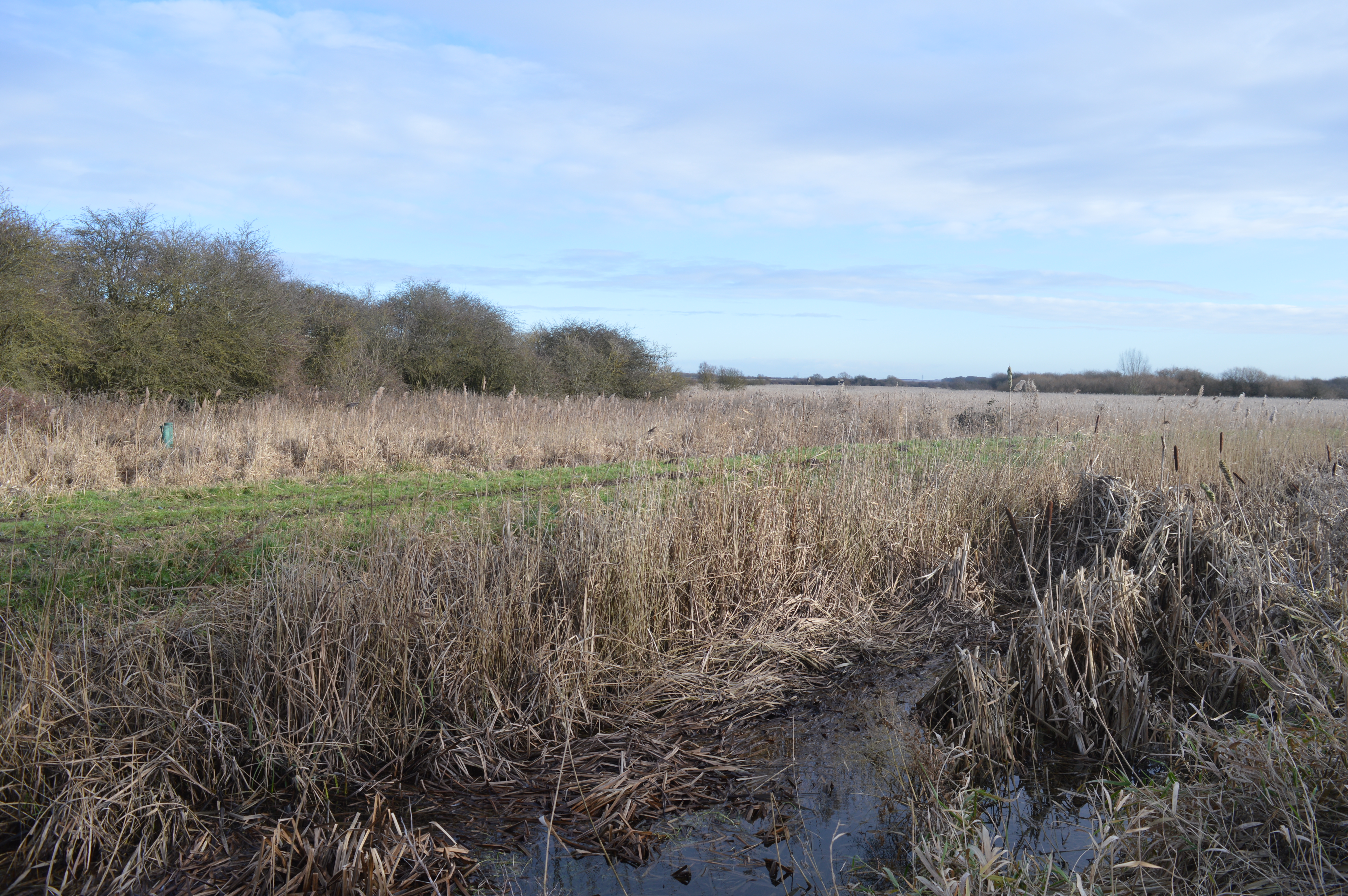
Fulbourn Fen is a nature reserve located in the county of Cambridgeshire, England. Spanning an area of approximately 40 hectares, it is situated near the village of Fulbourn and is considered to be one of the finest remaining examples of fenland habitat in the region.

The fen is characterized by a diverse range of flora and fauna, making it an important site for conservation and biodiversity. The landscape consists of wet grassland, reed beds, and small pools, which provide an ideal habitat for a variety of plant and animal species.

The plant life at Fulbourn Fen is particularly notable. It is home to several rare and protected species, including the fen violet, marsh helleborine, and grass-of-Parnassus. These species thrive in the fen's alkaline soil and wet conditions.

The reserve is also a haven for birdwatchers, with over 100 species of birds recorded within its boundaries. Visitors may spot a variety of waterfowl, including Eurasian teal and gadwall, as well as the occasional bittern or marsh harrier.

In addition to its natural beauty, Fulbourn Fen offers several walking trails and observation points, allowing visitors to explore the reserve and observe its wildlife up close. Interpretative signs provide information about the flora and fauna found in the area, enhancing the educational experience.

Overall, Fulbourn Fen is a valuable and well-preserved fenland ecosystem that provides a sanctuary for numerous rare and protected species. Its natural beauty and biodiversity make it a popular destination for nature lovers and wildlife enthusiasts.

If you have any feedback on the listing, please let us know in the comments section below.

Fulbourn Fen Images

Images are sourced within 2km of 52.196697/0.20792316 or Grid Reference TL5157. Thanks to Geograph Open Source API. All images are credited.

Fulbourn: changes on Pierce Lane A garage has been demolished on the left and a lean-to section removed from the building in the centre. Asbestos roofing is being removed from the large building behind the digger. The road was closed to vehicles, but not to cyclists and pedestrians. After a bright start to the day, clouds were rolling in in mid morning.
Fulbourn: changes on Pierce Lane
A garage has been demolished on the left and a lean-to section removed from the building in the centre. Asbestos roofing is being removed from the large building behind the digger. The road was closed to vehicles, but not to cyclists and pedestrians. After a bright start to the day, clouds were rolling in in mid morning.
The A1303 This is a very busy road and waiting for a gap in the traffic took some time, even so there is a lorry and car visible.
The A1303
This is a very busy road and waiting for a gap in the traffic took some time, even so there is a lorry and car visible.
Fulbourn: Mill Hill and the windmill A field-edge view taken on a morning which was sunnier than the weather forecast had suggested. It's still summer in mid September.
Fulbourn: Mill Hill and the windmill
A field-edge view taken on a morning which was sunnier than the weather forecast had suggested. It's still summer in mid September.
Fulbourn: Pierce Lane changing The site on the left has been cleared since I took <a href="https://www.geograph.org.uk/photo/6919578">TL5156 : Fulbourn: changes on Pierce Lane</a> early in August 2021. For a look behind the boarding, see <a href="https://www.geograph.org.uk/photo/6963665">TL5156 : Fulbourn: site clearance on Pierce Lane</a>.
Fulbourn: Pierce Lane changing
The site on the left has been cleared since I took TL5156 : Fulbourn: changes on Pierce Lane early in August 2021. For a look behind the boarding, see TL5156 : Fulbourn: site clearance on Pierce Lane.
Fulbourn: site clearance on Pierce Lane Houses are to be built on this site near the centre of the village. The picture was taken through the site fence.

Related pictures: <a href="https://www.geograph.org.uk/photo/6919578">TL5156 : Fulbourn: changes on Pierce Lane</a> and <a href="https://www.geograph.org.uk/photo/6963650">TL5156 : Fulbourn: Pierce Lane changing</a>.
Fulbourn: site clearance on Pierce Lane
Houses are to be built on this site near the centre of the village. The picture was taken through the site fence. Related pictures: TL5156 : Fulbourn: changes on Pierce Lane and TL5156 : Fulbourn: Pierce Lane changing.
Fulbourn: The Haven Modern houses off Pierce Lane, quite near the centre of a large village not far from Cambridge.
Fulbourn: The Haven
Modern houses off Pierce Lane, quite near the centre of a large village not far from Cambridge.
Fulbourn: light and shade on Ludlow Lane The Grade II listed house on the left dates from the late 18th century. The former maltings, further along, on the corner, is also Grade II listed and a century older. It has a rusty corrugated-iron roof. For a closer look at it, see <a href="https://www.geograph.org.uk/photo/2351864">TL5256 : Old maltings, Ludlow Lane</a>.
Fulbourn: light and shade on Ludlow Lane
The Grade II listed house on the left dates from the late 18th century. The former maltings, further along, on the corner, is also Grade II listed and a century older. It has a rusty corrugated-iron roof. For a closer look at it, see TL5256 : Old maltings, Ludlow Lane.
Fulbourn: Swifts Corner The parking spaces are for the nearby health centre.
Fulbourn: Swifts Corner
The parking spaces are for the nearby health centre.
Fulbourn: traffic calming and distant turbines Cambridge Road, with some of the newer houses in this large village on the left. Some of the turbines at Wadlow Wind Farm, about four miles away, show on the skyline to the right of the approaching car.
Fulbourn: traffic calming and distant turbines
Cambridge Road, with some of the newer houses in this large village on the left. Some of the turbines at Wadlow Wind Farm, about four miles away, show on the skyline to the right of the approaching car.
Fulbourn: November sunlight, Apthorpe Street The 18th-century timber-framed cottages are Grade II listed.
Fulbourn: November sunlight, Apthorpe Street
The 18th-century timber-framed cottages are Grade II listed.
Fulbourn to the Wilbrahams in December Not far out of Fulbourn on the road to Great and Little Wilbraham (ahead). These are the three most southerly villages in the Cambridgeshire Fens.
Fulbourn to the Wilbrahams in December
Not far out of Fulbourn on the road to Great and Little Wilbraham (ahead). These are the three most southerly villages in the Cambridgeshire Fens.
Fulbourn: building site on Pierce Lane Footings for new houses were being dug. <a href="https://www.geograph.org.uk/photo/6963650">TL5156 : Fulbourn: Pierce Lane changing</a> shows the site in September 2021 and has links to earlier pictures.
Fulbourn: building site on Pierce Lane
Footings for new houses were being dug. TL5156 : Fulbourn: Pierce Lane changing shows the site in September 2021 and has links to earlier pictures.
Fulbourn: winter sunlight, Hinton Road The sun was low in the sky at 9.36 on the frosty morning after the winter solstice. It was a welcome sight after two weeks of unbroken grey cloud in South Cambridgeshire.
Fulbourn: winter sunlight, Hinton Road
The sun was low in the sky at 9.36 on the frosty morning after the winter solstice. It was a welcome sight after two weeks of unbroken grey cloud in South Cambridgeshire.
Fulbourn: harvested beet by Hinton Road Looking up the hill towards Cambridge Road with the sun low in the sky shortly after 9.30 on the morning after the winter solstice. The beet will in due course be taken to a sugar refinery - the nearest is at Bury St Edmunds.
Fulbourn: harvested beet by Hinton Road
Looking up the hill towards Cambridge Road with the sun low in the sky shortly after 9.30 on the morning after the winter solstice. The beet will in due course be taken to a sugar refinery - the nearest is at Bury St Edmunds.
Along Cambridge Road Looking towards Cambridge on the road from Fulbourn. This was one of very few bright mornings in December 2021, a generally dreary and overcast month in these parts.
Along Cambridge Road
Looking towards Cambridge on the road from Fulbourn. This was one of very few bright mornings in December 2021, a generally dreary and overcast month in these parts.
Fulbourn: up Mill Hill The road to Cambridge, photographed from the corner of Caraway Road on a January morning. The windmill was built by Thomas Hunt of Soham in 1808.
Fulbourn: up Mill Hill
The road to Cambridge, photographed from the corner of Caraway Road on a January morning. The windmill was built by Thomas Hunt of Soham in 1808.
Fulbourn: Cambridge Road This part of the village has changed out of all recognition in recent years.
Fulbourn: Cambridge Road
This part of the village has changed out of all recognition in recent years.
Fulbourn: Pierce Lane progress Foundations for a new housing development are being put in. <a href="https://www.geograph.org.uk/photo/7051257">TL5156 : Fulbourn: building site on Pierce Lane</a> shows the site just before Christmas 2021 and has a link to earlier views.
Fulbourn: Pierce Lane progress
Foundations for a new housing development are being put in. TL5156 : Fulbourn: building site on Pierce Lane shows the site just before Christmas 2021 and has a link to earlier views.
Show me another place!

Fulbourn Fen is located at Grid Ref: TL5157 (Lat: 52.196697, Lng: 0.20792316)

Administrative County: Cambridgeshire

District: South Cambridgeshire

Police Authority: Cambridgeshire

What 3 Words

///wash.sums.mash. Near Fulbourn, Cambridgeshire

Nearby Locations

Fulbourn Fen

Related Wikis

Teversham

Teversham is a small village in Cambridgeshire, England about 2 miles (3 km) from Fulbourn and about 3 miles (5 km) from the centre of Cambridge. It is...

Wilbraham Fens

Wilbraham Fens is a 62.5-hectare (154-acre) biological Site of Special Scientific Interest east of Cambridge.This is an example of a fen habitat, which...

Fulbourn railway station

Fulbourn railway station (for some time misspelled "Fulbourne" by British Rail) is a disused railway station on the Ipswich to Ely Line, and located between...

Fulbourn Hospital

Fulbourn Hospital is a mental health facility located between the Cambridgeshire village of Fulbourn and the Cambridge city boundary at Cherry Hinton,...

Landmark International School

Landmark International School is a mixed non-selective international school for children aged 6 to 16 located in Fulbourn village, on the outskirts of...
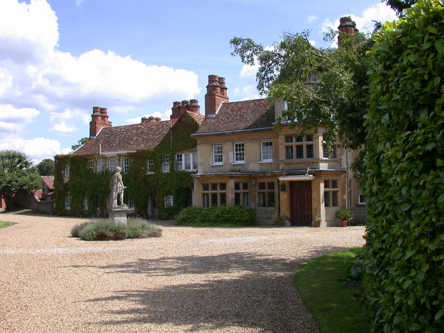
Fulbourn Manor

Fulbourn Manor is a Grade II listed building in the county of Cambridgeshire and the sole surviving manor of the Five Manors of Fulbourn. == History... ==
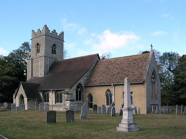
Fulbourn

Fulbourn is a village in Cambridgeshire, England, with evidence of settlement dating back to Neolithic times. The village was probably established under...

St Andrew's Church, Cherry Hinton

St Andrew's Church, Cherry Hinton is a Church of England parish church in Cherry Hinton, Cambridge. It is Grade I listed. The building dates from the late...

Nearby Amenities

Located within 500m of 52.196697,0.20792316
Ele: 6.134
Lat/Long: 52.196798/0.2027767
Ele: -1.556
Lat/Long: 52.1981782/0.2063572
Design: three-level
Power: tower
Source: yahoo
Structure: lattice
Lat/Long: 52.1954623/0.2018862
Power: tower
Source: yahoo
Lat/Long: 52.200718/0.2103281
Design: three-level
Power: tower
Source: yahoo
Structure: lattice
Lat/Long: 52.1989787/0.2075778
Design: three-level
Power: tower
Source: yahoo
Structure: lattice
Lat/Long: 52.1972323/0.2047344
Addr Housenumber: 10
Addr Postcode: CB1 9AL
Addr Street: Ferndale
Entrance: yes
Lat/Long: 52.1962852/0.2006864
Addr Housenumber: 12
Addr Postcode: CB1 9AL
Addr Street: Ferndale
Entrance: yes
Lat/Long: 52.1961645/0.2006902
Addr Housenumber: 11
Addr Postcode: CB1 9AL
Addr Street: Ferndale
Entrance: yes
Lat/Long: 52.1962354/0.2007187
The data included in this document is from www.openstreetmap.org. The data is made available under ODbL.

Have you been to Fulbourn Fen?

Leave your review of Fulbourn Fen below (or comments, questions and feedback).