Farcet Fen

Downs, Moorland in Huntingdonshire Huntingdonshire

England

Farcet Fen

Farcet Fen Taken during a 'fen blow' when a strong wind picked up the loose, dry topsoil from the fields and swirled it around - creating 'drifts' everywhere, damaging crops and forcing soil particles in through tiny gaps in windowframes, car door seals etc. A right mess!
Farcet Fen Credit: Katie

Farcet Fen is a small village located in Huntingdonshire, a historic county in the eastern part of England. Positioned on the outskirts of the town of Peterborough, Farcet Fen is known for its scenic Downs and Moorland landscapes.

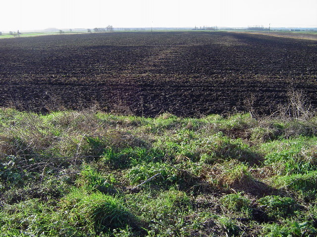
The village is situated on the edge of the Fens, a region characterized by low-lying marshy land. Farcet Fen benefits from its proximity to this unique natural environment, offering residents and visitors alike the opportunity to explore and appreciate the diverse flora and fauna that thrive in this wetland habitat.

The Downs in Farcet Fen are expansive grassy areas that provide picturesque views of the surrounding countryside. They are often used for recreational activities such as walking, picnicking, and kite flying. The Moorland, on the other hand, features heathland vegetation, including heather and gorse, creating a distinct and rugged landscape.

With its rural charm and tranquil atmosphere, Farcet Fen attracts nature enthusiasts and those seeking a peaceful escape from the bustle of city life. The village is home to a close-knit community, with a small number of local amenities including a village hall, a primary school, and a few shops.

In summary, Farcet Fen in Huntingdonshire offers a serene setting with its Downs and Moorland landscapes, providing a haven for nature lovers and a quiet retreat for residents and visitors.

If you have any feedback on the listing, please let us know in the comments section below.

Farcet Fen Images

Images are sourced within 2km of 52.521046/-0.189485 or Grid Reference TL2293. Thanks to Geograph Open Source API. All images are credited.

Farcet Fen Taken during a 'fen blow' when a strong wind picked up the loose, dry topsoil from the fields and swirled it around - creating 'drifts' everywhere, damaging crops and forcing soil particles in through tiny gaps in windowframes, car door seals etc. A right mess!
Farcet Fen
Taken during a 'fen blow' when a strong wind picked up the loose, dry topsoil from the fields and swirled it around - creating 'drifts' everywhere, damaging crops and forcing soil particles in through tiny gaps in windowframes, car door seals etc. A right mess!
Milk and Water Drove, west of Pondersbridge From just outside The Plough public house, looking west.
Milk and Water Drove, west of Pondersbridge
From just outside The Plough public house, looking west.
Milk and Water Drove, west of Pondersbridge Looking east towards Pondersbridge. From outside The Plough pub.
Milk and Water Drove, west of Pondersbridge
Looking east towards Pondersbridge. From outside The Plough pub.
The Plough pub, Milk and Water Drove, west of Pondersbridge
Osier Fen, Near Farcet From Conquest Drove looking SW.
Osier Fen, Near Farcet
From Conquest Drove looking SW.
Track near Farcet Fen On the track from Bedford's Barn Farm to Bradford or Froghall Bridge looking south. The farm building in the picture lies between the trig point and the bridge.
Track near Farcet Fen
On the track from Bedford's Barn Farm to Bradford or Froghall Bridge looking south. The farm building in the picture lies between the trig point and the bridge.
Road leading to Bedford's Barn Farm On Conquest Drove looking east.
Road leading to Bedford's Barn Farm
On Conquest Drove looking east.
Conquest Drove, near Farcet On Conquest Drove looking NW towards Marshall's farm.
Conquest Drove, near Farcet
On Conquest Drove looking NW towards Marshall's farm.
Johnson's Land, SE of Farcet On Conquest Drove looking NE along a dyke towards Park House Farm, Straight Drove.
Johnson's Land, SE of Farcet
On Conquest Drove looking NE along a dyke towards Park House Farm, Straight Drove.
From Straight Drove Looking NE towards Pondersbridge.
From Straight Drove
Looking NE towards Pondersbridge.
Farcet Fen Typical picture of this area, looking south.
Farcet Fen
Typical picture of this area, looking south.
Bradford or Froghall Bridge, near Farcet On the north bank of Black Ham (Drain) looking westerly towards Bradford or Froghall Bridge.
Bradford or Froghall Bridge, near Farcet
On the north bank of Black Ham (Drain) looking westerly towards Bradford or Froghall Bridge.
Bradford or Froghall Bridge, near Farcet Looking south, the concrete blocks stop the majority of traffic.
Bradford or Froghall Bridge, near Farcet
Looking south, the concrete blocks stop the majority of traffic.
North Western Cut (Drain), near Farcet Looking NE along the North Western Cut towards Bradford or Froghall Bridge.
North Western Cut (Drain), near Farcet
Looking NE along the North Western Cut towards Bradford or Froghall Bridge.
King's Delph, Near Farcet Taken from Milk and Water Drove looking towards King's Delph.
King's Delph, Near Farcet
Taken from Milk and Water Drove looking towards King's Delph.
Rape field and hedge
Junction of droves Richer's Drove meets Suet Hills Drove.
Junction of droves
Richer's Drove meets Suet Hills Drove.
Show me another place!

Farcet Fen is located at Grid Ref: TL2293 (Lat: 52.521046, Lng: -0.189485)

Administrative County: Cambridgeshire

District: Huntingdonshire

Police Authority: Cambridgeshire

What 3 Words

///puzzled.button.afflicted. Near Yaxley, Cambridgeshire

Related Wikis

Whittlesey Mere

Whittlesea Mere was an area of open water in the Fenland area of the county of Huntingdonshire (now Cambridgeshire), England. The mere occupied the land...

Farcet

Farcet is a village and civil parish in Cambridgeshire, England. Farcet lies approximately 2 miles (3 km) south of Peterborough city centre, between Yaxley...

Pondersbridge

Pondersbridge is a village in Whittlesey civil parish, part of the Fenland district of Cambridgeshire, England. Pondersbridge is essentially a settlement...

Yaxley and Farcet railway station

Yaxley and Farcet railway station is a former station in Yaxley, Cambridgeshire, just south of Peterborough. == History == The station was opened by the...

Nearby Amenities

Located within 500m of 52.521046,-0.189485
Building: yes
Lat/Long: 52.5208359/-0.1843459
Building: yes
Lat/Long: 52.5204964/-0.1858051
Building: yes
Lat/Long: 52.5218608/-0.1885838
Building: yes
Lat/Long: 52.5223896/-0.1880689
Building: yes
Lat/Long: 52.5224418/-0.1886053
The data included in this document is from www.openstreetmap.org. The data is made available under ODbL.

Have you been to Farcet Fen?

Leave your review of Farcet Fen below (or comments, questions and feedback).