Malting Square

Downs, Moorland in Huntingdonshire Huntingdonshire

England

Malting Square

Narrow Drove Yaxley Fen
Narrow Drove Yaxley Fen Credit: Andrew Tatlow

Malting Square is a charming village located in the Huntingdonshire district of Cambridgeshire, England. Situated amidst picturesque downs and moorland, this idyllic village offers a tranquil escape from the hustle and bustle of city life.

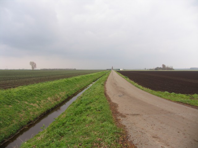
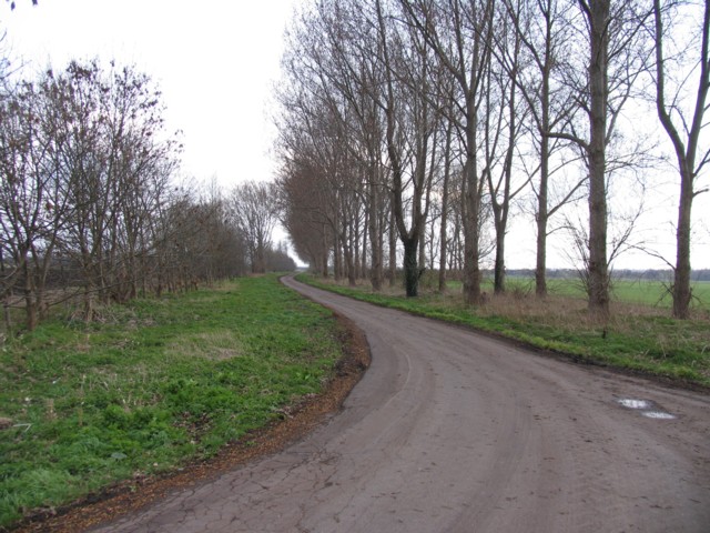
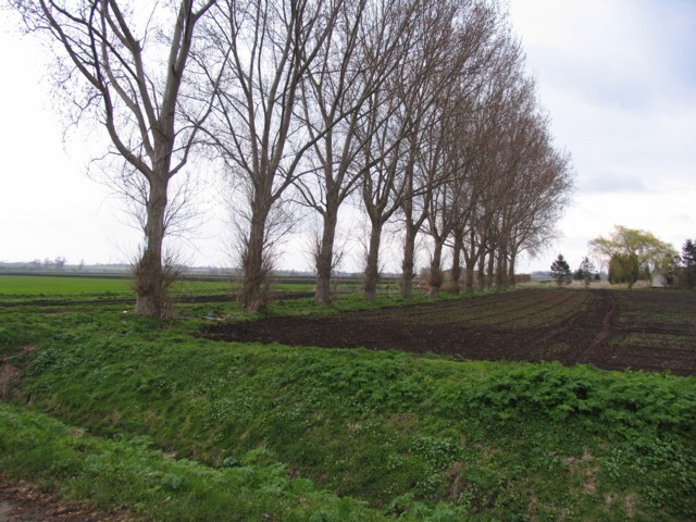
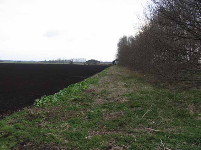
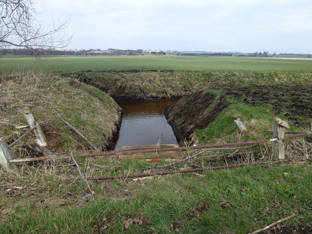
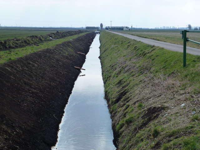
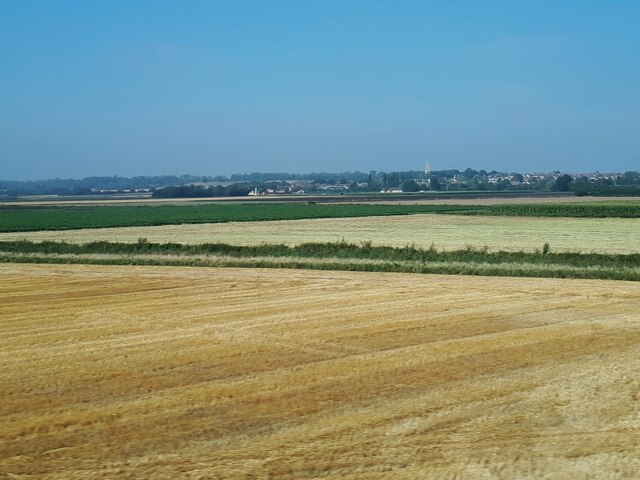
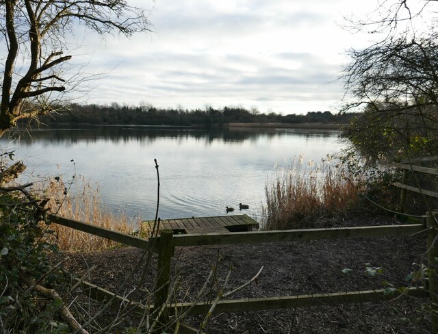
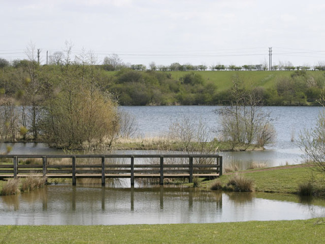
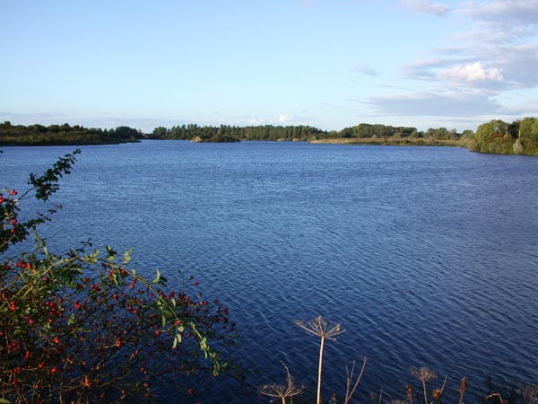
Surrounded by rolling hills and expansive meadows, Malting Square boasts a breathtaking natural landscape that attracts nature enthusiasts and outdoor adventurers alike. The village is renowned for its serene moorland, which provides ample opportunities for hiking, birdwatching, and exploring the diverse flora and fauna native to the region.

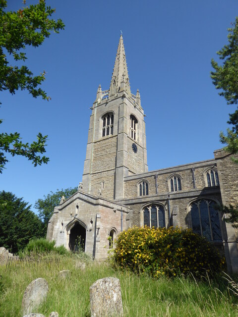
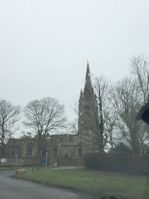
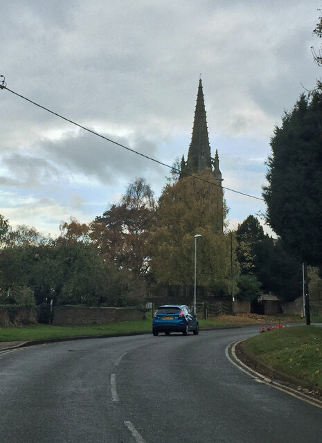
In addition to its natural beauty, Malting Square also has a rich historical heritage. The village is home to a number of historic buildings, including a well-preserved malt house that dates back to the 18th century. This malt house serves as a reminder of the village's past as a center of the local brewing industry.

Malting Square offers a close-knit community atmosphere, with friendly locals who take pride in their village's heritage and natural surroundings. The village has a small but vibrant town center, featuring a handful of local shops, cafes, and pubs. These establishments provide a welcoming space for residents and visitors to gather, socialize, and enjoy the warm hospitality of the villagers.

Overall, Malting Square is a hidden gem in Huntingdonshire, offering a harmonious blend of natural beauty and historical charm. Whether you seek a peaceful retreat or a chance to immerse yourself in the village's rich heritage, Malting Square is a destination that promises to leave a lasting impression.

If you have any feedback on the listing, please let us know in the comments section below.

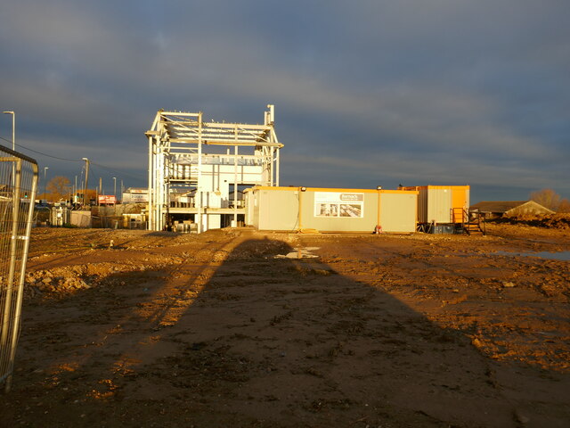
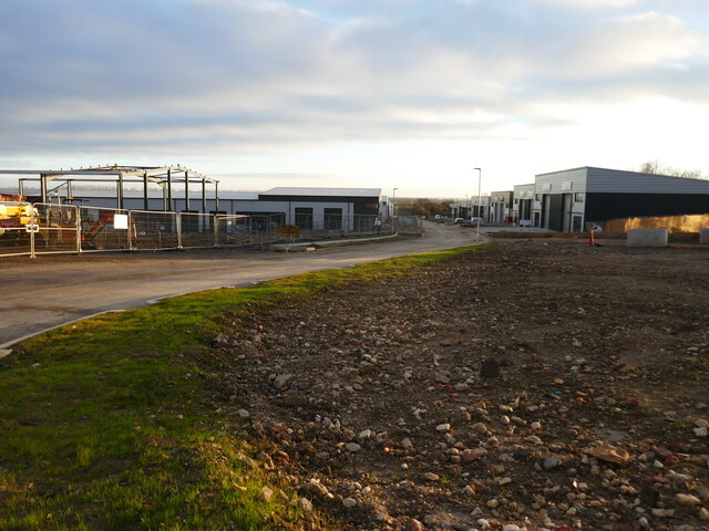
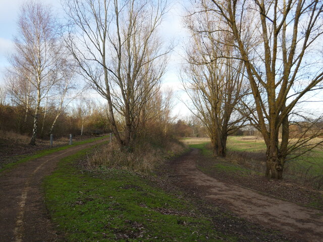
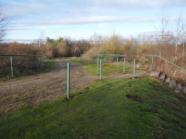
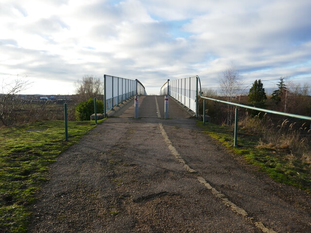
Malting Square Images

Images are sourced within 2km of 52.518453/-0.25326316 or Grid Reference TL1892. Thanks to Geograph Open Source API. All images are credited.

Narrow Drove Yaxley Fen
Broad Drove
Broad Drove
Fens and trees
Fens and trees
Field by Broad Drove Broad Drove is to the right of the trees.
Field by Broad Drove
Broad Drove is to the right of the trees.
Rusty railings on Broad Drove Broad Drove is a very rough dead end lane leading to the peat fenland east of Yaxley
Rusty railings on Broad Drove
Broad Drove is a very rough dead end lane leading to the peat fenland east of Yaxley
Slubbed out dike on Yaxley Fen Narrow Drove on the right is shown on OS maps (2006) as a public highway but it now appears to be a private road with a locked barrier
Slubbed out dike on Yaxley Fen
Narrow Drove on the right is shown on OS maps (2006) as a public highway but it now appears to be a private road with a locked barrier
Farmland near Yaxley The spire in the distance is that of St Peter's church, Yaxley <a href="https://www.geograph.org.uk/photo/3063831">TL1791 : St Peter's, Yaxley</a>.
Farmland near Yaxley
The spire in the distance is that of St Peter's church, Yaxley TL1791 : St Peter's, Yaxley.
Yaxley, St Peter
Yaxley, St Peter
St Peter, Yaxley on a wet day
St Peter, Yaxley from the roadside
Crown Lakes Country Park
New commercial development, Yaxley
Enterprise Way, Yaxley Industry and warehousing.
Enterprise Way, Yaxley
Industry and warehousing.
Crown Lakes Country Park
Longest way down on the left, shortest way down on the right Crown Lakes Country Park.
Longest way down on the left, shortest way down on the right
Crown Lakes Country Park.
Bridge over the East Coast Main Line On the bridleway between Farcet and the Hamptons.
Bridge over the East Coast Main Line
On the bridleway between Farcet and the Hamptons.
Crown Lakes Country Park, Farcet, Cambridgeshire Flooded brick pits, popular with dog walkers and ornithologists. A view southeast over the largest lake towards the B1091, which runs behind the hedge on the skyline.
Crown Lakes Country Park, Farcet, Cambridgeshire
Flooded brick pits, popular with dog walkers and ornithologists. A view southeast over the largest lake towards the B1091, which runs behind the hedge on the skyline.
Orton Brick Pit This disused clay pit is known locally as Orton Brick Pit. Taken from part of the Green Wheel.
Orton Brick Pit
This disused clay pit is known locally as Orton Brick Pit. Taken from part of the Green Wheel.
Show me another place!

Malting Square is located at Grid Ref: TL1892 (Lat: 52.518453, Lng: -0.25326316)

Administrative County: Cambridgeshire

District: Huntingdonshire

Police Authority: Cambridgeshire

What 3 Words

///snack.hammocks.consumed. Near Yaxley, Cambridgeshire

Related Wikis

Yaxley, Cambridgeshire

Yaxley is a village and civil parish in the Huntingdonshire district in Cambridgeshire, England. Yaxley lies approximately 4 miles (6 km) south of Peterborough...

Yaxley and Farcet railway station

Yaxley and Farcet railway station is a former station in Yaxley, Cambridgeshire, just south of Peterborough. == History == The station was opened by the...

Yaxley F.C.

Yaxley Football Club is a football club based in Yaxley, Cambridgeshire, England. They are currently members of the United Counties League Premier Division...

Hampton College, Peterborough

Hampton College is an all-through school for pupils aged 4 to 18, located in Hampton, Peterborough, England.The school opened to years 7 and 8 in September...

Nearby Amenities

Located within 500m of 52.518453,-0.25326316
Mini Roundabout
Direction: clockwise
Lat/Long: 52.5193892/-0.251122
Yaxley
Is In: Cambridgeshire
Place: town
Lat/Long: 52.5188785/-0.2530088
Turning Circle
Lat/Long: 52.5223768/-0.2509209
Post Box
Ref: PE7 355
Source: survey
Lat/Long: 52.5208836/-0.2471259
Turning Circle
Lat/Long: 52.5205881/-0.2537014
Atm
Lat/Long: 52.5215654/-0.2566704
Mini Roundabout
Direction: clockwise
Lat/Long: 52.5187485/-0.254192
Bus Stop
Queen Street
Bench: yes
Bin: yes
Bus: yes
Naptan AtcoCode: 0500HYAXL005
Naptan Bearing: E
Naptan CommonName: Queen Street
Naptan Indicator: near
Naptan Landmark: Lansdowne Road
Naptan NaptanCode: cmbdtmam
Naptan ShortCommonName: Queen Street
Naptan Street: Broadway
Naptan Verified: no
Public Transport: platform
Shelter: yes
Source: naptan_import
Lat/Long: 52.5189711/-0.253679
Bus Stop
Rosewood Close
Bus: yes
Naptan AtcoCode: 0500HYAXL008
Naptan Bearing: E
Naptan CommonName: Rosewood Close
Naptan Indicator: near
Naptan Landmark: Rosewood Close
Naptan NaptanCode: cmbdtmaw
Naptan ShortCommonName: Rosewood Close
Naptan Street: Main Street
Naptan Verified: no
Public Transport: platform
Source: naptan_import
Lat/Long: 52.5141244/-0.2536502
Bus Stop
Windsor Road
Bench: no
Bin: yes
Bus: yes
Naptan AtcoCode: 0500HYAXL009
Naptan Bearing: NE
Naptan CommonName: Windsor Road
Naptan Indicator: opp
Naptan Landmark: Windsor Road
Naptan NaptanCode: cmbdtmda
Naptan ShortCommonName: Windsor Road
Naptan Street: Broadway
Naptan Verified: no
Public Transport: platform
Shelter: yes
Source: naptan_import
Lat/Long: 52.5196458/-0.2506601
Bus Stop
The Duck & Drake
Bus: yes
Naptan AtcoCode: 0500HYAXL014
Naptan Bearing: E
Naptan CommonName: The Duck & Drake
Naptan Indicator: o/s
Naptan Landmark: The Duck & Drake PH
Naptan NaptanCode: cmbdtmdt
Naptan ShortCommonName: The Duck & Drake
Naptan Street: Main Street
Naptan Verified: no
Public Transport: platform
Source: naptan_import
Lat/Long: 52.5151817/-0.2491426
Bus Stop
Middletons Road
Bench: yes
Bin: yes
Bus: yes
Naptan AtcoCode: 0500HYAXL017
Naptan Bearing: E
Naptan CommonName: Middletons Road
Naptan Indicator: opp
Naptan Landmark: Middletons Road
Naptan NaptanCode: cmbdtmgd
Naptan ShortCommonName: Middletons Road
Naptan Street: Broadway
Naptan Verified: no
Public Transport: platform
Shelter: yes
Source: naptan_import
Lat/Long: 52.5179484/-0.2587161
Bus Stop
Windsor Road
Bus: yes
Naptan AtcoCode: 0500HYAXL018
Naptan Bearing: SW
Naptan CommonName: Windsor Road
Naptan Indicator: near
Naptan Landmark: Windsor Road
Naptan NaptanCode: cmbdtmgj
Naptan ShortCommonName: Windsor Road
Naptan Street: Broadway
Naptan Verified: no
Public Transport: platform
Source: naptan_import
Lat/Long: 52.5198719/-0.2495309
Bus Stop
Lansdowne Road
Bus: yes
Naptan AtcoCode: 0500HYAXL020
Naptan Bearing: NW
Naptan CommonName: Lansdowne Road
Naptan Indicator: near
Naptan Landmark: Lansdowne Road
Naptan NaptanCode: cmbdtmgp
Naptan ShortCommonName: Lansdowne Road
Naptan Street: Windsor Road
Naptan Verified: no
Public Transport: platform
Source: naptan_import
Lat/Long: 52.5169285/-0.2487047
Bus Stop
Lansdowne Road
Bus: yes
Naptan AtcoCode: 0500HYAXL021
Naptan Bearing: SE
Naptan CommonName: Lansdowne Road
Naptan Indicator: opp
Naptan Landmark: Lansdowne Road
Naptan NaptanCode: cmbdtmgt
Naptan ShortCommonName: Landsdowne Road
Naptan Street: Windsor Road
Naptan Verified: no
Public Transport: platform
Source: naptan_import
Lat/Long: 52.5173267/-0.2488805
Bus Stop
The Duck & Drake
Bench: yes
Bin: no
Bus: yes
Naptan AtcoCode: 0500HYAXL022
Naptan Bearing: W
Naptan CommonName: The Duck & Drake
Naptan Indicator: opp
Naptan Landmark: The Duck & Drake PH
Naptan NaptanCode: cmbdtmgw
Naptan ShortCommonName: The Duck & Drake
Naptan Street: Main Street
Naptan Verified: no
Public Transport: platform
Shelter: yes
Source: naptan_import
Lat/Long: 52.5148886/-0.2499943
Bus Stop
Middletons Road
Bench: no
Bin: yes
Bus: yes
Naptan AtcoCode: 0500HYAXL024
Naptan Bearing: SW
Naptan CommonName: Middletons Road
Naptan Indicator: near
Naptan Landmark: Middletons Road
Naptan NaptanCode: cmbdtmjd
Naptan ShortCommonName: Middletons Road
Naptan Street: Broadway
Naptan Verified: no
Public Transport: platform
Shelter: no
Source: naptan_import
Lat/Long: 52.5175192/-0.2594848
Bus Stop
Queen Street
Bench: no
Bin: yes
Bus: yes
Naptan AtcoCode: 0500HYAXL031
Naptan Bearing: W
Naptan CommonName: Queen Street
Naptan Indicator: opp
Naptan Landmark: Lansdowne Road
Naptan NaptanCode: cmbdtmpd
Naptan ShortCommonName: Queen Street
Naptan Street: Broadway
Naptan Verified: no
Public Transport: platform
Shelter: no
Source: naptan_import
Lat/Long: 52.5188416/-0.2534336
Bus Stop
Morgan Close
Bus: yes
Naptan AtcoCode: 0500HYAXL044
Naptan Bearing: NE
Naptan CommonName: Morgan Close
Naptan Indicator: opp
Naptan Landmark: Morgan Close
Naptan NaptanCode: cmbgjdmd
Naptan ShortCommonName: Morgan Close
Naptan Street: Bentley Avenue
Naptan Verified: no
Public Transport: platform
Source: naptan_import
Lat/Long: 52.5203334/-0.2583539
Bus Stop
Morgan Close
Bus: yes
Naptan AtcoCode: 0500HYAXL045
Naptan Bearing: SW
Naptan CommonName: Morgan Close
Naptan Indicator: near
Naptan Landmark: Morgan Close
Naptan NaptanCode: cmbgjdjp
Naptan ShortCommonName: Morgan Close
Naptan Street: Bentley Avenue
Naptan Verified: no
Public Transport: platform
Source: naptan_import
Lat/Long: 52.5203243/-0.2579385
Recycling
Lat/Long: 52.5180979/-0.2521755
Toilets
Lat/Long: 52.5216025/-0.2565268
Pub
The Duck & Drake
Lat/Long: 52.5151016/-0.2496658
Atm
Lat/Long: 52.5187413/-0.2530506
Post Box
Post Box Type: pillar
Lat/Long: 52.5188149/-0.2530555
Post Box
Lat/Long: 52.5215192/-0.2569085
Pharmacy
Healthcare: pharmacy
Lat/Long: 52.5179873/-0.2528642
Post Office
Yaxley Post Office
Lat/Long: 52.518725/-0.2529582
Fast Food
Cuisine: chinese
Lat/Long: 52.5184579/-0.2530112
Shop: greengrocer
Lat/Long: 52.5180303/-0.2529226
Fast Food
Wong's
Addr County: Cambridgeshire
Addr Housenumber: 14
Addr Postcode: PE7 3JJ
Addr Village: Yaxley
Cuisine: fish_and_chips
Fhrs Id: 1578187
Source Addr: FHRS Open Data
Lat/Long: 52.5187256/-0.2531614
Cafe
Sunny Café
Addr County: Cambridgeshire
Addr Postcode: PE7 3JL
Addr Unit: Unit 1 Landsdowne Road
Addr Village: Yaxley
Cuisine: coffee_shop
Fhrs Id: 341213
Source Addr: FHRS Open Data
Lat/Long: 52.5181543/-0.2526973
Shop: hairdresser
Lat/Long: 52.5187125/-0.2532606
Shop: alcohol
Lat/Long: 52.5183273/-0.253164
Pharmacy
Healthcare: pharmacy
Lat/Long: 52.5178442/-0.2532284
Fast Food
Cuisine: chinese
Lat/Long: 52.5180939/-0.2528207
Fast Food
Cuisine: kebab
Lat/Long: 52.5178997/-0.2527376
Barrier: cycle_barrier
Lat/Long: 52.5208264/-0.2569162
Shop: doityourself
Lat/Long: 52.518573/-0.2529255
Library
Yaxley Library
Wikidata: Q55163470
Lat/Long: 52.5179412/-0.2534714
Barrier: bollard
Lat/Long: 52.51782/-0.2506539
Barrier: bollard
Lat/Long: 52.5214182/-0.2574944
Barrier: bollard
Lat/Long: 52.5214255/-0.2572275
Barrier: bollard
Lat/Long: 52.5215651/-0.2580885
Fast Food
Cuisine: indian
Lat/Long: 52.517944/-0.2527985
Generator Method: photovoltaic
Generator Output Electricity: yes
Generator Source: solar
Generator Type: solar_photovoltaic_panel
Location: roof
Power: generator
Lat/Long: 52.5164308/-0.2515324
Generator Method: photovoltaic
Generator Output Electricity: yes
Generator Source: solar
Generator Type: solar_photovoltaic_panel
Location: roof
Power: generator
Lat/Long: 52.517777/-0.2492544
Generator Method: photovoltaic
Generator Output Electricity: yes
Generator Source: solar
Generator Type: solar_photovoltaic_panel
Location: roof
Power: generator
Lat/Long: 52.5157417/-0.2519806
Generator Method: photovoltaic
Generator Output Electricity: yes
Generator Source: solar
Generator Type: solar_photovoltaic_panel
Location: roof
Power: generator
Lat/Long: 52.5159265/-0.2508235
Generator Method: photovoltaic
Generator Output Electricity: yes
Generator Source: solar
Generator Type: solar_photovoltaic_panel
Location: roof
Power: generator
Lat/Long: 52.5152588/-0.2514995
Generator Method: photovoltaic
Generator Output Electricity: yes
Generator Source: solar
Generator Type: solar_photovoltaic_panel
Location: roof
Power: generator
Lat/Long: 52.5180306/-0.2479004
Generator Method: photovoltaic
Generator Output Electricity: yes
Generator Source: solar
Generator Type: solar_photovoltaic_panel
Location: roof
Power: generator
Lat/Long: 52.5184268/-0.2492863
Generator Method: photovoltaic
Generator Output Electricity: yes
Generator Source: solar
Generator Type: solar_photovoltaic_panel
Location: roof
Power: generator
Lat/Long: 52.5184506/-0.2492184
Generator Method: photovoltaic
Generator Output Electricity: yes
Generator Source: solar
Generator Type: solar_photovoltaic_panel
Location: roof
Power: generator
Lat/Long: 52.5164744/-0.247574
Generator Method: photovoltaic
Generator Output Electricity: yes
Generator Source: solar
Generator Type: solar_photovoltaic_panel
Location: roof
Power: generator
Lat/Long: 52.5194811/-0.2494786
Generator Method: photovoltaic
Generator Output Electricity: yes
Generator Source: solar
Generator Type: solar_photovoltaic_panel
Location: roof
Power: generator
Lat/Long: 52.5217492/-0.2517496
Generator Method: photovoltaic
Generator Output Electricity: yes
Generator Source: solar
Generator Type: solar_photovoltaic_panel
Location: roof
Power: generator
Lat/Long: 52.5140359/-0.2528559
Generator Method: photovoltaic
Generator Output Electricity: yes
Generator Source: solar
Generator Type: solar_photovoltaic_panel
Location: roof
Power: generator
Lat/Long: 52.5173763/-0.2516752
Generator Method: photovoltaic
Generator Output Electricity: yes
Generator Source: solar
Generator Type: solar_photovoltaic_panel
Location: roof
Power: generator
Lat/Long: 52.5164205/-0.2505993
Generator Method: photovoltaic
Generator Output Electricity: yes
Generator Source: solar
Generator Type: solar_photovoltaic_panel
Location: roof
Power: generator
Lat/Long: 52.51732/-0.2482506
Generator Method: photovoltaic
Generator Output Electricity: yes
Generator Source: solar
Generator Type: solar_photovoltaic_panel
Location: roof
Power: generator
Lat/Long: 52.5157213/-0.250643
Generator Method: photovoltaic
Generator Output Electricity: yes
Generator Source: solar
Generator Type: solar_photovoltaic_panel
Location: roof
Power: generator
Lat/Long: 52.5207879/-0.2494509
Generator Method: photovoltaic
Generator Output Electricity: yes
Generator Source: solar
Generator Type: solar_photovoltaic_panel
Location: roof
Power: generator
Lat/Long: 52.5222723/-0.2500165
Generator Method: photovoltaic
Generator Output Electricity: yes
Generator Source: solar
Generator Type: solar_photovoltaic_panel
Location: roof
Power: generator
Lat/Long: 52.5155023/-0.2503801
Generator Method: photovoltaic
Generator Output Electricity: yes
Generator Source: solar
Generator Type: solar_photovoltaic_panel
Location: roof
Power: generator
Lat/Long: 52.5171044/-0.2464163
Generator Method: photovoltaic
Generator Output Electricity: yes
Generator Source: solar
Generator Type: solar_photovoltaic_panel
Location: roof
Power: generator
Lat/Long: 52.5160101/-0.2508639
Generator Method: photovoltaic
Generator Output Electricity: yes
Generator Source: solar
Generator Type: solar_photovoltaic_panel
Location: roof
Power: generator
Lat/Long: 52.5188532/-0.2492314
Generator Method: photovoltaic
Generator Output Electricity: yes
Generator Source: solar
Generator Type: solar_photovoltaic_panel
Location: roof
Power: generator
Lat/Long: 52.5200051/-0.2487924
Crossing
Lat/Long: 52.5190795/-0.2569677
Fast Food
Friar Tuck's
Addr County: Cambridgeshire
Addr Housenumber: 189
Addr Postcode: PE7 3NT
Addr Street: Broadway
Addr Village: Yaxley
Cuisine: fish_and_chips
Fhrs Id: 818567
Source Addr: FHRS Open Data
Lat/Long: 52.5171069/-0.2602943
Fast Food
Subway
Brand: Subway
Brand Wikidata: Q244457
Brand Wikipedia: en:Subway (restaurant)
Contact Website: https://restaurants.subway.com/united-kingdom/en/yaxley/the-maltings
Cuisine: sandwich
Takeaway: yes
Lat/Long: 52.5183637/-0.2533148
William H. Brown
Brand: William H. Brown
Brand Wikidata: Q81787271
Office: estate_agent
Lat/Long: 52.51789/-0.2528655
Generator Method: photovoltaic
Generator Output Electricity: yes
Generator Source: solar
Generator Type: solar_photovoltaic_panel
Location: roof
Power: generator
Lat/Long: 52.5210177/-0.2543271
Generator Method: photovoltaic
Generator Output Electricity: yes
Generator Source: solar
Generator Type: solar_photovoltaic_panel
Location: roof
Power: generator
Lat/Long: 52.5214094/-0.2543056
Generator Method: photovoltaic
Generator Output Electricity: yes
Generator Source: solar
Generator Type: solar_photovoltaic_panel
Location: roof
Power: generator
Lat/Long: 52.5190592/-0.2517012
Generator Method: photovoltaic
Generator Output Electricity: yes
Generator Source: solar
Generator Type: solar_photovoltaic_panel
Location: roof
Power: generator
Lat/Long: 52.5168101/-0.2499416
Defibrillator
Access: yes
Defibrillator Location: On outside wall of Duck & Drake pub, facing Main Street.
Emergency: defibrillator
Indoor: no
Ref GB The Circuit: 940EFFB9-52E7-4FFB-AC93-AD3B00D93132
Source: bing_streetside
Survey Date: 2010-09-27
Lat/Long: 52.515085/-0.2495818
The data included in this document is from www.openstreetmap.org. The data is made available under ODbL.

Have you been to Malting Square?

Leave your review of Malting Square below (or comments, questions and feedback).